Frog Lake─Just a hop, skip, and jump away from Darrington
Quick Facts
Location: Mountain Loop Highway, Darrington
Land Agency: Mount Baker-Snoqualmie National Forest
Roundtrip: 2.0 miles
Elevation Gain: 300 feet
Green Trails Map: Silverton, WA-No. 110
Access: From Arlington follow SR 530 east for 28 miles to Darrington. At a three-way stop, turn right onto the Mountain Loop Highway and proceed for 3.0 miles to Clear Creek Campground. Continue another .2 mile to trailhead (unsigned) located on right just before bridge over Clear Creek.
Contact: Darrington Ranger District: Mount Baker Snoqualmie National Forest (360) 436-1155; www.fs.fed.us/r6/mbs
The charm in this hike is the journey, not the destination. Frog Lake isn’t much of a lake, and only a place that a bunch of amphibians can love. But the short trail that leads to the 1.5 acre lake is a real charm. It’s a surviving section of an historic trail that was once used as a shortcut between Darrington and Verlot. Past logging and abandonment have all but erased this trail from the ground and memory. But another short section remains over Deer Pass near Kelcema Lake, and the road that was built in much of its place doesn’t get much use these days and may very well end up reverting back to trail someday.
Before setting out on this hike, consider a quick look-see in the Clear Creek Campground across the road from the trailhead. Here you can see the remains—an old fireplace that once belonged to the guardhouse which sat at the start of this trail.
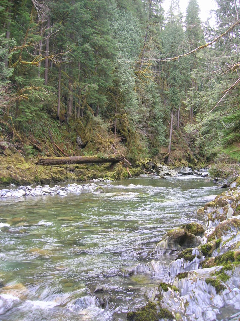
Okay, time to explore the trail. The way starts at the mouth of a deep and dramatic chasm cut by the cool waters of Clear Creek. The creek is quite a sight here with plummeting cascades—and the surroundings primeval forest of giant cedars and firs is quite wild and dramatic. Just a few steps from the Mountain Loop Highway, most folks traveling this popular recreation byway are oblivious that such a wild canyon exists mere minutes from the road.
The way starts out with a steep little climb but soon levels out. Never leaving Clear Creek far behind, the trail remains just out of eyesight from the cascading waterway for much of the way. But it can be heard loud and clear crashing through the chasm. If you’re enticed to sneak a peak of the crashing creek, carefully (use extreme caution here especially with children and dogs) walk a few feet off of the trail to peer over the canyon lip down a couple hundred feet to the crashing creek. It’s quite a sight and one to instill vertigo in some hikers. After heavy rains small cascades tumble down the canyon walls to intensify the show.
The trail meets up with Forest Road 2060 at about .75 mile. Frog Lake is reached by following a muddy track taking off from the road where it meets the trail. Don’t expect to be wooed by this little water hole, especially after seeing Clear Creek Canyon. But do check out this little “lake” for wildlife—and if you return in the spring, for birds and its amphibious namesakes. If you want to wander more — you can follow FR 2060 for about 1.5 miles to Asbestos Falls. Do be mindful of avalanche conditions however, as the road passes an avalanche chute along the way.
For information on lodging and other attractions near Frog Lake visit www.snohomish.org.