Archives
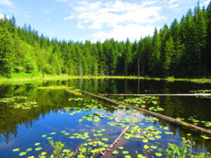
Peaceful wandering near the Oyster Dome Quick Facts: Location: Blanchard State Forest Distance: 7.5 miles roundtrip Elevation Gain: 1,500 feet Contact: Washington Department of Natural Resources Map: Square One Maps Chuckanut Recreation Area Notes: Discover Pass required to park at trailheads Trailhead directions: From I-5 Exit 240 in Alger head…
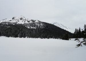
Snowshoe to a “deer” location in Mount Rainier National Park Quick Facts: Location: Mount Rainier National Park Distance: 10.2 miles roundtrip Elevation Gain: 1,350 feet Contact: Mount Rainier National Park Green Trails Map: Mount Rainier National Park 269SX Notes: Dogs are prohibited; Route is non-groomed and shared with skiers; National…
Quick Facts: Location: Hurricane Ridge, Olympic National Park Land Agency: National Park Service Roundtrip: 6.0 miles Elevation Gain: 900 feet Contact: Olympic National Park Green Trails Map: Elwha North Hurricane Ridge, No 134S Notes: Dogs are prohibited. National Park Entry Fee Required. Dec–Mar the road is open Fri–Sun and Holiday…
Quick Facts: Location: Mount Tahoma Trails near Ashford Land Agency: Washington DNR and Mount Tahoma Trails Association Roundtrip: 8.6 miles Elevation gain: 2,400 feet Contact: Mount Tahoma Trails Association MTTA Map: Mount Tahoma Ski Trail System (MTTA) Notes: Sno-Park Pass required; Reservations required for overnight stays in hut Access: From…
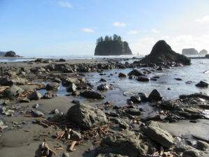
Quick Facts: Location: Olympic National Park Land Agency: Quileute Nation and National Park Service Roundtrip: 4.0 miles Elevation Gain: 310 feet Contact: Olympic National Park, Wilderness Information Center Green Trails Map: 99S Olympic Coast Beaches Notes: Dogs prohibited Access: From Forks follow US 101 north for 1.5 miles turning left onto State Route…
Quick Facts: Location: Edmonds Waterfront Land Agency: City of Edmonds Parks and Recreation Roundtrip: 1.8 miles Elevation Gain: Level Access: From I-5 follow SR 104 west towards the Edmonds-Kingston Ferry. One stoplight before the ferry terminal, turn left onto Dayton Street. Then continue for .1 mile to just before the…
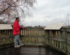
Quick Facts: Location: Saanich Peninsula, Vancouver Island Land Agency: Swan Lake Christmas Hill Sanctuary Roundtrip: 3.5 miles/ 5.6 kilometers Elevation gain: 325 feet/ 100 meters Contact: Swan Lake Christmas Hill Sanctuary Notes: dogs prohibited Access: From Victoria or Sidney, follow BC 17 (Patricia Bay Highway) exiting onto McKenzie Ave. Proceed…
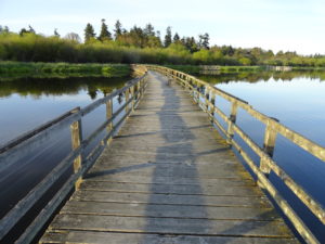
Quick Facts: Location: Snohomish Valley Land Agency: Snohomish County Parks Roundtrip: 5.2 miles Elevation gain: 650 feet Contact: Snohomish County Parks Map: Snohomish County Parks Notes: Dogs permitted on leash Good to know: Dog-friendly, kid-friendly, snow-free winter hike, good trail running Access: From Everett follow US 2 to SR 9. Head south…
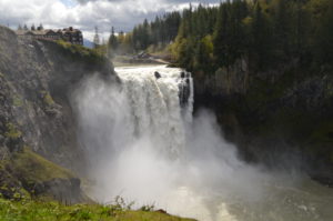
Hike to the base of the falls where heaven connects to earth Quick Facts: Location: Snoqualmie Valley Distance: 1.4 miles Elevation Gain: 280 feet Contact: Puget Sound EnergyDetailed Information: Urban Trails Eastside (Mountaineers Books) Green Trails Map: Rattlesnake Mountain/ Mountains to Sound Greenway No. 205S Notes: dogs permitted on leash.…
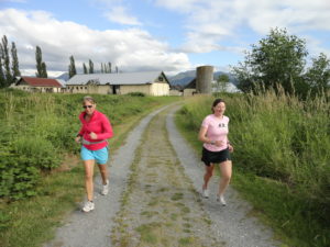
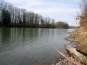
Wander the former farm grounds of a state mental health hospital Quick Facts: Location: Skagit Valley Distance: more than 7.0 miles of trails Elevation Gain: up to 400 feet Contact: Skagit County ParksDetailed Information: Urban Trails Bellingham (Mountaineers Books) Notes: dogs permitted on leash; park open dawn to dusk. Access:…