Archives
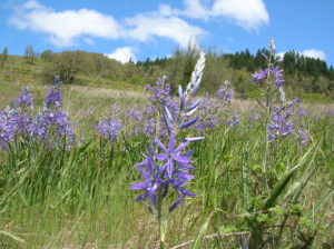
Quick Facts: Location: Willamette Valley south of Eugene Land Agency: Lane County Parks Roundtrip: 3.0 miles Elevation gain: 1,050 feet Map: Park map available online Contact: Friends of Buford Park and Mount Pisgah Notes: $5.00 day use fee; dogs must be leashed Access: From Eugene follow Franklin Blvd (Exit 189 I-5…
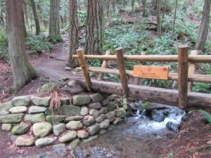
No views, but lots of big trees and pretty cascades Quick Facts: Location: Cougar Mountain Regional Wildland Park. Land Agency: King County Parks. Distance: 3.9 mile lollipop loop. Elevation Gain: 1200 feet. Contact: King County Parks. Green Trails Map: Cougar Mtn/ Squak Mtn No. 203S. Notes: dogs permitted on leash,…
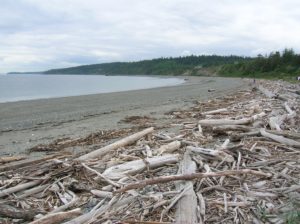
Quick Facts: Location: Marrowstone Island Land Agency: Washington State Parks Contact: Fort Flagler State Park Roundtrip: 5.6 miles Elevation Gain: 200 feet Access: From Kingston Ferry Terminal, follow SR 104 west for 15 miles turning right onto SR 19. Continue north for 9 miles to Chimicum turning right onto Irondale…
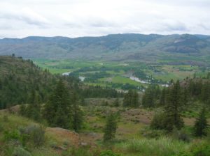
Location: Okanogan Valley near Oroville Land Agency: Okanogan-Wenatchee National Forest Roundtrip: 5.0 miles High Point: 1,950 feet Elevation gain: 1,250 feet Difficulty: moderate Contact: Pacific Northwest Trail Association Note: Dogs should be under strict control as to not disturb the bighorn sheep. Access: From Tonasket, follow US 97 north for…
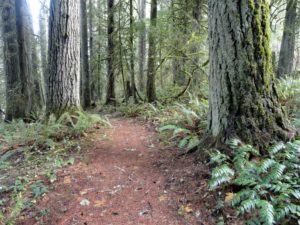
Stroll through groves of Old-growth above the Chehalis River Quick Facts: Location: Chehalis River Valley Land Agency: Washington State Parks Roundtrip: up to 3.0 miles Elevation gain: 300 feet Contact: Rainbow Falls State Park Notes: Discover Pass required; dogs must be leashed Access: From Chehalis (exit 77 on I-5) follow…
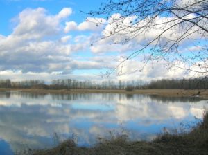
Quick Facts: Location: Snohomish River, south of Snohomish Land Agency: Snohomish County Parks Roundtrip: 1.5 miles Elevation Gain: 50 feet Contact: Snohomish County Parks and Recreation Special Note: Dogs prohibited. Trails can flood during rainy period. Expect wet and muddy trails. Access: From the city of Snohomish, travel south on…
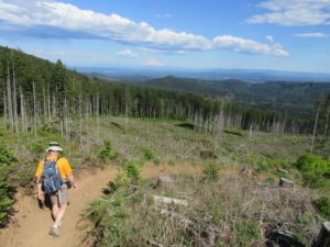
The views rule from this prominent peak near Olympia Quick Facts: Location: Capitol State Forest Land Agency: Washington Department of Natural Resources (DNR) Distance: 17.0 mile loop Elevation Gain: 2300 feet Contact: Washington Department of Natural Resources (DNR); South Puget Sound Region Office Notes: dogs permitted on leash; Trails also…
Explore an excellent trail system in the heart of Vashon Island Quick Facts: Location: Vashon Island Land Agency: King County Parks and Vashon Maury Island Land Trust Distance: more than 10 miles of trails Elevation Gain: up to 200 feet Contact: King County Parks Notes: dogs permitted on leash: Trails…

Quick Facts: Location: White River Valley Land Agency: Mount Baker-Snoqualmie National Forest Roundtrip: 2.5 miles Elevation gain: 500 feet Green Trails Map: Mount Rainier Wonderland no. 269SX Contact: Mount Baker-Snoqualmie National Forest; Snoqualmie Ranger DistrictNotes: Northwest Forest Pass required at actual trailhead. When snow level is low, parking may be…
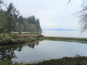
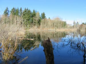
Explore a small trail network on the Nisqually Reach Quick Facts: Location: Lacey Land Agency: Washington State Parks Distance: 3.0 miles of trails Elevation Gain: up to 225 feet Contact: Tolmie State Park Notes: Discover Pass required; dogs permitted on leash: Hours: April 20-September 20: 8 a.m to dusk September…