Archives
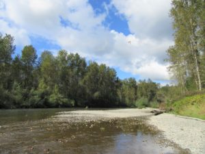
Quick Facts: Location: South King County Land Agency: King County Parks Round Trip: more than 7 miles of trails Elevation Gain: up to 650 feet Contact: King County Parks Recommended Resource: Urban Trails Tacoma (Mountaineers Books) Notes: Dogs allowed on leash Access: From SR 18 in Auburn the exit for…
Quick Facts: Location: Chuckanut Mountains Land Agency: Whatcom County Parks and Washington State Parks Round Trip: 10.8 miles roundtrip Elevation Gain: 2000 feet Contact: Whatcom County Parks Recommended Resource: Urban Trails Bellingham (Mountaineers Books) Detailed map: Square One Maps Chuckanut Recreation Area Notes: Dogs allowed on leash Access: From Bellingham…
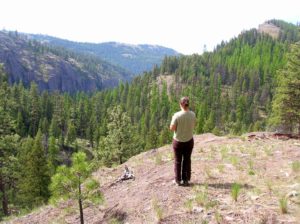
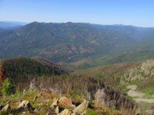
Location: Colville National Forest, Ferry County, Wa Land Agency: National Forest Service Roundtrip: 9.0 miles Elevation gain: 1,700 feet Contact: Colville National Forest, Republic Ranger District Notes: beware of rattlesnakes Access: From Republic follow SR 21 south 12.3 miles to trailhead located just within the Colville Indian Reservation Boundary. If…
Quick Facts: Location: Mountain Loop Highway Land Agency: Mount Baker-Snoqualmie National Forest; Washington Department of Natural Resources Roundtrip: 6.0 miles Elevation gain: 1,700 feet Green Trails Maps: Mountain Loop Highway 111SX Recommended Resource: Day Hiking North Cascades (Romano; Mountaineers Books) Contact: Darrington Ranger District: Mount Baker-Snoqualmie National Forest Notes: access road is…
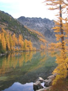
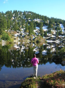
Quick Facts: Location: North Cascades – Sawtooth Ridge Land Agency: U.S. Forest Service Roundtrip: 13.0 miles Elevation Gain: 3,730 feet Green Trails Map: Prince Creek, WA- No. 115 Recommended Resource: Day Hiking North Cascades (Romano; Mountaineers Books) Access: From Twisp drive SR 20 east for 2.0 miles. Continue south on SR 153…
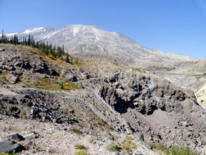
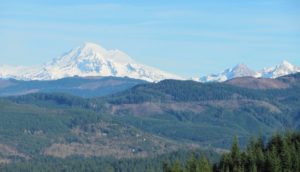
Quick Facts: Location: Mount St. Helens National Volcanic Monument Land Agency: National Forest Service Roundtrip: 9.4 miles Elevation Gain: 1,550 feet Contact: Mount St. Helens National Volcanic Monument Green Trails Map: Mount St Helens 332 Recommended Resource: Day Hiking Mount St Helens (Mountaineers Books) Notes: Northwest Forest Pass or Interagency Pass required. Trail…
Quick Facts: Location: North Cascades, E.C. Manning Provincial Park Land Agency: BC Parks Roundtrip: 13.2 miles Elevation Gain: 3820 feet Contact: E.C. Manning Provincial Park Notes: Dogs permitted on leash. Practice Leave No Trace principles. Access: From Vancouver BC follow Trans-Canada Highway 1 east to Hope. Then continue east on BC 3 (Crowsnest…
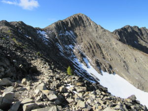
Quick Facts: Location: Selkirk Mountains, Eastern Washington Land Agency: National Forest Service Roundtrip: 14 miles Elevation Gain: 4130 feet Contact: Sullivan Lake District, Colville National Forest Notes: Practice Leave No Trace principles; grizzly habitat, trail passes recent burn zone–use caution Access: From Newport, Washington follow SR 20 north (west) 47 miles to the…

Location: Mount Rainier National Park Land Agency: National Park Service Roundtrip: 7.0 miles High Point: 7,078 feet Elevation gain: 1,500 feet Difficulty: moderate Green Trails Map: Mount Rainier Wonderland Map 269S Contact: Mount Rainier National Park Note: Park entrance fee; dogs prohibited Access: From Enumclaw, follow SR 410 east to…
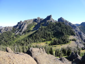
Quick Facts: Location: Hurricane Ridge-Heart of the Hills Land Agency: Olympic National Park Roundtrip: 10 miles Elevation Gain: 3,940 feet Green Trails Map: Hurricane Ridge-Elwha North No. 134S Access: From Port Angeles, follow Race Street south 1.2 miles passing the Olympic National Park Visitors Center to the Hurricane Ridge Road…