Archives
Quick Facts: Location: Mountain Loop Highway near Darrington Land Agency: Mount Baker-Snoqualmie National Forest Roundtrip: 7.0 miles Elevation Gain: 900 feet Green Trails Map: Mountain Loop Highway no.111SX Note: NW Forest Pass required Access: From Granite Falls follow the Mountain Loop Highway east for 31 miles to Barlow Pass and end of pavement.…

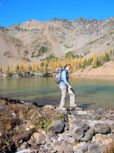
Quick Facts: Location: Mount Rainier National park Land Agency: National Park Service One way: 9.0 miles Elevation Loss: 2,200 feet Contact: Mount Rainier National Park Green Trails Maps: Mount Rainier National Park 269S Notes: National Park entry fee; Dogs prohibited; Keep children nearby around waterfalls and creek sides as a slip…
Quick Facts: Location: Mountain Loop Highway Land Agency: Mount Baker-Snoqualmie National Forest Roundtrip: 3.8 miles Elevation gain: 100 feet Green Trails Map: Mountain Loop Highway 111SX Contact: Darrington Ranger District: Mount Baker Snoqualmie National Forest Notes: Northwest Forest Pass or Interagency Pass required Access: From Darrington, follow Mountain Loop Highway…

Quick Facts: Location: Northern Snohomish County, near Stanwood Land Agency: Pacific Denkmann Company Pilchuck Tree Farm Roundtrip: 3.2 miles Elevation Gain: 400 feet Contact: Pilchuck Recreation Association: www.pilchuckra.org Notes: All trail users MUST sign a liability release and have it on file to use these trails. Download here and mail (with $2…
Quick Facts: Location: Skykomish River Valley near Index Land Agency: Washington State Parks Roundtrip: 2.6 miles Elevation gain: 1,300 feet Green Trails Maps: Alpine Lakes Stevens Pass Map 176S Contact: Washington State Parks Notes: Discover Pass required; Dogs must be leashed Access: From Everett follow US 2 east for 36…
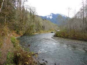
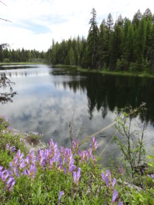
Quick Facts: Location: Twisp River Valley Land Agency: Okanogan-Wenatchee National Forest Roundtrip: 8.5 miles Elevation gain: 3,800 feet Green Trails Map: Stehekin, WA – No 82 Contact: Methow Valley Ranger District: Okanogan-Wenatchee National Forest Notes: NW Forest Pass or Interagency Pass required Access: From Twisp, follow Twisp River Road…
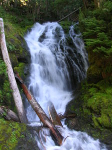
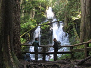
Quick Facts: Location: Mountain Loop Highway near Granite Falls Land Agency: Mount Baker-Snoqualmie National Forest Roundtrip: 2.2 miles Elevation gain: 200 feet Difficulty: easy Green Trails Map: Mountain Loop Highway 111SX Contact: Darrington Ranger District: Mount Baker- Snoqualmie National Forest or Verlot Public Service Center (summer weekends) (360) 691-7791 Notes: NW…
Quick Facts: Location: Carbon River Valley, Mount Rainier National Park Land Agency: National Park Service Roundtrip: 9.6 miles Elevation Gain: 1,350 feet Contact: Mount Rainier National Park Green Trails Map: Mount Rainier National Park 269SX Notes: National Park entrance fee; Dogs Prohibited; Practice Leave No Trace Principles; camping only in designated spots and with…
Quick Facts: NOTE: Road to Swan Lake has been damaged due to winter storms and may not be open. Call Republic Ranger District for road status (509) 775-7400 Location: Colville National Forest, near Republic Land Agency: US Forest Service Roundtrip: 3.1 miles Elevation gain: 360 feet Contact: Colville National Forest Notes:…
Quick Facts Location: SR 9 just south of Skagit County line Land Agency: Snohomish County Parks Roundtrip: 8.0 miles Elevation Gain: Minimal Access: From Arlington (junction of SR 530-SR 9), follow SR 9 north for 7.6 miles turning left into park. Proceed .1 mile to parking area. Notes: Dogs must…