Archives
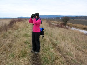
Quick Facts Location: Skagit Bay, Stanwood Land Agency: Washington Department of Fish and Wildlife Roundtrip: 3.6 miles Elevation Gain: None Access: From Exit 212 on I-5 head west on SR 532 for five miles to the town of Stanwood. Turn right onto the Pioneer Highway and proceed for 2.6 miles to…
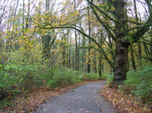
Quick Facts: Location: City of Monroe Land Agency: Monroe Parks and Recreation Department Roundtrip: 1.5 miles Elevation Gain: Minimal Notes: Dogs must be on leash; Trail is prone to flooding during periods of heavy rain. Access: From Everett follow US 2 east to Monroe. Turn right onto SR 203 (Lewis Street). Proceed past Main Street traffic…
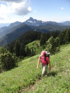
Location: White Chuck River Valley, Mountain Loop Highway Land Agency: Mount Baker-Snoqualmie National Forest Roundtrip: 18.6 miles High Point: 5,983 feet Elevation gain: 4,800 feet Difficulty: challenging Notes:FR 23 is currently is closed at mile 4 due to a washout Green Trails Maps: Mountain Loop Highway no. 111SX Recommended Guidebook:…
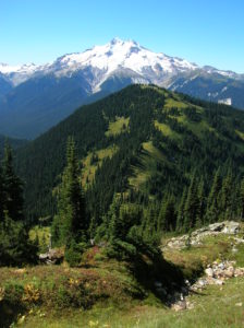
Quick Facts: Location: Glacier Peak Wilderness Land Agency: Mount Baker-Snoqualmie National Forest Roundtrip: 21.0 miles Elevation Gain: 3,700 feet Green Trails Map: Holden, WA- No. 113 Contact: Darrington Ranger District: Mount Baker Snoqualmie National Forest Notes: Northwest Forest Pass or Interagency Pass required Access: From Everett, head 85 miles east on US 2 to…
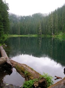
Quick Facts: Location: Sultan Basin Land Agency: Snohomish County Public Utility District Roundtrip: 1.6 miles Elevation Gain: 300 feet Green Trails Map: Mountain Loop HIghway No. 111SX Access: From Everett follow US 2 east to Sultan. At a traffic light just past Milepost 23 turn left onto Sultan Basin Road. Follow for 13.2 miles (pavement…
Quick Facts: Location: Marysville Land Agency: Marysville Parks and Recreation Roundtrip: 1.5 miles Elevation Gain: 50 feet Contact: Marysville Parks Notes: Dogs must be leashed. Access: From Exit 199 on I-5, head east on SR 528 (4th Street) about 1.5 miles to parking and trailhead on left. Good to know:…
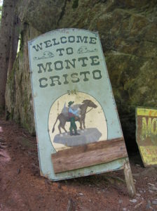
Quick Facts: Location: Mountain Loop Highway near Granite Falls Land Agency: Mount Baker-Snoqualmie National Forest Roundtrip: 8.0 miles High Point: 2,800 feet Elevation gain: 500 feet Difficulty: moderate Green Trails Maps: Sloan Peak, WA- No. 111; Monte Cristo, WA- No. 143 Contact: Darrington Ranger District: Mount Baker Snoqualmie National Forest Notes: Northwest Forest Pass required. Trail and town site closes…
Quick Facts: Location: Colville National Forest, Ferry County, Wa Land Agency: National Forest Service Roundtrip: 3.2 miles Elevation gain: 550 feet Contact: Colville National Forest, Republic Ranger District Notes: Trail is currently under construction. Check with ranger district on progress, changes and/or closures. Once completed, trail will be a loop…
Location: Stanwood Land Agency: Washington Department of Fish and Wildlife (WDFW) Roundtrip: 1.0 mile Elevation gain: None Difficulty: Easy Contact: Washington Department of Fish and Wildlife Notes: Discover Pass or WDFW Vehicle Use Permit required; Active hunting area from October to late January Access: From Exit 212 on I-5, travel…
Quick Facts Location: Mountain Loop Highway near Granite Falls Land Agency: Mount Baker-Snoqualmie…