Archive
Suiattle River– A wild river and majestic primeval forest within the shadows of Glacier Peak
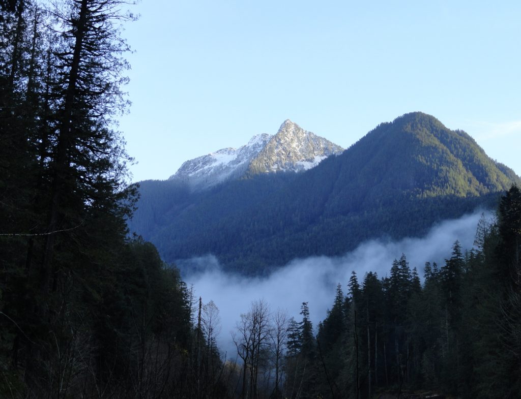
Quick Facts: Location: Suiattle River Road Land Agency: Mount Baker-Snoqualmie National Forest Roundtrip: 13.0 miles Elevation gain: 1,000 feet Green Trails Maps: Mountain Loop Highway no. 111SX Contact: Darrington Ranger District: Mount Baker-Snoqualmie National Forest Notes: Northwest Forest Pass or interagency pass required Access: From Darrington travel north on SR 530 for 7.5 miles turning…
Read MoreMelakwa Lake–The buzz is out on this great Snoqualmie Pass hike
Location: Snoqualmie Pass region Land Agency: Mount Baker-Snoqualmie National Forest Roundtrip: 9.0 miles High Point: 4,600 feet Elevation gain: 2,400 feet Difficulty: difficult Green Trails Map: Snoqualmie Pass Gateway, WA- No 207SX Contact: North Bend Ranger District: Mount Baker Snoqualmie National Forest Notes: NW Forest Pass or Interagency Pass required; dogs must be on a…
Read MoreLake Valhalla– No slain souls here-just renewed ones
Quick Facts: Location: Henry M Jackson Wilderness, Stevens Pass area Land Agency: Okanogan-Wenatchee National Forest Roundtrip: 11.6 miles Elevation gain: 1,850 feet Difficulty: moderate Green Trails Map: Alpine Lakes-Stevens Pass No. 176S Contact: Wenatchee River Ranger District (Leavenworth): Okanogan-Wenatchee National Forest Access: From Everett, head east on US 2 for 65 miles to Stevens Pass.…
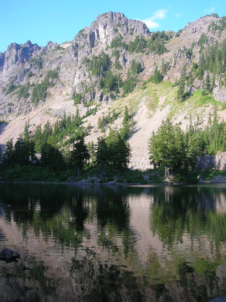
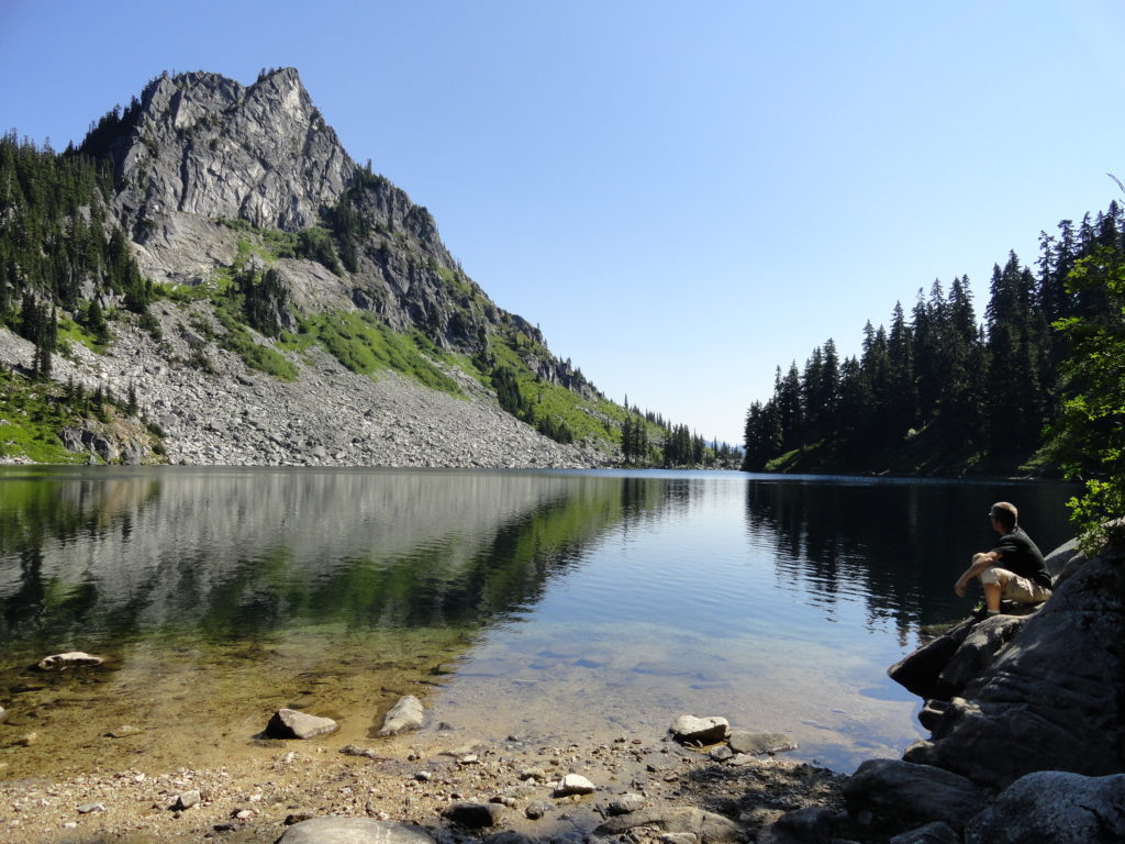
Read MoreBald Eagle Peak — Old-growth, stunning views, and solitude

Special Note: We apologize for sending out the Longs Pass Hike earlier today as it is currently closed due to a forest fire. We had scheduled the hike to run about a month ago and regret not catching that the trail is now closed. We try to provide timely hiking destinations, but you should always…
Read MoreGrand Valley–Aptly named valley has it all; lakes, meadows, and fantastic alpine scenery

Quick Facts: Location: Obstruction Point (Hurricane Ridge) Land Agency: National Park Service Roundtrip: 9.8 miles Elevation gain: 2,400 feet Contact: Olympic National Park Wilderness Information Center Green Trails Map: Elwha North/Hurricane Ridge-No. 134S Notes: Dogs prohibited; National Park Entry Fee required Access: From Port Angeles follow the Hurricane Ridge Road (Heart O the Hills Parkway)…
Read MoreCooney Lake–larches at the edge of the North Cascades
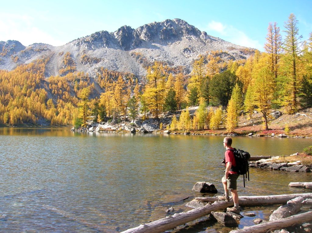
Location: Sawtooth Ridge Roadless Area Land Agency: Okanogan-Wenatchee National Forest Roundtrip: 16 miles High Point: 7,300 feet Elevation gain: 3,800 feet Difficulty: moderate Green Trails Maps: Prince Creek, WA- No. 115 Contact: Methow Valley Ranger District: Okanogan-Wenatchee National Forest Notes: Northwest Forest Pass or Interagency Pass required Access: From Twisp follow SR 153 south turning…
Read MoreSilver Lake─Precious body of water above old mining district
Quick Facts: Location: Mountain Loop Highway near Granite Falls Land Agency: Mount Baker-Snoqualmie National Forest Roundtrip: 13.0 miles Elevation Gain: 2,100 feet Green Trails Map: Mountain Loop Highway 111SX Access: From Granite Falls, follow the Mountain Loop Highway east for 31 miles to Barlow Pass. Hike begins by walking up gated Monte Cristo Road. Note: Northwest…
Read MoreWest Cady Ridge—from wildflowers to autumn colors
Quick Facts: Location: Wild Sky and Henry Jackson Wildernesses, North Fork Skykomish River Valley Land Agency: National Forest Service Roundtrip: 8.0 miles Elevation Gain: 2,300 feet Green Trails Map: Monte Cristo, WA- No. 143 Recommended source: Day Hiking Central Cascades 2nd edition (Mountaineers Books) Contact: Skykomish Ranger District: Mount Baker Snoqualmie National Forest Notes: Northwest…
Read MoreRoyal Basin–Crown jewel of the Olympic Rain shadow

Location: Northeast Olympic Peninsula Land Agency: National Park Service Roundtrip: 16.0 miles Elevation gain: 2700 feet Contact: Olympic National Park Wilderness Information Center Green Trails Map: Olympic Mountains East No. 168SX Notes: NW Forest Pass or Interagency Pass required; Dogs-prohibited at national park boundary (at 1.3 miles) Good to Know: Exceptional Wildflowers, Backpacking options Access: Take…
Read MoreNorth Lake–Secluded Lake off popular Mountain Loop Highway
Quick Facts: Location: Mountain Loop Highway near Granite Falls Land Agency: Mount Baker-Snoqualmie National Forest Roundtrip: 6.0 miles High Point: 4,925 feet Elevation gain: 2,250 feet Difficulty: difficult Green Trails Map: Mountain Loop Highway no. 111SX Contact: Darrington Ranger District Notes: Access road is rough in spots; high clearance recommended Access: From Granite Falls follow the Mountain Loop Highway east for 26 miles. Just…
Read More