Best Lake Hikes
Sullivan Lake — Enjoy an “On Golden Pond” moment
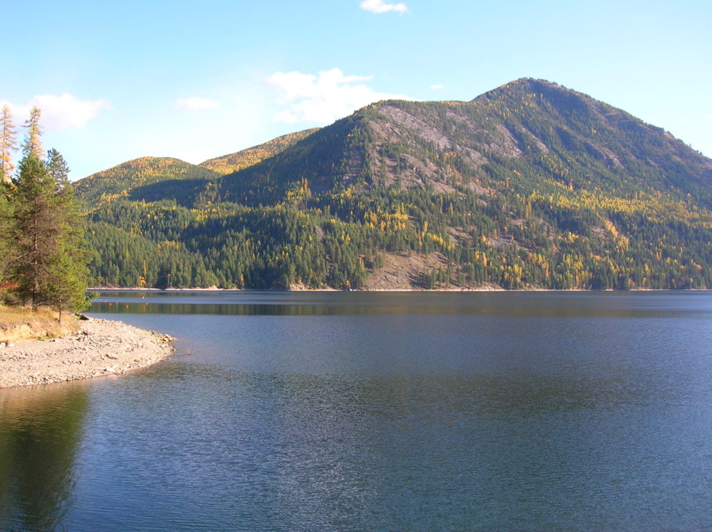
Quick Facts: Location: Selkirk Mountains Northeastern Washington Land Agency: Colville National Forest Roundtrip: 9.2 miles Elevation Gain: 650 feet Access: From Metaline Falls, Washington drive 2 miles north on SR 31. Turn right onto Sullivan Lake Road. Continue on this road for 4.7 miles before turning left onto FR 22. Proceed 0.4 mile, then turn right onto…
Read MoreBoulder Lake—trail to this Sultan Basin Lake once again open!
Quick Facts: Location: Sultan Basin Land Agency: Washington Department of Natural Resources Roundtrip: 13.8 miles Elevation Gain: 2,140 feet Green Trails Map: Index WA- No. 142 Notes: Dogs must be on leash; All hikers are required to stop and register (no fee) at kiosk at Olney Pass upon entering Sultan Basin Watershed. Access: From Everett…
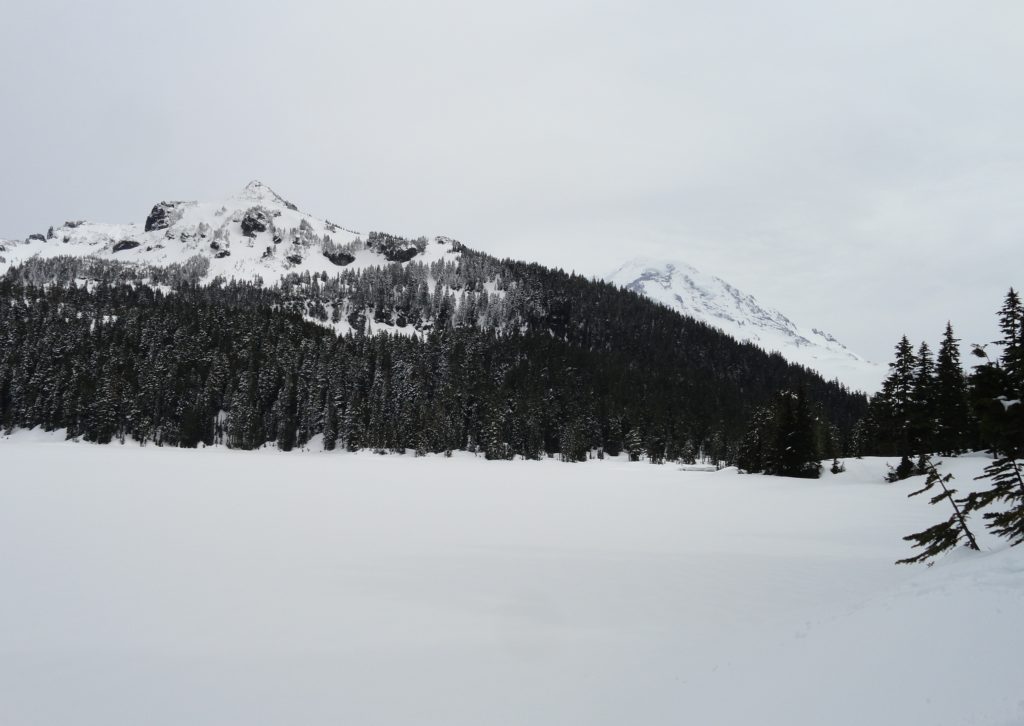
Read MoreGobblers Knob and Lake George –In your face glacier views from Mount Rainier National Park lookout

Quick Facts: Location: Mount Rainier National Park Land Agency: National Park Service Roundtrip: 12.4 miles Elevation Gain: 2,600 feet Contact: Mount Rainier National Park Green Trails Map: Green Trails Mount Rainier National Park 269SX Notes: National Park entrance fee; Dogs Prohibited; Practice Leave No Trace Principles; camping only in designated spots and with a permit Access:…
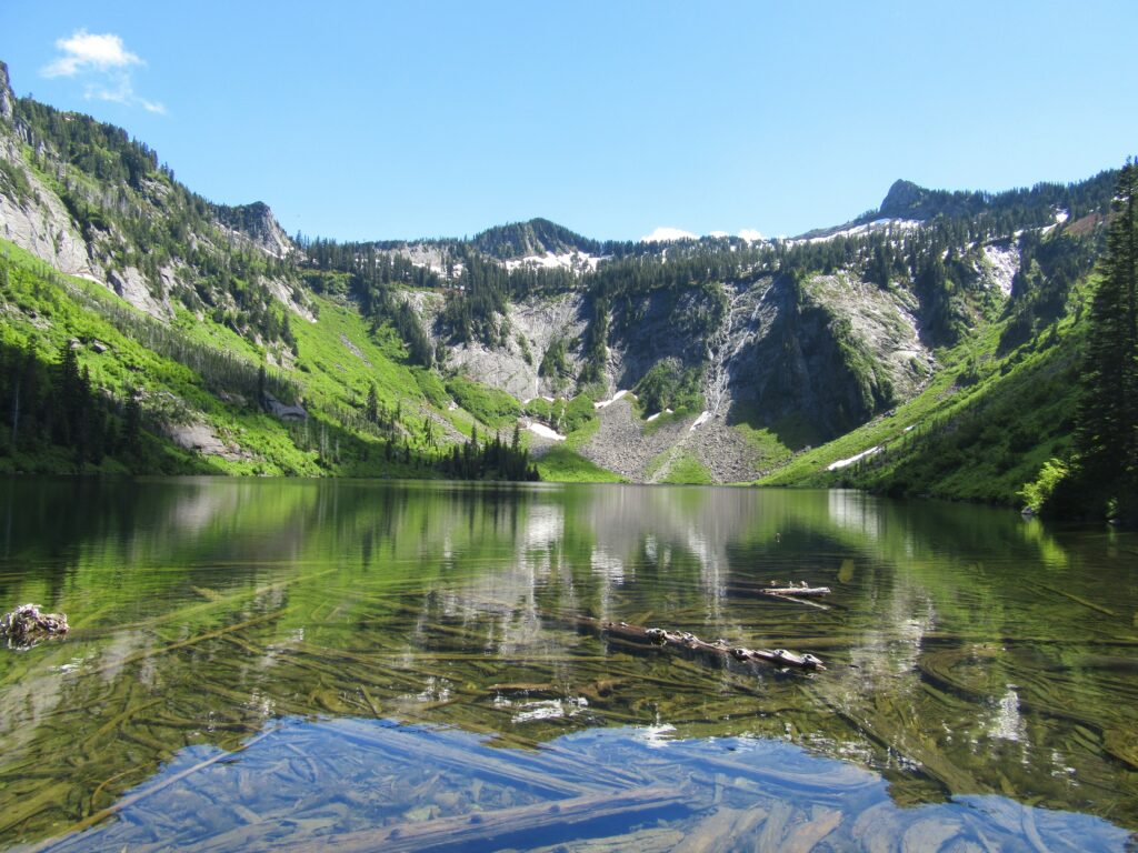
Read MoreRound Lake — Find solitude on Lost Creek Ridge

Quick Facts: Location: Mountain Loop Highway near Darrington Land Agency: Mount Baker-Snoqualmie National Forest Roundtrip: 9.8 miles Elevation gain: 4300 feet Difficulty: strenuous Green Trails Map: Mountain Loop Highway 111SX Contact: Darrington Ranger District; Mount Baker-Snoqualmie National Forest Access: From Darrington follow the Mountain Loop Highway for 16 miles to a junction with Forest Road 49. Turn…
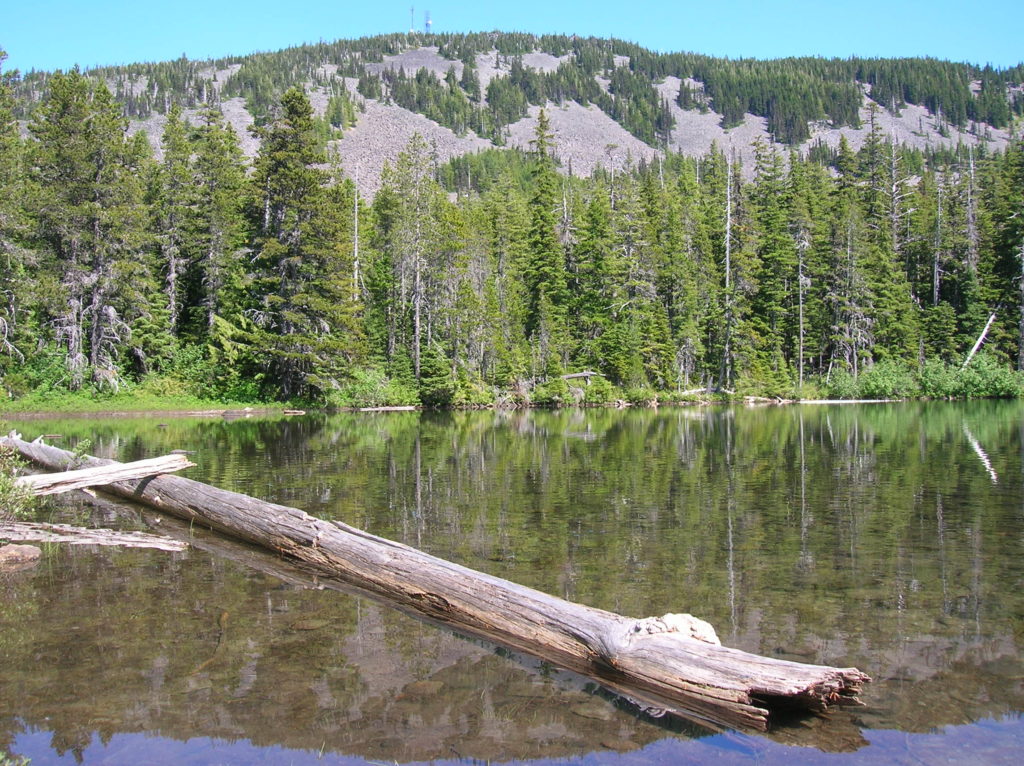
Read MoreGreider Lakes — shimmering subalpine lakes in the Sultan Basin
Quick Facts: Location: Sultan Basin Land Agency: Washington Department of Natural Resources Roundtrip: 9.6 miles Elevation gain: 1,600 feet Green Trails Map: Mountain Loop Highway 111SX Contact: Snohomish County Public Utility District Notes: Register (no fee) at entrance to watershed. Dogs must be on leash. Access: From Everett follow US 2 east to Sultan. At…
Read MoreBear Lake—A bear of a lake but not of a hike!
Quick Facts: Location: Mark O Hatfield Wilderness, Columbia River Gorge National Scenic Area, Oregon Land Agency: National Forest Service Roundtrip: 2.4 miles Elevation Gain: 575 feet Green Trails Map: Columbia River Gorge -West No 428S Contact: Mount Hood National Forest, Hood River Ranger Station Notes: Wilderness rules apply Access: From Portland follow I-84 east to…
Read MoreMowich Lake
Snowshoe to a “deer” location in Mount Rainier National Park Quick Facts: Location: Mount Rainier National Park Distance: 10.2 miles roundtrip Elevation Gain: 1,350 feet Contact: Mount Rainier National Park Green Trails Map: Mount Rainier National Park 269SX Notes: Dogs are prohibited; Route is non-groomed and shared with skiers; National Park pass or Interagency Pass…
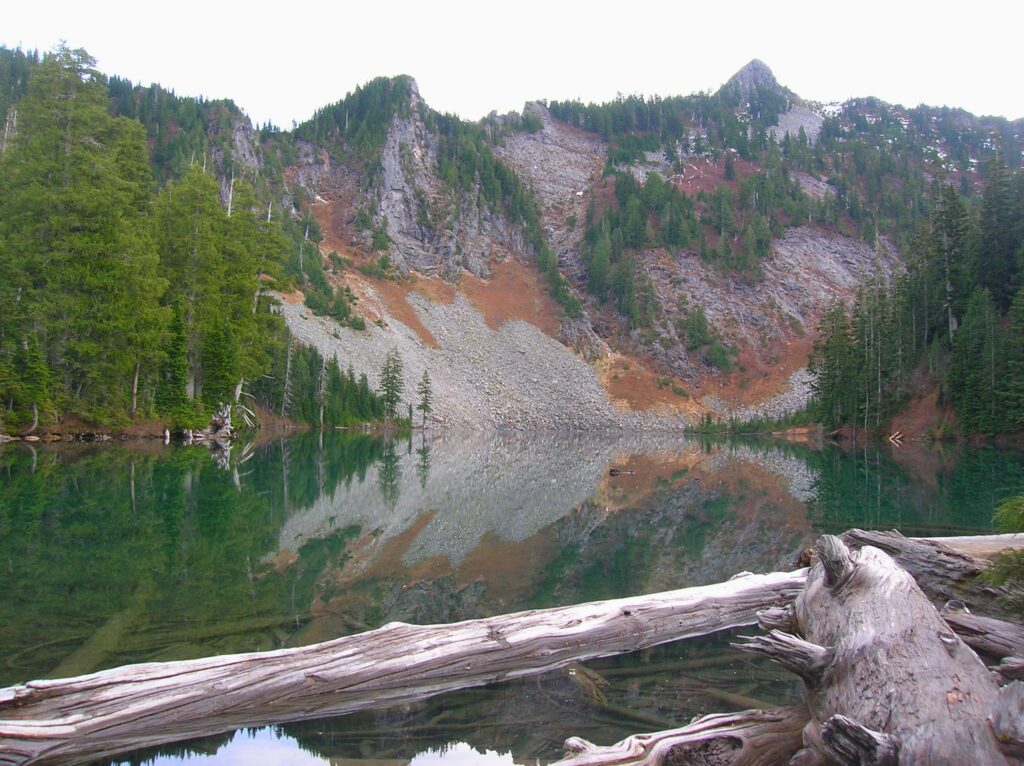
Read MoreHeather Lake — placid lake in a rugged cirque
Quick Facts: Location: Mountain Loop Highway near Granite Falls Land Agency: Mount Baker-Snoqualmie National Forest Roundtrip: 5.0 miles Elevation gain: 1,100 feet Difficulty: moderate Green Trails Map: Mountain Loop Highway Special Series 111SX Contact: Darrington Ranger District: Mount Baker-Snoqualmie National Forest Access: From Granite Falls, follow the Mountain Loop Highway east. One mile beyond the Verlot Visitors…
Read MoreLake Ingalls
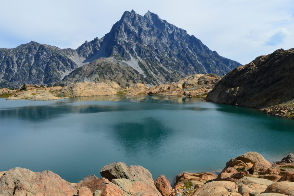
Capture breathtaking reflective views of Mount Stuart Quick Facts: Location: Alpine Lake Wilderness, Teanaway Country Round Trip: 9.2 miles Elevation Gain: 2600 feet Contact: Okanogan-Wenatchee National Forest, Cle Elum Ranger District, https://www.fs.usda.gov/okawen/Detailed Information: 100 Classic Hikes Washington (Mountaineers Books) Notes: Northwest Forest Pass required; dogs prohibited; wilderness rules apply; no camping at lake. Green Trails…
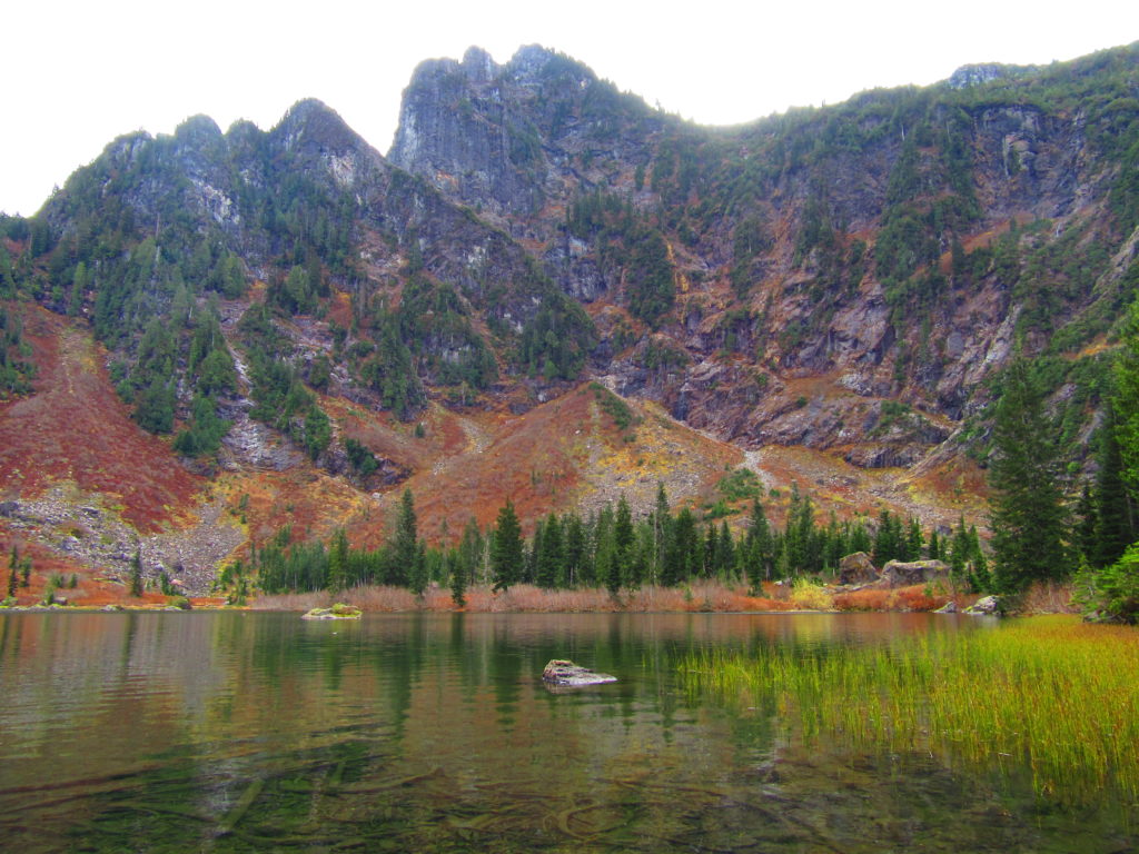
Read MoreBlanca Lake– A strikingly beautiful lake set beneath a formidable wall of jagged peaks
Quick Facts: Location: Wild Sky and Henry Jackson Wildernesses, North Fork Skykomish River Valley Land Agency: Mount Baker-Snoqualmie National Forest Roundtrip: 8.4 miles Elevation gain: 3,300 feet Green Trails Map: Monte Cristo, WA- No. 143 Contact: Skykomish Ranger District: Mount Baker Snoqualmie National Forest Notes: Northwest Forest Pass or Interagency Pass required. No fires allowed…
Read More