Bird Watching
Skagit River Loop– Where eagles dine
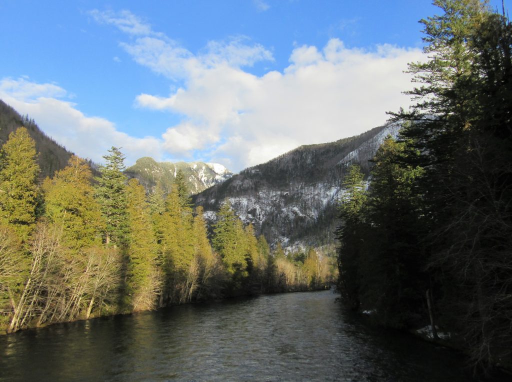
Quick Facts: Location: Ross Lake National Recreation Area, North Cascades Scenic Highway Land Agency: National Park Service Roundtrip: 1.8 miles Elevation gain: 100 feet Contact: NCNP Visitors Center Sedro-Woolley Green Trails Map: Marblemount, WA- No. 47 Guidebook: Day Hiking North Cascades 2nd edition (Mountaineers Books) Notes: dogs must be leashed, Practice Leave No Trace Principles Access:…
Read MoreSpencer Island — Wildlife refuge in the heart of the Snohomish River Delta
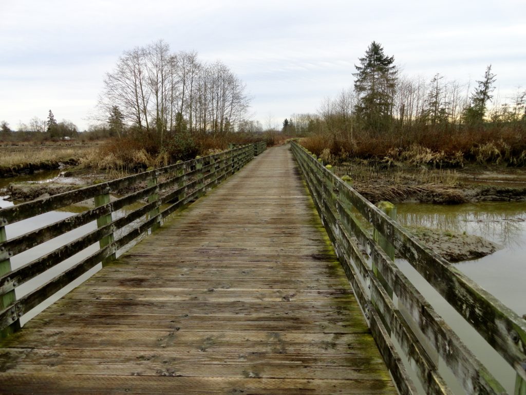
Quick Facts: Location: Snohomish River Delta, Everett Land Agency: Snohomish County Parks Roundtrip: 3.0 miles Elevation gain: none Contact: Snohomish County Parks Notes: Dogs prohibited; Washington Dept of Fish and Wildlife manages northern half of island which is open seasonally to hunting. Good to Know: Practice Leave No Trace, kid-friendly, snow free winter hike, exceptional bird…
Read MoreOaks Bottom Wildlife Refuge– Portland’s Premier Wildlife Refuge
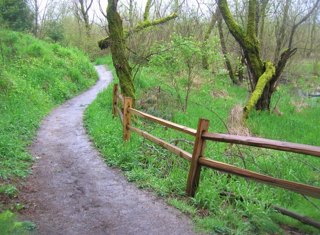
Quick Facts: Location: Sellwood neighborhood, Portland, Oregon Land Agency: Portland Parks and Recreation Roundtrip: 2.8 miles Elevation gain: 60 feet Contact: Portland Parks and Recreation Notes: dogs must be leashed Access: From Ross Island Bridge follow US 26 east (Powell Boulevard) immediately turning right onto SR 99E (SE McLoughlin Boulevard). In just over one mile exit…
Read MoreBoundary Bay Dyke Trail– Bundles of bald eagles, owls and shorebirds and breathtaking views of Mount Baker

Quick Facts: Location: BC Lower Mainland, Land Agency: Boundary Bay Wildlife Management Area One Way: 10.4 miles (16.7 kilometers) Elevation Gain: minimal Contact: Boundary Bay Wildlife Management Area Notes: trail also open to stock and bikes: dogs permitted on leash but note dogs not allowed on shoreline trail in Mud Bay Park from Oct 15-Apr…
Read MoreBrowns Point -Kalaloch–Kid and dog friendly hike on the wild Olympic Coast
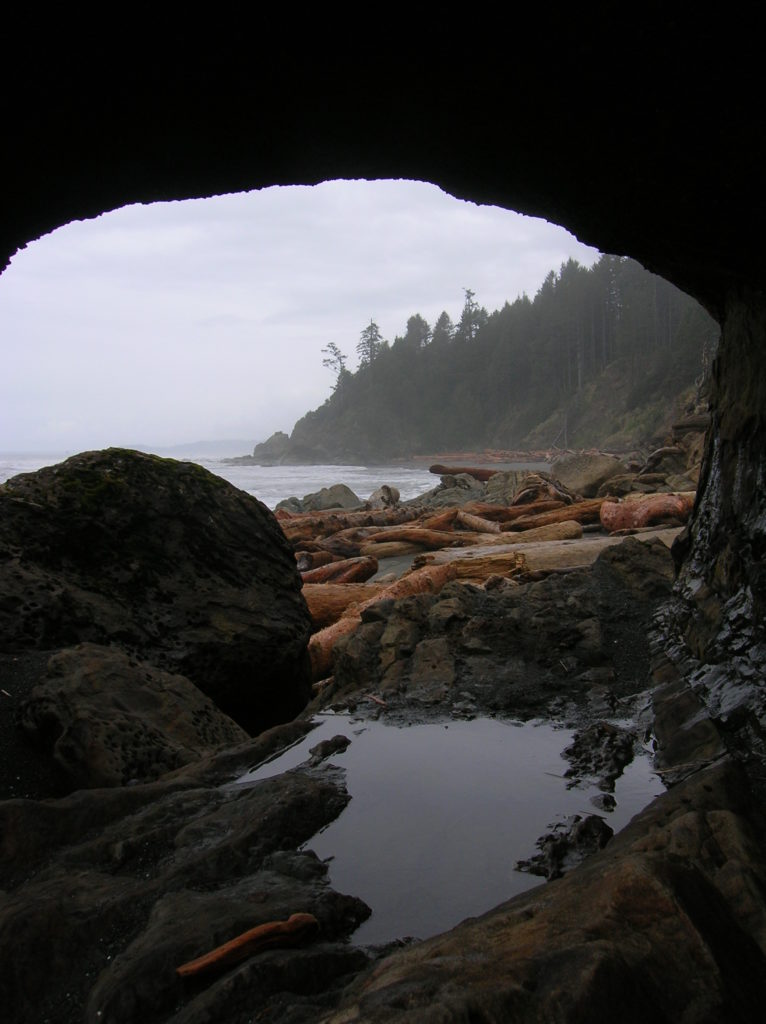
Location: Olympic National Park coast Land Agency: National Park Service Roundtrip: 4.0 miles Elevation gain: 50 feet Contact: Olympic National Park Wilderness Information Center Green Trails Map: Olympic Coast 99S Recommended Resource: Day Hiking Olympic Peninsula 2ed (Mountaineers Books) Notes: Dogs must be leashed; Browns Point can only be rounded during low tides; Practice Leave No…
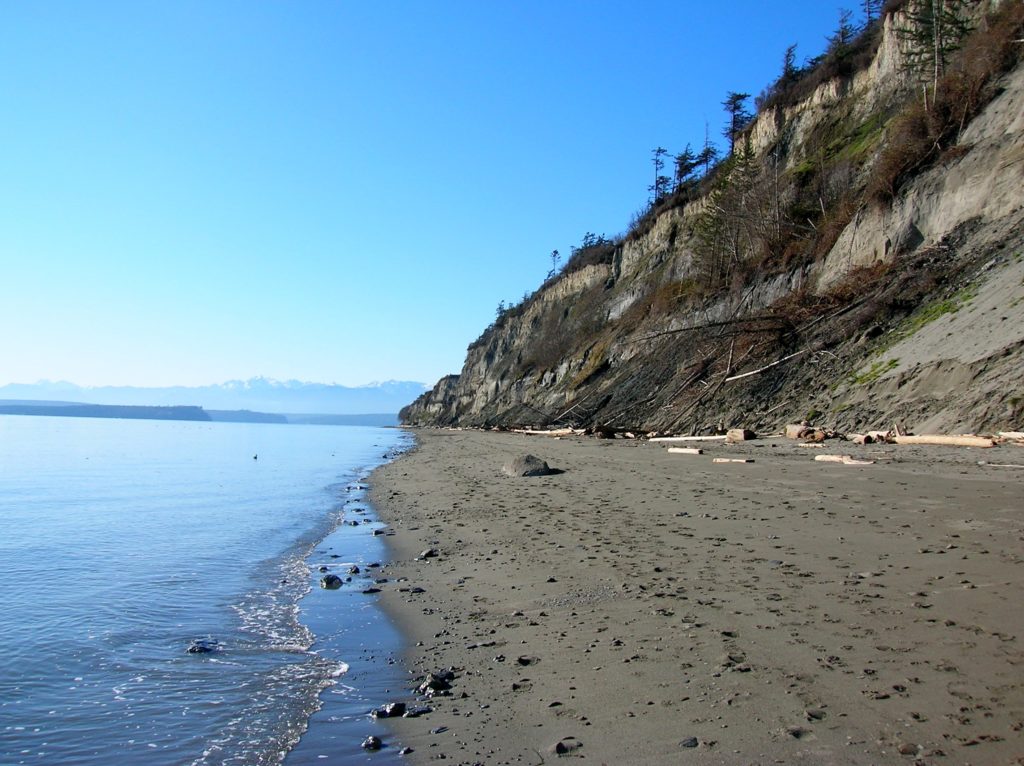
Read MoreFort Casey Historical State Park — Frolic through a fort, to a lighthouse, and on a pretty beach
Quick Facts: Location: Whidbey Island Land Agency: Washington State Parks Round Trip: 1.8 miles of trails Elevation Gain: up to 90 feet Contact: Washington State Parks Recommended Resource: Urban Trails Everett (Mountaineers Books) Notes: Discover Pass required; Dogs allowed on leash Access: From Mukilteo take ferry to Clinton on Whidbey Island. Then continue north on…
Read MorePoint Colville– Rugged coastal headland on Lopez Island

Quick Facts: Location: Lopez Island Land Agency: San Juan Islands National Monument Roundtrip: 2.2 miles Elevation Gain: 180 feet Contact: Bureau of Land Management Detailed Information: Day Hiking The San Juans and Gulf Islands (Mountaineers Books) Notes: Dogs permitted on leash; coastal cliffs—keep children nearby Access: From Anacortes, take Washington State Ferry to Lopez Island Landing. Follow Ferry…
Read MoreTom McCall Point─Legendary Columbia River Gorge Wildflower Display
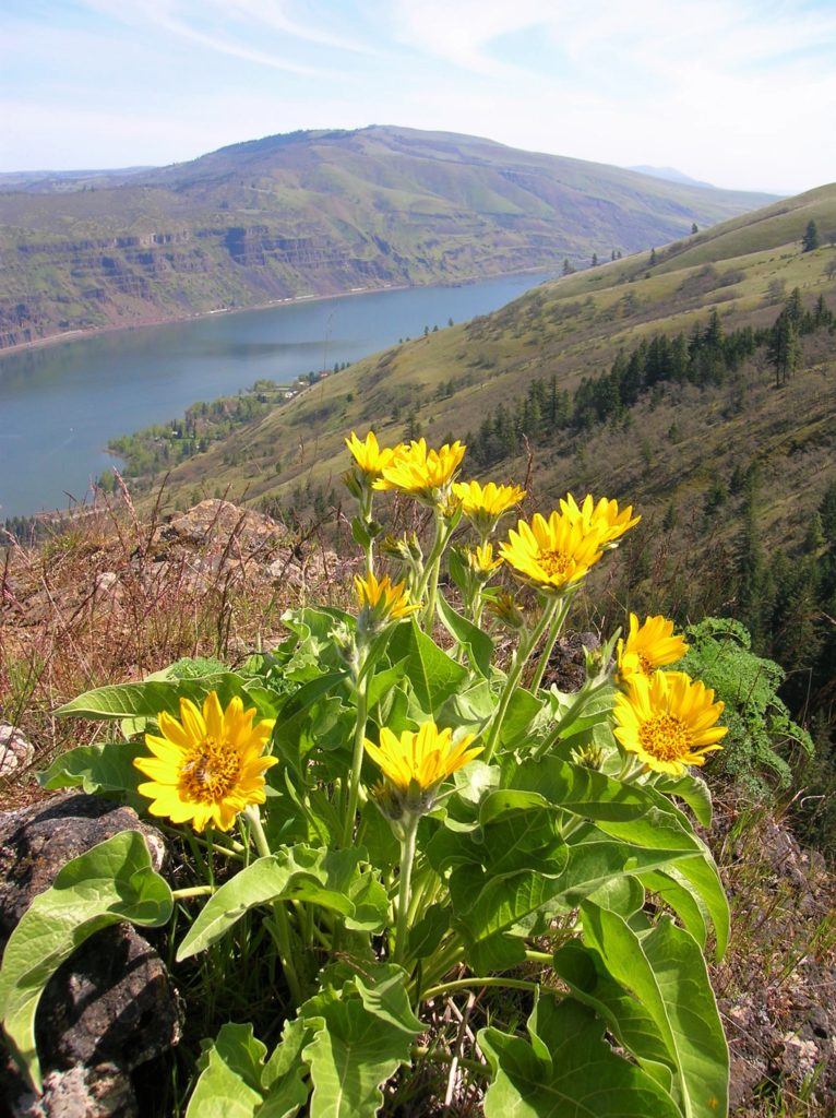
Quick Facts: Location: Columbia River Gorge National Scenic Area Land Agency: Oregon Nature Conservancy and Mayer State Roundtrip: 3.2 miles Elevation Gain: 1,000 feet Notes: Dogs prohibited; Trail closed from Nov 1 through Apr 30 to limit tread damage. Practice Leave No Trace Principles Green Trails Map: Columbia River Gorge East No. 432S Contact: Oregon…
Read MoreChelan Lakeshore Trail—Spring has sprung along Washington’s inland fjord
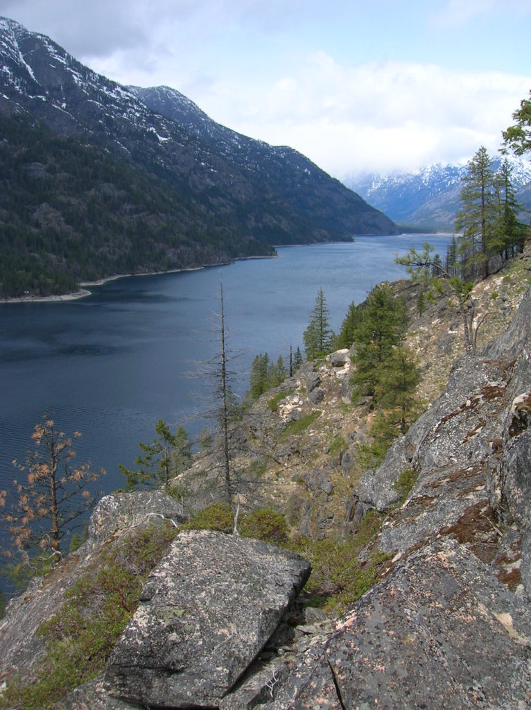
Quick Facts: Location: Central Cascades Land Agency: National Park Service Roundtrip: 10.0 miles Elevation Gain: 1,000 feet Green Trails Map: Stehekin, WA- No. 82 Contact: Lake Chelan National Recreation Area, Golden West Visitor Center in Stehekin; Special Note: Accessible only by boat or sea plane. Regular passenger ferry service is available from Chelan and Field’s…
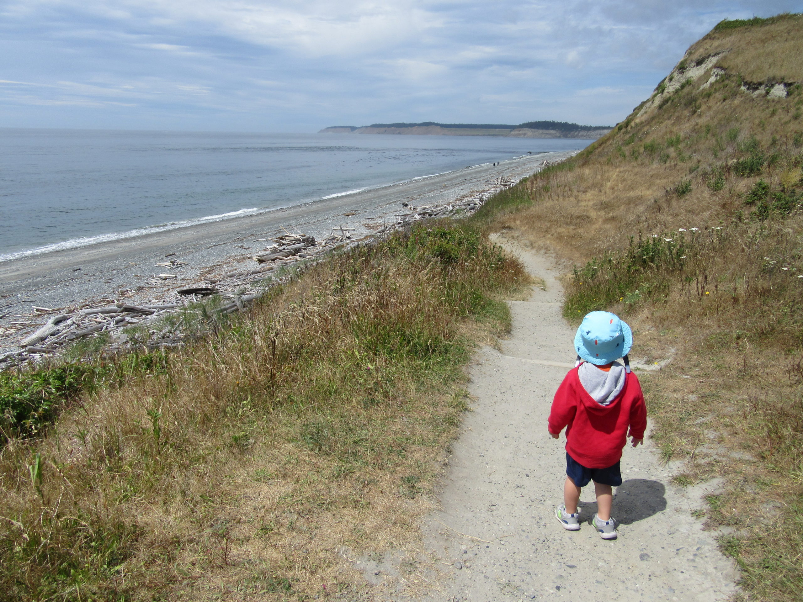
Read MoreDouble Bluff – Dog-friendly beach hiking on Whidbey Island
Quick Facts: Location: Whidbey Island Land Agency: Island County Parks, Washington State Parks, and the Washington DNR Roundtrip: 4.0 miles Elevation Gain: None Access: Take State Ferry from Mulkiteo to Clinton on Whidbey Island. Continue north on SR 525 for 8.5 miles turning left onto Double Bluff Road. Proceed for 2.0 miles to road end…
Read More