Central Cascades
Middle Ridge—Beneath a fortress in the middle of the Glacier Peak Wilderness
Quick Facts Location: Glacier Peak Wilderness Land Agency: Mount Baker-Snoqualmie National Forest Roundtrip: 26.6 miles Elevation Gain: 5,100 feet Green Trails Map: Holden, WA- No. 113 Contact: Darrington Ranger District: Mount Baker Snoqualmie National Forest (360) 436-1155; www.fs.fed.us/r6/mbs Notes: Northwest Forest Pass required. Access: From Everett, head 85 miles east on US 2 to Coles…
Read MoreColchuck Lake—Cobalt blue waters beneath a wall of rock and ice
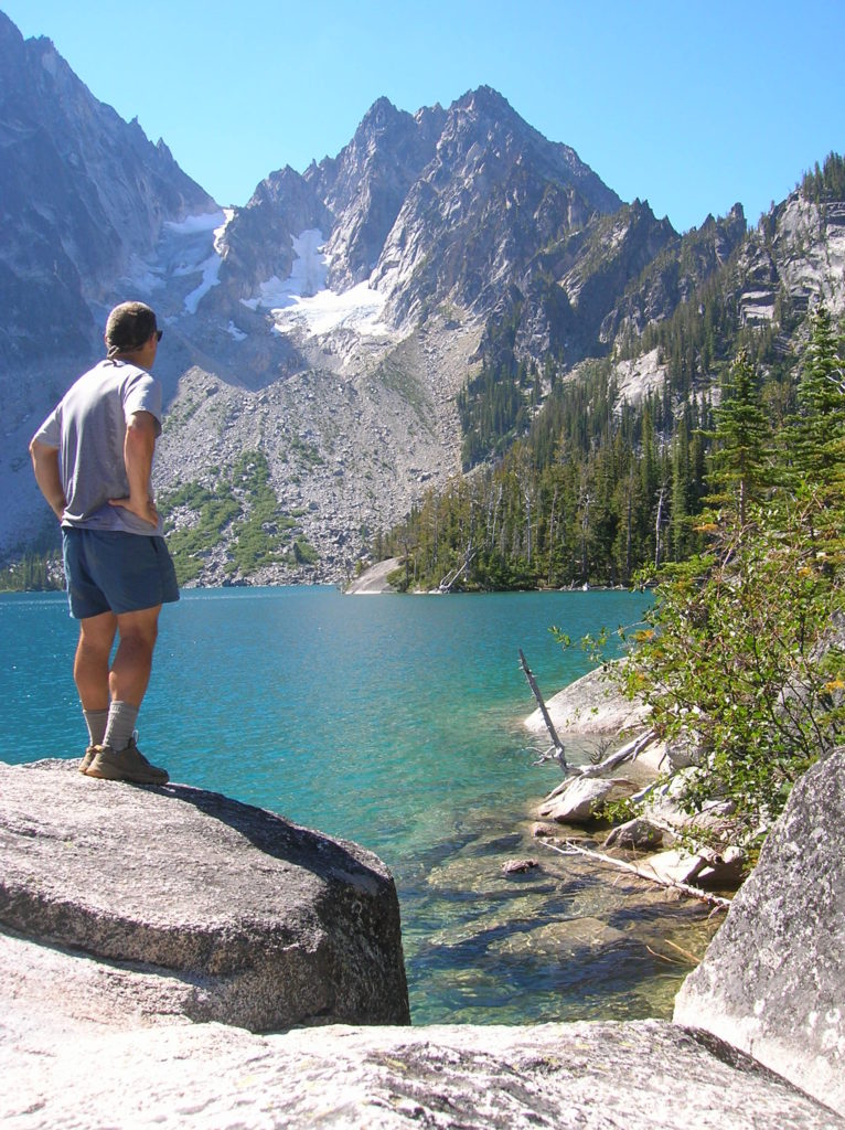
Quick Facts Location: Alpine Lakes Wilderness, Icicle River Valley Land Agency: National Forest Service Roundtrip: 8.4 miles Elevation Gain: 2,200 feet Green Trails Map: The Enchantments- No. 209S Contact: Wenatchee River Ranger District (Leavenworth): Okanogan-Wenatchee National Forest; www.fs.fed.us/r6/wenatchee Notes: Northwest Forest Pass required; Dogs prohibited; Special Enchantment Permit required for overnight visits. Access: From Milepost…
Read MoreNorth Fork Skykomish River—A wild and lonely hike in the Wild Sky and Henry M. Jackson Wildernesses
Quick Facts Location: North Fork Skykomish River Valley Land Agency: Mount Baker-Snoqualmie National Forest Roundtrip: 12.0 miles Elevation Gain: 1,200 feet Green Trails Map: Monte Cristo- No. 143, Benchmark Mtn- No. 144 Contact: Skykomish Ranger District: Mount Baker-Snoqualmie National Forest; (360) 677-2414; www.fs.fed.us/r6/mbs Special Note: Northwest Trail Pass required. Access: From Everett head east on…
Read MoreJumpoff Ridge—Follow an old logging road-turned-trail into the new Wild Sky Wilderness.
Quick Facts Location: North Fork of the Skykomish River near Index Land Agency: National Forest Service Roundtrip: 8.2 miles Elevation Gain: 2,100 feet Access: From Everett follow US 2 east for 35 miles turning left onto the Index-Galena Road (FR 63). Turn off is just after the bridge crossing of the Skykomish River. Continue for…
Read More