Hike of the Week
Barnaby Buttes
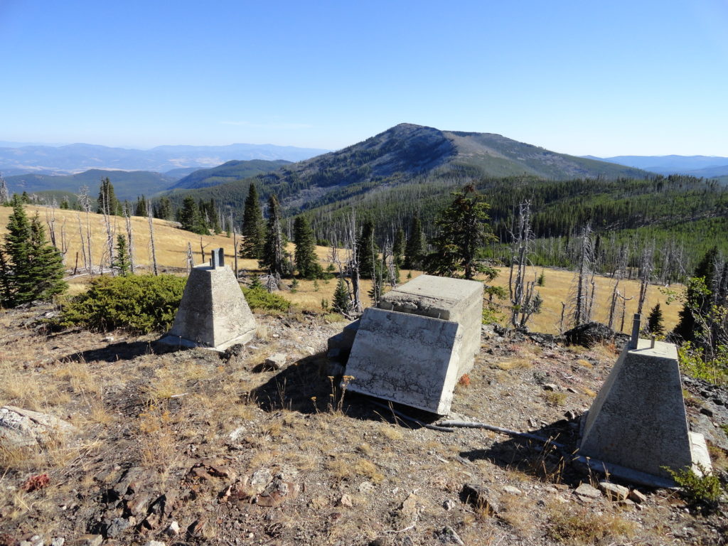
Mega-fauna hot spot in the Kettle River Range Quick Facts: Location: Kettle River Range Land Agency: National Forest Service Distance: 7.4 miles Elevation Gain: 1975 feet Contact: Colville National Forest Three Rivers Ranger District Recommended Guidebook: Day Hiking Eastern Washington (Mountaineers Books) Access: From Kettle Falls, travel west on SR 20 for 14 miles turning…
Read MoreHome Sweet Home
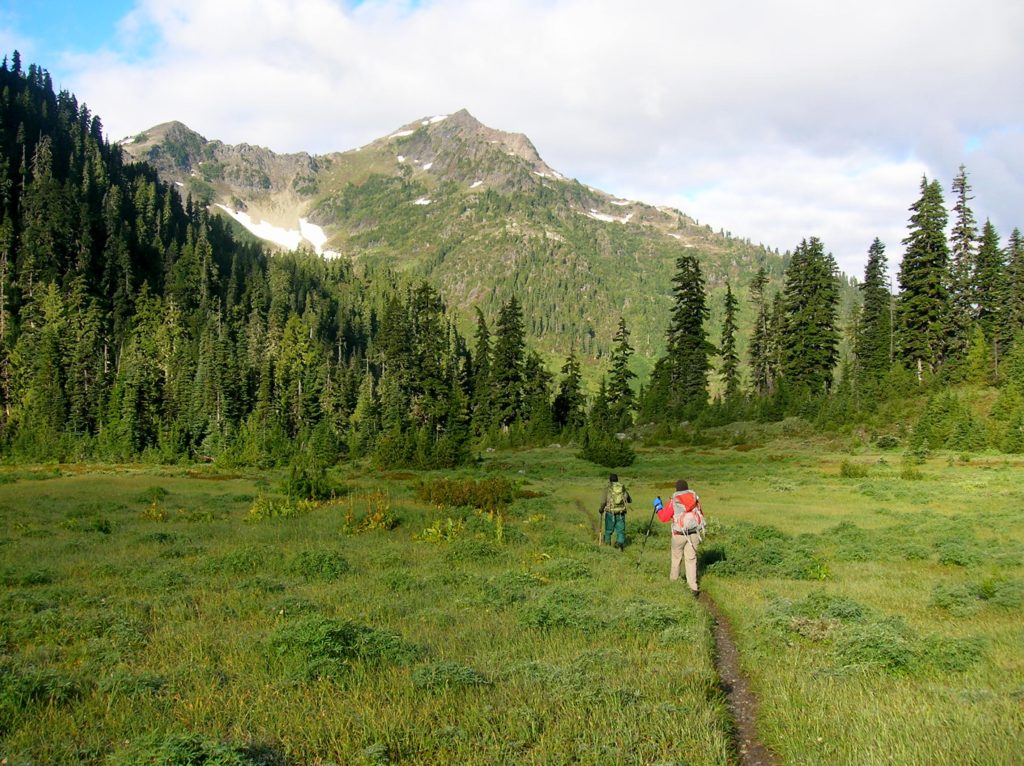
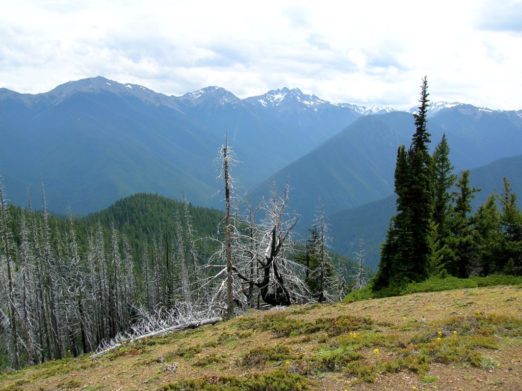
Bear haven in Olympic National Park Quick Facts: Location: Olympic National Park Land Agency: National Park Service Distance: 27.0 miles Elevation Gain: 4300 feet Contact: Olympic National Park www.nps.gov/olym Map: Green Trails Olympic Mountains East 168SX Notes: dogs prohibited; National Park entry fee (or Interagency pass) and Backcountry camping permit for overnight camping Access: From…
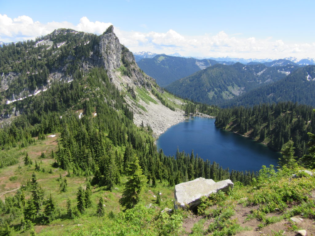
Read MoreQuartz Creek–Hike through a majestic primeval forest along a crystal clear creek
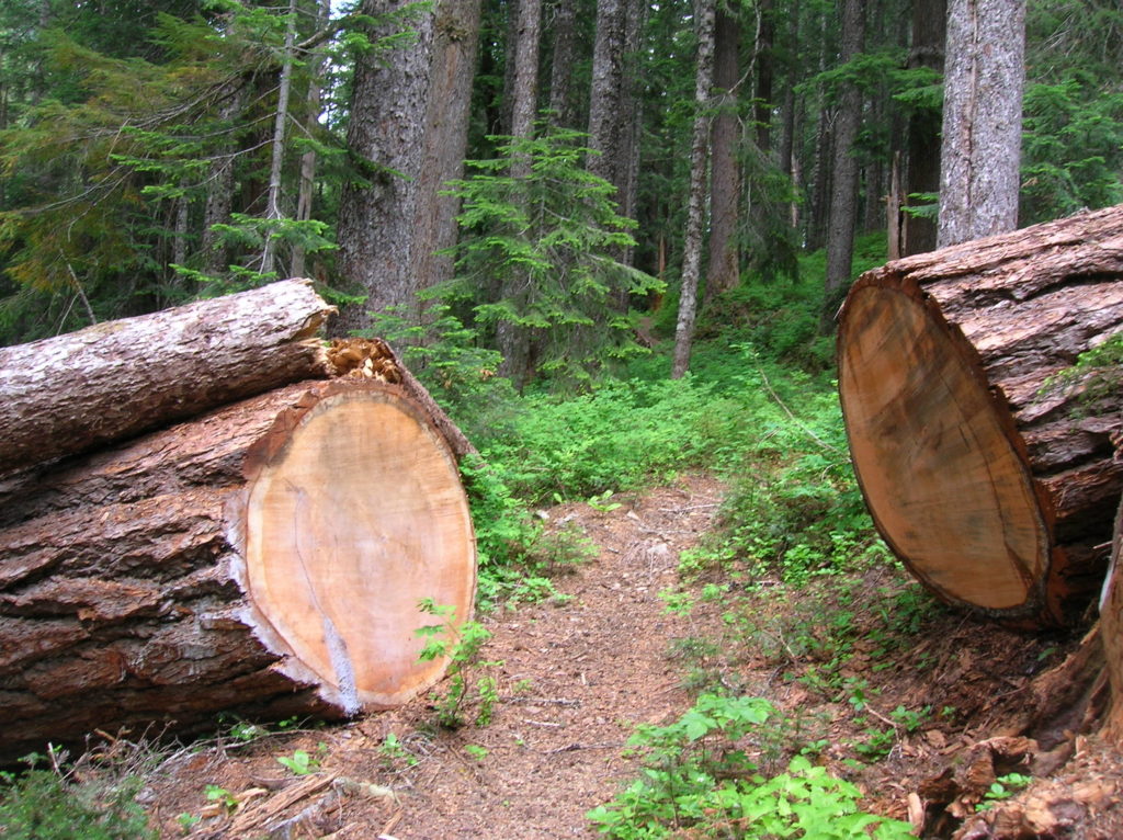
Quick Facts: Location: North Fork of the Skykomish River Land Agency: Mount Baker-Snoqualmie National Forest Roundtrip: 8.6 miles Elevation gain: 1450 feet Green Trails Maps: Monte Cristo, WA-No. 143 Contact: Skykomish Ranger District: Mount Baker Snoqualmie National Forest Notes: Northwest Forest Pass or Interagency Pass required. Access: The North Fork Skykomish River Road from Index, the…
Read MoreGoat Lake─A family friendly hike for old goats and kids alike!
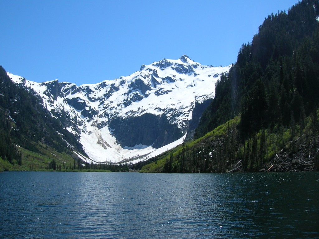
Quick Facts: Location: Mountain Loop Highway near Darrington Land Agency: Mount Baker-Snoqualmie National Forest Roundtrip: 10.4 miles Elevation Gain: 1,400 feet Green trails Map: Mountain Loop Highway-No. 111SX Access: From Granite Falls, follow the Mountain Loop Highway east for 31 miles to Barlow Pass and end of pavement. Continue for 3.5 miles turning right onto FR…
Read MoreDeer Ridge–Enjoy dear views of the Gray Wolf River Valley
Quick Facts: Location: Northeast Olympic Peninsula Land Agency: Olympic National Forest and Olympic National Park Roundtrip: 10.0 miles Elevation gain: 2800 feet Contact: Hood Canal Ranger District, Olympic National Forest; and Olympic National Park Green Trails Map: Olympics East no. 168SX Notes: Dogs are prohibited on trail in the national park Good to Know: dog-friendly…
Read MoreMount McCausland—Rise above Valhalla!
Quick Facts: Location: Henry M. Jackson Wilderness Land Agency: National Forest Service Roundtrip: 6.4 miles Elevation Gain: 1,800 feet Green Trails Map: Alpine Lakes Stevens Pass No. 176S Contact: Wenatchee River Ranger District: Okanogan-Wenatchee National Forest Access: From Everett head east on US 2 to Stevens Pass. Continue east for another 4.0 miles. Just after the…
Read MoreWhite Pass–Sprawling meadows and stupendous views high on the Cascade Crest
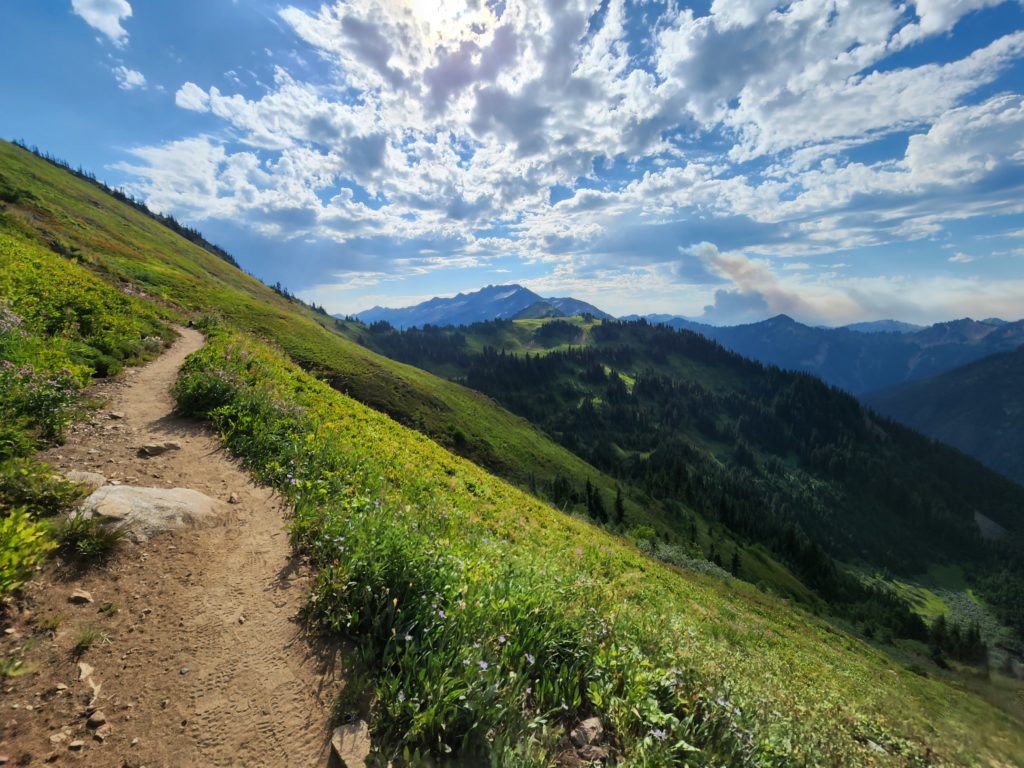
Location: North Fork Sauk River Land Agency: Mount Baker-Snoqualmie National Forest Roundtrip: 19.4 miles High Point: 5,850 feet Elevation gain: 4,000 feet Difficulty: strenuous Green Trails Maps: Mountain Loop Highway 111SX Contact: Darrington Ranger District: Mount Baker-Snoqualmie National Forest Note: Northwest Forest Pass or Interagency Pass Required Access: From Darrington, travel south on the Mountain…
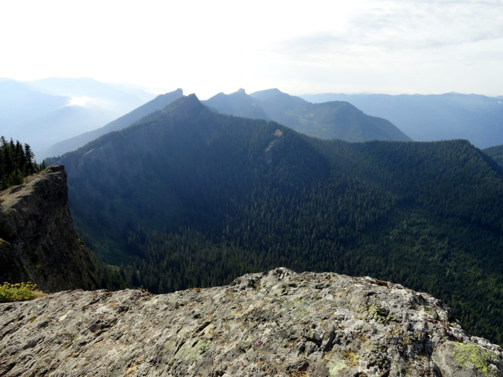
Read MoreHidden Lake Lookout
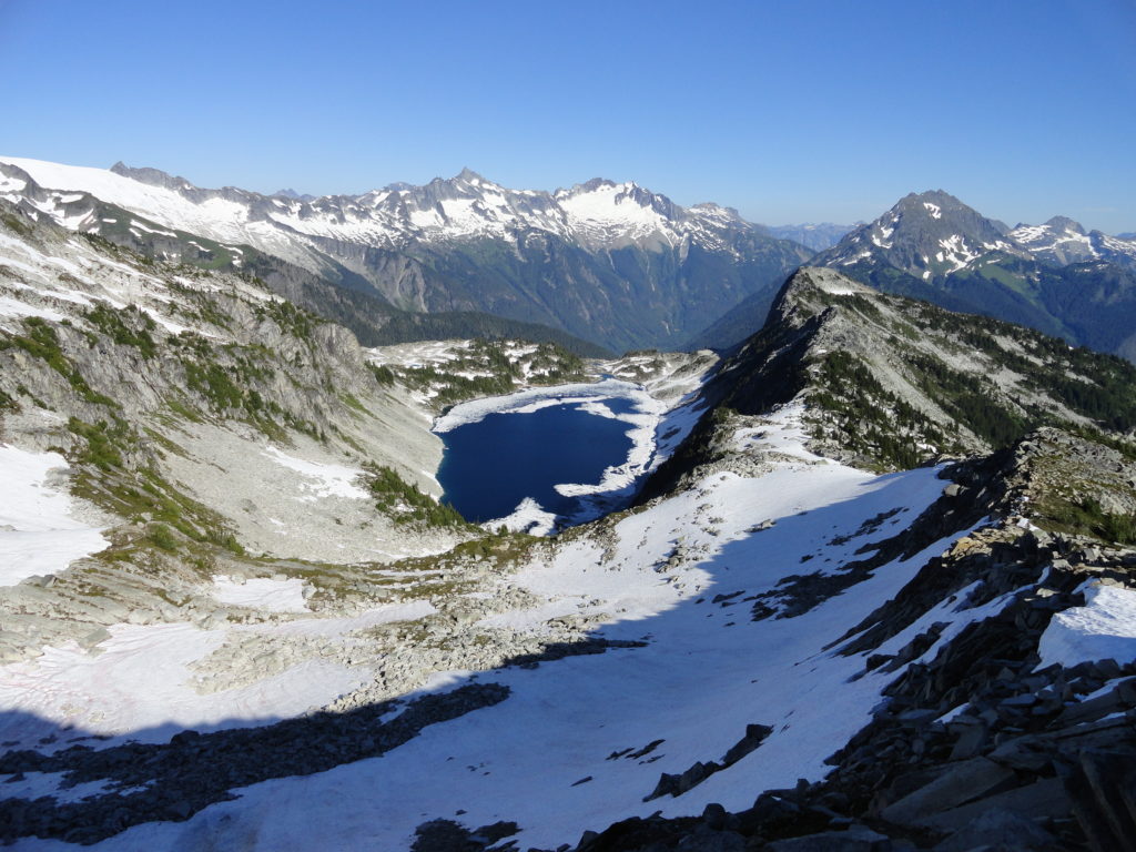
Savor stunning views from an historic fire lookout teetering on a lofty precipitous knoll Quick Facts: Location: Cascade River Road Land Agency: Mount Baker-Snoqualmie National Forest Roundtrip: 9.0 miles Elevation Gain: 3,340 feet Green Trails Maps: Diablo, WA-No. 48; Cascade Pass, WA-No. 80 Access: From Marblemount, head east on the Cascade River Road for 9.7…
Read MoreGreen Mountain –Banal is thy name—Breathtakingly beautiful is thy game
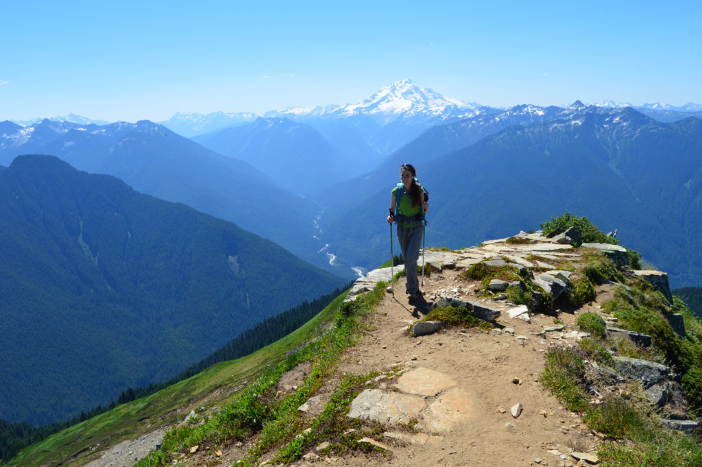
Quick Facts: Location: Glacier Peak Wilderness, Suiattle River Road Land Agency: Mount Baker-Snoqualmie National Forest Roundtrip: 8.0 miles Elevation gain: 3,100 feet Green Trails Maps: North Cascades Ross Lake 16SX Contact: Darrington Ranger District: Mount Baker-Snoqualmie National Forest Notes: wilderness rules apply Access: From Darrington, travel north on SR 530 for 7.5 miles turning right…
Read MoreHigh Rock– The view of Rainier simply rocks from this precipitous peak!
Quick Facts: Location: Sawtooth Ridge near Ashford and Packwood, WA Land Agency: Gifford Pinchot National Forest Roundtrip: 3.2 miles Elevation gain: 1,350 feet Green Trails Maps: Randle, WA no. 301 Contact: Cowlitz Valley Ranger Station (Randle); Gifford Pinchot National Forest Notes: Dogs are allowed, but should be on leash because of steep and dangerous drop offs.…
Read More