Hike of the Week
Tumwater Pipeline Trail—Hike along “strong water” watching rafters and rapids
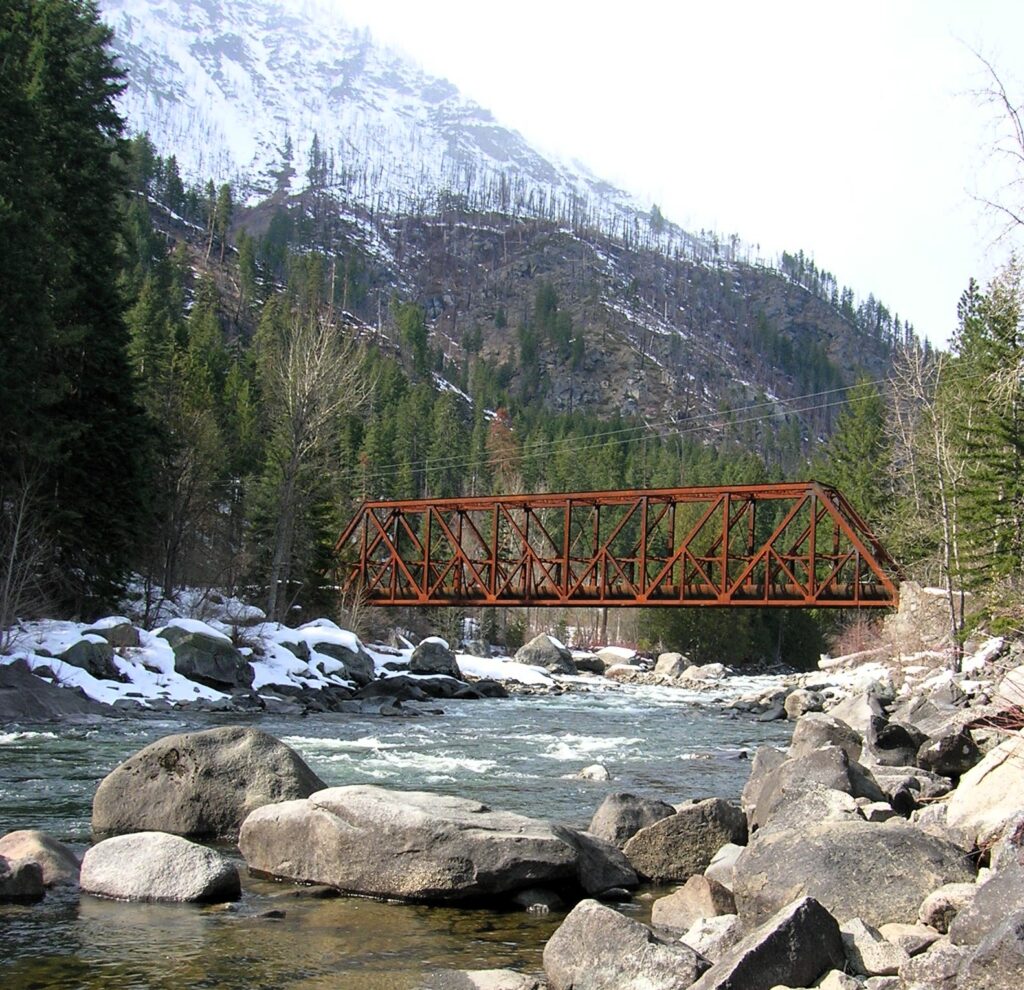
Quick Facts: Location: Wenatchee River Valley Land Agency: Okanogan-Wenatchee National Forest Roundtrip: 2.4 miles Elevation Gain: 100 feet Green trails Map: Leavenworth- No. 178 Access: From Everett head east on US 2 passing Stevens Pass to Coles Corner. Continue east on US 2 for 12.7 miles to trailhead located on your right (between Mileposts 97…
Read MoreStacker Butte─Blossoming Queen of the Columbia River Gorge
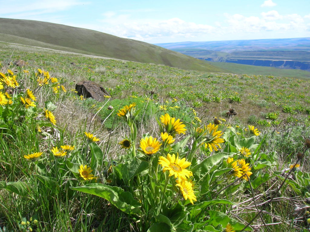
Quick Facts: Location: Columbia River Gorge National Scenic Area Land Agency: Washington Department of Natural Resources Roundtrip: 5.0 miles Elevation Gain: 1,150 feet Contact: Washington DNR Southeast Region Notes: Discover Pass required; Dogs prohibited; Practice Leave No Trace Principles Recommended Resource: Day Hiking Columbia River Gorge Green trails Map: Columbia River Gorge West No. 432S Good…
Read MoreQuinault Rainforest Loop — Easily accessible trail system through an Olympic Rainforest
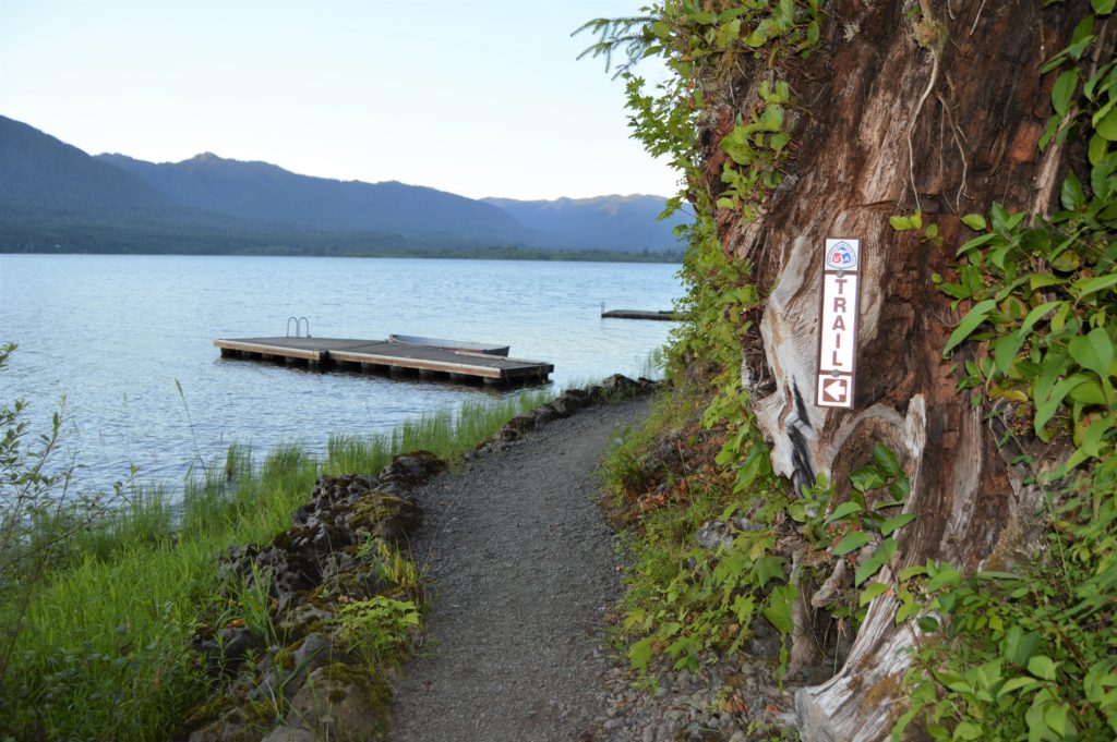
Quick Facts: Location: Lake Quinault Land Agency: Olympic National Forest Roundtrip: 3.9 miles Elevation Gain: 500 feet Contact: Olympic National Forest, Pacific Ranger District, Quinault Detailed Information: Day Hiking Olympic Peninsula 3rd edition (Mountaineers Books) Notes: Northwest Forest Pass or Interagency Pass required; dogs should on leash Access: From Hoquiam travel north on US 101 for 35 miles.…
Read MoreDalles Ridge — Wintering Elk and Sublime Alpine views
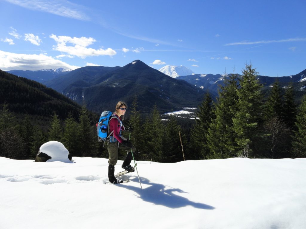
Quick Facts: Location: Mount Baker-Snoqualmie National Forest Land Agency: US Forest Service Round Trip: 8.2 miles Elevation Gain: 1900 feet Green Trails Map: Greenwater no. 238 Contact: Mount Baker-Snoqualmie National Forest Notes: During periods of low snow levels, parking may be difficult. Access: From Enumclaw follow SR 410 for 13.6 miles turning left (shortly after passing…
Read MoreBalch Creek–Dramatic Ravine a Forest Park highlight
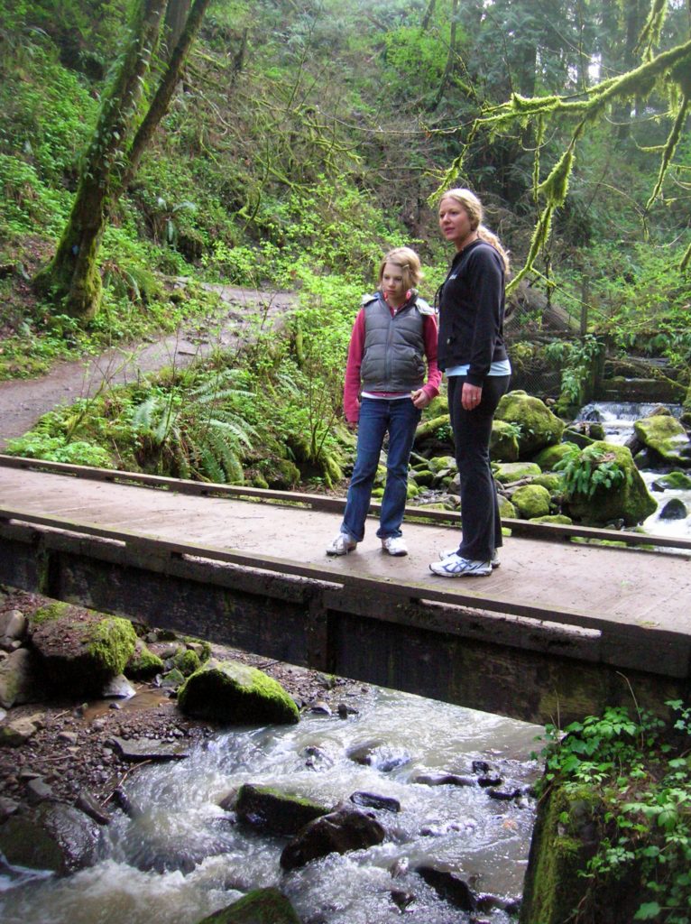
Location: Forest Park, Portland, Oregon Land Agency: Portland Parks and Recreation Roundtrip: 2.4 miles High Point: 425 feet Elevation gain: 300 feet Difficulty: easy Green Trails Map: Forest Park No 426S Contact: Contact/permits: Portland Parks and Recreation ; Forest Park Conservancy; Notes: dogs must be leashedAccess: From downtown Portland, follow NW Vaughn Street west turning…
Read MoreExplorer Falls–It's an easy search to find these falls

Quick Facts: Location: Near Lake Roesiger between Monroe and Granite Falls Land Agency: Washington DNR Roundtrip: 5.2 miles Elevation gain: 700 feet Contact: Washington DNR Notes: Discover Pass Required. Do not block gates, nor drive past it if open. Active logging area, be alert to trucks on roadway and yield right-of-way. Access: From Monroe, follow…
Read MoreCheam Lake Wetlands–Birding hotspot where the North Cascades meet the Fraser River
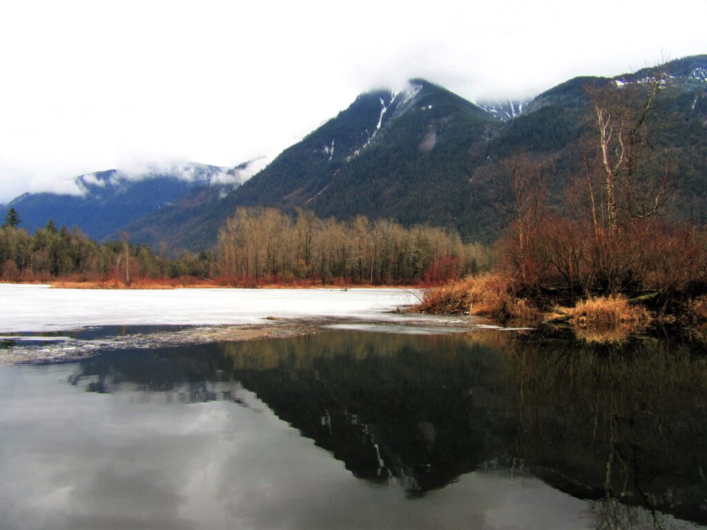
Quick Facts: Location: Popkum, Fraser Valley Regional District, BC Land Agency: Fraser Valley Regional Parks Round Trip: 2.5 miles (4.0 km) roundtrip Elevation Gain: minimal Contact: Fraser Valley Regional Parks Notes: Dogs prohibited Access: From Vancouver, BC follow Trans-Canada Highway 1 east to Exit 138 (12 miles /20 kilometers east of Chilliwack). Turn left and…
Read MoreCorral Pass –Challenging snow shoe trip to high pass on Castle Mountain

Quick Facts: Location: Mount Baker-Snoqualmie National Forest Land Agency: National Forest Service Roundtrip: 11.5 miles Elevation Gain: 2,800 feet Contact: Mount Baker-Snoqualmie National Forest Green Trails Maps: Greenwater no. 238, Lester no. 239, and on Mount Rainier National Park 269S Notes: When snow level is low, parking here can be a challenge. Do not block access…
Read MoreSouth Indian Island — Enjoy peaceful shoreline strolling along a line of defense
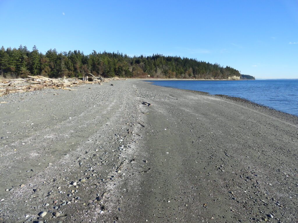
Quick Facts: Location: Indian Island near Port Hadlock Land Agency: Jefferson County Parks Roundtrip: 4.0 miles Elevation Gain: 70 feet Notes: Detailed information can be found in Day Hiking Olympic Peninsula (Mountaineers Books) Contact: Jefferson County Parks Access: From Kingston, drive State Route 104 turning right onto SR 19. Then continue north for 9 miles turning right onto…
Read MoreBig Finn Hill Park
Quiet Alternative to St Edward State Park Quick Facts: Location: Kirkland Land Agency: King County Parks Distances: up to 9.5 miles of trails Elevation Gain: up to 200 feet Contact: King County Parks Detailed Information: Urban Trails Eastside (Mountaineers Books) Notes: parking area on NE 138th Street gated at dusk Access: From Kenmore follow 68th…
Read More