Mt Rainier
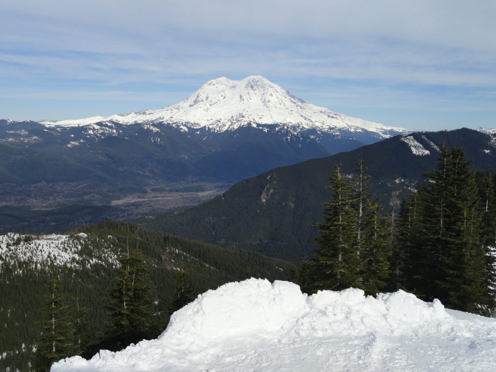
Dalles Ridge — Wintering Elk and Sublime Alpine views
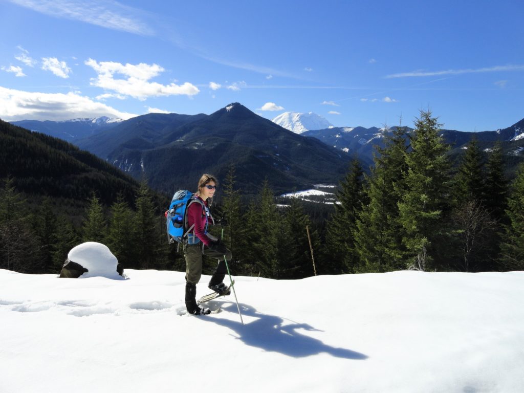
Quick Facts: Location: Mount Baker-Snoqualmie National Forest Land Agency: US Forest Service Round Trip: 8.2 miles Elevation Gain: 1900 feet Green Trails Map: Greenwater no. 238 Contact: Mount Baker-Snoqualmie National Forest Notes: During periods of low snow levels, parking may be difficult. Access: From Enumclaw follow SR 410 for 13.6 miles turning left (shortly after passing…
Read MoreCorral Pass –Challenging snow shoe trip to high pass on Castle Mountain

Quick Facts: Location: Mount Baker-Snoqualmie National Forest Land Agency: National Forest Service Roundtrip: 11.5 miles Elevation Gain: 2,800 feet Contact: Mount Baker-Snoqualmie National Forest Green Trails Maps: Greenwater no. 238, Lester no. 239, and on Mount Rainier National Park 269S Notes: When snow level is low, parking here can be a challenge. Do not block access…
Read MoreGreenwood Lake–Solitude in the shadow of High Rock

Quick Facts: Location: Nisqually River Valley Land Agency: National Forest Service Round Trip: 4.0 miles Elevation Gain: 1450 feet Contact: Cowlitz Valley Ranger Station (Randle), Gifford Pinchot National Forest Green Trails Maps: Randle, WA no. 301 Notes: Road to trailhead can be rough. Trail is open to motorcycles but sees little use as it receives little…
Read MoreSnoquera Falls — A touch of the Yosemite Valley in Washington
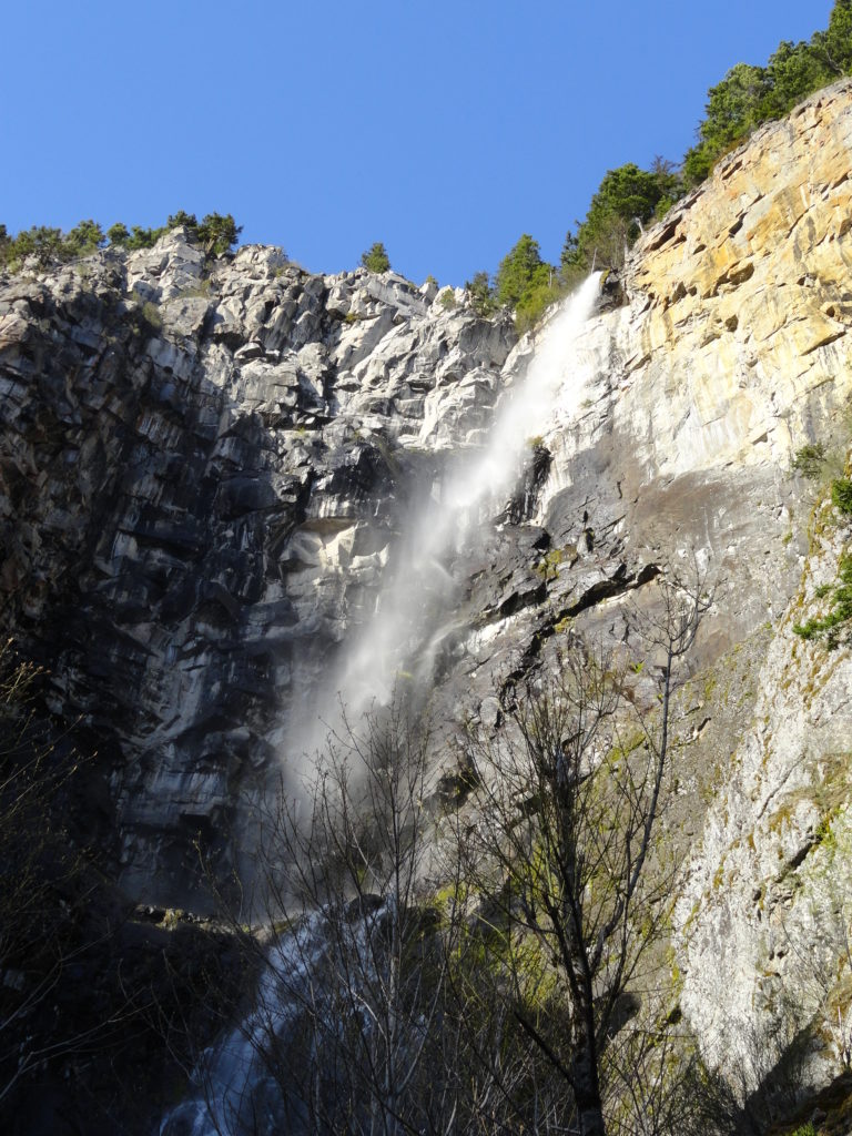
Quick Facts: Location: White River Valley Land Agency: Mount Baker-Snoqualmie National Forest Roundtrip: 4.2 miles Elevation Gain: 750 feet Contact: Snoqualmie Ranger District, Enumclaw office Green Trails Map: Greenwater no. 238 Notes: Northwest Forest Pass or Interagency Pass required; Dogs permitted on leash Access: From Enumclaw, follow SR 410 east for 28 miles. Turn left onto Camp Sheppard…
Read MoreGobblers Knob and Lake George –In your face glacier views from Mount Rainier National Park lookout

Quick Facts: Location: Mount Rainier National Park Land Agency: National Park Service Roundtrip: 12.4 miles Elevation Gain: 2,600 feet Contact: Mount Rainier National Park Green Trails Map: Green Trails Mount Rainier National Park 269SX Notes: National Park entrance fee; Dogs Prohibited; Practice Leave No Trace Principles; camping only in designated spots and with a permit Access:…
Read MoreIndian Henry’s Hunting Ground via Kautz Lake — Head to a fabled land of wildflowers!
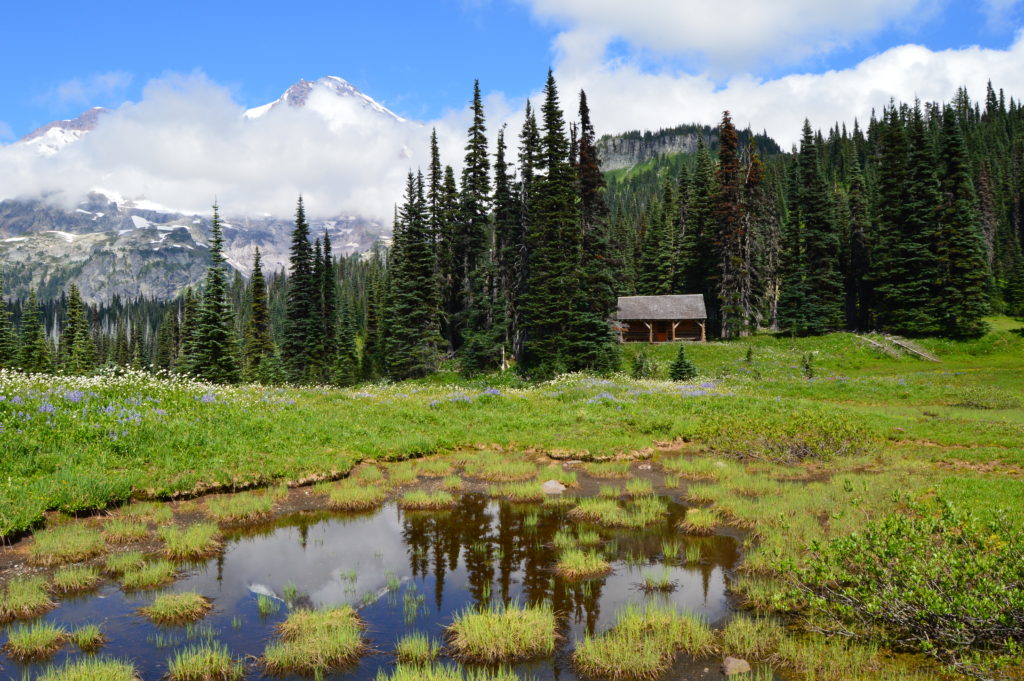
Quick Facts: Location: Nisqually Valley, Mount Rainier National Park Land Agency: National Park Service Roundtrip: 11.6 miles Elevation Gain: 3200 feet Contact: Mount Rainier National Park Green Trails Map: Mount Rainier National Park 269S Notes: National Park Entrance Fee or Interagency Pass required; Dog prohibited Timed entry pass required for entrance into Mount Rainier National Park (Longmire and Sunrise…
Read MoreParadise Glacier Trail — The ice caves are no more, but the views are still incredible

Quick Facts: Location: Mount Rainier National Park Land Agency: National Park Service Roundtrip: 5.6 miles Elevation Gain: 1,000 feet Contact: Mount Rainier National Park Green Trails Map: Green Trails Mount Rainier National Park 269SX Notes: National Park entrance fee; Dogs Prohibited; Practice Leave No Trace Principles; Timed entry pass required for entrance into Mount Rainier National…
Read MoreMowich Lake
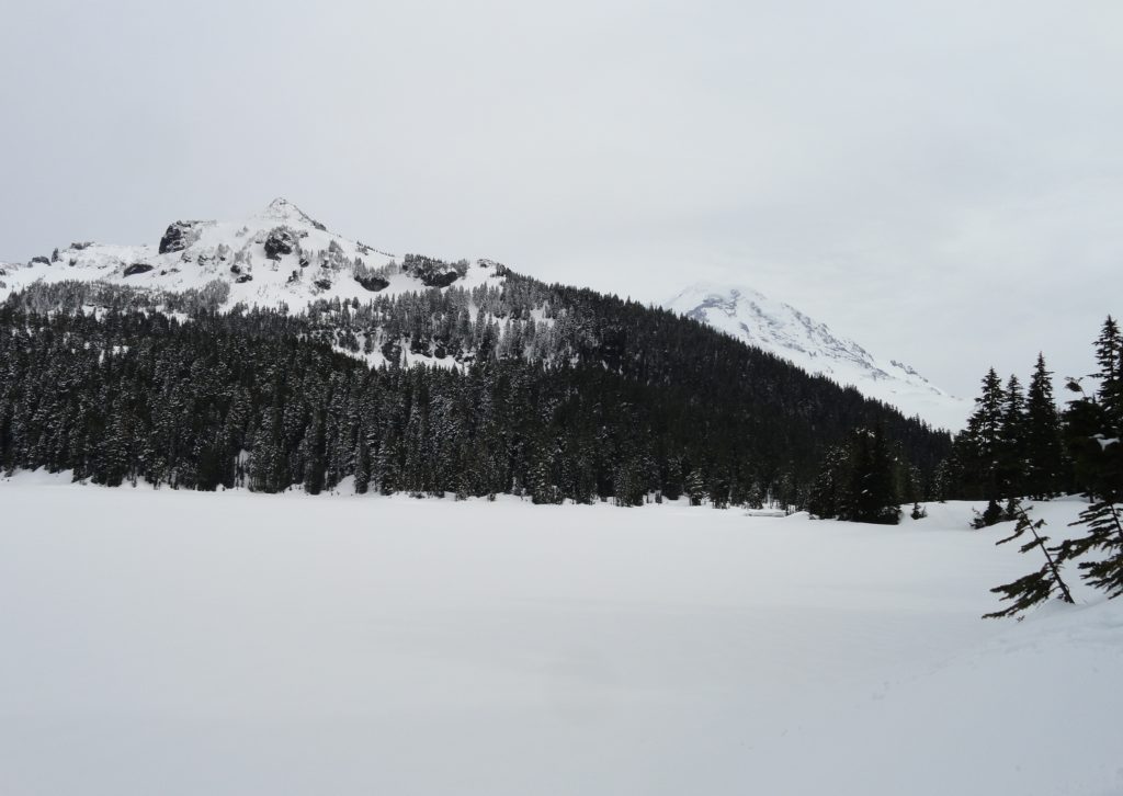
Snowshoe to a “deer” location in Mount Rainier National Park Quick Facts: Location: Mount Rainier National Park Distance: 10.2 miles roundtrip Elevation Gain: 1,350 feet Contact: Mount Rainier National Park Green Trails Map: Mount Rainier National Park 269SX Notes: Dogs are prohibited; Route is non-groomed and shared with skiers; National Park pass or Interagency Pass…
Read MoreHigh Hut — Snowshoe to a heavenly hut in the shadow of Rainier
Quick Facts: Location: Mount Tahoma Trails near Ashford Land Agency: Washington DNR and Mount Tahoma Trails Association Roundtrip: 8.6 miles Elevation gain: 2,400 feet Contact: Mount Tahoma Trails Association MTTA Map: Mount Tahoma Ski Trail System (MTTA) Notes: Sno-Park Pass required; Reservations required for overnight stays in hut Access: From Elbe head east 10 miles…
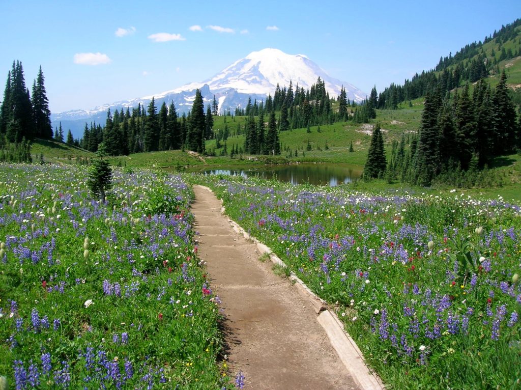
Read MoreNaches Peak–Big Scenic Payoff for little effort
Quick Facts: Location: Naches Pass, Mount Rainier National Park Land Agency: United States Park Service Roundtrip: 4.0 miles Elevation gain: 600 feet Green Trails Maps: Mount Rainier Wonderland Map 269SX Contact: Mount Rainier National Park Notes: Dogs prohibited Access: From Enumclaw follow SR 410 east to Tipsoo Lake parking area just before Chinook Pass. Good…
Read More