Pacific Northwest Trail
Padilla Bay Dike Trail–shore fine hike in the Skagit Valley
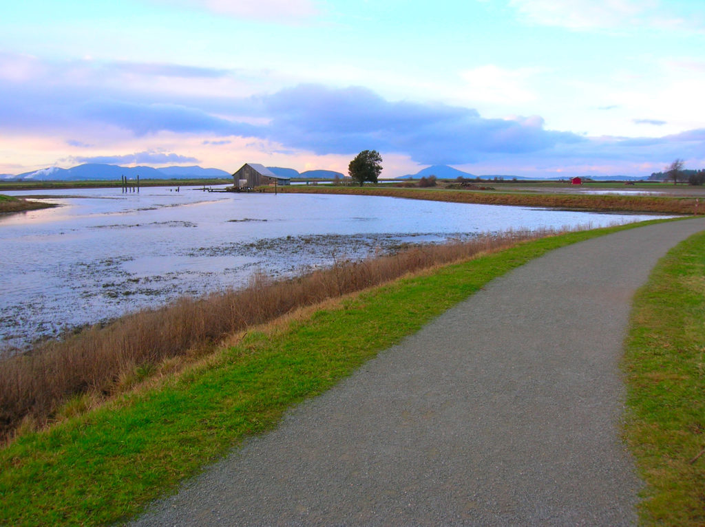
Quick Facts: Location: Skagit County Land Agency: Padilla Bay National Estuarine Research Reserve Roundtrip: 4.8 miles Elevation Gain: 30 feet Contact: Padilla Bay NERR Access: From Burlington (exit 231 on I-5) proceed through roundabouts and head west on Josh Wilson Road for 6.4 miles. Upon entering the village of Bay View turn left onto 2nd Street…
Read MoreWapaloosie Mountain–a wapaloosie of a peak indeed!
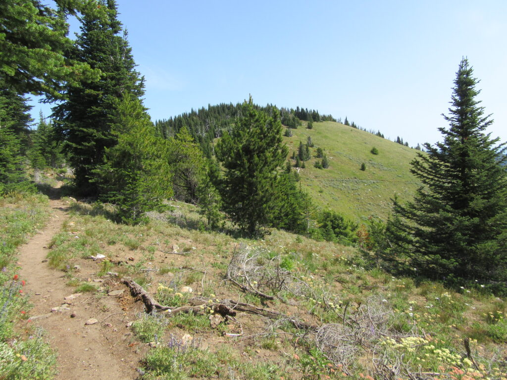
Location: Kettle River Range Land Agency: National Forest Service Roundtrip: 6.0 miles Elevation gain: 2,000 feet Contact: Colville National Forest Access: From Republic, head east on SR 20 for 21 miles turning left onto FR 2030 (Albion Hill Road). From Kettle Falls, head west on SR 20 for 22 miles, turning right onto FR 2030. Follow FR…
Read MoreLittle Cranberry Lake — A perfect complement hike to your Thanksgiving Day celebration
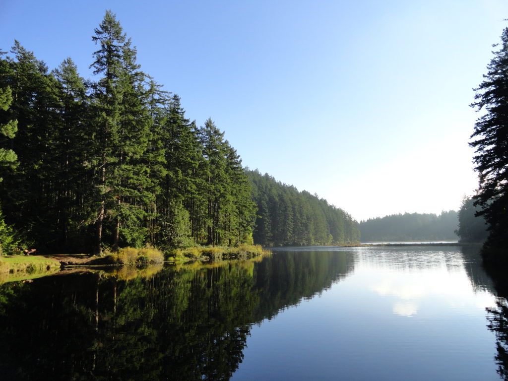
Quick Facts: Location: Anacortes-Fidalgo Island Land Agency: Anacortes Community Forest Lands Roundtrip: 1.9 miles Elevation Gain: 100 feet Access: From Exit 230 on I-5 in Burlington, head west on SR 20 to junction with SR 20-Spur. Continue right on SR 20-Spur to Anacortes. At traffic light near old town, continue left on 12th Street (still SR 20-Spur and12th Street…
Read MoreSherman Peak Loop– In general, the views are great

Quick Facts: Location: Kettle River Range, Ferry County Land Agency: National Forest Service Roundtrip: 6.0 miles Elevation gain: 1200 feet Contact: Colville National Forest, Republic Ranger District Notes: Hunting season has begun, wear orange Access: From Republic, head east on SR 20 for 16.8 miles to Sherman Pass. Turn left and follow access road .1…
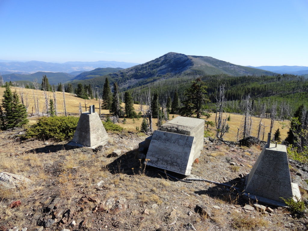
Read MoreCopper Butte via Old Stage Trail– Take a historic route to the rooftop of the Kettle River Range

Quick Facts: Location: Kettle River Range Land Agency: Colville National Forest Roundtrip: 6.0 miles Elevation Gain: 1615 feet Contact: Colville National Forest, Three Rivers Ranger District-Kettle Falls Access: From Republic, head east on SR 20 for 21 miles turning left onto FR 2030 (Albion Hill Road). From Kettle Falls, head west on SR 20 for 22 miles turning…
Read MoreLizard and Lily Lakes

Peaceful wandering near the Oyster Dome Quick Facts: Location: Blanchard State Forest Distance: 7.5 miles roundtrip Elevation Gain: 1,500 feet Contact: Washington Department of Natural Resources Map: Square One Maps Chuckanut Recreation Area Notes: Discover Pass required to park at trailheads Trailhead directions: From I-5 Exit 240 in Alger head north on Lake Samish Road…
Read MoreHannegan Peak─Supreme views of snow and ice—and that’s the truth, Ruth!
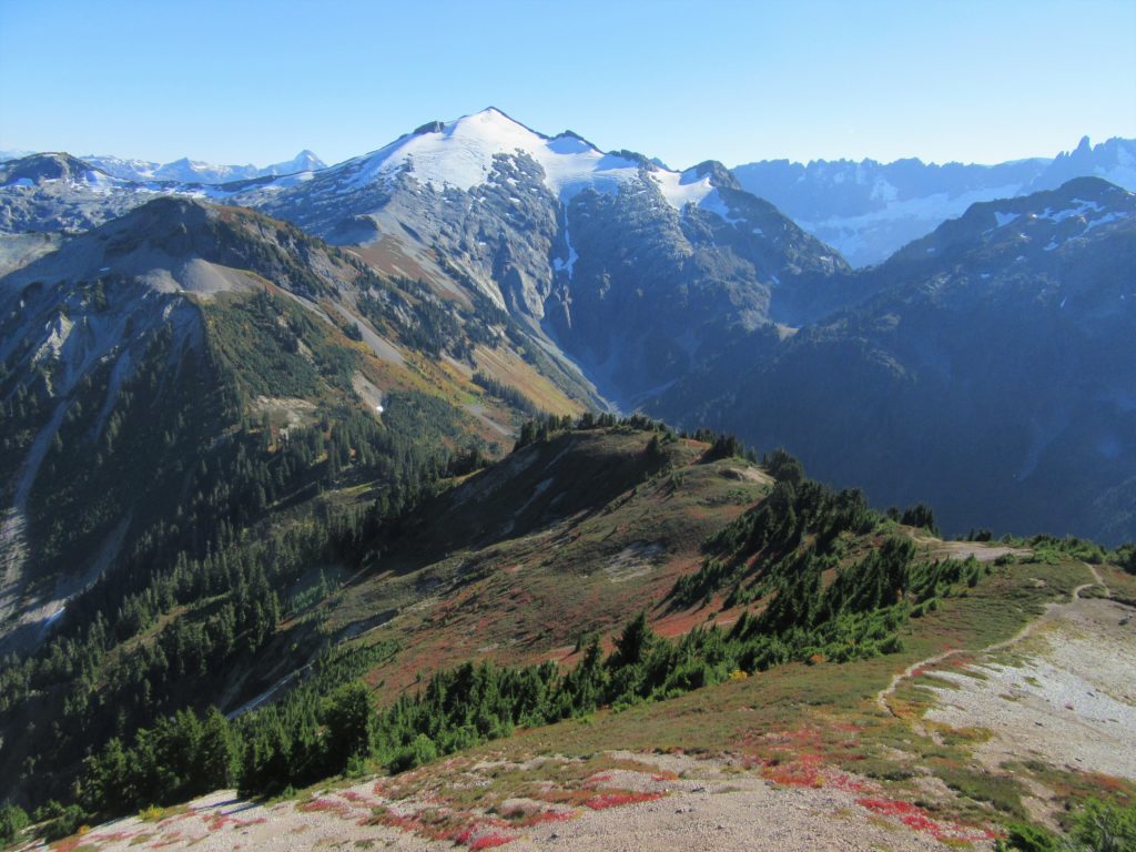
Quick Facts Location: North Cascades Mount Baker Wilderness Land Agency: Mount Baker-Snoqualmie National Forest Roundtrip: 10.4 miles Elevation Gain: 3,100 feet Contact: Glacier Public Service Center (360) 599-2714 or Mount Baker Ranger District: Mount Baker Snoqualmie National Forest (360) 856-5700; www.fs.fed.us/r6/mbs Green Trails Map: Mt Baker Wilderness 13SX Special Note: Northwest Trail Pass or Interagency…
Read MoreBarnaby Buttes
Mega-fauna hot spot in the Kettle River Range Quick Facts: Location: Kettle River Range Land Agency: National Forest Service Distance: 7.4 miles Elevation Gain: 1975 feet Contact: Colville National Forest Three Rivers Ranger District Recommended Guidebook: Day Hiking Eastern Washington (Mountaineers Books) Access: From Kettle Falls, travel west on SR 20 for 14 miles turning…
Read MoreHappy Panther Trail–Take a joyful catwalk in the North Cascades
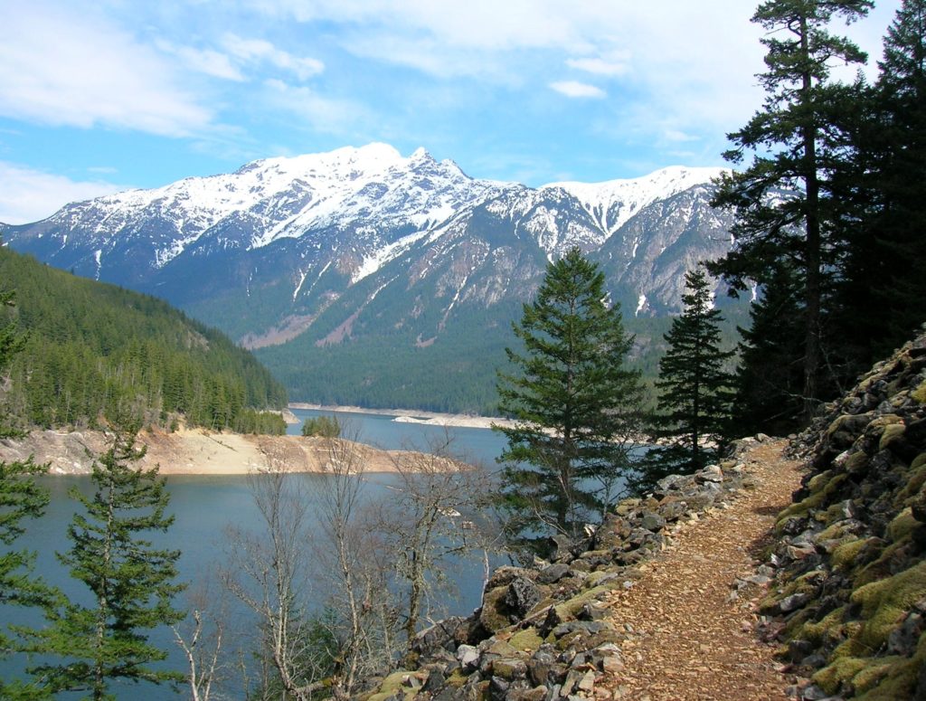
Quick Facts: Location: North Cascades Scenic Highway Land Agency: Ross Lake National Recreation Area, National Park Service Roundtrip: 11.8 miles Elevation gain: 1200 feet Green Trails Maps: Green Trails, North Cascades Ross Lake No. 16SX Contact: North Cascades National Park complex Notes: Dogs must be leashed Access: From Burlington follow SR 20 east to Marblemount. Then…
Read MoreOyster Dome─The Pearl of the Chuckanut Mountains
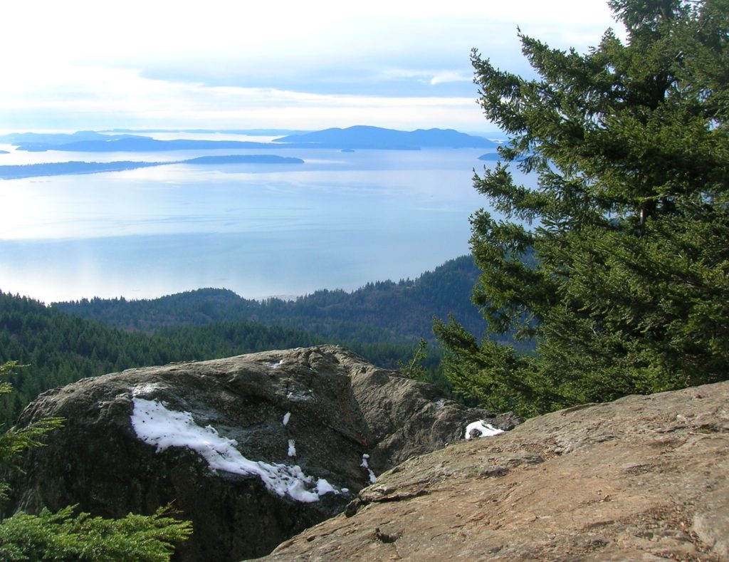
Quick Facts: Location: Chuckanut Mountains Land Agency: Washington Department of Natural Resources Roundtrip: 6.5 miles Elevation Gain: 1,900 feet Special Note: Oyster Dome can be hazardous in icy and wet conditions. Trail can be extremely popular, opt for a weekday visit. Contact: Washington DNR, Northwest Region; www.dnr.wa.gov Access: Trailhead is located just past milepost 10…
Read More