Hannegan Peak─Supreme views of snow and ice—and that’s the truth, Ruth!
Quick Facts
Location: North Cascades Mount Baker Wilderness
Land Agency: Mount Baker-Snoqualmie National Forest
Roundtrip: 10.4 miles
Elevation Gain: 3,100 feet
Contact: Glacier Public Service Center (360) 599-2714 or Mount Baker Ranger District: Mount Baker Snoqualmie National Forest (360) 856-5700; www.fs.fed.us/r6/mbs
Green Trails Map: Mt Baker Wilderness 13SX
Special Note: Northwest Trail Pass or Interagency Pass required.
Access: From Bellingham follow SR 542 (Mount Baker Highway) east for 47 miles turning left onto FR 32 (Hannigan Pass Road) just before bridge over North Fork Nooksack River. Follow FR 32 for 5.3 miles to road end and trailhead.
Good to Know: dog-friendly, exceptional wildflowers, exceptional alpine views, wilderness rules apply
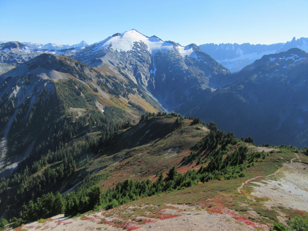
Venture up a wide open avalanched valley flanked by stark walls and snowy-crags, and reverberating with the sounds of crashing water. Under the ever-watchful eye of snow and ice shrouded Ruth Mountain make your way to a lonely pass—one of the few trailed portals into the deep wilderness of the North Cascades National Park. From here make a steep ascent to the 6,186-foot summit of Mount Hannegan to dizzying views of a plethora of North Cascades summits.
Starting on a wide path through avalanche chutes and cluster of hemlocks, head up the valley. Fantastic views immediately greet you. Sparkling waters glide off towering polished walls. Tenacious snowfields cling to dark clefts in spiraling crags. Water everywhere! Cross several creeks en route to your alpine objective.
The magnificently snow-capped Ruth Mountain soon comes into view keeping a lock on your attention for the rest of this hike. Cross rock slides and gullies, young and old. After not gaining much elevation the trail switchbacks towards Hannegan Pass. At 3.5 miles pass a spur trail leading right across lovely meadows to backcountry campsites. Continue upward through forest and meadow reaching the 5,050-ft pass at 4.0 miles. Take a break and resume climbing, following a trail left from the pass. Ascending over 1,000 feet in 1.2 miles, it’s a steep grunt. But once you break out upon the scree and tundra top of the 6,186-foot peak, there’ll be no doubt in your mind that it was worth it.
Now from one of the best viewing posts in these parts, scan the horizons. West down the valley you came along serrated Nooksack Ridge. Look north down the Silesia Creek Valley to BC’s Slesse Mountain. East, follow Copper Ridge out to massive Mount Redoubt in the distance. But by far, your eyes will spend the most time fixed south on snowy Baker, Shuksan, and Ruth. And that’s the truth! What a view!
For more detailed information on hiking Hannegan Peak and many other nearby trails, pick up a copy of my best selling and highly trusted Day Hiking North Cascades 2nd edition (Mountaineers Books)!