Snohomish County
North Fork Sauk Falls–Thundering Cataract is a spectacular spectacle in the spring
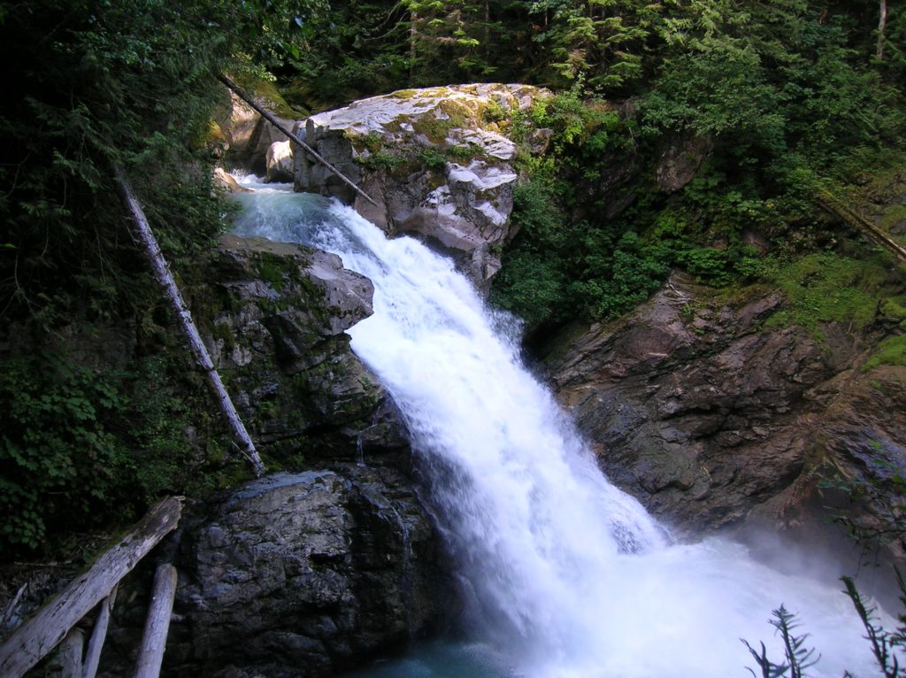
Location: Mountain Loop Highway near Darrington Land Agency: MountBaker-SnoqualmieNational Forest Roundtrip: .5 mile Elevation gain: 100 feet Contact: Darrington Ranger District: Mount Baker Snoqualmie National Forest (360) 436-1155 Green Trails Maps: Sloan Peak, WA-No. 111 Access: From Arlington, follow SR 530 east for 28 miles to Darrington. Turn right onto the Mountain Loop Highway and…
Read MoreRed Mountain Lookout Site─Feel the Pride from this old lookout site

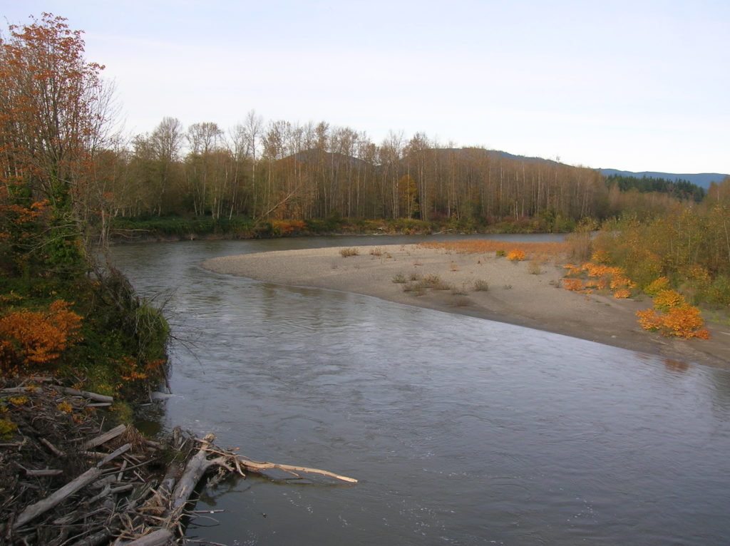
Quick Facts Location: Mountain Loop Highway near Darrington Land Agency: Mount Baker-Snoqualmie National Forest Roundtrip: 2.0 miles Elevation Gain: 800 feet Green Trails Map: Sloan Peak, WA-No. 111 Access: From Darrington, follow Mountain Loop Highway for 16 miles (pavement ends at 9.0 miles) to a junction with FR 49 (signed for North Fork Sauk Trail).…
Read MoreBig Four Ice Caves─Snowshoe along the Stilly to an iconic Mountain Loop Destination
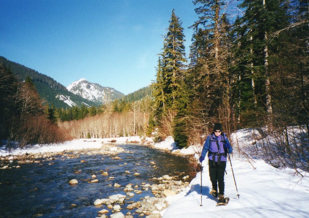
Quick Facts Location: Mountain Loop Highway near Granite Falls Land Agency: Mount Baker-Snoqualmie National Forest Roundtrip: 7.0 miles Elevation Gain: 300 feet Note: Northwest Forest Pass required; part of route is on Mountain Loop Highway which is open to snowmobile use. Access: From Granite Falls, follow the Mountain Loop Highway east for 23.5 miles to…
Read MoreEagle Trail─Come celebrate Arlington’s Eagle Festival on this hike along the Stillaguamish River
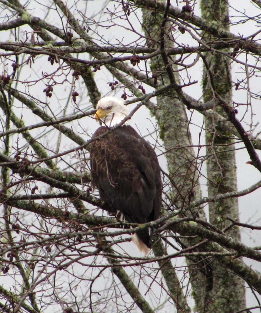
Quick Facts Location: Arlington Land Agency: City of Arlington Parks and Recreation Roundtrip: 1.7 miles Elevation Gain: none Special Note: Dogs permitted on leash. Access: From Exit 208 on I-5 head east on SR 530 for 4.0 miles to junction with SR 9 in Arlington. Continue east on SR 530 for another 0.1 mile turning…
Read MoreWhitehorse Trail-West─Snohomish County’s next great long distance rail trail
Quick Facts Location: North Fork Stillaguamish River Valley near Arlington Land Agency: Snohomish County Parks Roundtrip: 6.0 miles Elevation Gain: 150 feet Notes: Dogs permitted on leash. Access: From Exit 208 on I-5 head east on SR 530 for 4.0 miles to junction with SR 9 in Arlington. Continue east on SR 530 for another…
Read MoreFrog Lake─Just a hop, skip, and jump away from Darrington
Quick Facts Location: Mountain Loop Highway, Darrington Land Agency: Mount Baker-Snoqualmie National Forest Roundtrip: 2.0 miles Elevation Gain: 300 feet Green Trails Map: Silverton, WA-No. 110 Access: From Arlington follow SR 530 east for 28 miles to Darrington. At a three-way stop, turn right onto the Mountain Loop Highway and proceed for 3.0 miles to…
Read MoreWest Cady Ridge—Come September this old burn site is set ablaze in autumn colors
Quick Facts Location: Wild Sky and Henry Jackson Wildernesses, North Fork Skykomish River Valley Land Agency: National Forest Service Roundtrip: 8.0 miles Elevation Gain: 2,300 feet Green Trails Map: Monte Cristo, WA- No. 143 Contact: Skykomish Ranger District: Mount Baker Snoqualmie National Forest; www.fs.fed.us/r6/mbs Notes: Northwest Forest Pass required. Access: From Everett head east on…
Read MoreMiddle Ridge—Beneath a fortress in the middle of the Glacier Peak Wilderness
Quick Facts Location: Glacier Peak Wilderness Land Agency: Mount Baker-Snoqualmie National Forest Roundtrip: 26.6 miles Elevation Gain: 5,100 feet Green Trails Map: Holden, WA- No. 113 Contact: Darrington Ranger District: Mount Baker Snoqualmie National Forest (360) 436-1155; www.fs.fed.us/r6/mbs Notes: Northwest Forest Pass required. Access: From Everett, head 85 miles east on US 2 to Coles…
Read MoreInterurban Trail─Traipse along an old trolley line through suburban Snohomish County
Quick Facts Location: Mountlake Terrace, Edmonds and Lynnwood Land Agency: Snohomish County Parks Roundtrip: 5.0 miles Elevation Gain: Minimal Contact: Snohomish County Parks; www1.co.snohomish.wa.us/Departments/Parks Notes: Dogs permitted on leash. Access: From I-5 take exit 178. Head west on 236th Street SW which eventually becomes Lakeview Drive. After about one mile, reach Lake Ballinger Park; park…
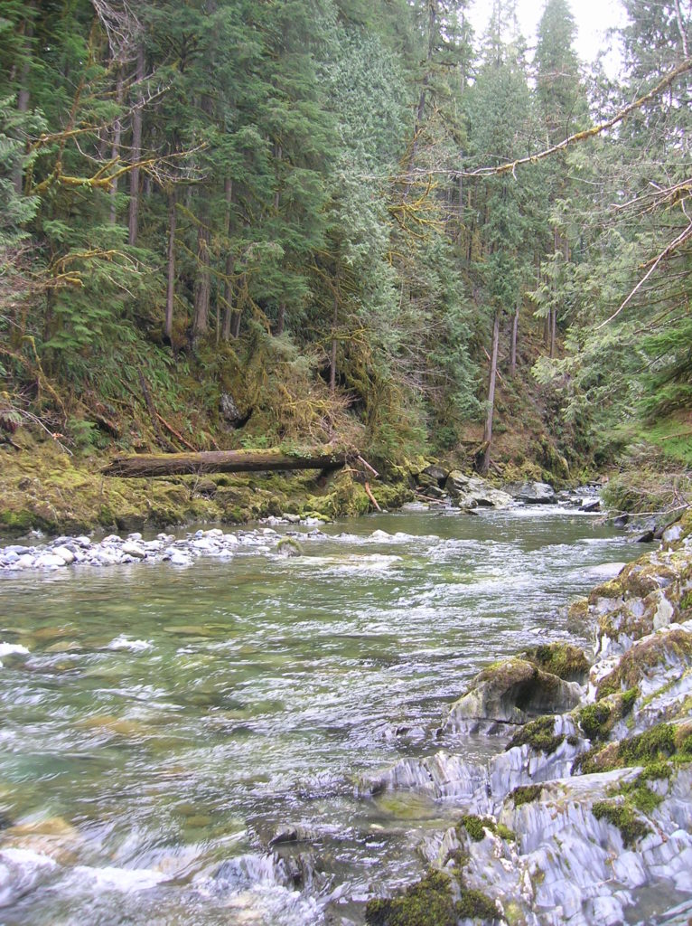
Read MoreTwin Rivers Park─A nice place to go with the flow
Quick Facts Location: Stillaguamish River Valley, Arlington Land Agency: Snohomish County Parks Roundtrip: 1.0 miles Elevation Gain: none Contact: Snohomish County Parks; www1.co.snohomish.wa.us/Departments/Parks/ Notes: Dogs must be on leash. Access: From Exit 208 on I-5, head east on SR 530 for 4.0 miles to Arlington. Continue east on SR 530 for another .5 mile turning…
Read More