Snohomish County
Edmonds Marsh─Over 225 species of birds on 23 acres of wetlands!
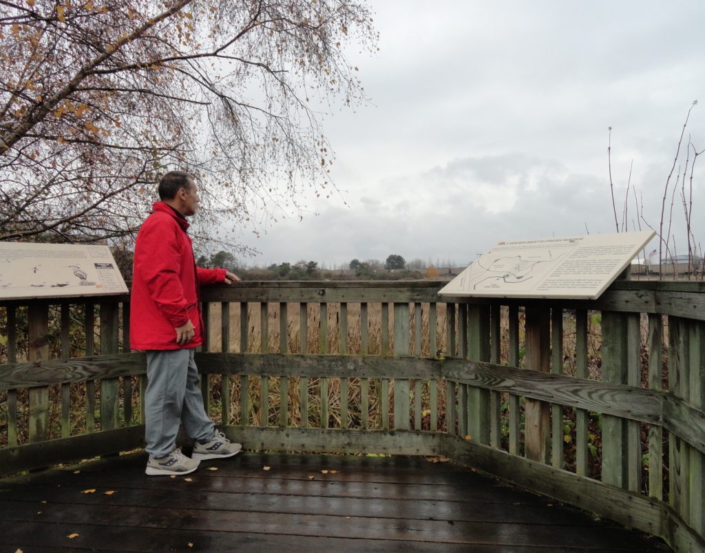
Quick Facts: Location: Edmonds Waterfront Land Agency: City of Edmonds Parks and Recreation Roundtrip: 1.8 miles Elevation Gain: Level Access: From I-5 follow SR 104 west towards the Edmonds-Kingston Ferry. One stoplight before the ferry terminal, turn left onto Dayton Street. Then continue for .1 mile to just before the railroad crossing. Turn left here…
Read MoreRiver Trail–Big maples and hidden Snohomish riverfront at Lord Hill
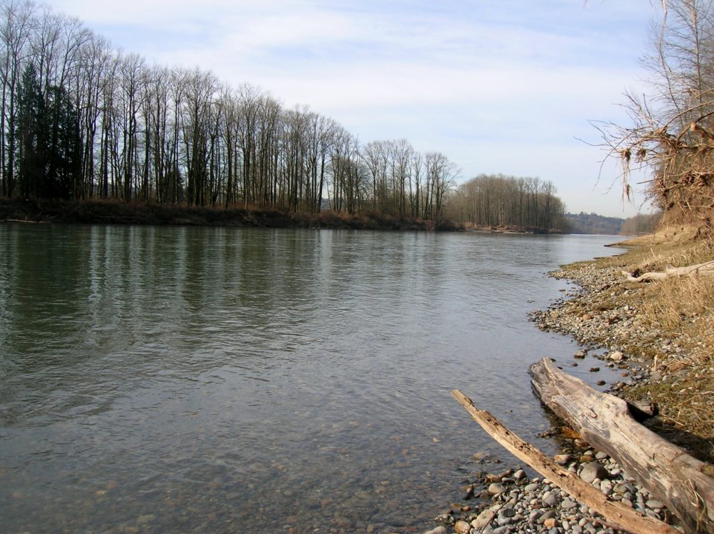
Quick Facts: Location: Snohomish Valley Land Agency: Snohomish County Parks Roundtrip: 5.2 miles Elevation gain: 650 feet Contact: Snohomish County Parks Map: Snohomish County Parks Notes: Dogs permitted on leash Good to know: Dog-friendly, kid-friendly, snow-free winter hike, good trail running Access: From Everett follow US 2 to SR 9. Head south on SR 9 and exit…
Read MoreHeybrook Ridge–From the town of Index to stunning views of Mount Index
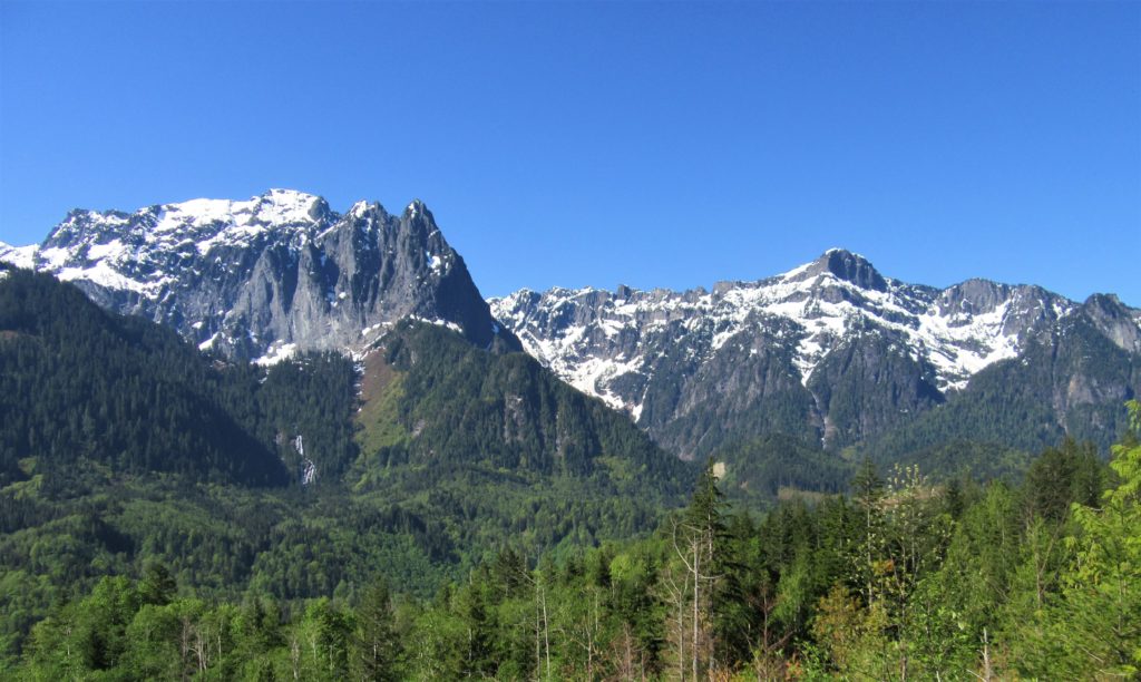
Quick Facts: Location: Skykomish Valley Land Agency: Snohomish County Parks Roundtrip: 3.4 miles Elevation Gain: 780 feet Contact: Friends of Heybrook Ridge Map: Green Trails, Alpine Lakes West Stevens Pass no. 176S Notes: Dogs allowed on leash Access: From Everett follow US 2 east for 35 miles turning left onto the Index Galena Road (just…
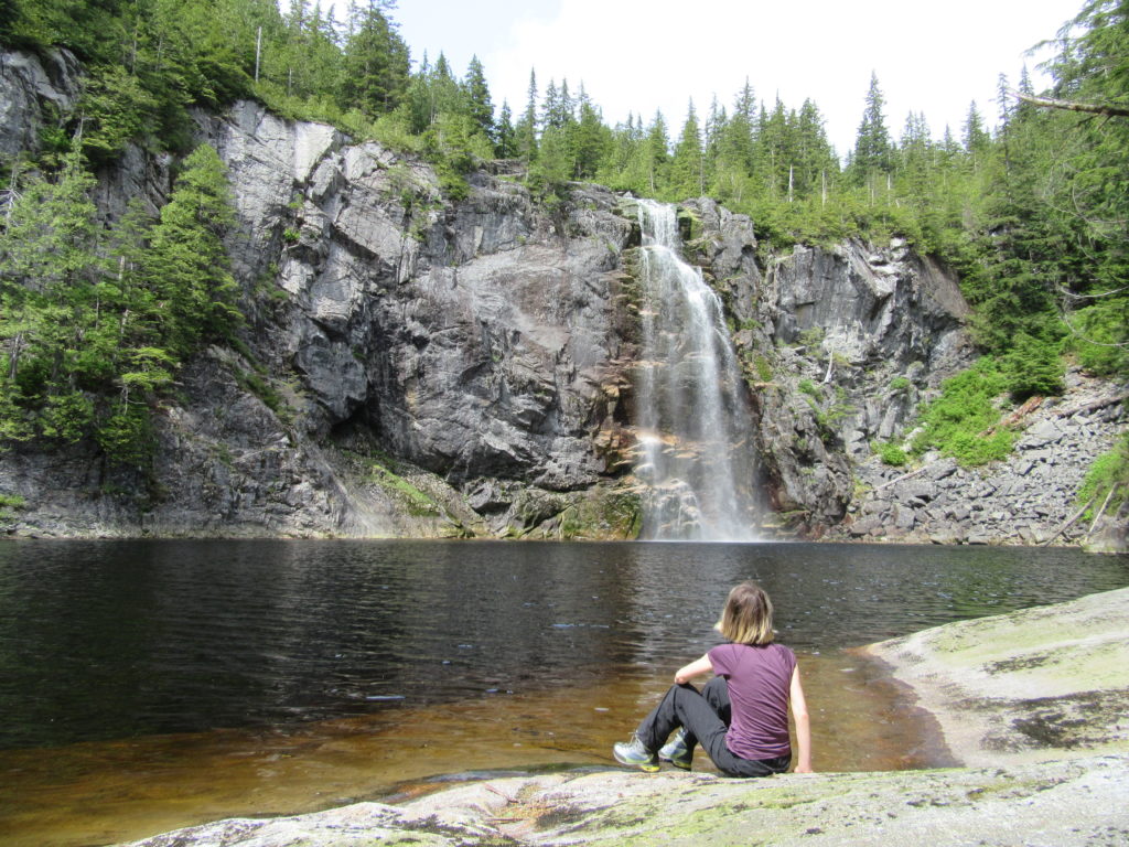
Read MoreWallace Falls –A classic series of falls and classic hike, fun for all
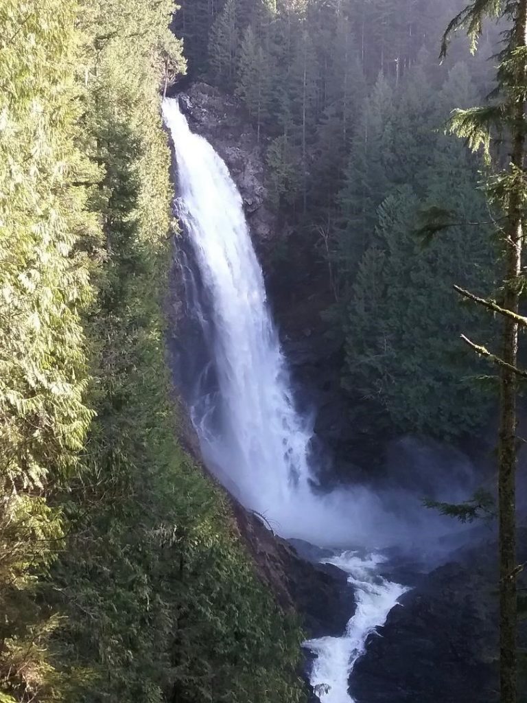
Quick Facts: Location: Skykomish River Valley Land Agency: Washington State Parks Roundtrip: 5.6 miles Elevation gain: 1,200 feet Green Trails Map: Alpine Lakes West Stevens Pass 176S Contact: Wallace Falls State Park Notes: Discover Pass required; Dogs must be leashed Access: From Everett follow US 2 for 28 miles east to Gold Bar. Just before…
Read MoreHeather Lake — placid lake in a rugged cirque
Quick Facts: Location: Mountain Loop Highway near Granite Falls Land Agency: Mount Baker-Snoqualmie National Forest Roundtrip: 5.0 miles Elevation gain: 1,100 feet Difficulty: moderate Green Trails Map: Mountain Loop Highway Special Series 111SX Contact: Darrington Ranger District: Mount Baker-Snoqualmie National Forest Access: From Granite Falls, follow the Mountain Loop Highway east. One mile beyond the Verlot Visitors…
Read MoreTwin Falls Lake–Hike to a secluded lake between two waterfalls
Quick Facts: Location: Mountain Loop Highway near Granite Falls Land Agency: Washington Department of Natural Resources Roundtrip: 8.8 miles Elevation gain: 1,200 feet Green Trails Map: Mountain Loop HIghway 111SX Contact: Northwest Region Ranger District WA DNR (360) 856-3500 Notes: Discover Pass required; trail beyond Ashland Lakes sees little maintenance, is extremely difficult and not…
Read MoreMount Pugh — It’s quite a view from the summit of Pugh
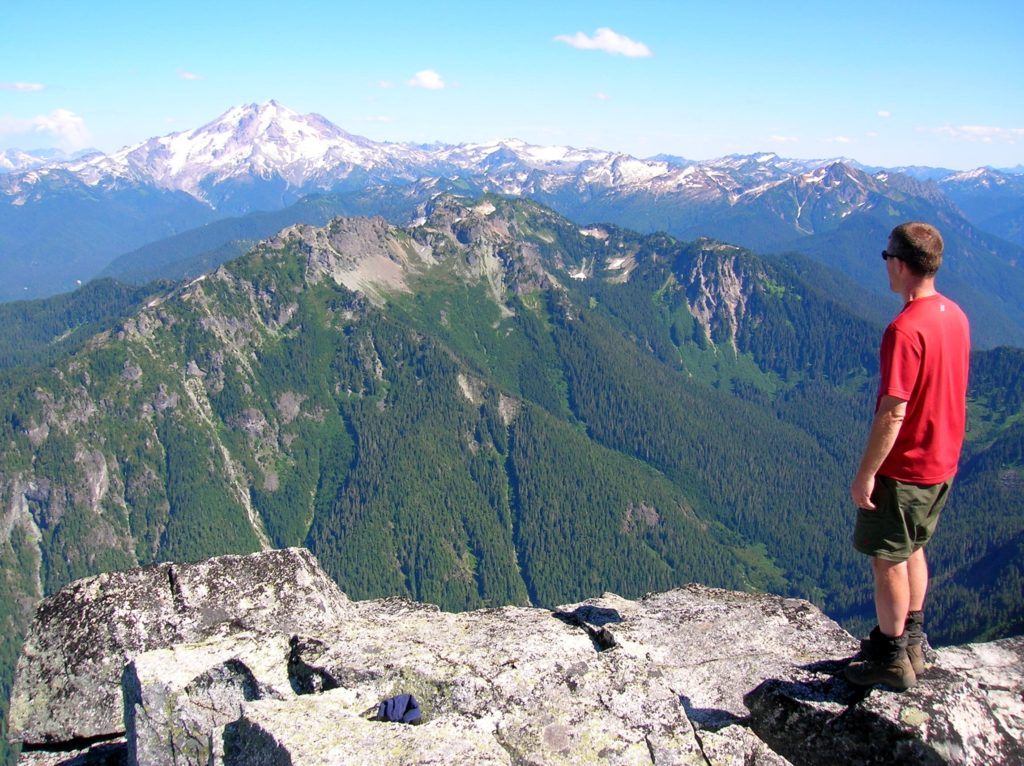
Quick Facts: Location: Glacier Peak Wilderness, Mountain Loop Highway near Darrington Land Agency: Mount Baker-Snoqualmie National Forest Roundtrip: 11.0 miles Elevation gain: 5,300 feet Green Trails Map: Mountain Loop Highway Special Series 111SX Contact: Darrington Ranger District: Mount Baker Snoqualmie National Forest Notes: NW Forest Pass or Interagency Pass required; The last 1.5 miles of hike…
Read MoreWhite Chuck Cinder Cone — Coolest volcanic cone north of Lassen
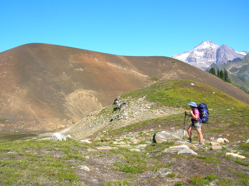
Quick Facts: Location: Glacier Peak Wilderness,Mountain Loop Highway near Darrington Land Agency: Mount Baker-Snoqualmie National Forest Roundtrip: 23.0 miles Elevation gain: 5,200 feet Green Trails Map: Mountain Loop Highway 111SX Contact: Darrington Ranger District: Mount Baker Snoqualmie National Forest (360) 436-1155 Notes: NW Forest Pass or Interagency Pass required Access: From Darrington, head south 16…
Read MoreJetty Island– It may be manmade, but it’s naturally delightful!
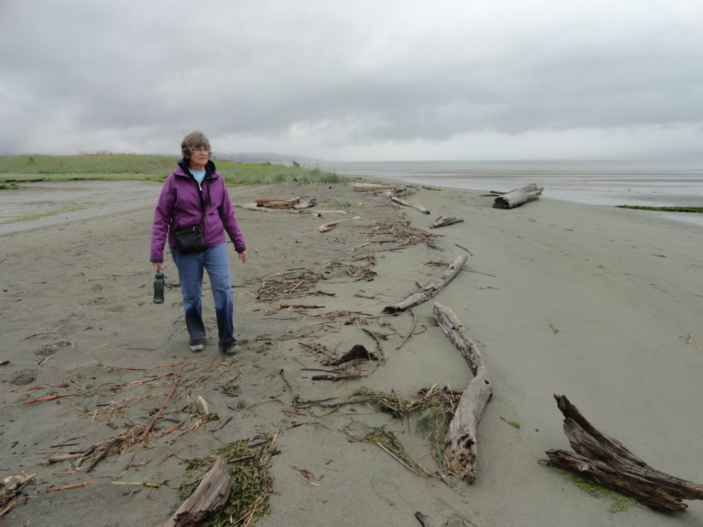
Quick Facts: Location: Everett Land Agency: Everett Parks and Recreation Roundtrip: up to 5.0 miles Elevation gain: none Difficulty: Easy Contact: Everett Parks and Recreation Department Notes: Parking fee $2.00 (credit card or exact amount cash) Passenger Ferry runs on Wednesday through Sunday from July 5th until September 3rd and requires a reservation ($3 per…
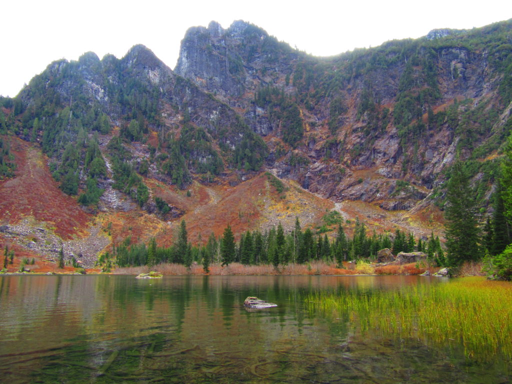
Read MoreBlanca Lake– A strikingly beautiful lake set beneath a formidable wall of jagged peaks
Quick Facts: Location: Wild Sky and Henry Jackson Wildernesses, North Fork Skykomish River Valley Land Agency: Mount Baker-Snoqualmie National Forest Roundtrip: 8.4 miles Elevation gain: 3,300 feet Green Trails Map: Monte Cristo, WA- No. 143 Contact: Skykomish Ranger District: Mount Baker Snoqualmie National Forest Notes: Northwest Forest Pass or Interagency Pass required. No fires allowed…
Read More