Urban Trails Eastside
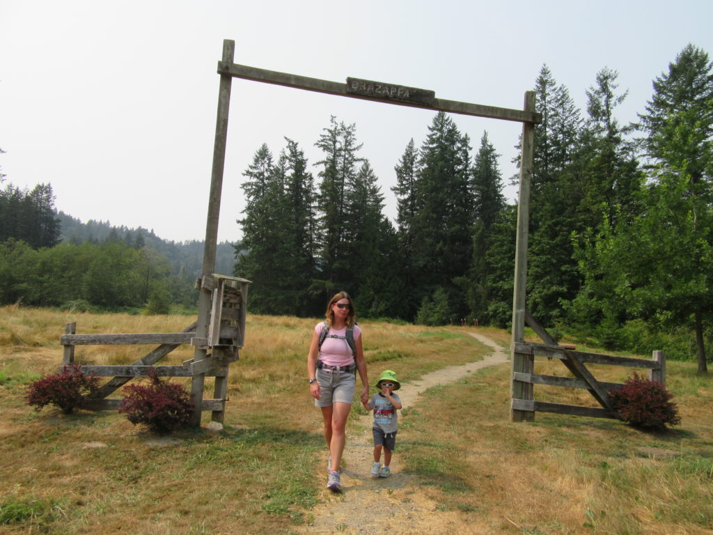
Tollgate Farm
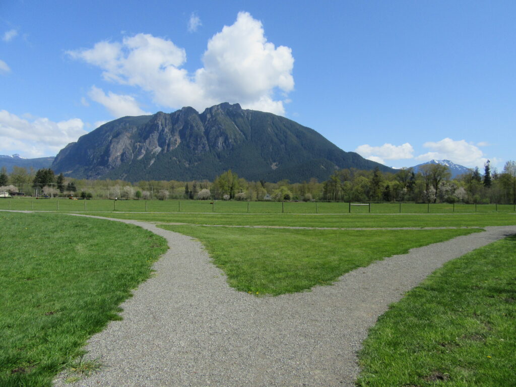
Historic prairie at the Forks of the Snoqualmie Quick Facts: Location: North Bend, WA Distance: 1.5 miles of trails Elevation Gain: minimal Contact: Si View Metropolitan District Green Trails Map: Mount Si NRCA no. 206S Notes: Dogs permitted on leash Trailhead directions: From Seattle follow I-90 east to Exit 27. Turn left onto Winery Road…
Read MoreSnoqualmie Falls
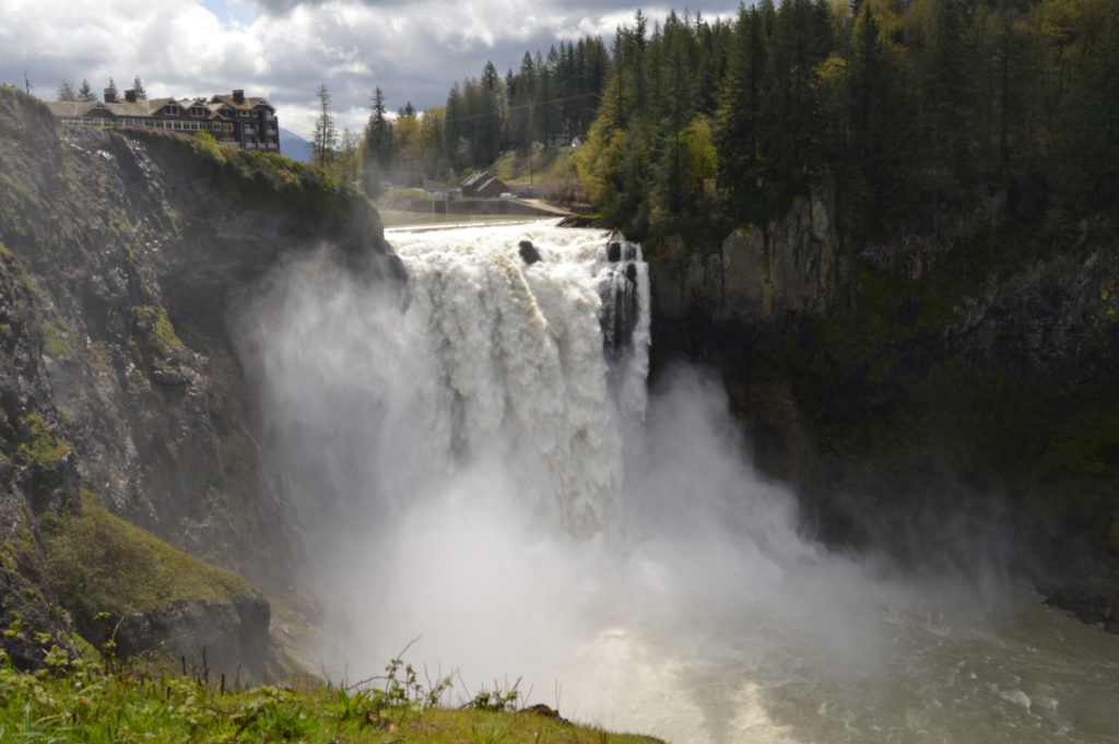
Hike to the base of the falls where heaven connects to earth Quick Facts: Location: Snoqualmie Valley Distance: 1.4 miles Elevation Gain: 280 feet Contact: Puget Sound EnergyDetailed Information: Urban Trails Eastside (Mountaineers Books) Green Trails Map: Rattlesnake Mountain/ Mountains to Sound Greenway No. 205S Notes: dogs permitted on leash. Parking lot on west side…
Read MoreWeowna Park
Hike a quiet forested bluff above Lake Sammamish Quick Facts: Location: Bellevue, WA Land Agency contact: city of Bellevue Parks and Recreation Round Trip: 2.5 miles of trails Elevation Gain: up to 500 feet Detailed Information: Urban Trails Eastside (Mountaineers Books) Map: online Notes: dogs permitted on leash Access: From I-90 exit 11B in Bellevue…
Read MoreChristmas Lake and Cedar Butte- Bad tidings and spelling
Quick Facts: Location: Snoqualmie Valley near North Bend Land Agency: Washington State Parks Roundtrip: 4.2 miles Elevation Gain: 900 feet Green Trails Map: Rattlesnake Mountain Upper Snoqualmie Valley 205S Access: From Seattle take I-90 east to exit 32 in North Bend turning right (south) onto 436th Ave SE which soon becomes Cedar Falls Road. Follow for 3.1…
Read MoreEvans Creek Preserve
A glimpse of the Eastside pre-Microsoft Quick Facts: Location: Sammamish Land Agency: Sammamish Parks and Recreation Distance: 3.5 miles of trails Elevation Gain: up to 475 feet Contact: Sammamish Parks and Recreation Detailed Information: Urban Trails Eastside (Mountaineers Books) Notes: Dogs permitted on leash Access: From Redmond Head east on SR 202 for 4.0 miles…
Read MoreLittle Si─You won’t sigh over the views from this open summit
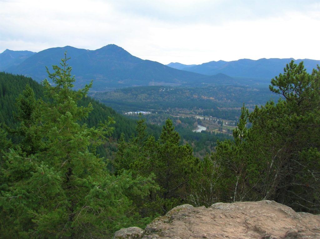
Quick Facts: Location: Snoqualmie Valley Land Agency: Washington DNR Roundtrip: 4.6 miles Elevation Gain: 1,100 feet Green Trails Map: Green Trails, Mount Si NRCA No. 206S Notes: Discover Pass Required; dogs must be leashed Contact: WA Department of Natural Resources, South Puget Sound Region (360) 825-1631; www.dnr.wa.gov Access: Take I-90 to exit 32 in North Bend…
Read MoreSoaring Eagle Regional Park- take a sleigh ride!
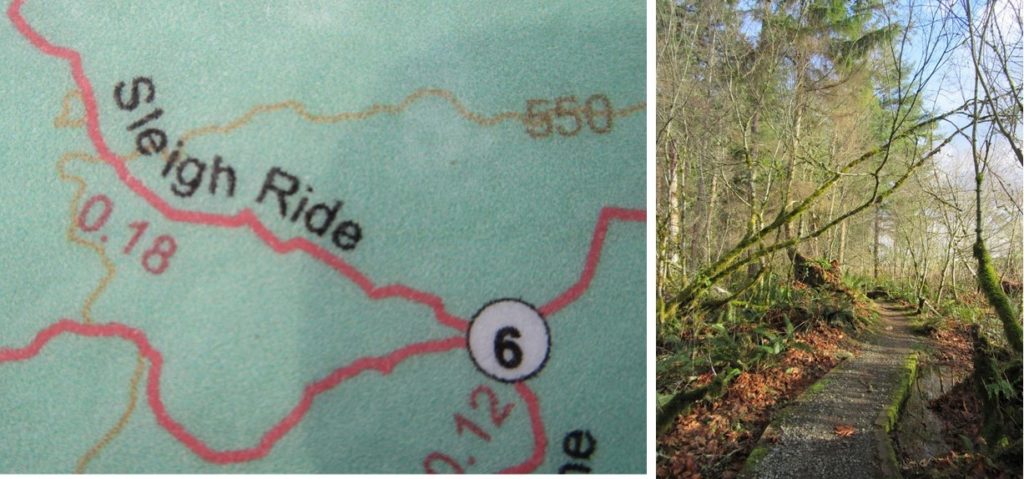
Quick Facts: Location: Sammamish Plateau Land Agency: King County Parks Distance: more than 12.0 miles of trails Elevation Gain: up to 325 feet Contact: King County Parks Notes: dogs permitted on leash; trails also open to horses and mountain bikes Map: Click Here Recommended Guidebook: Urban Trails Eastside (Mountaineers Books) Access: From Bellevue follow SR…
Read MoreMargaret’s Way to Debbie’s View
Excellent views on the quiet Issaquah Alp Quick Facts: Location: Squak Mountain, Issaquah Alps Land Agency: King County Parks, Washington State Parks Distance: 7.0 miles Elevation Gain: 1600 feet Contact: Squak Mountain State Park and King County Parks Green Trails Map: Green Trails Cougar Mtn/ Squak Mtn No. 203S Notes: dogs permitted on leash Recommended…
Read MoreCougar Mountain Wilderness Peak Loop
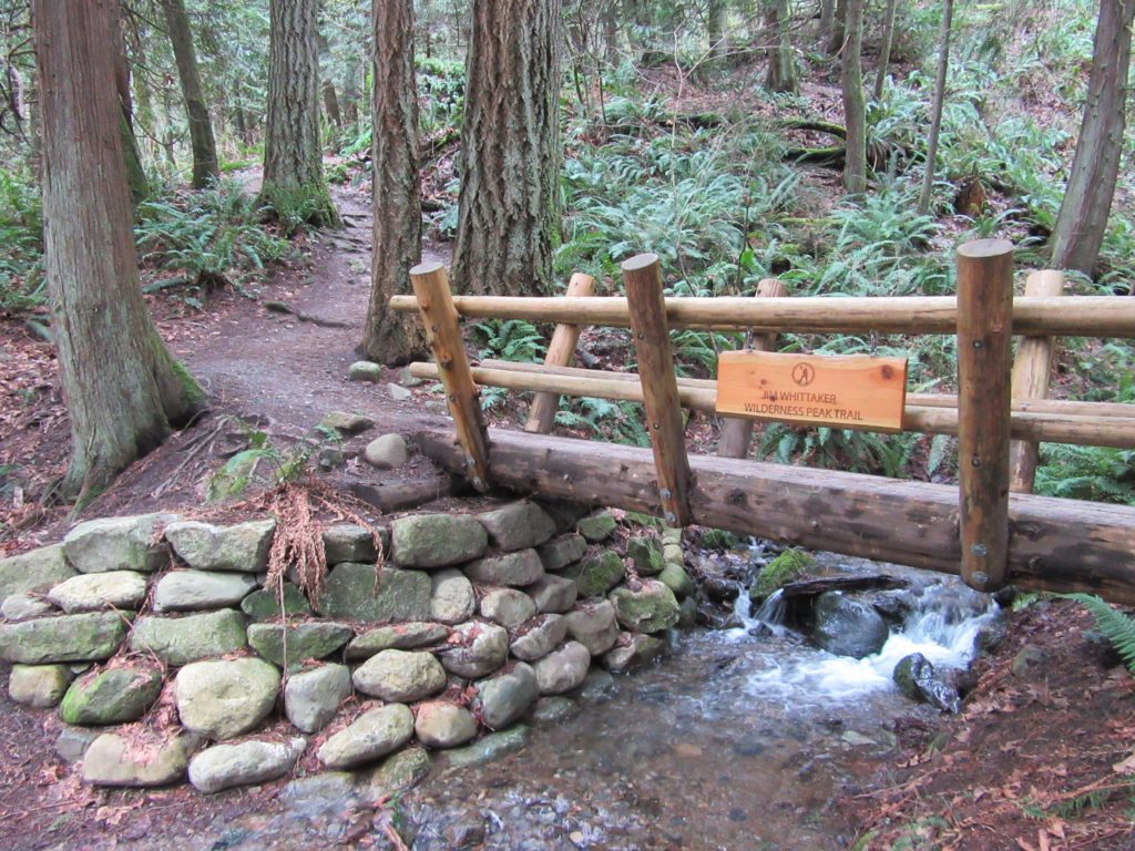
No views, but lots of big trees and pretty cascades Quick Facts: Location: Cougar Mountain Regional Wildland Park. Land Agency: King County Parks. Distance: 3.9 mile lollipop loop. Elevation Gain: 1200 feet. Contact: King County Parks. Green Trails Map: Cougar Mtn/ Squak Mtn No. 203S. Notes: dogs permitted on leash, Warning: car break-ins frequently occur…
Read MoreMercer Slough Nature Park
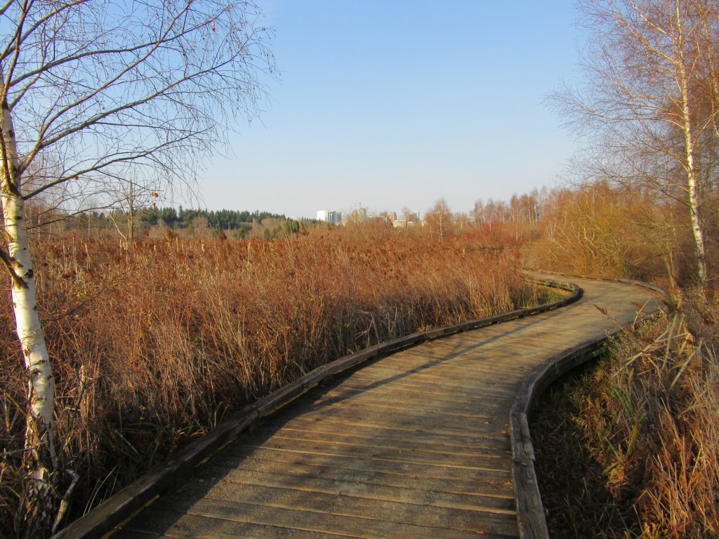
Hike a slew of trails near the heart of Bellevue Quick Facts: Location: Bellevue Land Agency: City of Bellevue Parks and Recreation Distance: more than 7.0 miles of trails Elevation Gain: minimal Contact: City of Bellevue Parks and Recreation Notes: dogs permitted on leash, Recommended Guidebook: Urban Trails Eastside (Mountaineers Book) Access: Take Exit 12…
Read More