Waterfalls
Snoqualmie Falls
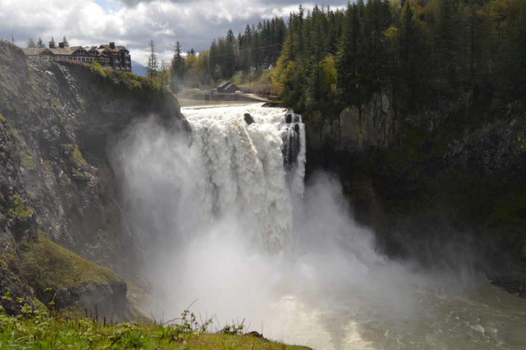
Hike to the base of the falls where heaven connects to earth Quick Facts: Location: Snoqualmie Valley Distance: 1.4 miles Elevation Gain: 280 feet Contact: Puget Sound EnergyDetailed Information: Urban Trails Eastside (Mountaineers Books) Green Trails Map: Rattlesnake Mountain/ Mountains to Sound Greenway No. 205S Notes: dogs permitted on leash. Parking lot on west side…
Read MoreWallace Falls –A classic series of falls and classic hike, fun for all
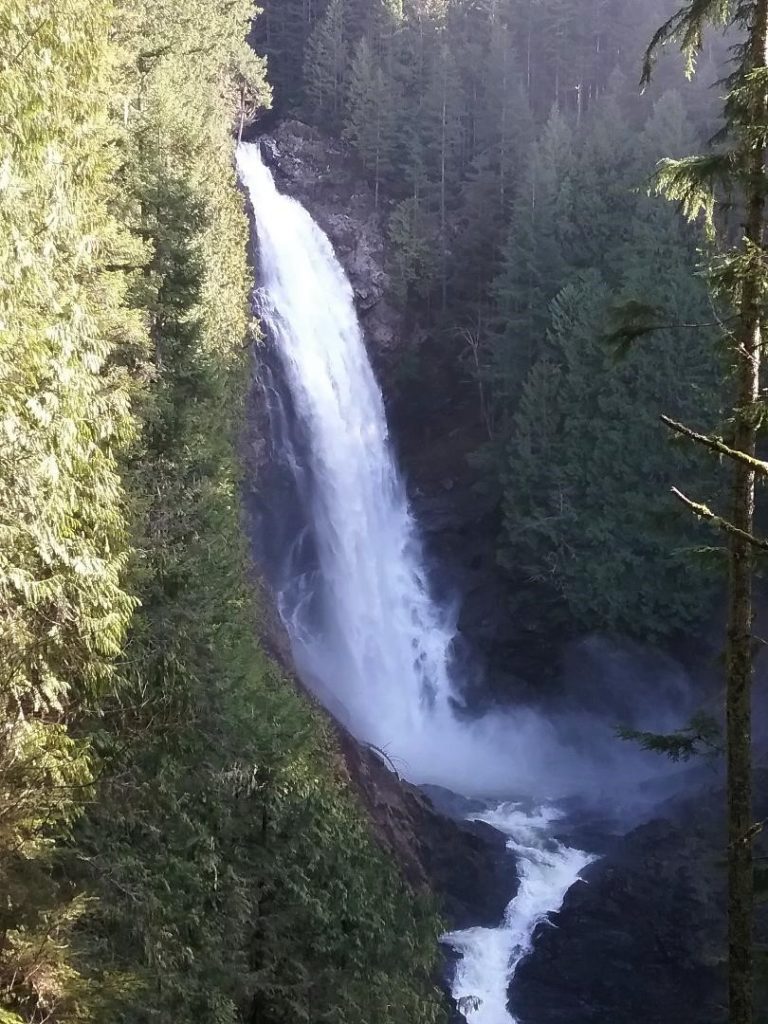
Quick Facts: Location: Skykomish River Valley Land Agency: Washington State Parks Roundtrip: 5.6 miles Elevation gain: 1,200 feet Green Trails Map: Alpine Lakes West Stevens Pass 176S Contact: Wallace Falls State Park Notes: Discover Pass required; Dogs must be leashed Access: From Everett follow US 2 for 28 miles east to Gold Bar. Just before…
Read MoreTwin Falls Lake–Hike to a secluded lake between two waterfalls
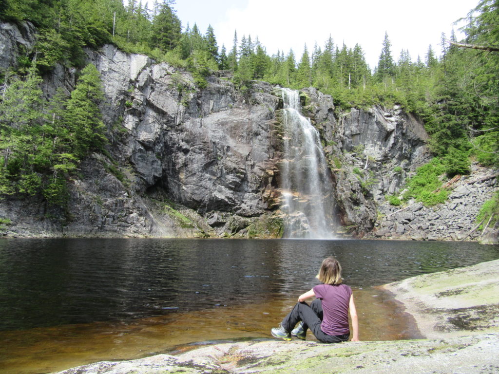
Quick Facts: Location: Mountain Loop Highway near Granite Falls Land Agency: Washington Department of Natural Resources Roundtrip: 8.8 miles Elevation gain: 1,200 feet Green Trails Map: Mountain Loop HIghway 111SX Contact: Northwest Region Ranger District WA DNR (360) 856-3500 Notes: Discover Pass required; trail beyond Ashland Lakes sees little maintenance, is extremely difficult and not…
Read MoreBridal Veil Falls — Visit after heavy rains for a bridal shower!

Quick Facts: Location: US 2 near Index, Land Agency: Mount Baker-Snoqualmie National Forest Roundtrip: 4.4 miles Elevation gain: 850 feet Green Trails Maps: Green Trails, Alpine Lakes Stevens Pass 176S Contact: Skykomish Ranger District: Mount Baker -Snoqualmie National Forest Notes: NW Forest Pass or Interagency Pass required Access: From Everett follow US 2 east for…
Read MoreLatourell Falls─First in a long line of stunning Columbia River Gorge waterfalls
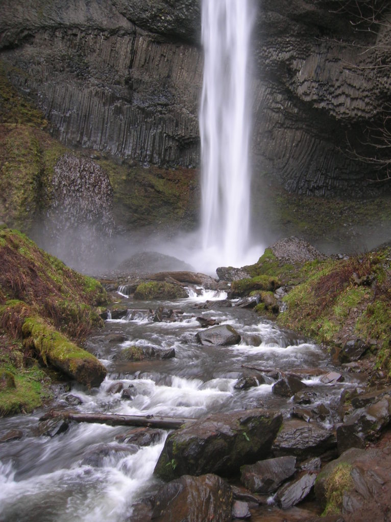
Quick Facts: Location: Columbia River Gorge National Scenic Area Land Agency: Oregon State Parks Roundtrip: 2.3 miles Elevation Gain: 650 feet Green Trails Map: Columbia River Gorge- West no. 428S Contact: Guy Talbot State Park Access: From Portland follow I-84 east to Exit 28. Then follow the Historic Columbia Highway west 2.6 miles to trailhead.…
Read MoreGoat Lake─A family friendly hike for old goats and kids alike!
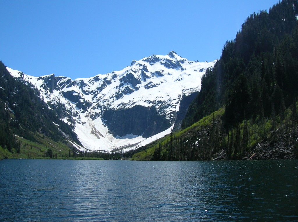
Quick Facts: Location: Mountain Loop Highway near Darrington Land Agency: Mount Baker-Snoqualmie National Forest Roundtrip: 10.4 miles Elevation Gain: 1,400 feet Green trails Map: Mountain Loop Highway-No. 111SX Access: From Granite Falls, follow the Mountain Loop Highway east for 31 miles to Barlow Pass and end of pavement. Continue for 3.5 miles turning right onto FR…
Read MoreEagle Creek — Classic Hike overflows with stunning waterfalls
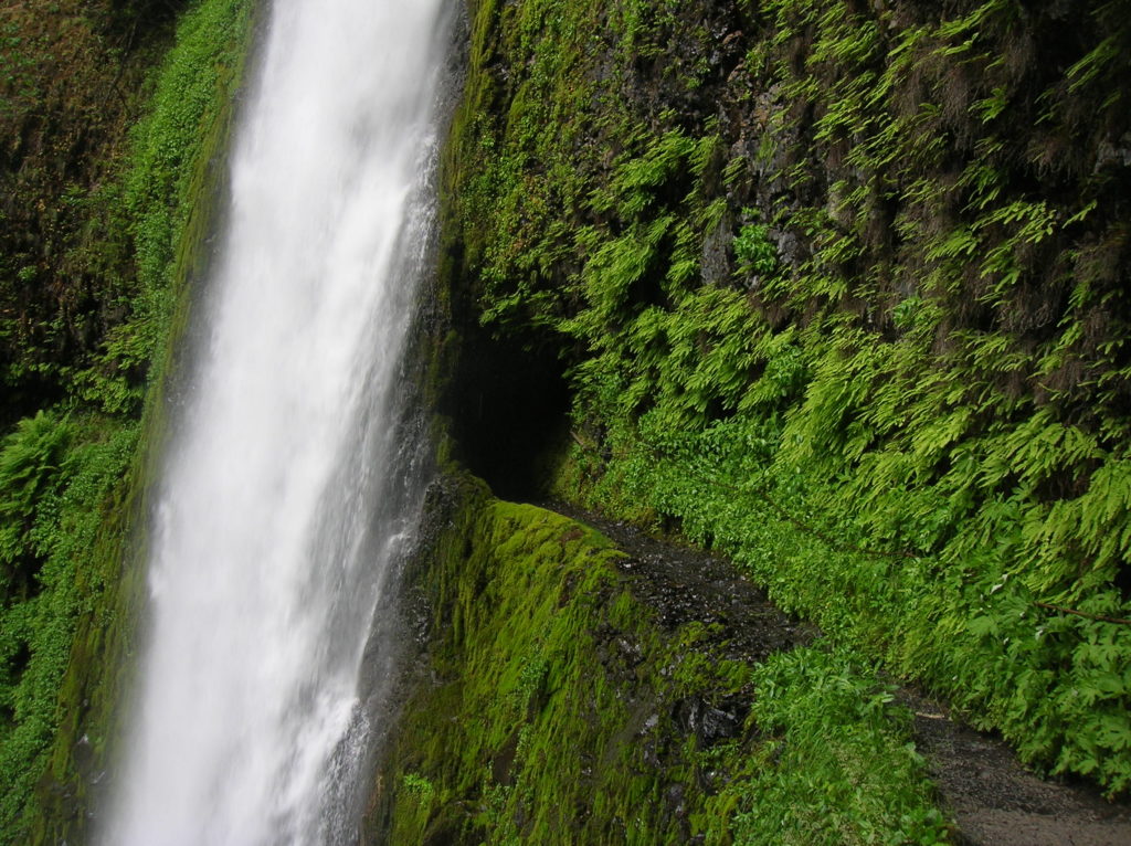
Quick Facts: Location: Columbia River Gorge near Cascades Locks, Oregon Land Agency: National Forest Service Roundtrip: 12 miles High Point: 1,100 feet Elevation gain: 1,600 feet Difficulty: moderate Green Trails Maps: Columbia Gorge West no. 428S Contact: Columbia Gorge National Scenic Area Notes: Northwest Forest Pass or Interagency Pass required; Dogs permitted (but not recommended) on leash; steep drop offs and exposure—keep children near.…
Read MoreMoulton Falls
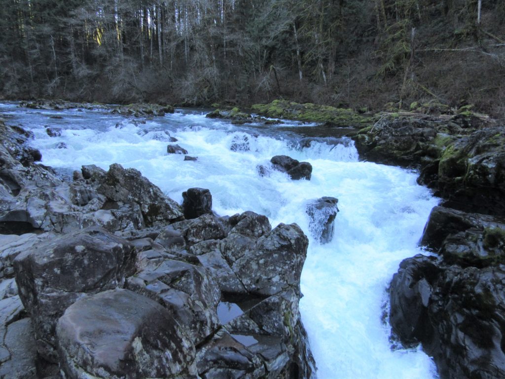
Walk along a wild river to an impressive set of rapids Quick Facts: Location: Clark County, WA Land Agency: Clark County Parks Roundtrip: 5.4 miles Elevation Gain: 200 feet Access: From Vancouver head north on I-5 to Exit 11 following SR 502 east for 6.0 miles to Battle Ground. Turn left onto SR 503 and…
Read MoreThird Beach– First Rate and second to none!
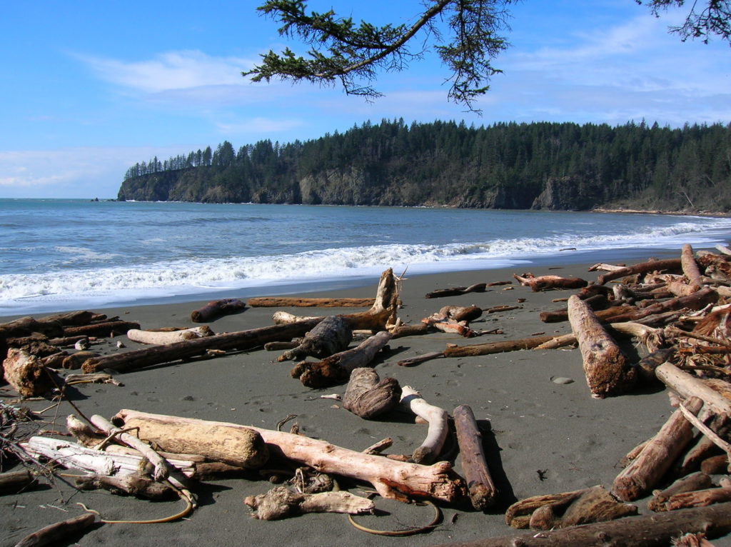
Quick Facts: Location: Olympic Coast near Forks Land Agency: National Park Service Roundtrip: 2.6 miles Elevation gain: 300 feet Contact: Olympic National Park Wilderness Information Center Green Trails Map: Olympic Beaches 99s Notes: Dogs Prohibited Recommended Guidebook: Day Hiking Olympic Peninsula 2nd edition (Mountaineers Books) Good to Know: kid-friendly, snow free winter hike; beach walking;…
Read MoreEastside Trail (Lower)
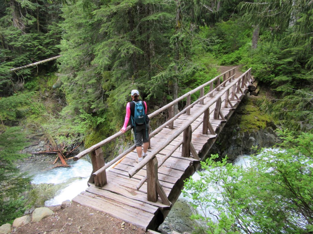
Quiet wanderings through ancient forests and by crashing cascades Quick Facts: Location Mount Rainier National Park Land Agency: United States National Park Service Distance: 9.0 miles one way Elevation Gain: 2200 feet Contact: Mount Rainier National Park Green Trails Map: Mount Rainier National Park 269SX Notes: Dog Prohibited, National Park Entrance Fee or Interagency Pass…
Read More