Wildflowers
Glacier Basin─Strike it rich with great views on this tough hike
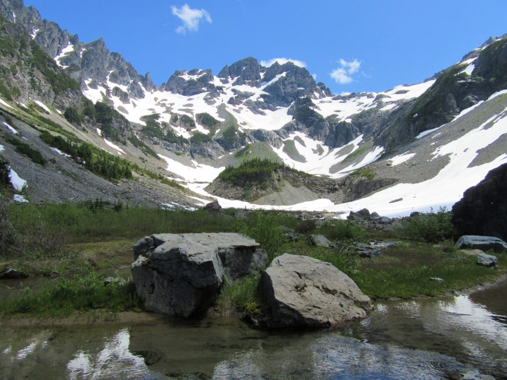
Quick Facts: Location: Mountain Loop Highway near Barlow Pass Land Agency: Mount Baker-Snoqualmie National Forest Roundtrip: 12.4 miles Elevation Gain: 2,300 feet Green Trails Map: Mountain Loop Highway 111SX Access: From Granite Falls follow the Mountain Loop Highway east for 30 miles to Barlow Pass. Hike begins by walking up gated Monte Cristo Road. Note: Northwest Forest…
Read MoreTubal Cain Mine and Buckhorn Lake — Take a “rhody trip” to an historic mine
Quick Facts: Location: Buckhorn Wilderness, Olympic National Forest Land Agency: National Forest Service Roundtrip: 12.4 miles Elevation Gain: 2,100 feet Contact: Olympic National Forest, Hood Canal Ranger District, Quilcene, Green Trails Map: Olympic Mountains East 168SX Notes: Wilderness regulations apply Access: From Discovery Bay (Jct SR 20 and US 101), drive no US 101 north and turn left…
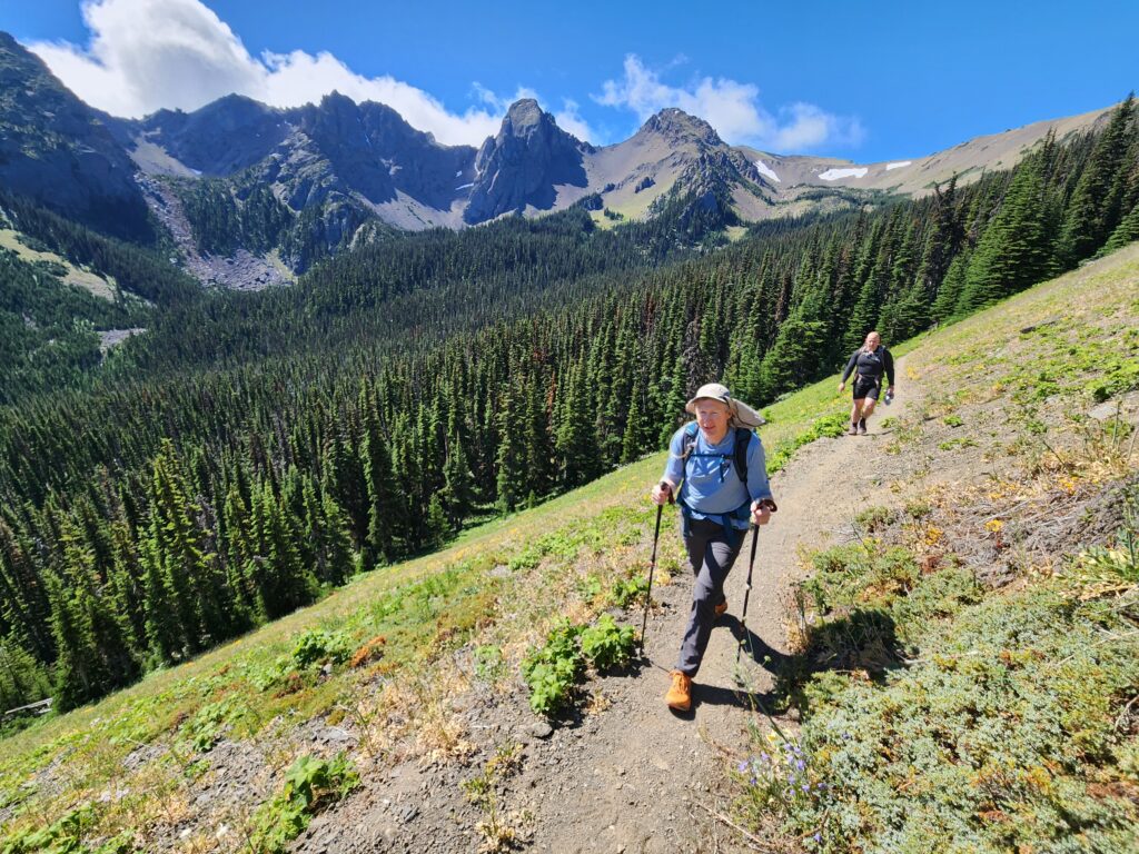
Read MoreGrand Ridge─Horizon-spanning views from the loftiest trail in the Olympics
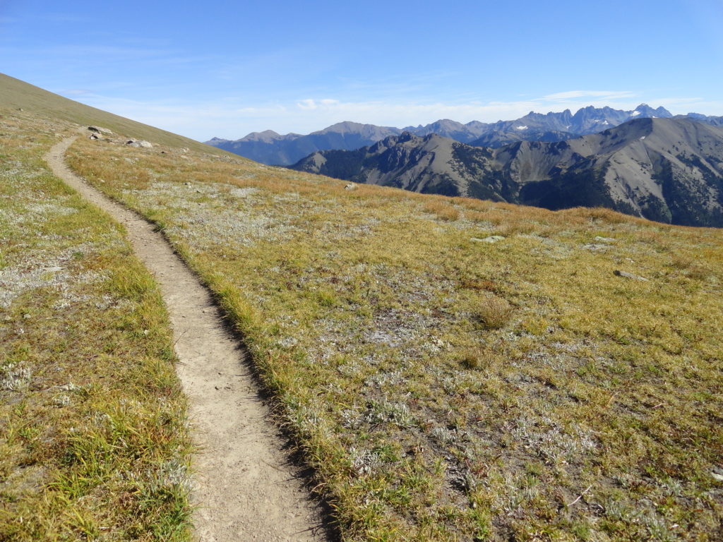
Quick Facts: Location: Deer Park-Obstruction Point, Olympic National Park Land Agency: National Park Service Roundtrip: 15.4 miles. To Maiden Peak: 7.0 miles Elevation Gain: 3,400 feet. To Maiden Peak: 1,600 feet Green Trails Map: Olympics Mountain East 168S Contact: Olympic National Park Notes: Park entry fee; Pavement on Deer Park Road ends at National Park Boundary…
Read MoreFourth of July Creek—Celebrate Independence Day with these explosive views!
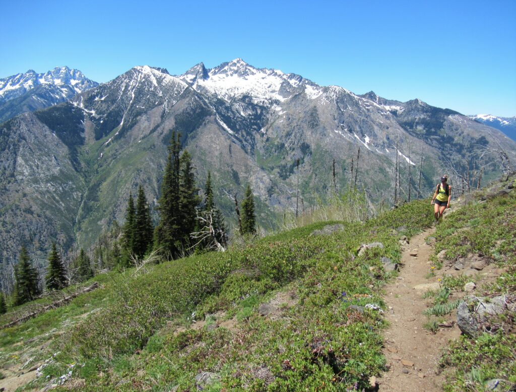
Quick Facts: Location: Central Cascades Land Agency: Okanogan-Wenatchee National Forest Roundtrip: 11.2 miles Elevation Gain: 4,700 feet Notes: rattlesnakes are common along lower portions of trail. Green Trails Map: Alpine Lakes East Stuart Range 208SX Contact: Wenatchee River Ranger District (Leavenworth) More information: Day Hiking Central Cascades 2nd edition (The Mountaineers Books) Access: From Leavenworth follow the…
Read MoreCopper Butte via Old Stage Trail– Take a historic route to the rooftop of the Kettle River Range

Quick Facts: Location: Kettle River Range Land Agency: Colville National Forest Roundtrip: 6.0 miles Elevation Gain: 1615 feet Contact: Colville National Forest, Three Rivers Ranger District-Kettle Falls Access: From Republic, head east on SR 20 for 21 miles turning left onto FR 2030 (Albion Hill Road). From Kettle Falls, head west on SR 20 for 22 miles turning…
Read MoreSteens Mountain– Into the heart of Oregon’s “Big Empty”
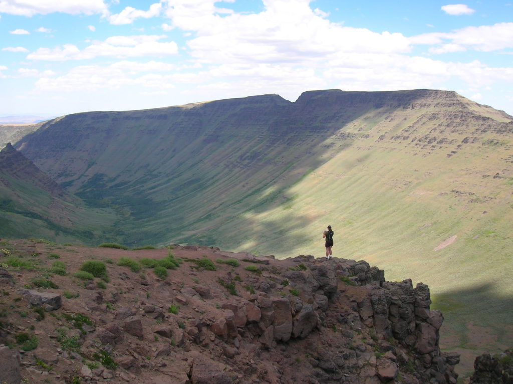
Quick Facts: Location: Great Basin, Eastern Oregon Land Agency: Steens Mountain Cooperative Management and Protection Area (BLM) Roundtrip: Kiger Gorge Rim; up to 4.0 miles Elevation gain: Up to 500 feet Difficulty: moderate Contact: BLM Burns Office Access: From Burns, Oregon travel 60 miles south to Frenchglen. Take Steens Mountan Loop Road for 23 miles.…
Read MoreLookout Mountain
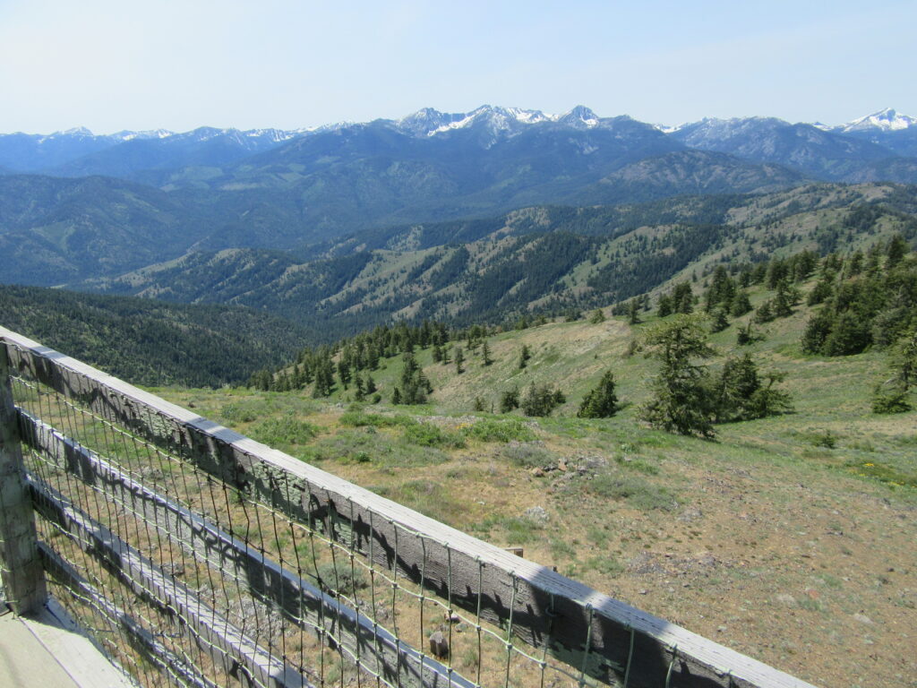
Look out over the Methow Valley and beyond Quick Facts: Location: Methow Valley, WA Distance: 3.0 miles one way Elevation Gain: 1170 feet Contact: Okanogan-Wenatchee National Forest, Methow Valley Ranger District Maps: Green Trails Methow Valley 51SX Recommended Guidebook: Day Hiking North Cascades (Mountaineers Books) Notes: trail open to mountain bikes and motorcycles; Final 1.5…
Read MoreMount Wells– Victoria area summit gushes with flowers and views

Quick Facts: Location: Victoria—Langford, BC Land Agency: Capital Regional District Parks Roundtrip: 2.0 miles/ 3.2 km Elevation gain: 865 feet/ 264 m Maps: CRDP site Contact: Capital Regional District Parks Notes: dogs permitted on leash; please stay on trail to protect rare plants Access: From Victoria, follow Trans-Canada Highway 10.5 for miles (17 km) exiting…
Read MoreJuniper Dunes Wilderness –A wilderness “sans” trails
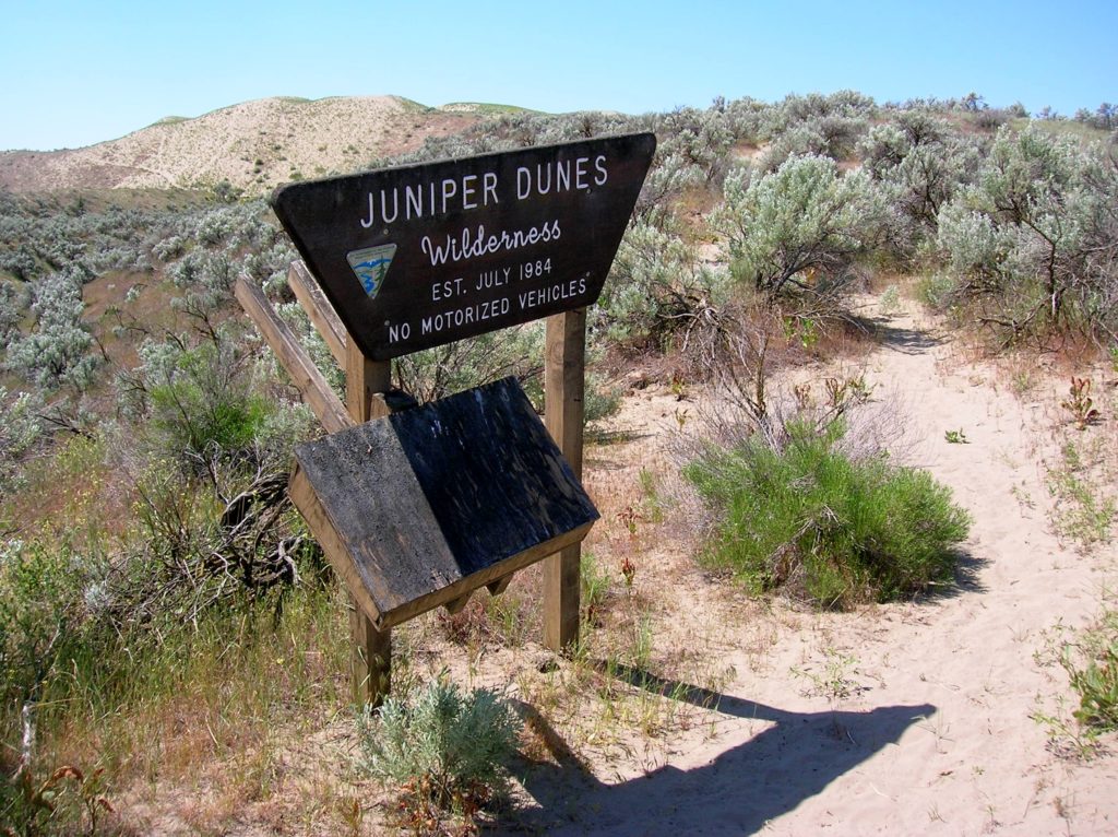
Quick Facts Location: Franklin County, Eastern Washington Land Agency: Bureau of Land Management Roundtrip: 2.0 miles Elevation gain: 200 feet Difficulty: Moderate Contact: Bureau of Land Management (BLM) Spokane Office Notes: All approaches to this wilderness area are currently via private roads and land. The southern approach cannot be recommended due to poor roads and changing…
Read MoreLyle Cherry Orchard–A great pick for spring wildflowers!
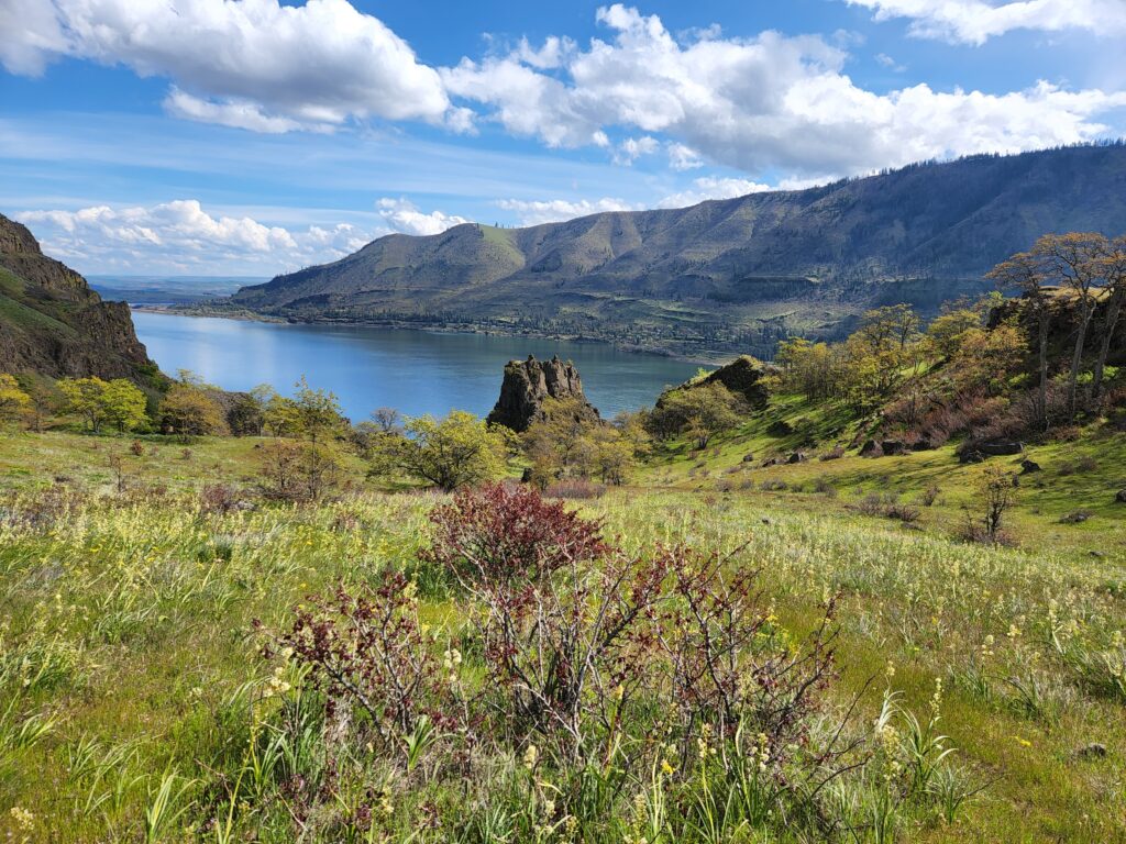
Location: Columbia River Gorge National Scenic Area Land Agency: Friends of the Columbia Gorge Roundtrip: 6.8 miles Elevation gain: 1,500 feet Contact: Friends of the Columbia Gorge Notes: Dogs permitted on leash; Beware ticks, rattlesnakes, and poison oak; parking limited especially on weekends Green Trails Map: Columbia River Gorge East No. 432S Access: From Bingen…
Read More