Wildflowers
Ebey’s Landing—A Sound Hiking Adventure
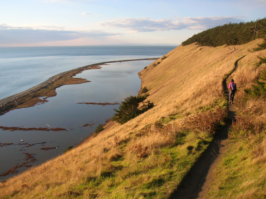
Quick Facts: Location: Whidbey Island Land Agency: National Park Service and Washington State Parks Roundtrip: 5.2 miles Elevation Gain: 260 feet Contact: Ebey’s Landing National Historical Reserve Suggested Guidebook: Urban Trails Everett Special note: Dogs permitted on leash. Access: Take Washington State Ferry from Mulkiteo to Clinton on Whidbey Island. Continue north on SR 525…
Read MoreVirginia Lake─Sweet bird watching spot on Sauvie Island
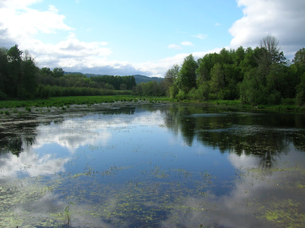
Quick Facts: Location: Sauvie Island (Portland, Oregon) Land Agency: Willamette River Greenway, Wapato Access (Oregon State Parks) Roundtrip: 2.4 miles Elevation Gain: 50 feet Notes: Dogs must be leashed. Access: From downtown Portland, follow US 30 (NW St Helens Road) west for just shy of 11 miles turning right onto the Suavie Island Bridge. Then…
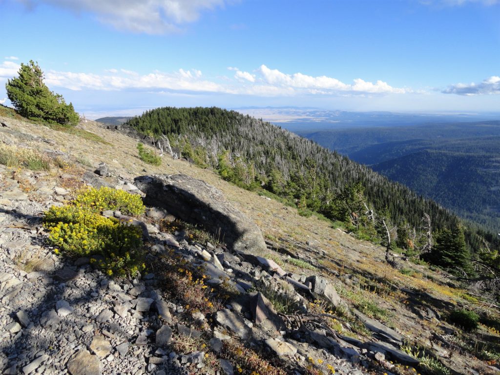
Read MoreBarnaby Buttes
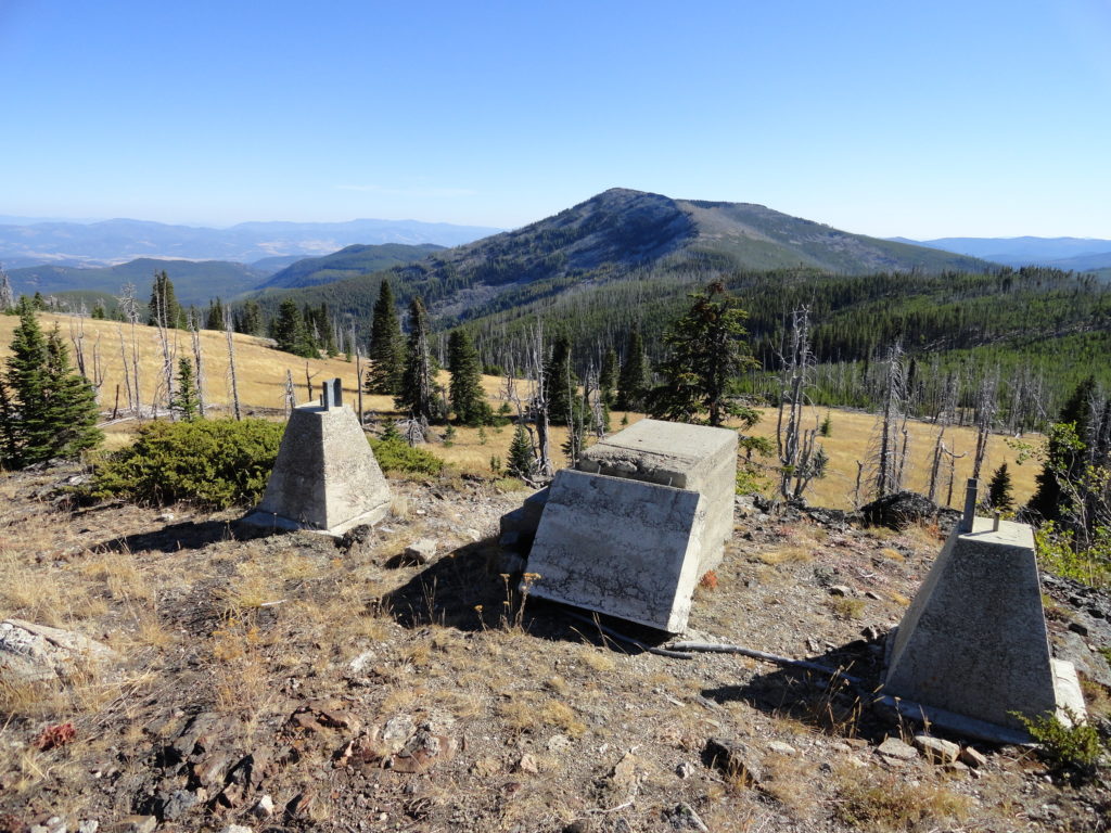
Mega-fauna hot spot in the Kettle River Range Quick Facts: Location: Kettle River Range Land Agency: National Forest Service Distance: 7.4 miles Elevation Gain: 1975 feet Contact: Colville National Forest Three Rivers Ranger District Recommended Guidebook: Day Hiking Eastern Washington (Mountaineers Books) Access: From Kettle Falls, travel west on SR 20 for 14 miles turning…
Read MoreDeer Ridge–Enjoy dear views of the Gray Wolf River Valley
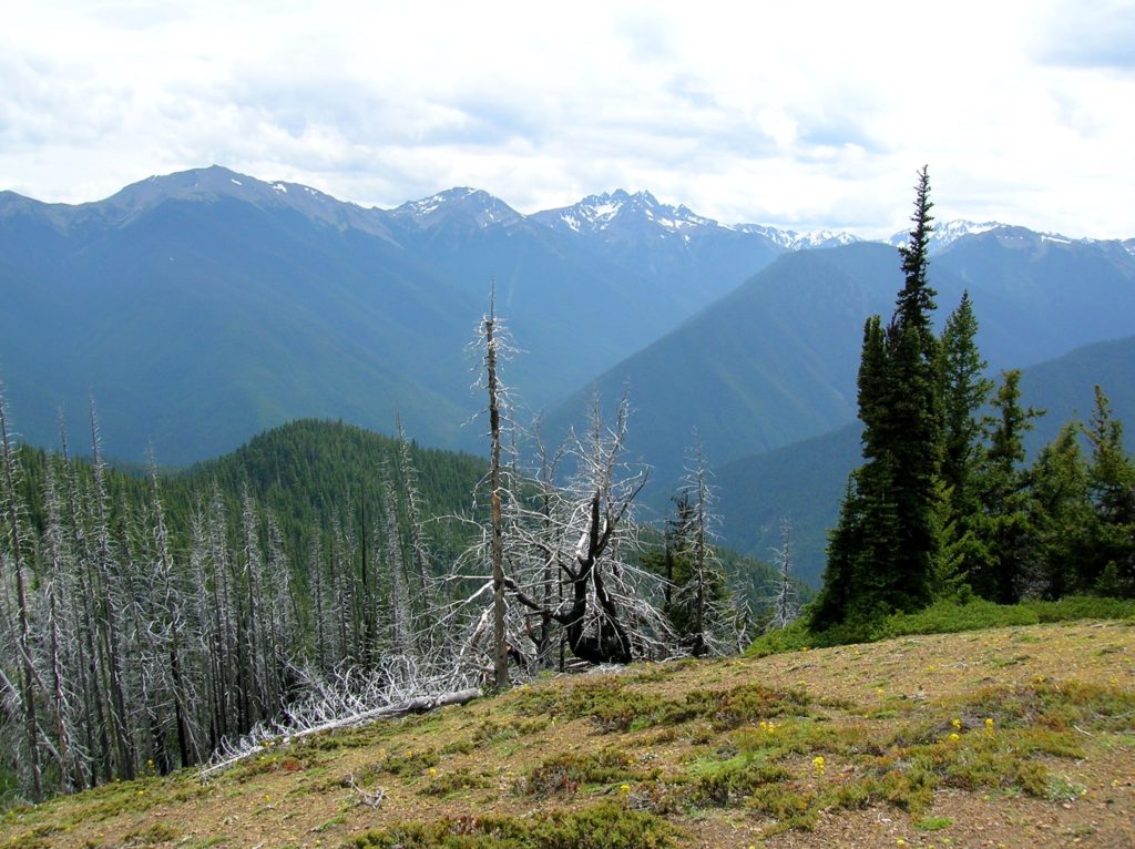
Quick Facts: Location: Northeast Olympic Peninsula Land Agency: Olympic National Forest and Olympic National Park Roundtrip: 10.0 miles Elevation gain: 2800 feet Contact: Hood Canal Ranger District, Olympic National Forest; and Olympic National Park Green Trails Map: Olympics East no. 168SX Notes: Dogs are prohibited on trail in the national park Good to Know: dog-friendly…
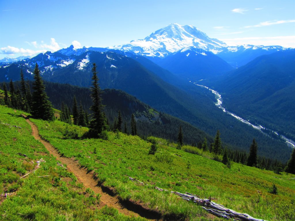
Read MoreWhite Pass–Sprawling meadows and stupendous views high on the Cascade Crest
Location: North Fork Sauk River Land Agency: Mount Baker-Snoqualmie National Forest Roundtrip: 19.4 miles High Point: 5,850 feet Elevation gain: 4,000 feet Difficulty: strenuous Green Trails Maps: Mountain Loop Highway 111SX Contact: Darrington Ranger District: Mount Baker-Snoqualmie National Forest Note: Northwest Forest Pass or Interagency Pass Required Access: From Darrington, travel south on the Mountain…
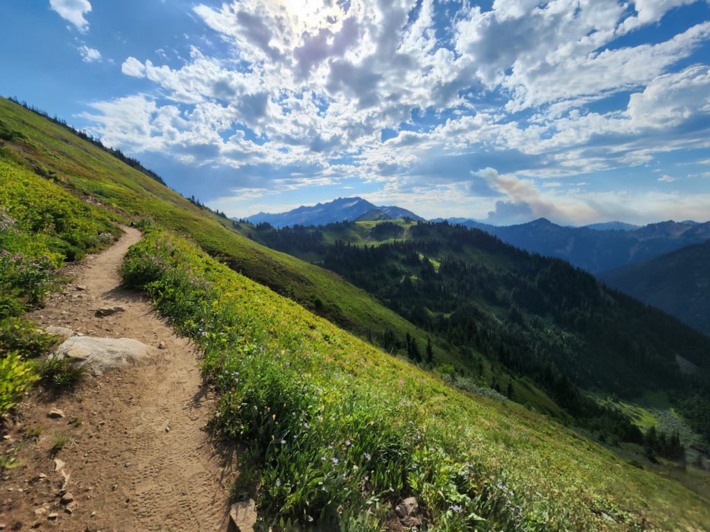
Read MoreGreen Mountain –Banal is thy name—Breathtakingly beautiful is thy game
Quick Facts: Location: Glacier Peak Wilderness, Suiattle River Road Land Agency: Mount Baker-Snoqualmie National Forest Roundtrip: 8.0 miles Elevation gain: 3,100 feet Green Trails Maps: North Cascades Ross Lake 16SX Contact: Darrington Ranger District: Mount Baker-Snoqualmie National Forest Notes: wilderness rules apply Access: From Darrington, travel north on SR 530 for 7.5 miles turning right…
Read MoreWindy Pass
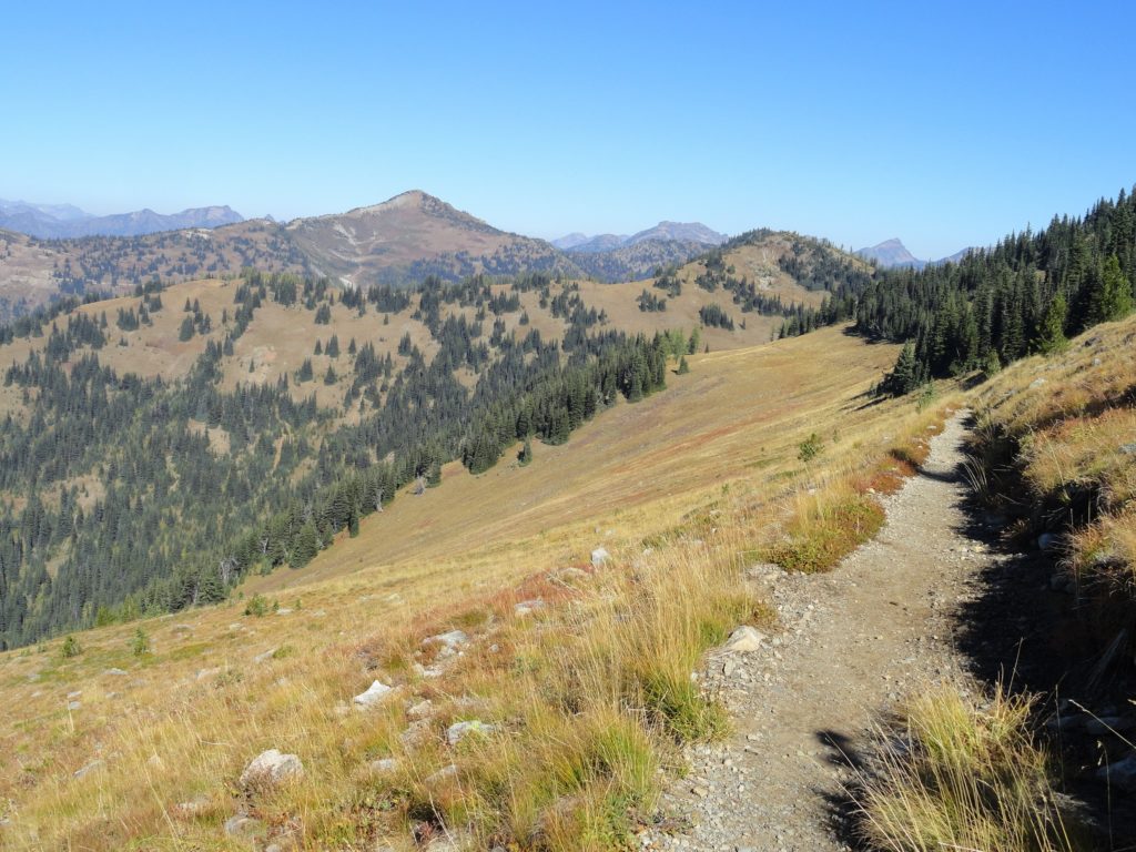
Easy wanderings high on the Pacific Crest Trail Quick Facts: Location: Harts Pass area Land Agency: National Forest Service Distance: 7.6 miles Elevation Gain: 900 feet Contact: Okanogan-Wenatchee National Forest, Methow Valley Ranger District Map: Green Trails Methow Valley Pasayten Wilderness 51SX Notes: Northwest Trail Pass or Interagency pass required Access: From Winthrop, drive State…
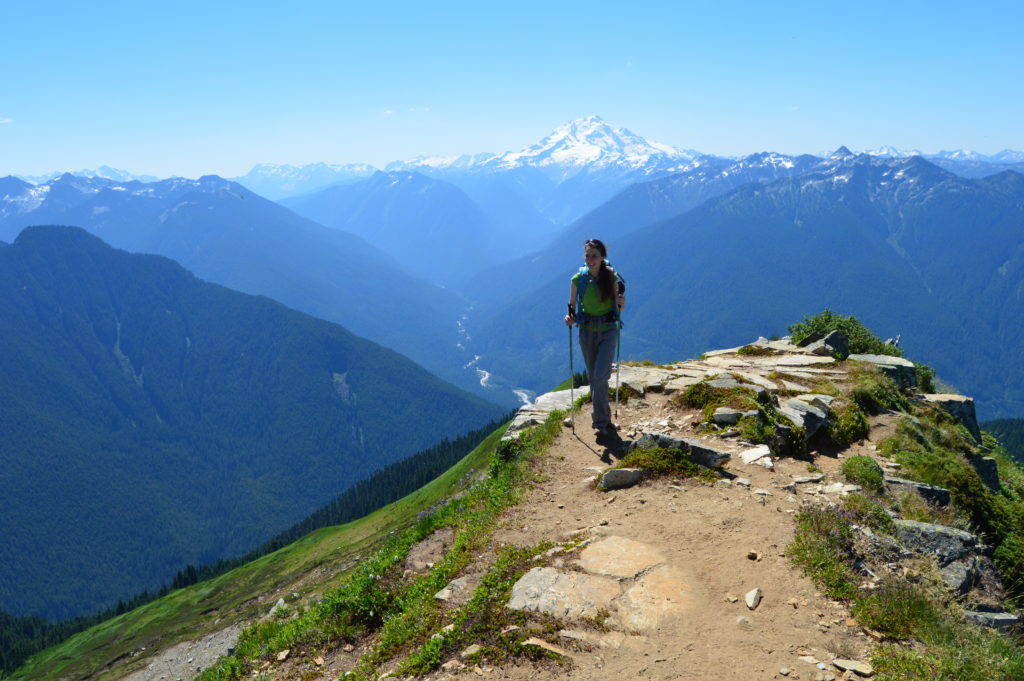
Read MoreCrystal Peak
Old fire lookout site grants some of the best views in Mount Rainier NP Quick Facts: Location: Mount Rainier National Park Land Agency: National Park Service Distance: 7.8 miles Elevation Gain: 3,400 feet Contact: Mount Rainier National Park Map: Green Trails Mount Rainier National Park 269SX Notes: National Park Entrance Fee or Interagency Pass, Dogs-prohibited…
Read MoreLookout Mountain
Flowers and sweeping views from highest point in the Badger Creek Wilderness Quick Facts: Location: Badger Creek Wilderness Land Agency: Mount Hood National Forest Distance: 2.5 miles roundtrip Elevation Gain: 550 feet Contact: Barlow Ranger District, Mount Hood National Forest Map: Green Trails Mount Hood Wilderness 462SX Notes: Northwest Trail Pass or interagency pass required…
Read MoreThe Hummocks — Hike through the former heart of Mount St. Helens
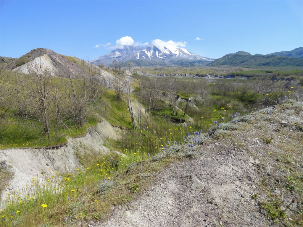
Quick Facts: Location: Spirit Lake Highway, Mount St Helens National Volcanic Monument Land Agency: National Forest Service Roundtrip: 2.5 miles Elevation Gain: 250 feet Contact: Mount St Helens National Volcanic Monument Green Trails Map: Mount St Helens 332S Notes: Northwest Forest Pass (or interagency pass) required; dogs permitted on leash; off trail travel prohibited. Practice Leave…
Read More