Wildflowers
South Coldwater Ridge — Elk, toppled tractors, and a stunning view of a volcano-formed lake
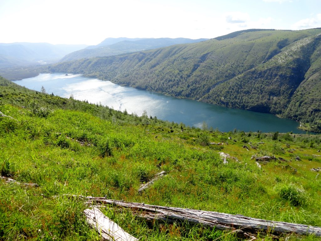
Quick Facts: Location: Spirit Lake Highway Mount St. Helens West Land Agency: Mount St. Helens National Volcanic Monument Roundtrip: 6.8 miles Elevation gain: 1525 feet Difficulty: moderate Green Trails Map: Mount St Helens 332S Recommended Guidebook: Day Hiking Mount St Helens Contact: Mount St. Helens National Volcanic Monument Access: From Castle Rock follow SR 504 east…
Read MoreBlack Lake─Wildflowers bring Black Lake back to life from past forest fires
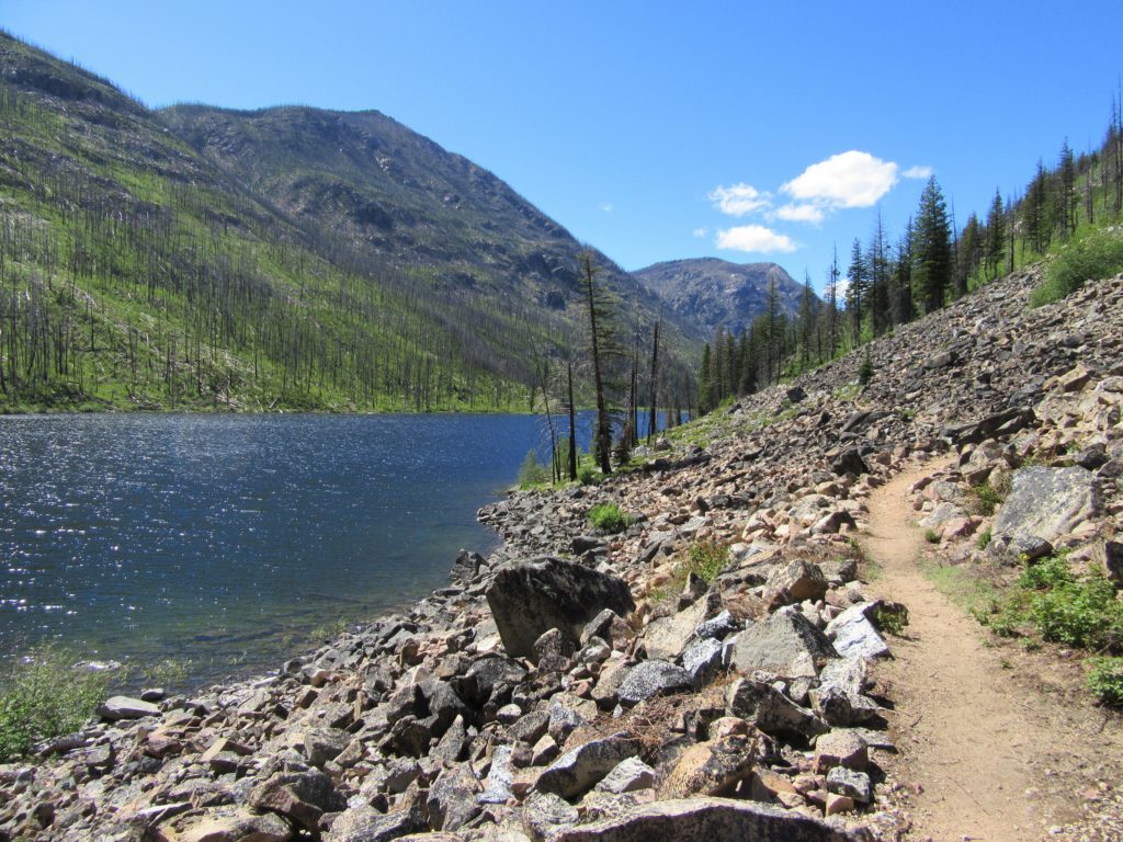
Quick Facts: Location: Chewuch River Valley Land Agency: National Forest Service Roundtrip: 10.2 miles Elevation Gain: 800 feet Contact: Methow Valley Ranger District: Okanogan-Wenatchee National Forest Green Trails Map: Methow Valley 51SX Recommended Guidebook: Day Hiking North Cascades 2nd edition Special Note: Northwest Forest Pass or Interagency Pass required. Good to Know: Dog-friendly, kid-friendly, wildflowers,…
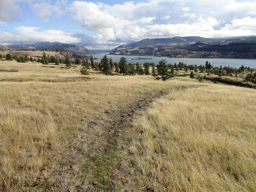
Read MoreHamilton Mountain — Breathtaking views from above Beacon Rock
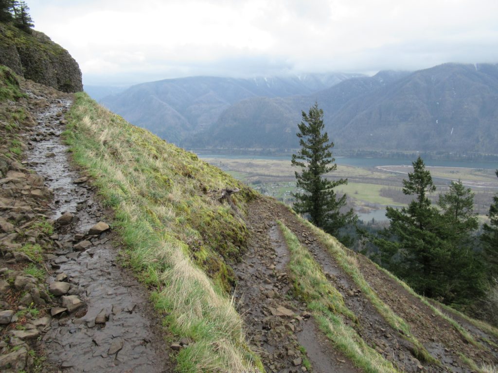
Quick Facts: Location: Beacon Rock State Park, Columbia River Gorge National Scenic Area Land Agency: Washington State Parks Roundtrip: 7.5 miles Elevation gain: 2,100 feet Contact: Beacon Rock State Park Notes: Discover Pass required; Dogs permitted on leash. Green Trails Map: Columbia River Gorge West No. 428S Recommended Guidebooks: Day Hiking Columbia River Gorge, 100…
Read MoreMount Pisgah–Hike to a promising land of spectacular wildflowers
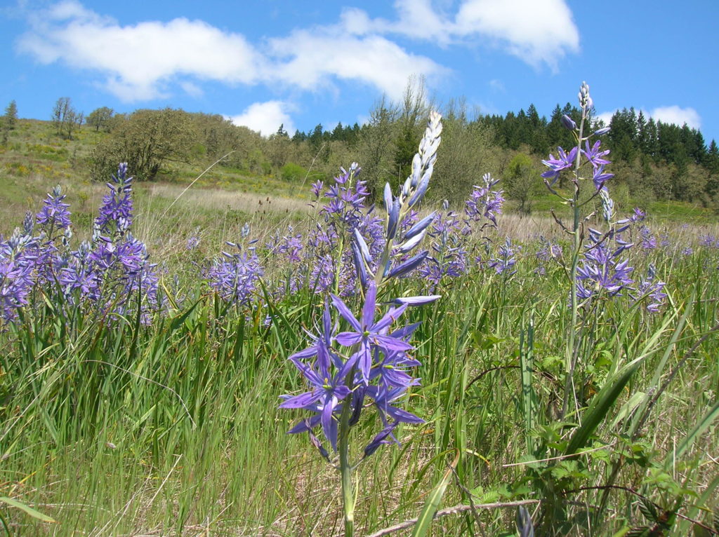
Quick Facts: Location: Willamette Valley south of Eugene Land Agency: Lane County Parks Roundtrip: 3.0 miles Elevation gain: 1,050 feet Map: Park map available online Contact: Friends of Buford Park and Mount Pisgah Notes: $5.00 day use fee; dogs must be leashed Access: From Eugene follow Franklin Blvd (Exit 189 I-5 southbound or Exit 188B northbound…
Read MoreWhistler Canyon-big on bighorn sheep and Okanogan River views
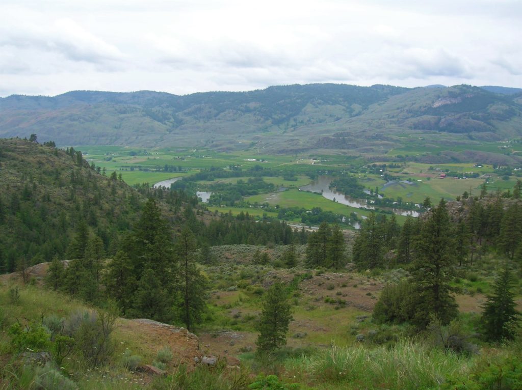
Location: Okanogan Valley near Oroville Land Agency: Okanogan-Wenatchee National Forest Roundtrip: 5.0 miles High Point: 1,950 feet Elevation gain: 1,250 feet Difficulty: moderate Contact: Pacific Northwest Trail Association Note: Dogs should be under strict control as to not disturb the bighorn sheep. Access: From Tonasket, follow US 97 north for 14.5 miles to trailhead turnoff…
Read MoreTracy Hill — Wild turkeys and sublime views
Quick Facts: Location: Columbia River Gorge National Scenic Area Land Agency: Columbia Gorge National Scenic Area Roundtrip: 5.0 miles Elevation gain: 1150 feet Difficulty: Moderate Contact: Columbia Gorge National Scenic Area Notes: Dogs permitted on leash. Be aware of ticks and poison oak. Green Trails Map: Columbia River Gorge East No. 432S Good to Know:…
Read MoreJungle Hill–a scenic and challenging boogie to the Kettle Crest
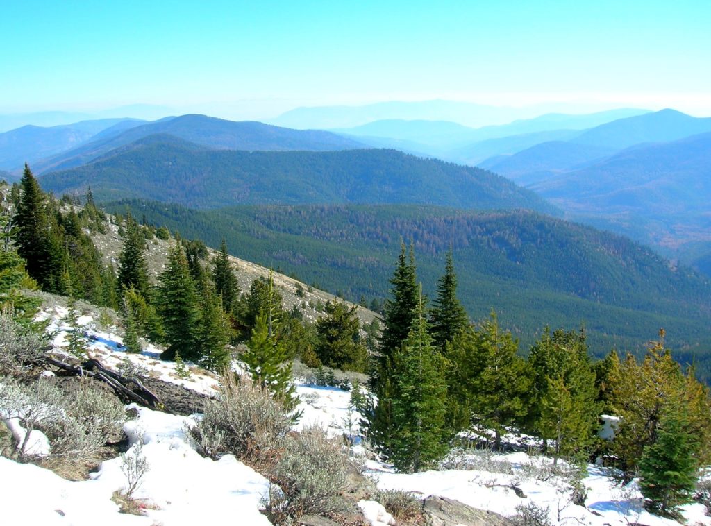
Location: Colville National Forest, near Republic Land Agency: US Forest Service Roundtrip: 8.0 miles High Point: 6,550 feet Elevation gain: 2,250 feet Difficulty: moderate Recommended Guidebook: Day Hiking Eastern Washington Contact: Colville National Forest Access: From Republic, head east on SR 20 for 25 miles turning left onto FR 2030 (Albion Hill Road). From Kettle…
Read MoreBlue Lake and Johnson Mountain–divine ridge walking

Quick Facts: Location: Mountain Loop Highway near Darrington Land Agency: Mount Baker-Snoqualmie National Forest Roundtrip: 28.3 miles Elevation Gain: 6,725 feet Green Trails Maps: Mountain Loop Highway 111SX Recommended Guidebook: Backpacking Washington (Romano; Mountaineers Books) Access: From Darrington, head south on the Mountain Loop Highway 16.0 miles turning left onto FR 49. Follow for 6.4 miles bearing…
Read MoreTiffany Mountain — Enjoy horizon-spanning views at the edge of the North Cascades

Quick Facts: Location: Northeastern Cascades Land Agency: Okanogan-Wenatchee National Forest Roundtrip: 5.0 miles Elevation Gain: 1,700 feet Green Trails Map: Green Trails, Tiffany Mountain, WA- No. 53 Contact: Tonasket Ranger District, Okanogan-Wenatchee National ForestAccess: From Burlington follow SR 20 east to Winthrop. Then continue north on East Chewuch River Road for 6.5 miles and turn right onto FR…
Read MoreAllen Mountain Trail Less Traveled near Mount Rainier
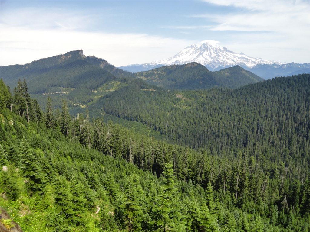
Quick Facts: Location: Mount Rainier region Land Agency: Gifford Pinchot National Forest Round Trip: 10.0 miles Elevation Gain: 2,350 feet Contact: Cowlitz Valley Ranger Station (Randle), Gifford Pinchot National Forest Green Trails Map: Randle, WA no. 301 Notes: Trails are also open to mountain bikes and motorcycles but use is light; this hike is lightly…
Read More