Jungle Hill–a scenic and challenging boogie to the Kettle Crest
Location: Colville National Forest, near Republic
Land Agency: US Forest Service
Roundtrip: 8.0 miles
High Point: 6,550 feet
Elevation gain: 2,250 feet
Difficulty: moderate
Recommended Guidebook: Day Hiking Eastern Washington
Contact: Colville National Forest
Access: From Republic, head east on SR 20 for 25 miles turning left onto FR 2030 (Albion Hill Road). From Kettle Falls, head west on SR 20 for 22 miles, turning right onto FR 2030. Follow FR 2030 for .5 mile turning left onto a spur. Continue .3 mile to trailhead in the Jungle Hill Campground.
Good to know: Dog-friendly, summer wildflowers, autumn larches, trail less traveled, practice Leave No Trace principles
Welcome to the Jungle—Jungle Hill; an obscure peak in the Kettle River Range of northeastern Washington. Few folks venture onto Jungle Hill’s 6,544-foot summit because it’s forested and trail-less. But the Jungle Hill Trail which terminates high on the Kettle Crest north of Jungle Hill grants some sweet extensive views..
The trail starts with a short descent to Sherman Creek reaching a junction with the Sherman Pass Trail. Continue straight, cross the creek and start climbing. Paralleling Sherman Creek for a short distance, the trail eventually pulls away from it, although its tumbling waters can be heard throughout most of the hike.
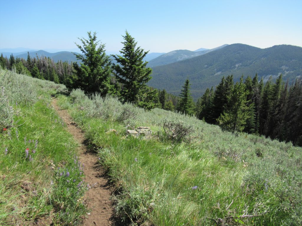
Winding through impressive groves of giant larches, and clusters of aspen, this path is quite colorful come late September. But owing to its southern exposure, the Jungle Hill Trail is a good choice for late spring hiking too. Along a sun kissed ridge, the way steadily gains elevation, steeply at times and occasionally via short switchbacks.
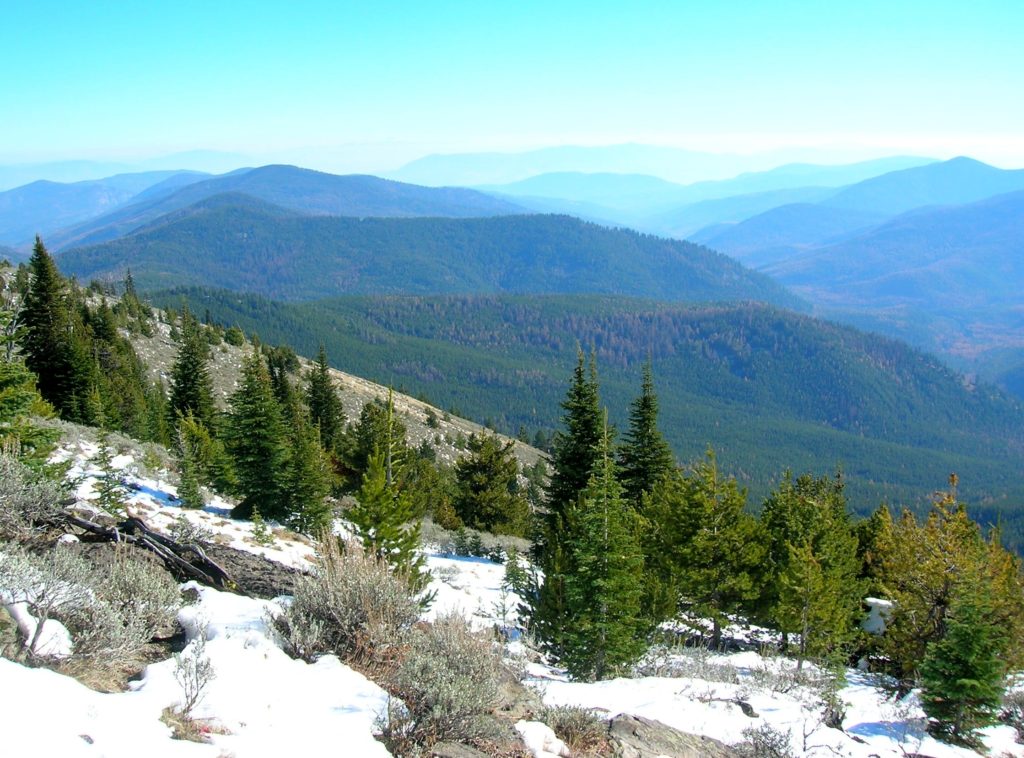
At about 2.0 miles, Jungle Hill comes into view. The trail continues upward now traversing lodgepole pine forest punctuated with pocket meadows. The grade eventually eases as the trail travels through meadows fragranced with sage. Views eastward over the Sherman Creek Valley and out to Huckleberry Mountain and Calispell Peak are excellent.
Continue across sage flats taking in views westward through a gap in the Kettle Crest out to Moses Mountain and the North Cascades. Views south along the Crest aren’t too bad either. At 4.0 miles near a campsite and spring reach the Kettle Crest Trail. Call it a hike or venture 1.2 miles north through beautiful meadows to Wapaloosie Mountain.
For more detailed information on this hike including maps; and information on other great hikes in the Colville National Forest, consult my Day Hiking Eastern Washington book (co-written with Spokane’s Rich Landers).
There is great camping at nearby Curlew Lake State Park or consider staying at the Northern Inn in the nearby historic mining town of Republic. For information on other area attractions consult Northwest Trip Finder.