Region
Mount Rainier
Quick Facts: Location: Mount Baker-Snoqualmie National Forest Land Agency: US Forest Service Round Trip: 8.2 miles Elevation Gain: 1900 feet Green Trails Map: Greenwater no. 238 Contact: Mount Baker-Snoqualmie National Forest Notes: During periods of low snow levels, parking may be difficult. Access: From Enumclaw follow SR 410 for 13.6 miles turning left (shortly after passing…
Quick Facts: Location: Mount Baker-Snoqualmie National Forest Land Agency: National Forest Service Roundtrip: 11.5 miles Elevation Gain: 2,800 feet Contact: Mount Baker-Snoqualmie National Forest Green Trails Maps: Greenwater no. 238, Lester no. 239, and on Mount Rainier National Park 269S Notes: When snow level is low, parking here can be a challenge. Do not block access…
Quick Facts: Location: Nisqually River Valley Land Agency: National Forest Service Round Trip: 4.0 miles Elevation Gain: 1450 feet Contact: Cowlitz Valley Ranger Station (Randle), Gifford Pinchot National Forest Green Trails Maps: Randle, WA no. 301 Notes: Road to trailhead can be rough. Trail is open to motorcycles but sees little use as it receives little…
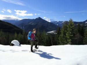
Quick Facts: Location: White River Valley Land Agency: Mount Baker-Snoqualmie National Forest Roundtrip: 4.2 miles Elevation Gain: 750 feet Contact: Snoqualmie Ranger District, Enumclaw office Green Trails Map: Greenwater no. 238 Notes: Northwest Forest Pass or Interagency Pass required; Dogs permitted on leash Access: From Enumclaw, follow SR 410 east for 28 miles. Turn left onto Camp Sheppard…

Quick Facts: Location: Mount Rainier National Park Land Agency: National Park Service Roundtrip: 12.4 miles Elevation Gain: 2,600 feet Contact: Mount Rainier National Park Green Trails Map: Green Trails Mount Rainier National Park 269SX Notes: National Park entrance fee; Dogs Prohibited; Practice Leave No Trace Principles; camping only in designated spots and with a permit Access:…
Quick Facts: Location: Nisqually Valley, Mount Rainier National Park Land Agency: National Park Service Roundtrip: 11.6 miles Elevation Gain: 3200 feet Contact: Mount Rainier National Park Green Trails Map: Mount Rainier National Park 269S Notes: National Park Entrance Fee or Interagency Pass required; Dog prohibited Timed entry pass required for entrance into Mount Rainier National Park (Longmire and Sunrise…

Quick Facts: Location: Mount Rainier National Park Land Agency: National Park Service Roundtrip: 5.6 miles Elevation Gain: 1,000 feet Contact: Mount Rainier National Park Green Trails Map: Green Trails Mount Rainier National Park 269SX Notes: National Park entrance fee; Dogs Prohibited; Practice Leave No Trace Principles; Timed entry pass required for entrance into Mount Rainier National…
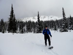
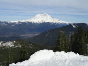
Snowshoe to a “deer” location in Mount Rainier National Park Quick Facts: Location: Mount Rainier National Park Distance: 10.2 miles roundtrip Elevation Gain: 1,350 feet Contact: Mount Rainier National Park Green Trails Map: Mount Rainier National Park 269SX Notes: Dogs are prohibited; Route is non-groomed and shared with skiers; National Park pass or Interagency Pass…
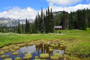
Quick Facts: Location: Mount Tahoma Trails near Ashford Land Agency: Washington DNR and Mount Tahoma Trails Association Roundtrip: 8.6 miles Elevation gain: 2,400 feet Contact: Mount Tahoma Trails Association MTTA Map: Mount Tahoma Ski Trail System (MTTA) Notes: Sno-Park Pass required; Reservations required for overnight stays in hut Access: From Elbe head east 10 miles…
Quick Facts: Location: Naches Pass, Mount Rainier National Park Land Agency: United States Park Service Roundtrip: 4.0 miles Elevation gain: 600 feet Green Trails Maps: Mount Rainier Wonderland Map 269SX Contact: Mount Rainier National Park Notes: Dogs prohibited Access: From Enumclaw follow SR 410 east to Tipsoo Lake parking area just before Chinook Pass. Good…