Region
North Cascades
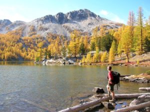
Location: Sawtooth Ridge Roadless Area Land Agency: Okanogan-Wenatchee National Forest Roundtrip: 16 miles High Point: 7,300 feet Elevation gain: 3,800 feet Difficulty: moderate Green Trails Maps: Prince Creek, WA- No. 115 Contact: Methow Valley Ranger District: Okanogan-Wenatchee National Forest Notes: Northwest Forest Pass or Interagency Pass required Access: From Twisp follow SR 153 south turning…

Quick Facts: Location: Mountain Loop Highway near Granite Falls Land Agency: Mount Baker-Snoqualmie National Forest Roundtrip: 13.0 miles Elevation Gain: 2,100 feet Green Trails Map: Mountain Loop Highway 111SX Access: From Granite Falls, follow the Mountain Loop Highway east for 31 miles to Barlow Pass. Hike begins by walking up gated Monte Cristo Road. Note: Northwest…
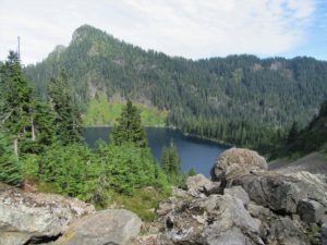
Quick Facts: Location: Mountain Loop Highway near Granite Falls Land Agency: Mount Baker-Snoqualmie National Forest Roundtrip: 6.0 miles High Point: 4,925 feet Elevation gain: 2,250 feet Difficulty: difficult Green Trails Map: Mountain Loop Highway no. 111SX Contact: Darrington Ranger District Notes: Access road is rough in spots; high clearance recommended Access: From Granite Falls follow the Mountain Loop Highway east for 26 miles. Just…
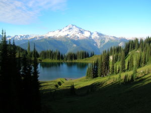
Quick Facts: Location: Glacier Peak Wilderness Land Agency: Mount Baker-Snoqualmie National Forest Roundtrip: 33.0 miles Elevation Gain: 4,700 feet Green Trails Map: Mountain Loop Highway 111SX Contact: Darrington Ranger District: Mount Baker Snoqualmie National Forest Notes: NW Forest or Interagency Pass required; No camping within ¼ mile of Image Lake—use established campsites; no fires at lake; respect re-vegetation…
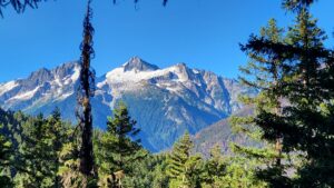
Quick Facts: Location: Ross Lake National Recreation Area, North Cascades Scenic Highway (SR20) Land Agency: National Park Service Roundtrip: 9.0 miles Elevation Gain: 2,350 feet Green Trails Map: North Cascades Ross Lake 16SX Special Note: Dogs must be leashed. Contact: North Cascades National Park Visitors Center Newhalem Recommended Guidebook: Day Hiking North Cascades 2nd Edition Access: From Marblemount…

Quick Facts: Location: North Cascades Highway Land Agency: Ross Lake National Recreation Area Roundtrip: 7.6 miles Elevation Gain: 1400 feet Contact: North Cascades National Park Detailed Information: Day Hiking North Cascades 2nd edition (Mountaineers Books) Notes: Dogs must be leashed. Access road gated at 4:15 pm during winter Access: From Marblemount follow SR 20 east for 21.5 miles.…

Quick Facts: Location: Boulder River Wilderness, near Darrington Land Agency: National Forest Service Round trip: 8.6 miles Elevation Gain: 750 feet Green Trails Maps: Mountain Loop Highway 111SX Access: From Arlington follow SR 530 for 20 miles. Just beyond Milepost 41 near a subdivision turn right onto FR 2010 and continue for 3.7 miles to trailhead. Contact:…
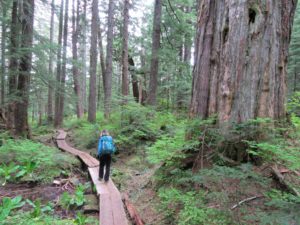
Old growth forest serenity Quick Facts: Location: Mountain Loop Highway Land Agency: National Forest Service Roundtrip: 5.5 miles Elevation Gain: 800 feet Green Trails Map: Mountain Loop Highway no. 111SX Contact: Darrington Ranger District: Mount Baker- Snoqualmie National Forest Access: From Granite Falls follow the Mountain Loop Highway east to the Verlot Visitors Center. Proceed for…

Quick Facts: Location: Mountain Loop Highway near Darrington, Land Agency: Mount Baker -Snoqualmie National Forest Roundtrip: 6.0 miles Elevation gain: 150 feet Green Trails Maps: Mountain Loop Highway 111SX Contact: Darrington Ranger District: Mount Baker -Snoqualmie National Forest Notes: Northwest Forest or Interagency Pass required Access: Take Exit 208 off of I-5 following SR 530…
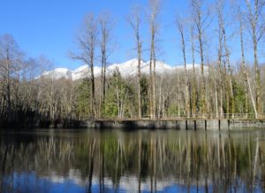
Quick Facts: Location: Darrington Land Agency: Snohomish County Parks Roundtrip: 2.0 miles Elevation gain: none Difficulty: Easy Contact: Snohomish County Parks Green Trails Map: Mountain Loop Highway 111SX Notes: Dogs allowed on leash Access: From Exit 208 on I-5 (Arlington) travel east on SR 530 for 25.2 miles turning left onto Fortson Mill Road (near…