Region
Puget Sound Islands & Lowlands
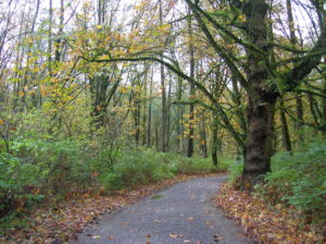
Quick Facts: Location: Whidbey Island Land Agency: Washington State Parks Roundtrip: 2.3 miles Elevation Gain: 200 feet Contact: South Whidbey State Park Notes: Discover Pass Required: Dogs must be leashed Access: From the Clinton Ferry Terminal on Whidbey Island follow SR 525 north for 9.4 miles turning left onto Bush Point Road. After 2.2 miles road…
Quick Facts: Location: Edmonds Land Agency: Snohomish County Parks and Recreation Roundtrip: Up to 5 miles Elevation Gain: up to 250 feet Access: From Everett follow I-5 south to exit 181. Now follow SR 524 (196th St SW) west passing SR 99 and in about another mile turn right onto 76th Ave W. Proceed for about .5…
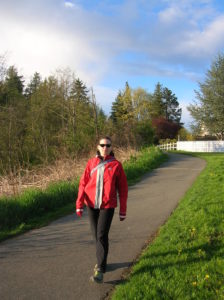
Quick Facts: Location: Arlington Land Agency: Snohomish County Parks Roundtrip: 6.2 miles Elevation Gain: 100 feet Contact: Snohomish County Parks Notes: Paved trail is also open to bicycles and is wheelchair accessible; dogs must be leashed. Access: Southern Access is from Haller Park in Arlington near the junction of SR 9 and SR 530, four miles…
Quick Facts: Location: Mountlake Terrace, southern Snohomish County Land Agency: City of Mountlake Terrace Roundtrip: 2.0 miles Elevation Gain: 125 feet Access: From Seattle: drive I-5 north to exit 178. Turn right and follow 236th Street SW for 0.7 mile. Then turn left onto 48th Ave W and drive north 0.2 mile to park and parking on your…

Quick Facts: Location: Northern Snohomish County, near Stanwood Land Agency: Pacific Denkmann Company Pilchuck Tree Farm Roundtrip: 3.2 miles Elevation Gain: 400 feet Contact: Pilchuck Recreation Association: www.pilchuckra.org Notes: All trail users MUST sign a liability release and have it on file to use these trails. Download here and mail (with $2 donation) to Pilchuck Recreation Association. Dogs…
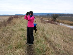
Quick Facts Location: Skagit Bay, Stanwood Land Agency: Washington Department of Fish and Wildlife Roundtrip: 3.6 miles Elevation Gain: None Access: From Exit 212 on I-5 head west on SR 532 for five miles to the town of Stanwood. Turn right onto the Pioneer Highway and proceed for 2.6 miles to the junction with the Old…
Quick Facts: Location: City of Monroe Land Agency: Monroe Parks and Recreation Department Roundtrip: 1.5 miles Elevation Gain: Minimal Notes: Dogs must be on leash; Trail is prone to flooding during periods of heavy rain. Access: From Everett follow US 2 east to Monroe. Turn right onto SR 203 (Lewis Street). Proceed past Main Street traffic lights and within a short…
Quick Facts: Location: Marysville Land Agency: Marysville Parks and Recreation Roundtrip: 1.5 miles Elevation Gain: 50 feet Contact: Marysville Parks Notes: Dogs must be leashed. Access: From Exit 199 on I-5, head east on SR 528 (4th Street) about 1.5 miles to parking and trailhead on left. Good to know: dog-friendly, kid-friendly, historic Jennings Park…
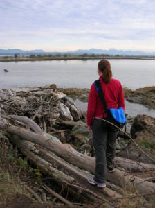
Location: Stanwood Land Agency: Washington Department of Fish and Wildlife (WDFW) Roundtrip: 1.0 mile Elevation gain: None Difficulty: Easy Contact: Washington Department of Fish and Wildlife Notes: Discover Pass or WDFW Vehicle Use Permit required; Active hunting area from October to late January Access: From Exit 212 on I-5, travel west 5.0 miles to Stanwood.…
Quick Facts Location: Stillaguamish River Valley, Arlington Land Agency: Snohomish County Parks Roundtrip: 1.0 miles Elevation Gain: none Contact: Snohomish County Parks; www1.co.snohomish.wa.us/Departments/Parks/ Notes: Dogs must be on leash. Access: From Exit 208 on I-5, head east on SR 530 for 4.0 miles to Arlington. Continue east on SR 530 for another .5 mile turning…