Region
Urban Trails
Quick Facts: Location: Mukilteo Land Agency: Mukilteo Parks and Recreation Contact: Mukilteo Recreation Department Roundtrip: 4.0 miles Elevation Gain: 350 feet Access: From Everett follow SR 526 to SR 525. Turn left (south) on SR 525 and drive .5 mile to 92nd Street. Turn right and then immediately turn left into the 92nd Street Park parking area.…
Quick Facts Location: City of Snohomish Land Agency: Snohomish Department of Parks and Volunteer Programs Roundtrip: 2.2 miles Elevation gain: minimal Difficulty: Easy Contact: City of Snohomish and Pilchuck Audubon Society Notes: Dogs must be on a leash. Access: From Everett head east on US 2 to SR 9. Then follow SR 9 south exiting…
Quick Facts: Location: Mill Creek Land Agency: Snohomish County Parks Roundtrip: 2.0 miles Elevation Gain: 30 feet Access: From I-5 Exit 183 follow 164th Street SE east to SR 527. Turn south and follow SR 527 to 183rd Street SE. Turn right (west) and proceed for a 0.5 mile to park entrance on right. Alternatively take…
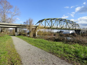
Quick Facts: Location: La Center, Clark County Wash. Land Agency: Clark County Parks Roundtrip: 2.0 miles Elevation Gain: 30 feet Special Note: Dogs permitted on leash. Access: From Vancouver, head north on I-5 to Exit 16. Turn right onto La Center Road and proceed for 1.6 miles to the bridge over the East Fork Lewis River.…
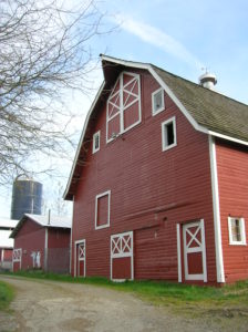
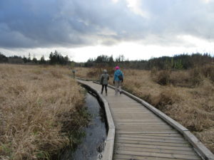
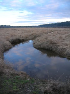
Quick Facts: Location: North Fork Stillaguamish River Valley near Arlington Land Agency: Snohomish County Parks Roundtrip: 4.5 miles Elevation gain: 50 feet Difficulty: easy Contact: Snohomish County Parks Notes: Dogs permitted on leash. All farm buildings are closed to public. Access: From Exit 208 on I-5 head east on SR 530 for 4.0 miles to Arlington. Continue east on SR 530 for…
Quick Facts: Location: Preston and Snoqualmie Land Agency: King County Parks Distance: 11.0 miles roundtrip Elevation Gain: 500 feet Contact: King County Parks Notes: dogs on leash Access: From Seattle follow I-90 east to Exit 22. Then turn left on SE 82nd Street, cross freeway and turn right onto SE High Point Way. Drive 0.4…
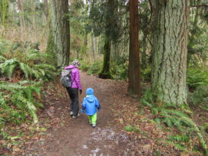
Location: Lord Hill Park near Snohomish Land Agency: Snohomish County Parks Roundtrip: 2.2 miles High Point: 650 feet Elevation gain: 200 feet Difficulty: easy Contact: Snohomish County Parks Notes: Dogs must be on leash; Map available online Access: From Everett, head east on US 2 for 8.0 miles and take 88th Street SE Exit. Turn right…
Quick Facts: Location: Lowell neighborhood, city of Everett Land Agency: Everett Parks and Recreation Contact: Everett Parks and Recreation Department Roundtrip: 4.0 miles Elevation Gain: None Access: From Exit 192 on I-5 in Everett head east on 41st Street. Turn right (south) onto 3rd Ave and proceed for 1.2 miles to four-way stop. Turn left onto…
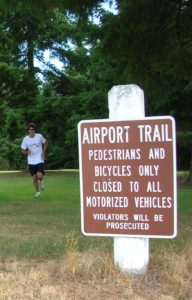
Quick Facts: Location: Arlington Land Agency: City of Arlington Roundtrip: 5.5 miles Elevation gain: 50 feet Difficulty: Easy Contact: Arlington Airport Commission Notes: Dogs must be on leash Access: From Everett, head north on I-5 to Exit 206. Continue east on SR 531 (172nd Street NE) for 1.4 miles. Turn left onto 59th Avenue NE and…
Quick Facts: Location: Snohomish County near Monroe and Snohomish Land Agency: Snohomish County Parks Roundtrip: 3.7 miles Elevation Gain: 150 feet Access: From the city of Snohomish, exit SR 9 onto 2nd Street. Proceed east for a one mile; then turn right onto Lincoln Ave which becomes the Old Snohomish-Monroe Highway. After 2.7 miles turn…