Posts Tagged ‘dog-friendly hike’
Wallace Falls –A classic series of falls and classic hike, fun for all
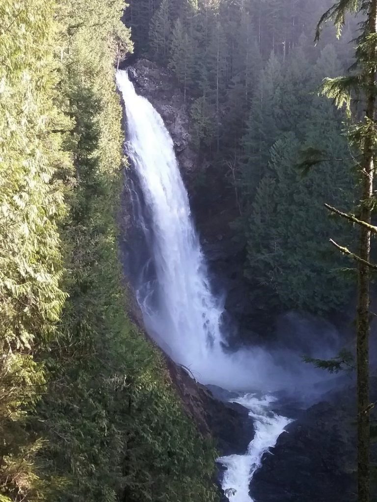
Quick Facts: Location: Skykomish River Valley Land Agency: Washington State Parks Roundtrip: 5.6 miles Elevation gain: 1,200 feet Green Trails Map: Alpine Lakes West Stevens Pass 176S Contact: Wallace Falls State Park Notes: Discover Pass required; Dogs must be leashed Access: From Everett follow US 2 for 28 miles east to Gold Bar. Just before…
Read MoreMaple Pass — Lofty North Cascades Loop lined with larches and long ranging vistas
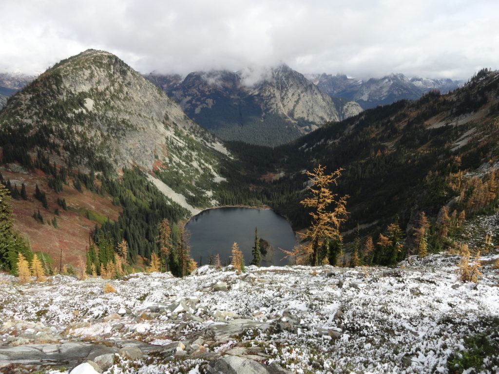
Quick Facts: Location: North Cascades Highway –Rainy Pass Land Agency: Okanogan-Wenatchee National Forest Roundtrip: 7.2 miles Difficulty: Moderate Elevation Gain: 2,000 feet Green Trails Maps: Ross Lake North Cascades 16SX Access: From I-5 north (Exit 230 ) in Burlington, head east on SR 20 (North Cascades Highway) for 98 miles to Rainy Pass near Milepost 158. Turn right into the…
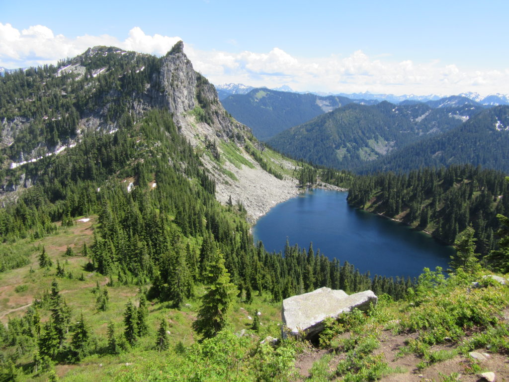
Read MoreBlanca Lake– A strikingly beautiful lake set beneath a formidable wall of jagged peaks
Quick Facts: Location: Wild Sky and Henry Jackson Wildernesses, North Fork Skykomish River Valley Land Agency: Mount Baker-Snoqualmie National Forest Roundtrip: 8.4 miles Elevation gain: 3,300 feet Green Trails Map: Monte Cristo, WA- No. 143 Contact: Skykomish Ranger District: Mount Baker Snoqualmie National Forest Notes: Northwest Forest Pass or Interagency Pass required. No fires allowed…
Read MoreRuby Beach─Easily accessible but still wild
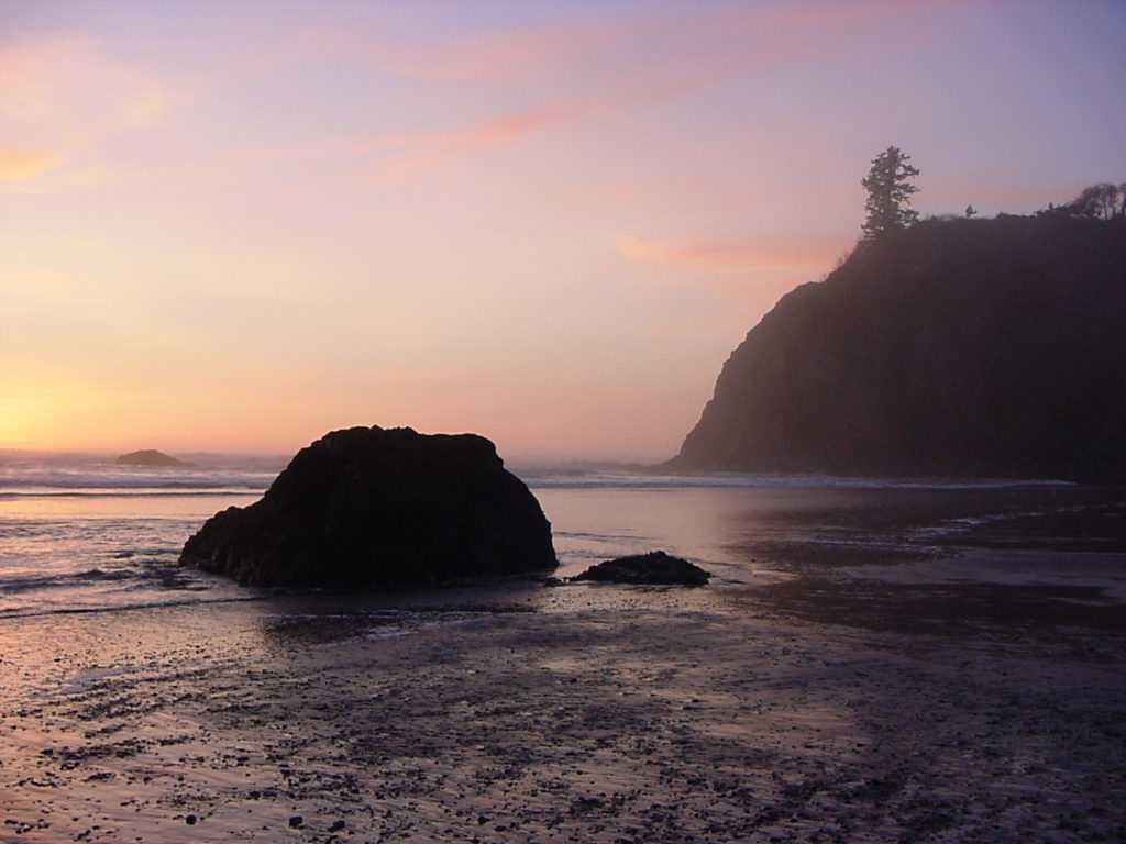
Quick Facts: Location: Olympic Coast Land Agency: National Park Service Roundtrip: To Ruby Beach: 0.5 mile; To Hoh River: 6.0 miles Elevation Gain: 80 feet Green Trails Map: Olympic Coast 99S Notes: Dogs permitted but must be on a leash. Access: From Forks, head south on US 101 for 27 miles to Ruby Beach trailhead.…
Read MoreFour Springs Lake Preserve
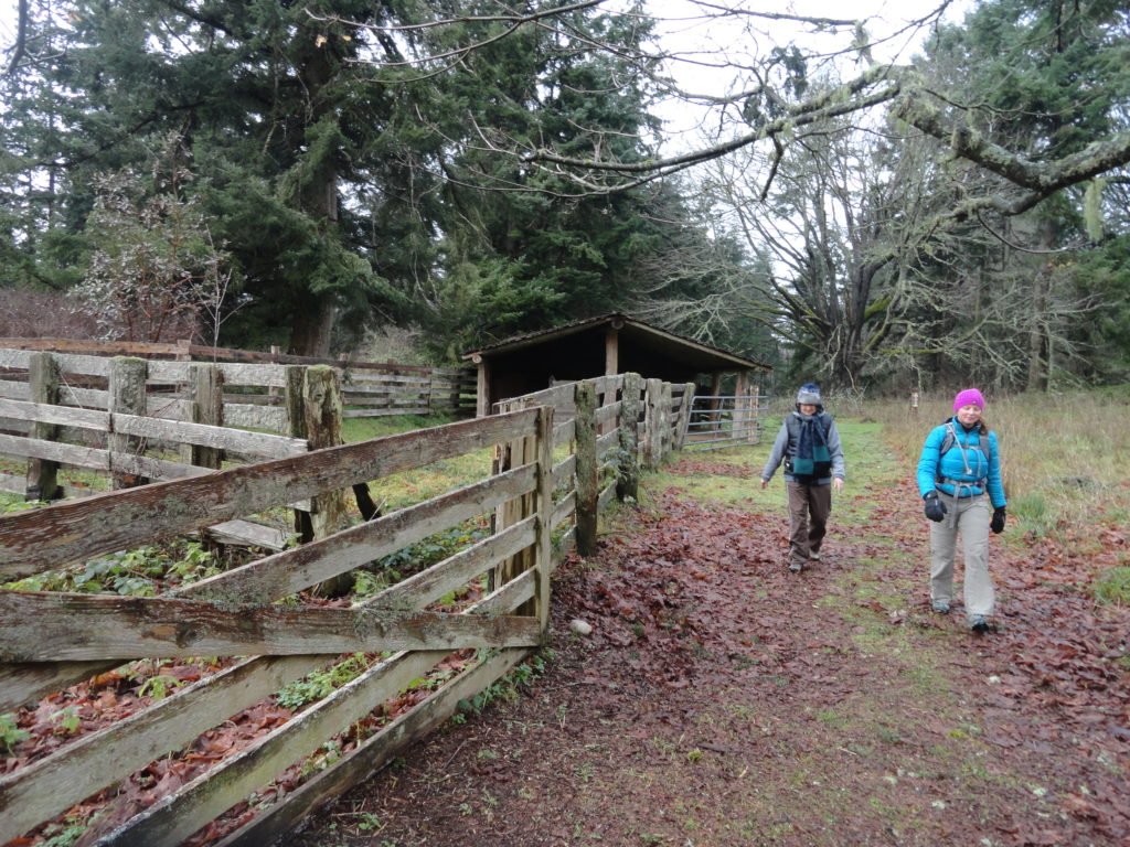
Explore a former farm in the heart of Camano Island Quick Facts: Location: Camano Island Land Agency: Island County Parks Round Trip: 1.5 miles of trails Elevation Gain: up to 200 feet Contact: Island County Parks Detailed Information: Urban Trails Everett (Mountaineers Books) Notes: Dogs permitted on leash. No map online but available in pamphlet,…
Read MoreQuartz Creek–Hike through a majestic primeval forest along a crystal clear creek
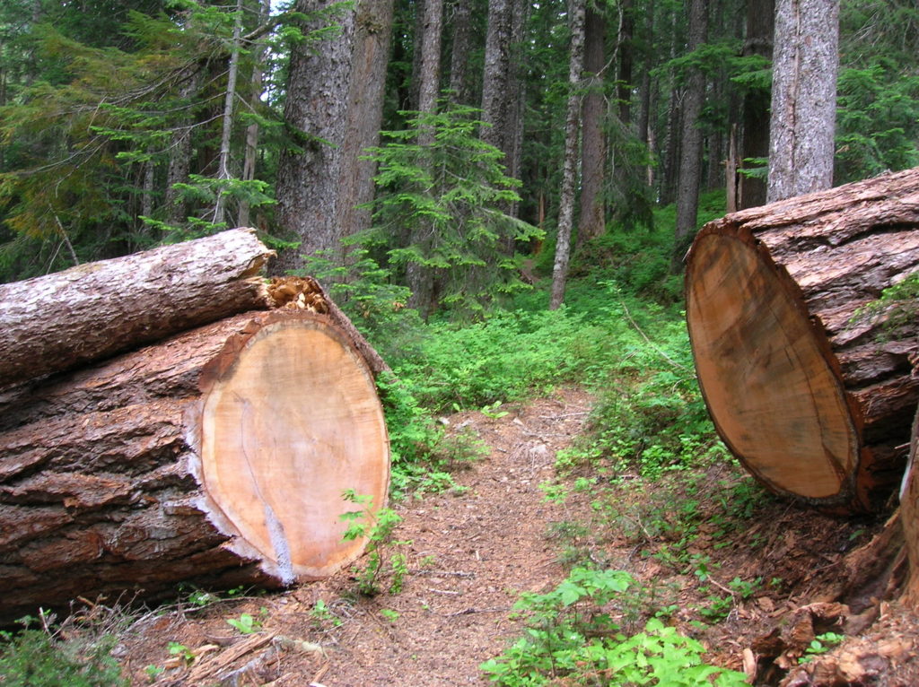
Quick Facts: Location: North Fork of the Skykomish River Land Agency: Mount Baker-Snoqualmie National Forest Roundtrip: 8.6 miles Elevation gain: 1450 feet Green Trails Maps: Monte Cristo, WA-No. 143 Contact: Skykomish Ranger District: Mount Baker Snoqualmie National Forest Notes: Northwest Forest Pass or Interagency Pass required. Access: The North Fork Skykomish River Road from Index, the…
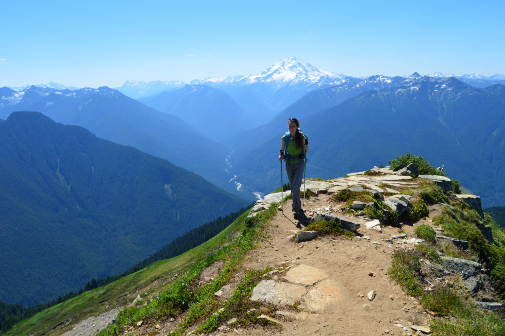
Read MoreMount McCausland—Rise above Valhalla!
Quick Facts: Location: Henry M. Jackson Wilderness Land Agency: National Forest Service Roundtrip: 6.4 miles Elevation Gain: 1,800 feet Green Trails Map: Alpine Lakes Stevens Pass No. 176S Contact: Wenatchee River Ranger District: Okanogan-Wenatchee National Forest Access: From Everett head east on US 2 to Stevens Pass. Continue east for another 4.0 miles. Just after the…
Read MoreWhite Pass–Sprawling meadows and stupendous views high on the Cascade Crest
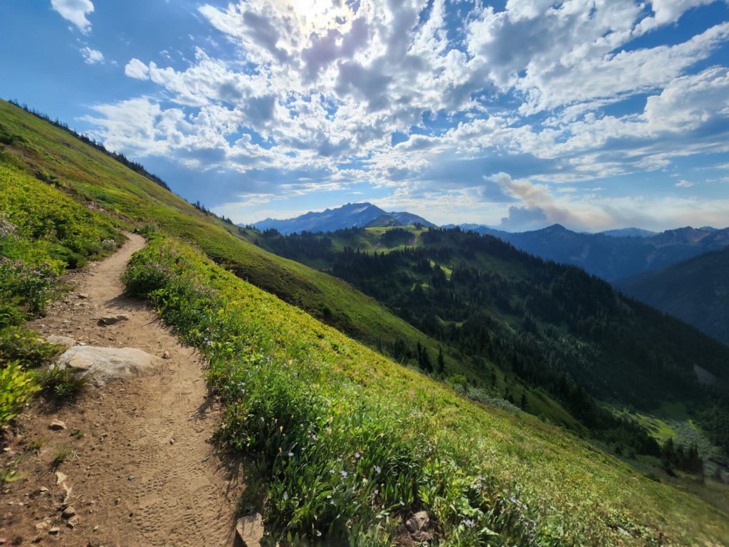
Location: North Fork Sauk River Land Agency: Mount Baker-Snoqualmie National Forest Roundtrip: 19.4 miles High Point: 5,850 feet Elevation gain: 4,000 feet Difficulty: strenuous Green Trails Maps: Mountain Loop Highway 111SX Contact: Darrington Ranger District: Mount Baker-Snoqualmie National Forest Note: Northwest Forest Pass or Interagency Pass Required Access: From Darrington, travel south on the Mountain…
Read MoreGreen Mountain –Banal is thy name—Breathtakingly beautiful is thy game
Quick Facts: Location: Glacier Peak Wilderness, Suiattle River Road Land Agency: Mount Baker-Snoqualmie National Forest Roundtrip: 8.0 miles Elevation gain: 3,100 feet Green Trails Maps: North Cascades Ross Lake 16SX Contact: Darrington Ranger District: Mount Baker-Snoqualmie National Forest Notes: wilderness rules apply Access: From Darrington, travel north on SR 530 for 7.5 miles turning right…
Read MoreTwin Lakes—The fishing is good, but only if you’re an osprey!
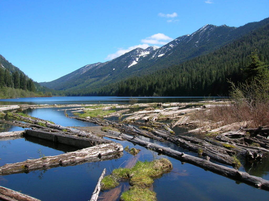
Quick Facts: Location: Lake Wenatchee Area Land Agency: Okanogan-Wenatchee National Forest Roundtrip: 6.8 miles Elevation Gain: 1,200 feet Green Trails Map: Wenatchee Lake- No. 145 Contact: Wenatchee River Ranger District (Leavenworth) Notes: Northwest Forest Pass or Interagency Pass required; wilderness rules apply Access: From Everett head east on US 2 to Coles Corner. Turn left (north)…
Read More