Posts Tagged ‘kid-friendly’
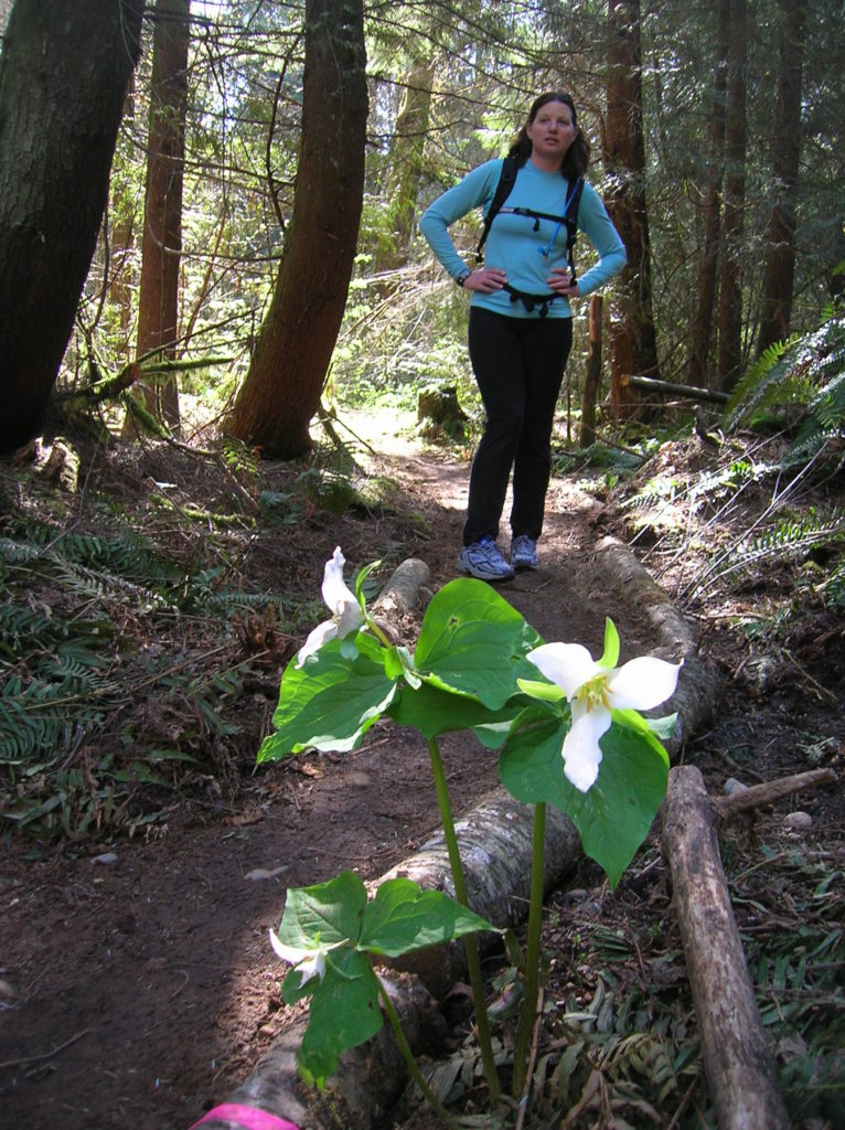
Lyle Cherry Orchard–A great pick for spring wildflowers!
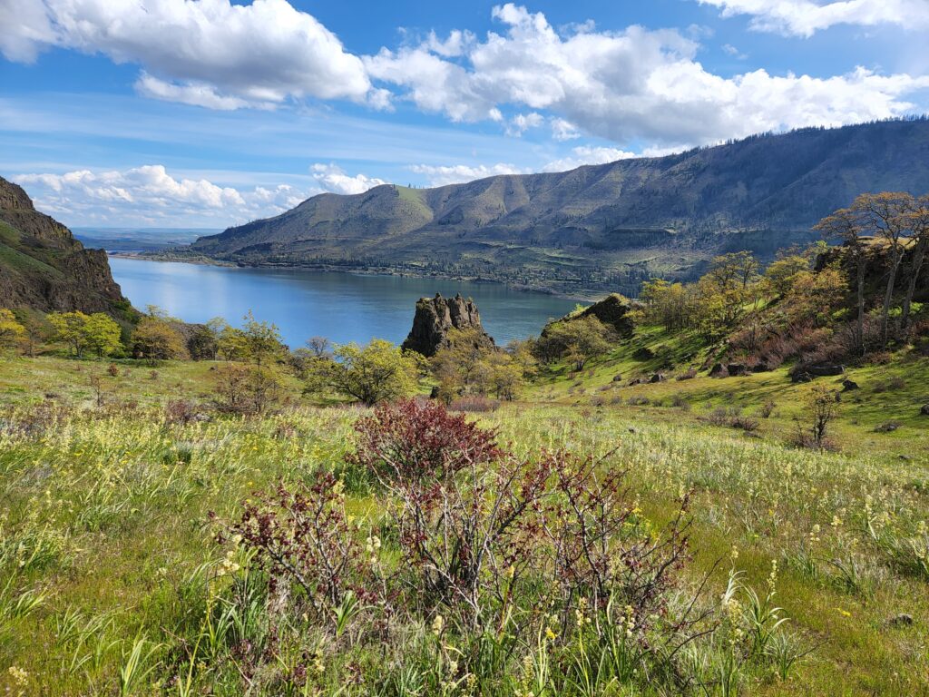
Location: Columbia River Gorge National Scenic Area Land Agency: Friends of the Columbia Gorge Roundtrip: 6.8 miles Elevation gain: 1,500 feet Contact: Friends of the Columbia Gorge Notes: Dogs permitted on leash; Beware ticks, rattlesnakes, and poison oak; parking limited especially on weekends Green Trails Map: Columbia River Gorge East No. 432S Access: From Bingen…
Read MoreBlythe and Chukar Lakes─Birds and beauty in the Channeled Scablands
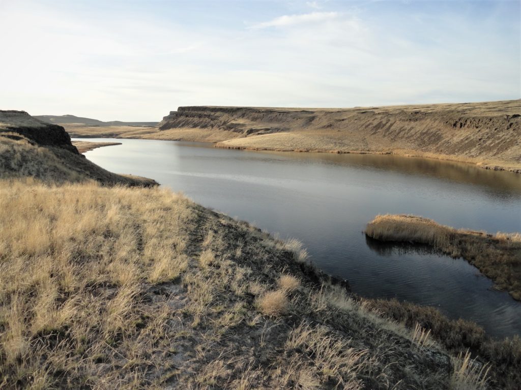
Location: Columbia National Wildlife Refuge, Grant County Land Agency: U.S. Department of the Interior Contact: Columbia National Wildlife Refuge Roundtrip: 3.0 miles Elevation Gain: 300 feet Note: Dogs permitted on leash. Be snake and tick aware Good to know: dog-friendly, kid-friendly, spring wildflowers, exceptional birdwatching, snow-free hike Access: From Spokane, take I-90 west to Exit 179…
Read MoreOaks to Wetlands Trail─ A slough of birds and delights along the Columbia River
Quick Facts: Location: Ridgefield National Wildlife Refuge, Clark County Land Agency: U.S. Fish and Wildlife Roundtrip: 2.0 miles Elevation Gain: 75 feet Contact: Ridgefield National Wildlife Refuge Notes: Dogs prohibited. Recommended Guidebook: Urban Trails Vancouver WA (Mountaineers Books) Access: From Exit 14 on I-5 head west 3.0 miles on SR 501 (Pioneer Street) to its…
Read MoreWhitehorse Trail East–Hike along the North Fork Stilly
Quick Facts: Location: SR 530 Darrington Land Agency: Snohomish County Parks Roundtrip: 14 miles Elevation gain: 160 feet Difficulty: Easy Contact: Snohomish County Parks Green Trails Map: Mountain Loop Highway no. 111SX Recommended Guidebook: Day Hiking North Cascades (Mountaineers Books) Notes: Dogs allowed on leash Access: Take exit 208 off of I-5 and drive 25 miles east…
Read MoreLanham Lake—Sublime snowshoeing above Stevens Pass
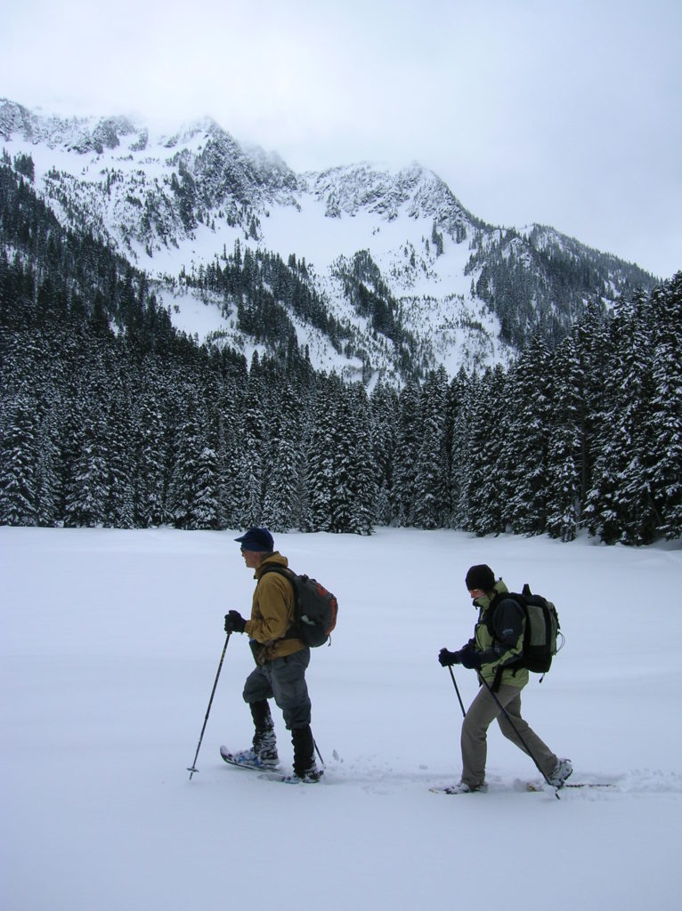
Quick Facts: Location: Stevens Pass Land Agency: Okanogan-Wenatchee National Forest Roundtrip: 3.2 miles Elevation Gain: 1,140 feet Green Trails Map: Alpine Lakes-Stevens Pass WA No. 176S Special Note: Slight avalanche concern. Contact: Okanogan-Wenatchee National Forest Access: From Everett head east on US 2 to Stevens Pass. Continue east for another 5.8 miles turning right into the…
Read MoreEphemeral Trail–Enjoy lasting memories on this Paradise Valley Trail
Location: Maltby Land Agency: Snohomish County Parks Roundtrip: 4.0 miles Elevation gain: 200 feet Difficulty: Easy Contact: Snohomish County Parks Notes: Dogs must be on leash; partially open to mountain bikes and horses Access: From SR 522 in Maltby (5.0 miles east of Woodinville; 8.0 miles west of Monroe) head east on Paradise Lake Road…
Read MoreGreen to Cedar Rivers Trail
Walk across Maple Valley through a “wilderness” park Quick Facts: Location: Maple Valley, WA Distance: 3.3 miles one way Contact: King County Parks Elevation Gain: 250 feet Notes: Dogs permitted on leash Trailhead directions: From Seattle follow I-5 to I-405 and take Exit 4 in Renton. Then drive SR 169 south for 11.3 miles turning…
Read MoreHeart O' the Forest Trail─Peaceful path in the shadow of Hurricane Ridge
Quick Facts: Location: Heart O’ the Hills Campground Land Agency: Olympic National Park Roundtrip: 4.6 miles Elevation Gain: 550 feet Notes: Dogs prohibited, National Park Entry fee. Green Trails Map: Elwha North/ Hurricane Ridge No-134S Access: From Olympic National Park Visitors Center in Port Angeles, follow Hurricane Ridge Road (aka Heart O’ the Hills Parkway) south. Continue 5.4 miles turning left into…
Read MoreMount Finlayson─This spoil of war now offers peaceful wandering
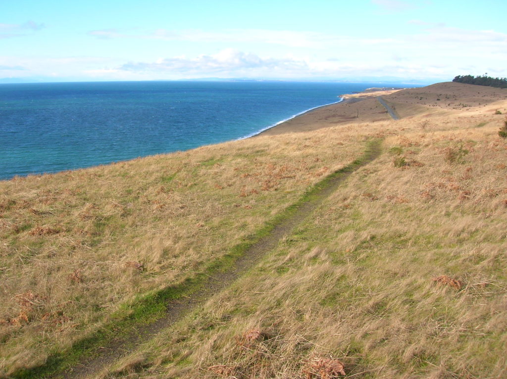
Quick Facts Location: San Juan Island Land Agency: National Park Service Roundtrip: 3.5 miles Elevation Gain: 290 feet Contact: San Juan Island National Historic Park Notes: Dogs must be leashed. Access: Take Washington State Ferry from Anacortes to Friday Harbor on San Juan Island. Follow Spring Street for .5 mile through town turning left onto…
Read MoreTollgate Farm
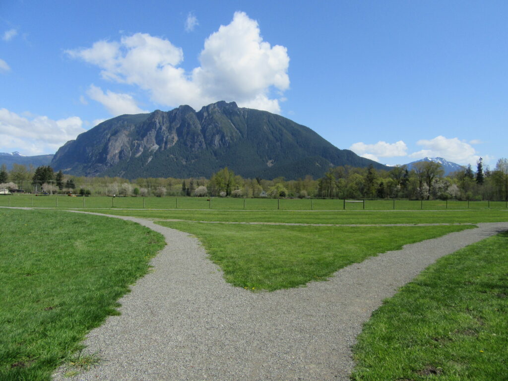
Historic prairie at the Forks of the Snoqualmie Quick Facts: Location: North Bend, WA Distance: 1.5 miles of trails Elevation Gain: minimal Contact: Si View Metropolitan District Green Trails Map: Mount Si NRCA no. 206S Notes: Dogs permitted on leash Trailhead directions: From Seattle follow I-90 east to Exit 27. Turn left onto Winery Road…
Read More