Posts Tagged ‘kid-friendly’
Heybrook Ridge–From the town of Index to stunning views of Mount Index
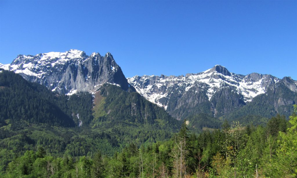
Quick Facts: Location: Skykomish Valley Land Agency: Snohomish County Parks Roundtrip: 3.4 miles Elevation Gain: 780 feet Contact: Friends of Heybrook Ridge Map: Green Trails, Alpine Lakes West Stevens Pass no. 176S Notes: Dogs allowed on leash Access: From Everett follow US 2 east for 35 miles turning left onto the Index Galena Road (just…
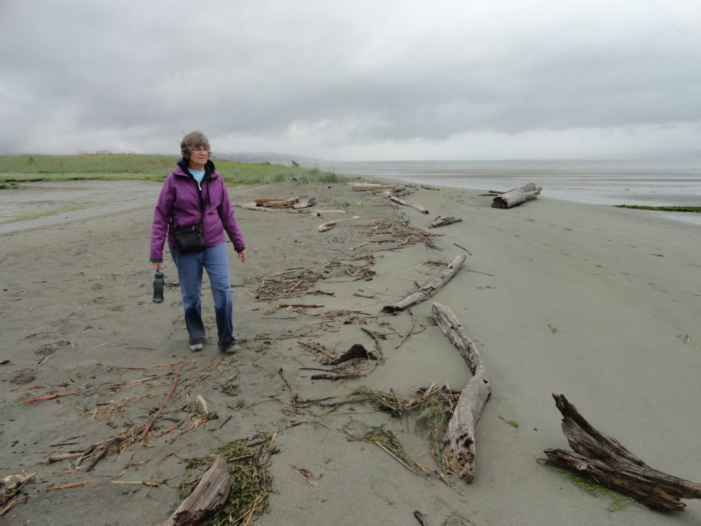
Read MoreClallam Bay Spit — Explore Washington’s deserted and spectacular North Coast
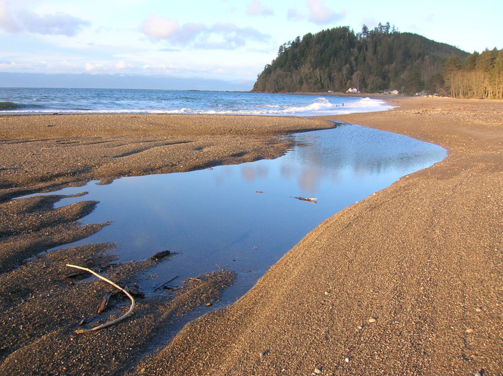
Quick Facts: Location: Strait of Juan de Fuca, North Olympic Peninsula Land Agency: Clallam County Parks and Washington State Parks Roundtrip: 2.1 miles Elevation Gain: minimal Contact: Clallam County Parks Notes: Dogs permitted on leash Access: From Port Angeles follow US 101 west for 5.4 miles to SR 112. Continue west for 44 miles on SR 112 to the community…
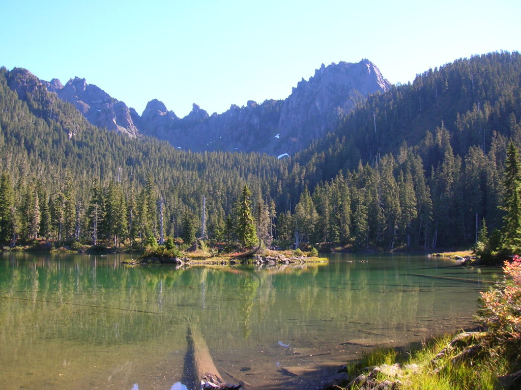
Read MoreClara and Marion Lakes
Quick Facts: Location: Mission Ridge, Okanogan-Wenatchee National Forest Land Agency: Okanogan-Wenatchee National Forest Roundtrip: 3.2 miles Elevation Gain: 960 feet Green Trails Map: Wenatchee/ Mission Ridge, WA- No 211S Access: Follow US 2 to Wenatchee turning south onto SR 285 and continuing for 4.5 miles until it turns east to cross the Columbia River into…
Read MoreWallace Falls –A classic series of falls and classic hike, fun for all
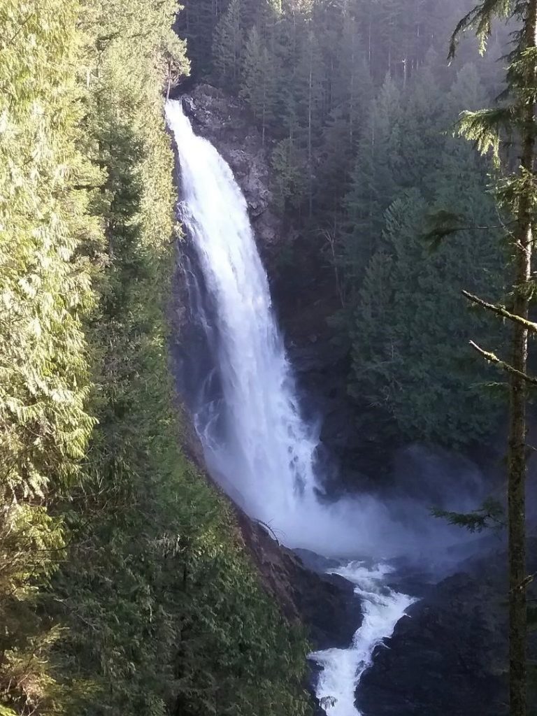
Quick Facts: Location: Skykomish River Valley Land Agency: Washington State Parks Roundtrip: 5.6 miles Elevation gain: 1,200 feet Green Trails Map: Alpine Lakes West Stevens Pass 176S Contact: Wallace Falls State Park Notes: Discover Pass required; Dogs must be leashed Access: From Everett follow US 2 for 28 miles east to Gold Bar. Just before…
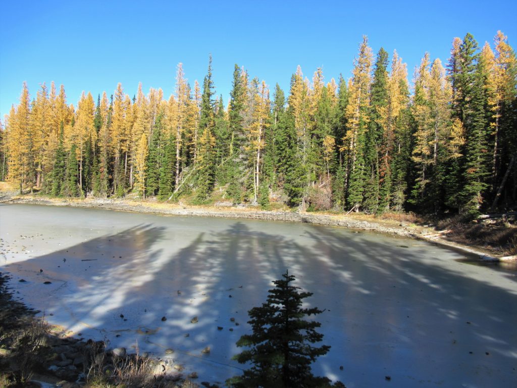
Read MoreMaple Pass — Lofty North Cascades Loop lined with larches and long ranging vistas
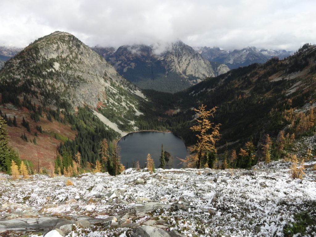
Quick Facts: Location: North Cascades Highway –Rainy Pass Land Agency: Okanogan-Wenatchee National Forest Roundtrip: 7.2 miles Difficulty: Moderate Elevation Gain: 2,000 feet Green Trails Maps: Ross Lake North Cascades 16SX Access: From I-5 north (Exit 230 ) in Burlington, head east on SR 20 (North Cascades Highway) for 98 miles to Rainy Pass near Milepost 158. Turn right into the…
Read MoreColumbia Mountain─Historic peak overflows with autumn colors
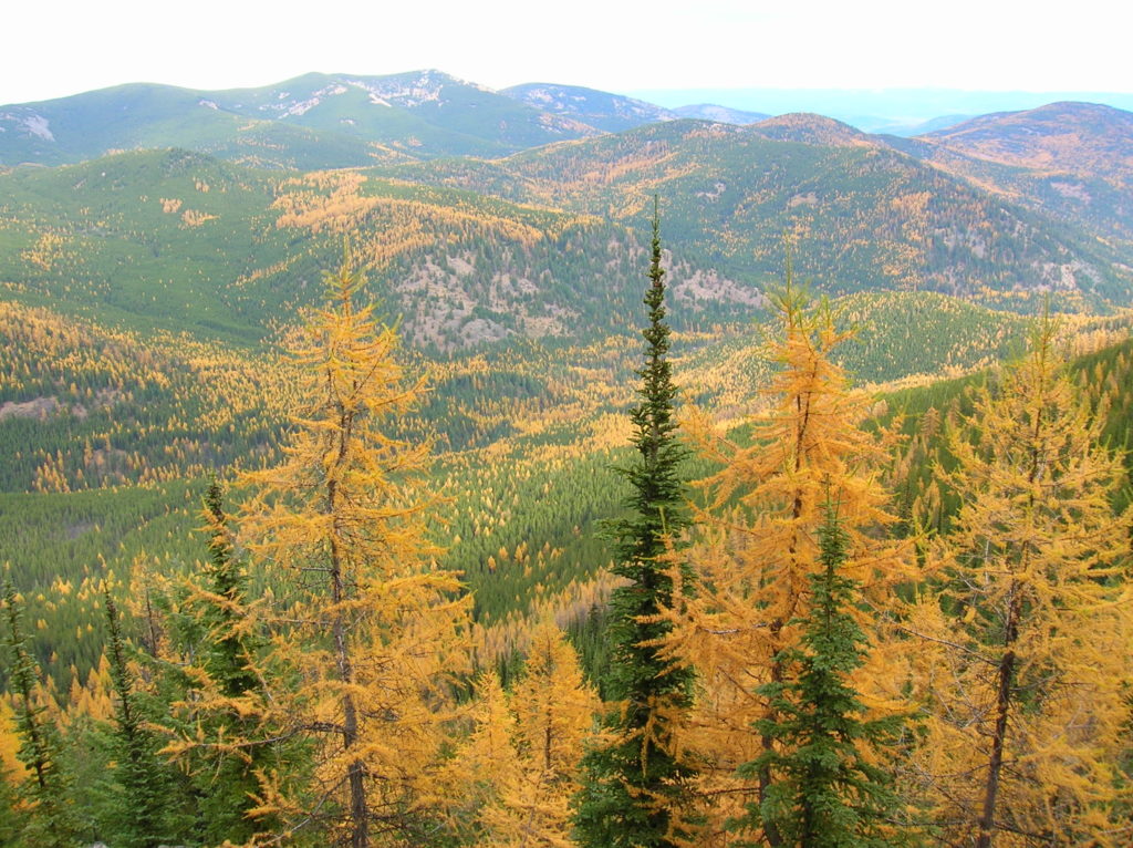
Quick Facts: Location: Kettle River Range, Sherman Pass Land Agency: Colville National Forest Roundtrip: 8.0 miles Elevation Gain: 1,360 feet Access: From Republic travel east 17 miles on SR 20 to trailhead at Sherman Pass. From Kettle Falls, follow SR 20 for 26 west miles to Sherman Pass. Contact: Colville National Forest, Republic Ranger District Good…
Read MoreSunrise Ridge─What a setting!
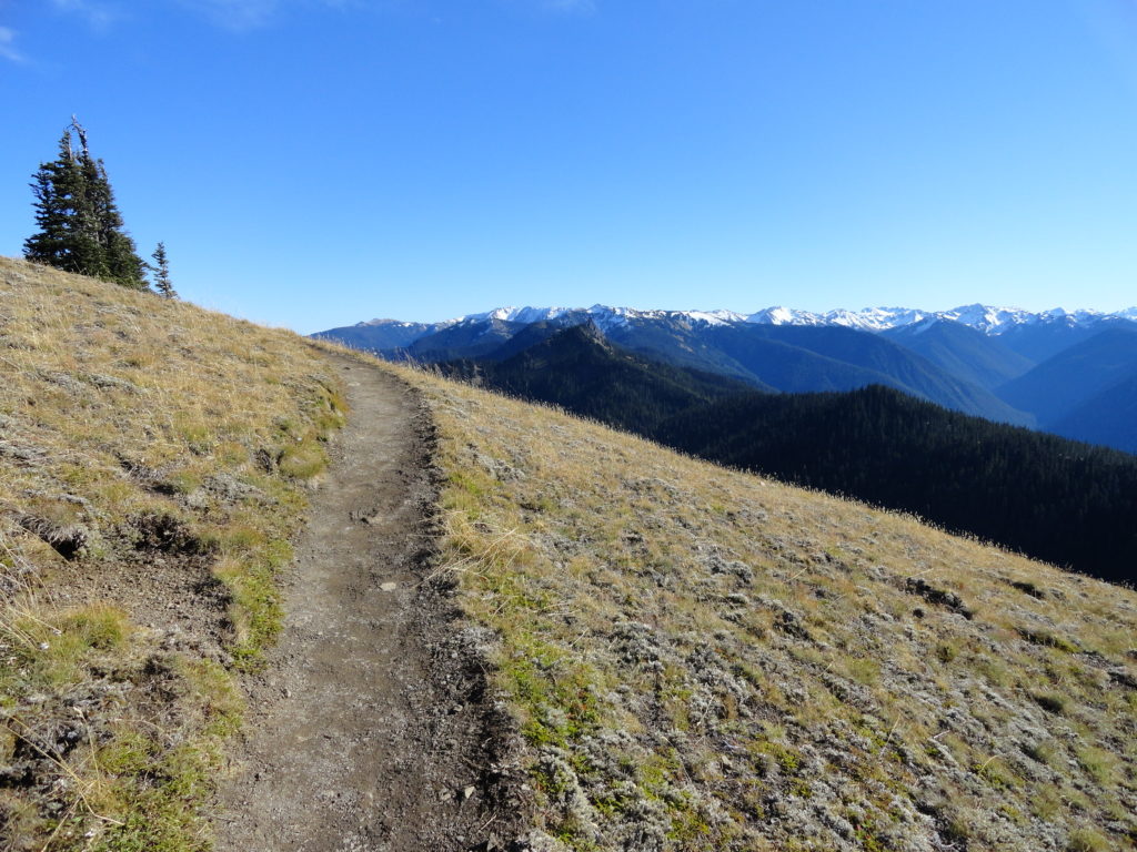
Quick Facts: Location: Olympic National Park – Hurricane Ridge Road Land Agency: National Park Service Roundtrip: 5.2 miles Elevation Gain: 1,100 feet Green Trails Map: Elwha North-Hurricane Ridge No. 134S Contact: Olympic National Park Access: From Port Angeles, follow Race Street south to Mount Angeles Ave to the Heart O’ the Hills Parkway (Hurricane Ridge…
Read MoreJetty Island– It may be manmade, but it’s naturally delightful!
Quick Facts: Location: Everett Land Agency: Everett Parks and Recreation Roundtrip: up to 5.0 miles Elevation gain: none Difficulty: Easy Contact: Everett Parks and Recreation Department Notes: Parking fee $2.00 (credit card or exact amount cash) Passenger Ferry runs on Wednesday through Sunday from July 5th until September 3rd and requires a reservation ($3 per…
Read MoreNaches Peak–Big Scenic Payoff for little effort
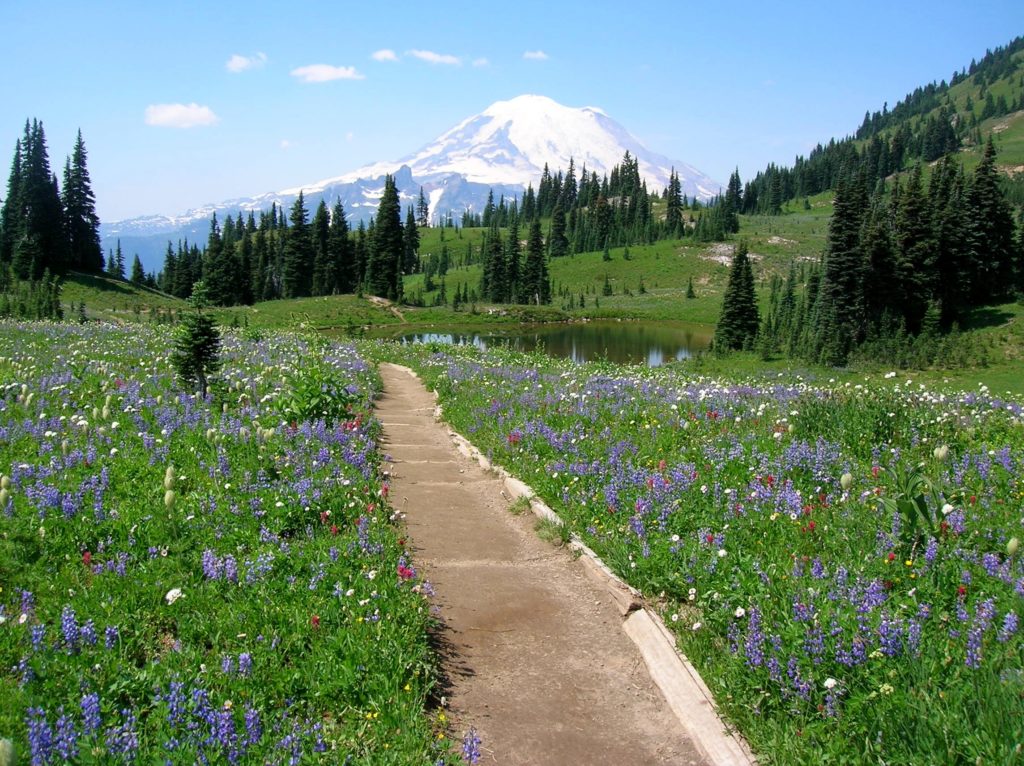
Quick Facts: Location: Naches Pass, Mount Rainier National Park Land Agency: United States Park Service Roundtrip: 4.0 miles Elevation gain: 600 feet Green Trails Maps: Mount Rainier Wonderland Map 269SX Contact: Mount Rainier National Park Notes: Dogs prohibited Access: From Enumclaw follow SR 410 east to Tipsoo Lake parking area just before Chinook Pass. Good…
Read MoreFlapjack Lakes — Served with a healthy dose of scenery
Quick Facts: Location: Staircase, Olympic National Park Land Agency: National Park Service Roundtrip: 15.4 miles Elevation gain: 3,050 feet Contact: Olympic National Park Wilderness Information Center (360) 565-3100 Green Trails Map: Olympic Mountains East 168S Notes: Dogs prohibited; National Park entry fee; Backcountry camping permit required for overnight trips; Practice Leave No Trace Principles Access: From…
Read More