Posts Tagged ‘Snohomish County’
Kelley Creek—Wild Sky gem and quiet portal to Johnson Ridge
Quick Facts: Location: Wild Sky Wilderness, Skykomish Valley Land Agency: Mount Baker-Snoqualmie National Forest Roundtrip: 8.8 miles Elevation Gain: 2,900 feet Green Trails Map: Green Trails Stevens Pass No 176, Benchmark Mtn No. 144 Recommended Guidebook: Day Hiking Central Cascades 2nd edition Contact: Skykomish Ranger District: Mount Baker Snoqualmie National Forest Notes: Northwest Forest Pass…
Read MoreNarbeck Wetland Sanctuary–Bird bursting, frog hopping wildlife habitat beside Boeing
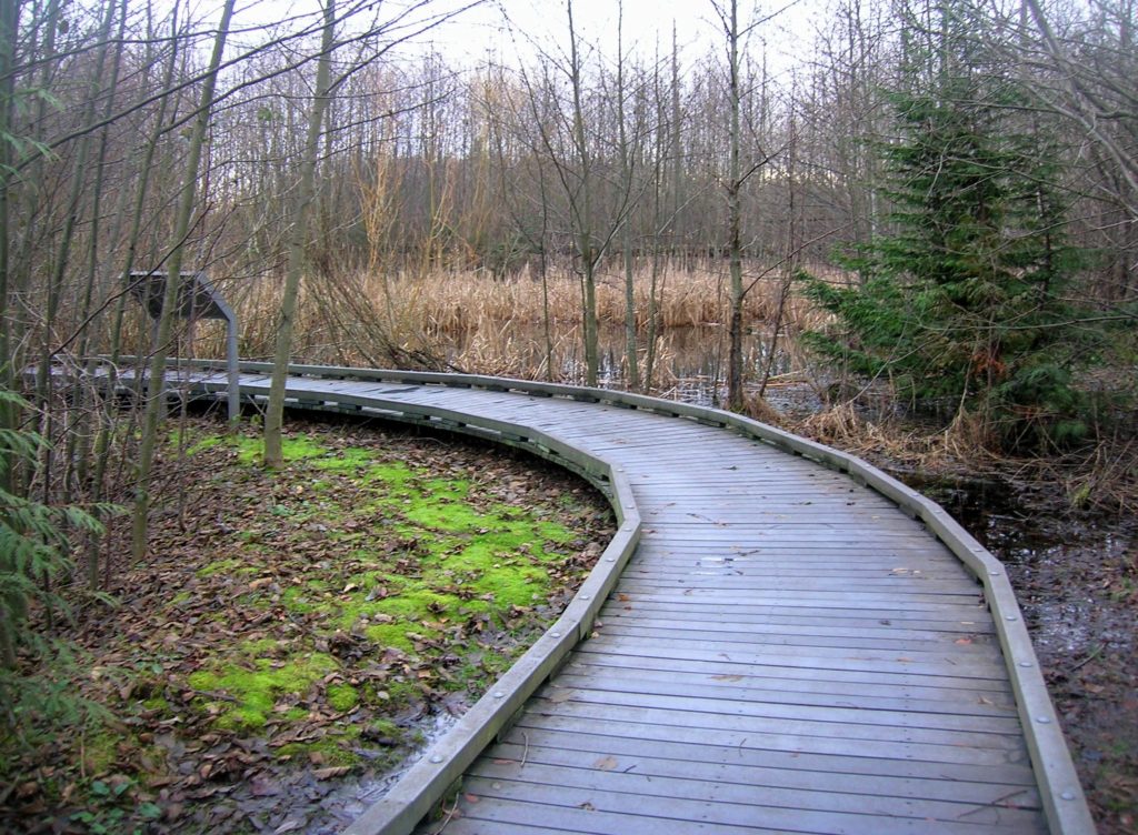
Quick Facts: Location: Everett Land Agency: Snohomish County Roundtrip: 1.8 miles Elevation gain: none Difficulty: Easy Contact: Friends of Narbeck Wetland Sanctuary Notes: Dogs must be leashed; open 7 a.m. to dusk Access: From Everett follow SR 526 west 2.5 miles exiting onto Seaway Boulevard. Proceed for 1.0 mile north. Entrance is on right, across…
Read MorePortage Creek Wildlife Area─Wetland wandering on the Stillaguamish Floodplain

Quick Facts: Location: Arlington Land Agency: Snohomish County Parks and Recreation Contact: Snohomish Parks and Recreation Department Roundtrip: 2.0 miles Elevation Gain: minimal Notes: Dogs prohibited Access: From Exit 208 on I-5 (Arlington) head east on SR 530 for 2.3 miles. Then turn right onto 59th Ave SE. Continue for 0.2 mile and turn right…
Read MoreLake Tye—Greenbelt Park preserves history and scenery
Quick Facts: Location: City of Monroe Land Agency: Monroe Parks and Recreation Department Roundtrip: 1.6 miles Elevation Gain: None Notes: Dogs must be on leash. Access: From Everett follow US 2 east towards Monroe. Turn right at first traffic light onto Fryelands Boulevard. Continue for .7 mile to junction with Wales Street. Turn right into…
Read MoreLookout Tree Trail — Snag a glimpse into the past
Quick Facts: Location: Mountain Loop Highway Land Agency: Mount Baker-Snoqualmie National Forest Roundtrip: 1.5 mile Elevation gain: 200 feet Green Trails Map: Mountain Loop Highway 111SX Contact: Darrington Ranger District: Mount Baker Snoqualmie National Forest Notes: No passes needed Access: From Darrington, follow Mountain Loop Highway for 11.3 miles to unmarked trailhead located on your…
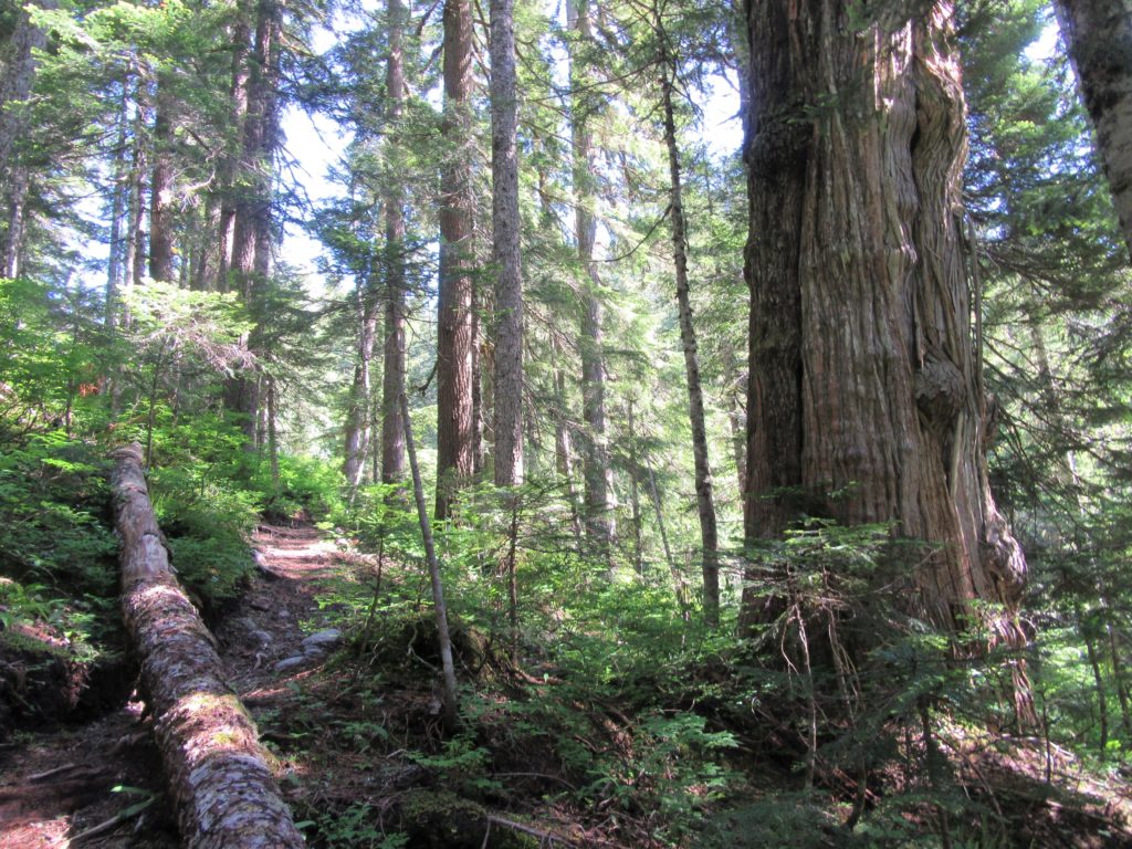
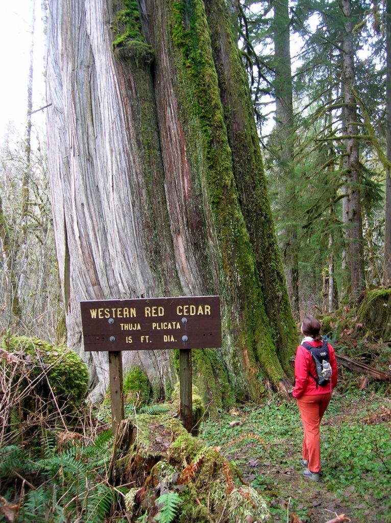
Read MoreQuartz Creek–Hike through a majestic primeval forest along a crystal clear creek
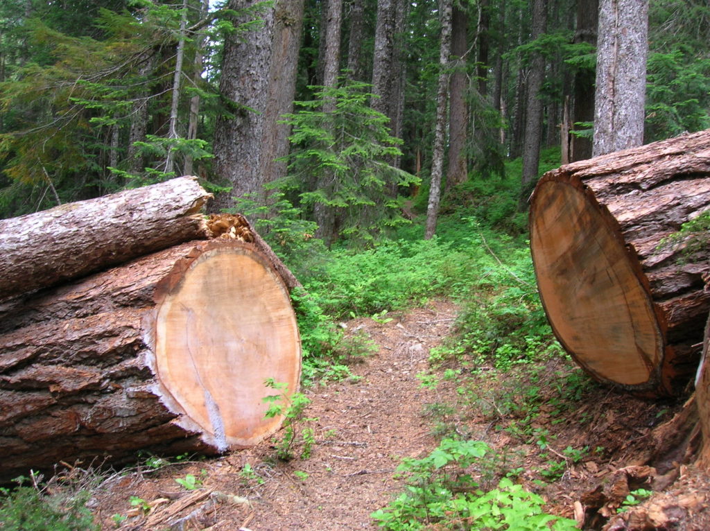
Quick Facts: Location: North Fork of the Skykomish River Land Agency: Mount Baker-Snoqualmie National Forest Roundtrip: 8.6 miles Elevation gain: 1450 feet Green Trails Maps: Monte Cristo, WA-No. 143 Contact: Skykomish Ranger District: Mount Baker Snoqualmie National Forest Notes: Northwest Forest Pass or Interagency Pass required. Access: The North Fork Skykomish River Road from Index, the…
Read MoreMount McCausland—Rise above Valhalla!
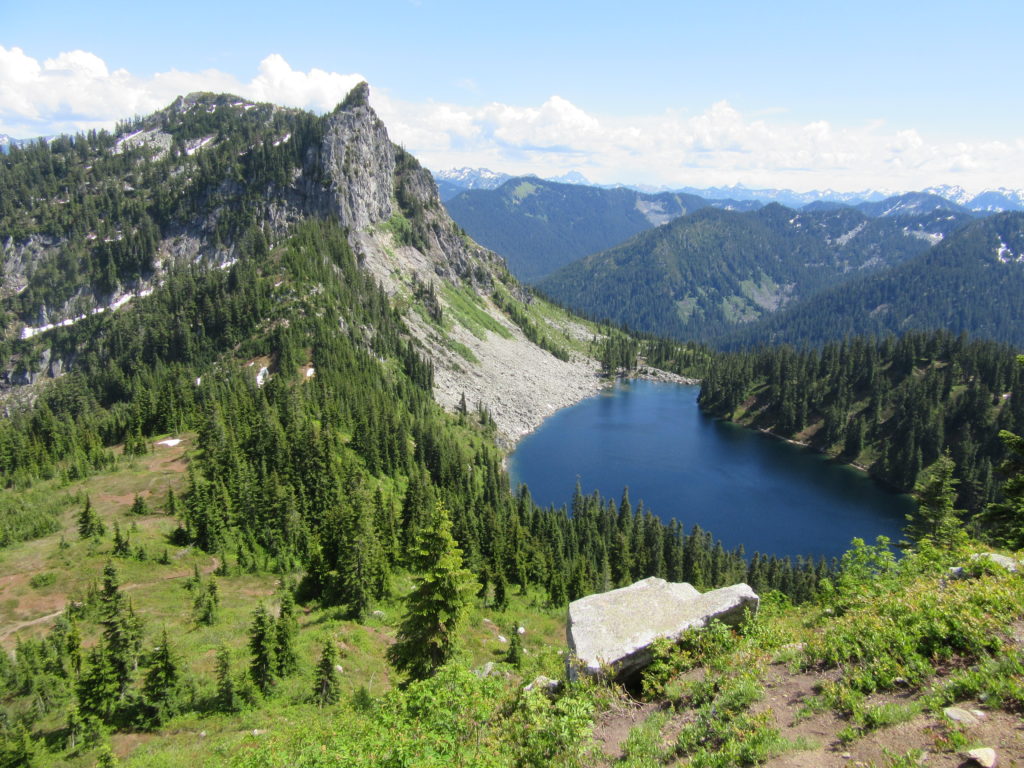
Quick Facts: Location: Henry M. Jackson Wilderness Land Agency: National Forest Service Roundtrip: 6.4 miles Elevation Gain: 1,800 feet Green Trails Map: Alpine Lakes Stevens Pass No. 176S Contact: Wenatchee River Ranger District: Okanogan-Wenatchee National Forest Access: From Everett head east on US 2 to Stevens Pass. Continue east for another 4.0 miles. Just after the…
Read MoreWhite Pass–Sprawling meadows and stupendous views high on the Cascade Crest
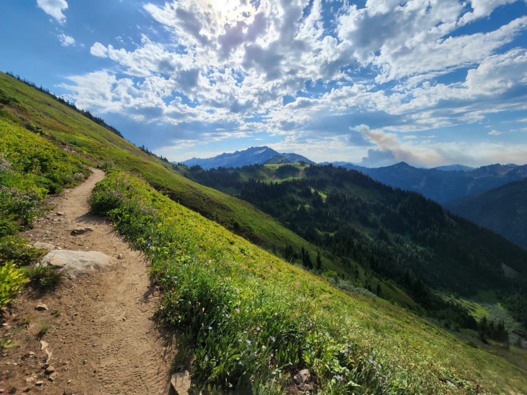
Location: North Fork Sauk River Land Agency: Mount Baker-Snoqualmie National Forest Roundtrip: 19.4 miles High Point: 5,850 feet Elevation gain: 4,000 feet Difficulty: strenuous Green Trails Maps: Mountain Loop Highway 111SX Contact: Darrington Ranger District: Mount Baker-Snoqualmie National Forest Note: Northwest Forest Pass or Interagency Pass Required Access: From Darrington, travel south on the Mountain…
Read MoreWhispering Firs Trail– While away a winter day on this Paradise Valley trail

Location: Maltby Land Agency: Snohomish County Parks Roundtrip: 0.6 mile Elevation gain: minimal Contact: Snohomish County Parks; map available on line Notes: Dogs must be on a leash Access: From SR 522 in Maltby (5.0 miles east of Woodinville; 8.0 miles west of Monroe) head east on Paradise Lake Road for 1.7 miles to trailhead.…
Read MoreScriber Lake–Wetland Wonder in the heart of Lynnwood
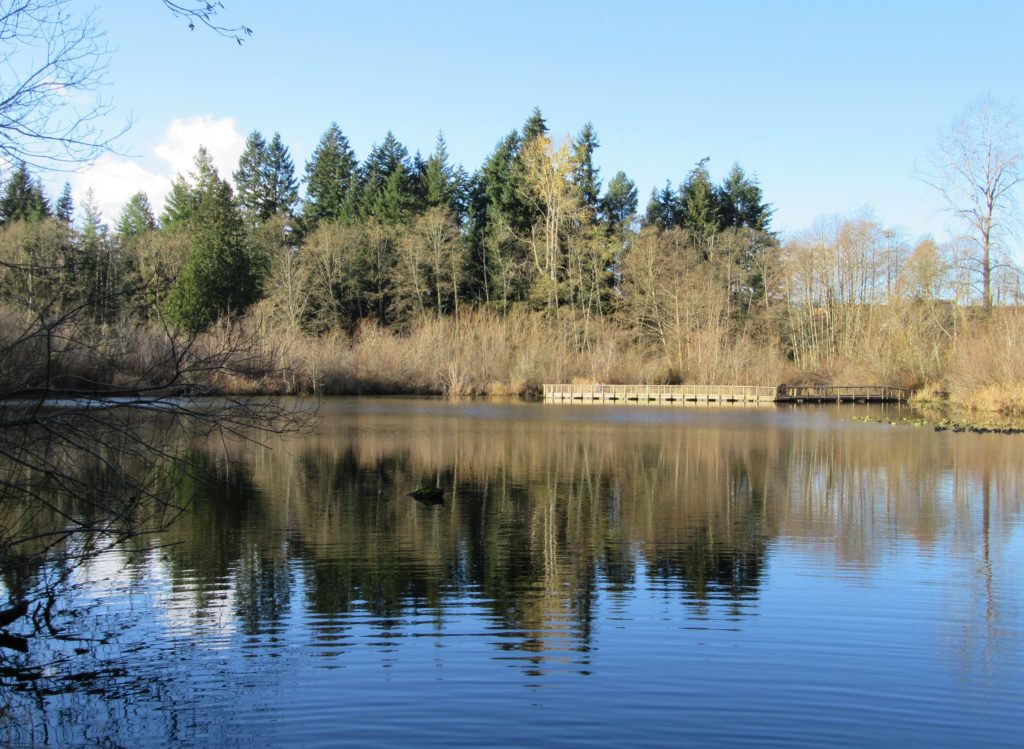
Quick Facts: Location: Lynnwood Land Agency: City of Lynnwood Parks and Recreation Roundtrip: 1.2 miles Elevation gain: none Difficulty: Easy Contact: Lynnwood Parks and Recreation Department; (425-771-4030) Notes: Dogs must be leashed Access: From Seattle take I-5 to exit 181. Turn left onto 44th Ave NW. At third light turn left onto SR 524 (196th…
Read More