Posts Tagged ‘snow free winter hikes’
Quinault Rainforest Loop — Easily accessible trail system through an Olympic Rainforest
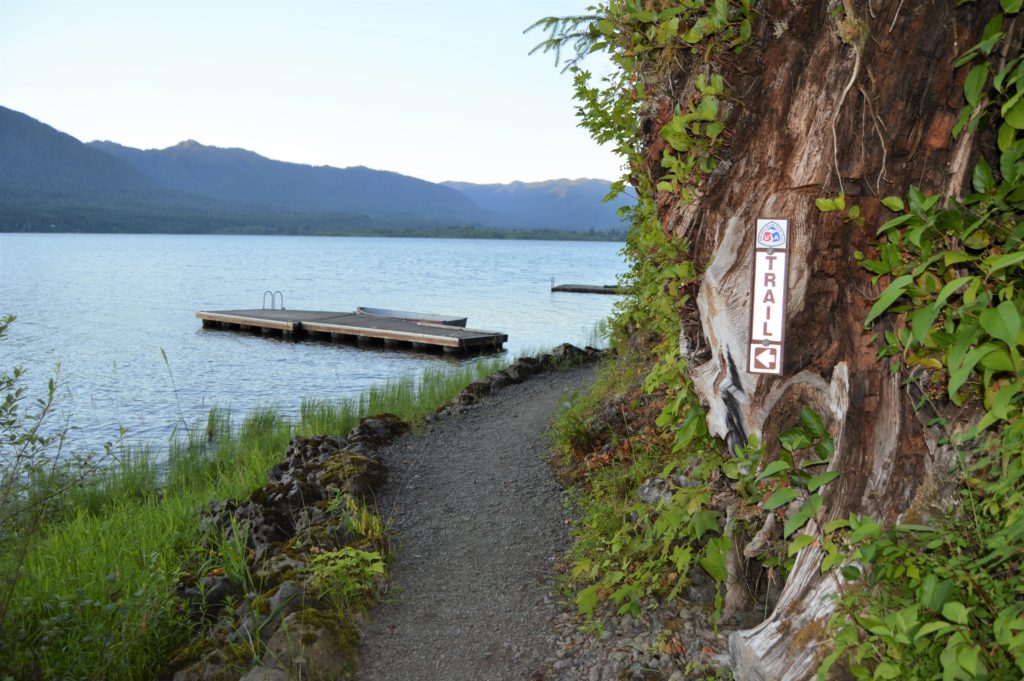
Quick Facts: Location: Lake Quinault Land Agency: Olympic National Forest Roundtrip: 3.9 miles Elevation Gain: 500 feet Contact: Olympic National Forest, Pacific Ranger District, Quinault Detailed Information: Day Hiking Olympic Peninsula 3rd edition (Mountaineers Books) Notes: Northwest Forest Pass or Interagency Pass required; dogs should on leash Access: From Hoquiam travel north on US 101 for 35 miles.…
Read MoreExplorer Falls–It's an easy search to find these falls

Quick Facts: Location: Near Lake Roesiger between Monroe and Granite Falls Land Agency: Washington DNR Roundtrip: 5.2 miles Elevation gain: 700 feet Contact: Washington DNR Notes: Discover Pass Required. Do not block gates, nor drive past it if open. Active logging area, be alert to trucks on roadway and yield right-of-way. Access: From Monroe, follow…
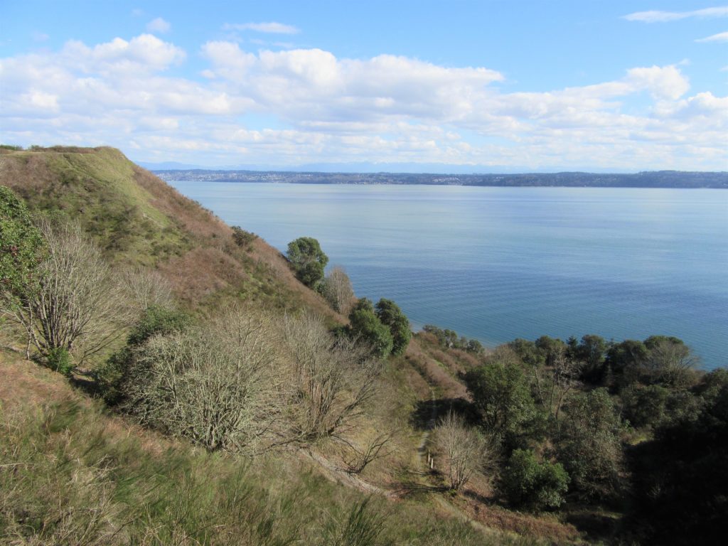
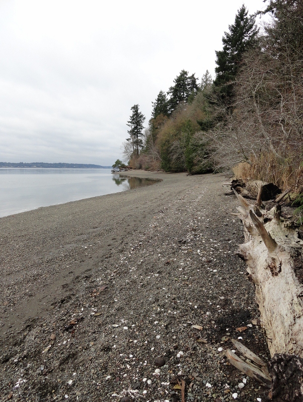
Read MoreAndy’s Marine Park
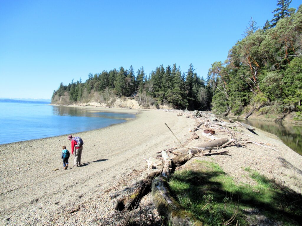
Hike to a cove and beach on Anderson Island Quick Facts: Location: Anderson Island Land Agency: Anderson Island Park and Recreation District Round Trip: 1.5 miles roundtrip Elevation Gain: 190 feet Contact: Andy’s Marine Park Detailed Information: Urban Trails Tacoma (Mountaineers Books) Notes: dogs prohibited. Trails can be slick in wet weather Access: From Anderson…
Read MorePadilla Bay Dike Trail–shore fine hike in the Skagit Valley
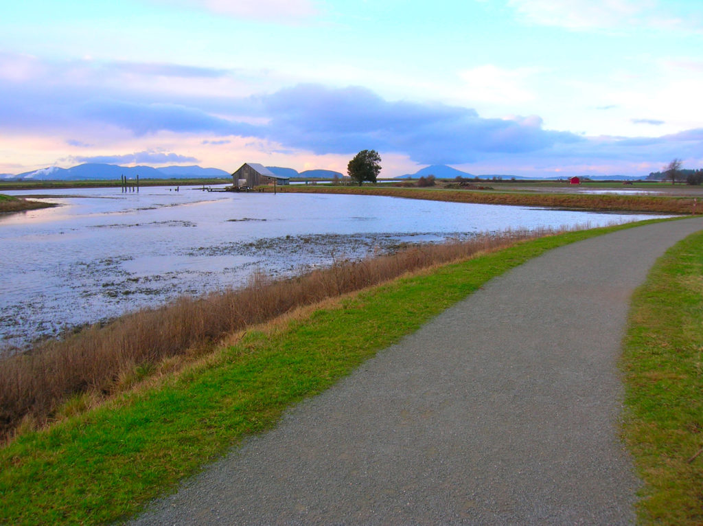
Quick Facts: Location: Skagit County Land Agency: Padilla Bay National Estuarine Research Reserve Roundtrip: 4.8 miles Elevation Gain: 30 feet Contact: Padilla Bay NERR Access: From Burlington (exit 231 on I-5) proceed through roundabouts and head west on Josh Wilson Road for 6.4 miles. Upon entering the village of Bay View turn left onto 2nd Street…
Read MoreYost Park– Slice of Nature in the heart of Edmonds
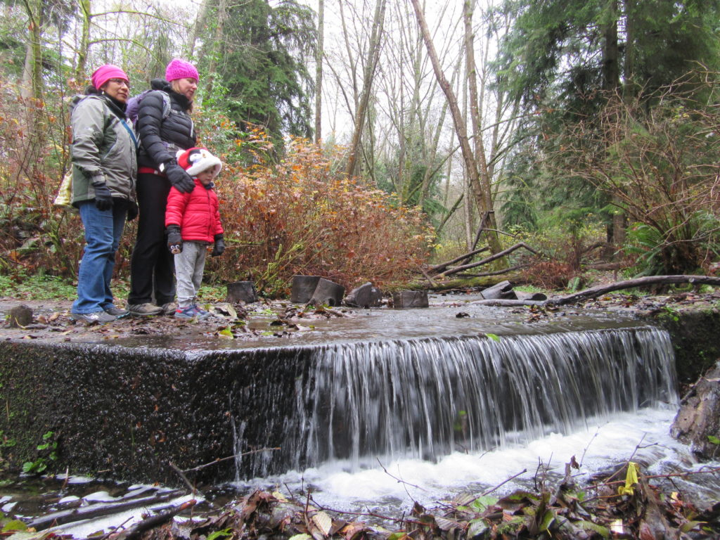
Quick Facts: Location: Edmonds Land Agency: Edmonds Parks and Recreation Department Roundtrip: About 1.5 miles of trails Elevation Gain: up to 300 feet Contact: Edmonds Parks and Recreation Access: From Everett or Seattle take I-5 to Exit 179. Then head west on 220th Street SW for 2.1 miles. Turn right and head north on 96th Ave…
Read MoreDockton Forest and Maury Island Natural Area — Explore Vashon Island’s grand park
Quick Facts: Location: Vashon Island Land Agency: King County Parks Round Trip: More than 10 miles of trails Elevation Gain: up to 450 feet Contact: King County Parks Detailed Information: Urban Trails Seattle (Mountaineers Books) Notes: Dogs allowed on leash Access: From Seattle take Washington State Ferry from Fauntleroy (West Seattle) to Vashon Island Ferry…
Read MoreSquaxin Park─ Make it your mission to hike this park
Quick Facts: Location: Olympia, Washington Land Agency: City of Olympia Parks and Recreation Roundtrip: 2.5 miles Elevation Gain: 300 feet Notes: Dogs must be on a leash. Access: From Lacey, follow I-5 south to Olympia taking Exit 105B to Plum Street. From Tumwater, follow I-5 north to Olympia taking Exit 105. Turn right onto Henderson…
Read MoreLangus Waterfront Trail
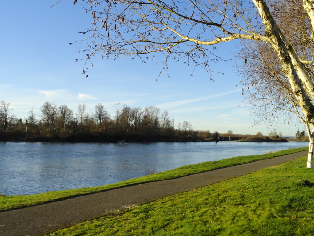
A slough of surprises await just minutes from downtown Everett Quick Facts: Location: City of Everett Land Agency: Everett Parks and Recreation Department Roundtrip: 4.0 miles Elevation Gain: None Access: From Everett, take Exit 195 off of I-5 turning left onto East Grand Ave. In 0.5 mile bear right onto East Marine View Drive and follow…
Read MoreBoulder River- waterfalls among old-growth forest

Quick Facts: Location: Boulder River Wilderness, near Darrington Land Agency: National Forest Service Round trip: 8.6 miles Elevation Gain: 750 feet Green Trails Maps: Mountain Loop Highway 111SX Access: From Arlington follow SR 530 for 20 miles. Just beyond Milepost 41 near a subdivision turn right onto FR 2010 and continue for 3.7 miles to trailhead. Contact:…
Read MoreJay Lake — Solitude and camping at Wallace Falls State Park

Quick Facts: Location: Skykomish River Valley, US 2 Land Agency: Washington State Parks Roundtrip: 11.5 miles Elevation gain: 1,575 feet Green Trails Map: Contact: Wallace Falls State Park Notes: Discover Pass required; Dogs must be leashed; Camping requires a permit-attain from park prior to trip. Access: From Everett, follow US 2 for 28 miles east…
Read More