Posts Tagged ‘snow free winter hikes’
Discovery Trail – Follow Lieutenant Clark along the Long Beach Peninsula
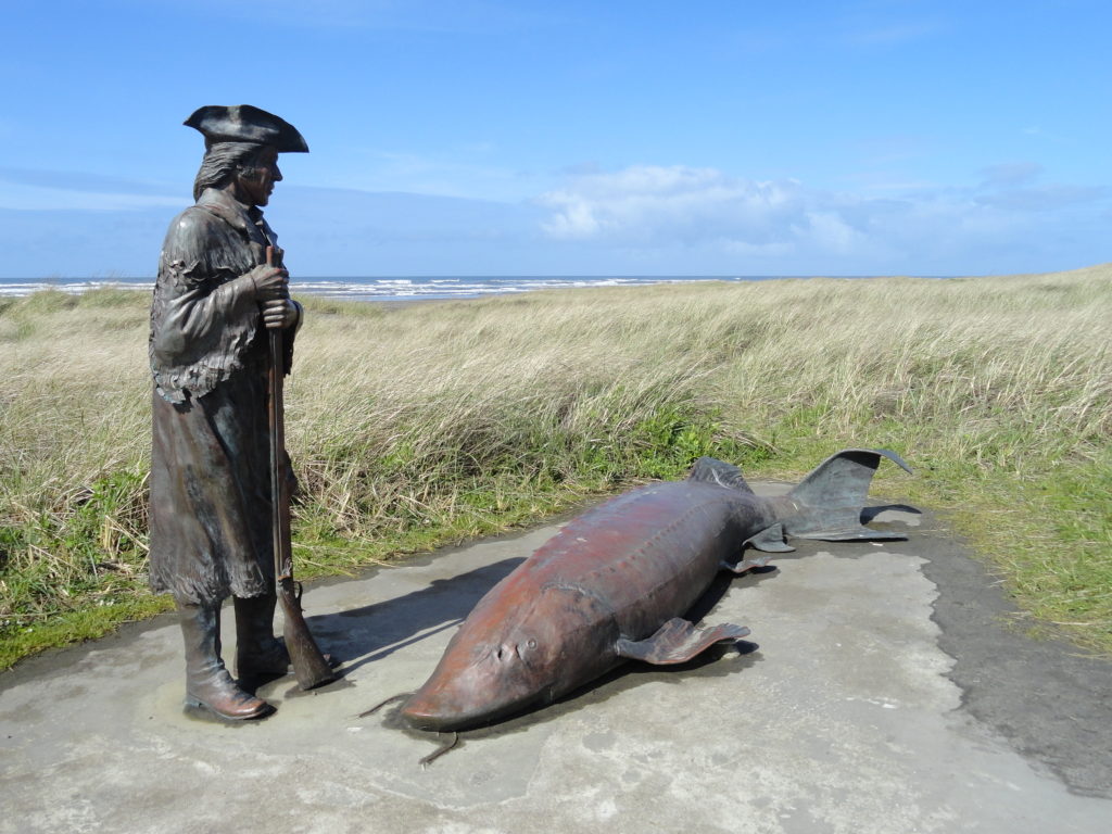
Quick Facts: Location: Long Beach Peninsula Land Agency: Washington State Parks and others Roundtrip: 8.2 miles on way Elevation Gain: 200 feet Contact: Long Beach Peninsula Visitors Bureau Access: For the southern trailhead, follow US 101 to Ilwaco. Turn left onto Elizabeth Ave and after two blocks turn right onto Howerton Ave. Park on Howerton Ave. Trail begins…
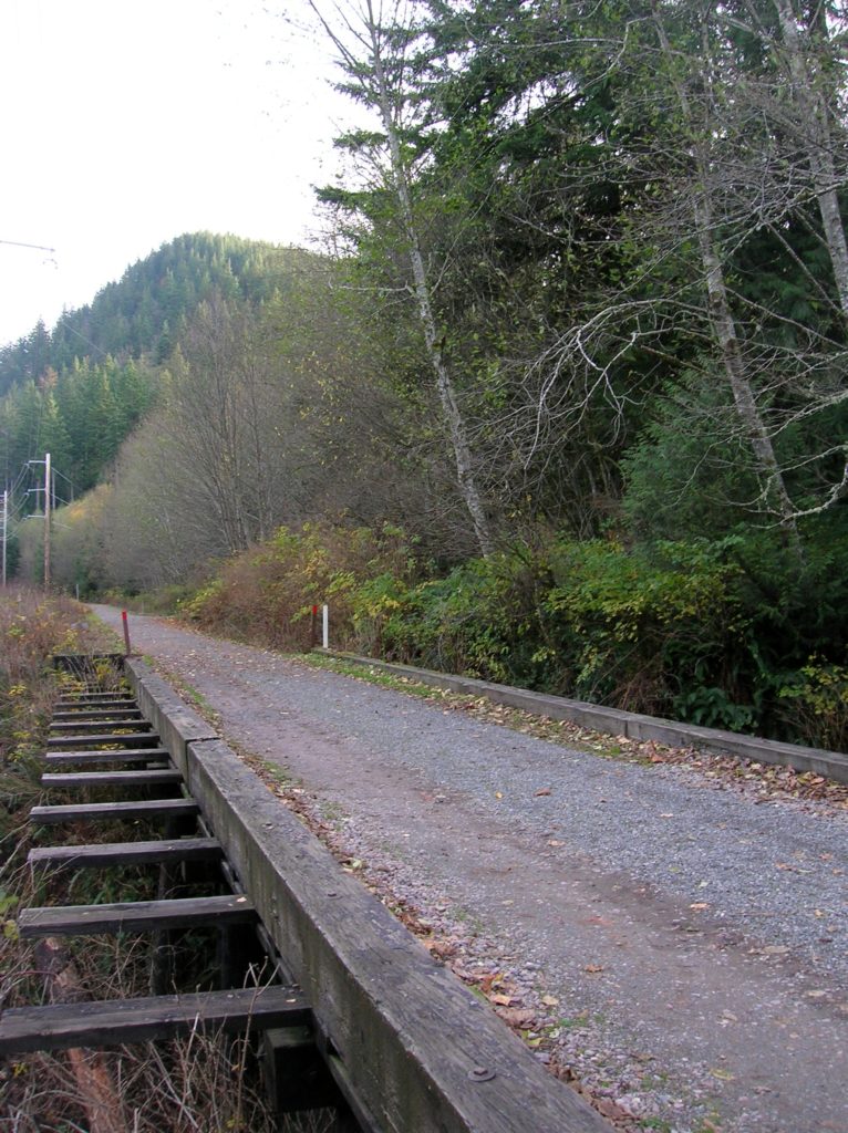
Read MoreGreen to Cedar Rivers Trail
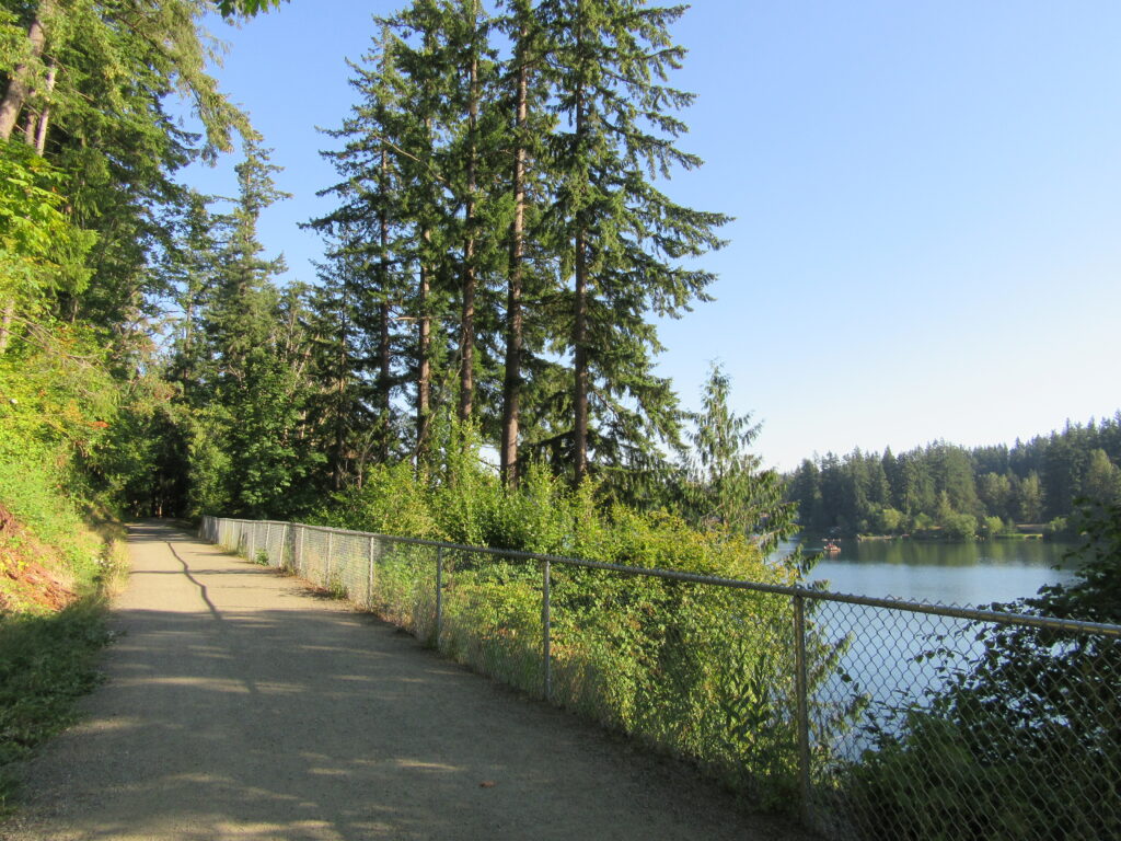
Walk across Maple Valley through a “wilderness” park Quick Facts: Location: Maple Valley, WA Distance: 3.3 miles one way Contact: King County Parks Elevation Gain: 250 feet Notes: Dogs permitted on leash Trailhead directions: From Seattle follow I-5 to I-405 and take Exit 4 in Renton. Then drive SR 169 south for 11.3 miles turning…
Read MoreTollgate Farm
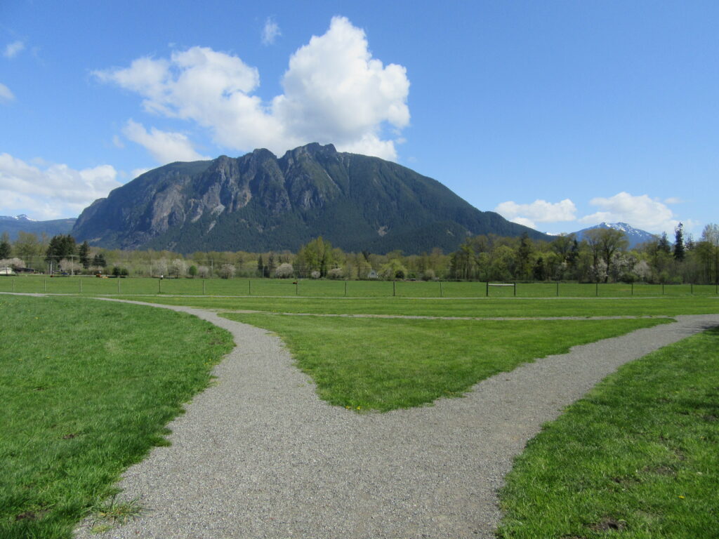
Historic prairie at the Forks of the Snoqualmie Quick Facts: Location: North Bend, WA Distance: 1.5 miles of trails Elevation Gain: minimal Contact: Si View Metropolitan District Green Trails Map: Mount Si NRCA no. 206S Notes: Dogs permitted on leash Trailhead directions: From Seattle follow I-90 east to Exit 27. Turn left onto Winery Road…
Read MoreSwan Lake and Christmas Hill –A very merry hike minutes from downtown Victoria

Quick Facts: Location: Saanich Peninsula, Vancouver Island Land Agency: Swan Lake Christmas Hill Sanctuary Roundtrip: 3.5 miles/ 5.6 kilometers Elevation gain: 325 feet/ 100 meters Contact: Swan Lake Christmas Hill Sanctuary Notes: dogs prohibited Access: From Victoria or Sidney, follow BC 17 (Patricia Bay Highway) exiting onto McKenzie Ave. Proceed east turning right onto Rainbow…
Read MoreBridal Veil Falls — Visit after heavy rains for a bridal shower!

Quick Facts: Location: US 2 near Index, Land Agency: Mount Baker-Snoqualmie National Forest Roundtrip: 4.4 miles Elevation gain: 850 feet Green Trails Maps: Green Trails, Alpine Lakes Stevens Pass 176S Contact: Skykomish Ranger District: Mount Baker -Snoqualmie National Forest Notes: NW Forest Pass or Interagency Pass required Access: From Everett follow US 2 east for…
Read MoreCrescent Lake─Swan stop at the confluence of the Skykomish and Snoqualmie Rivers
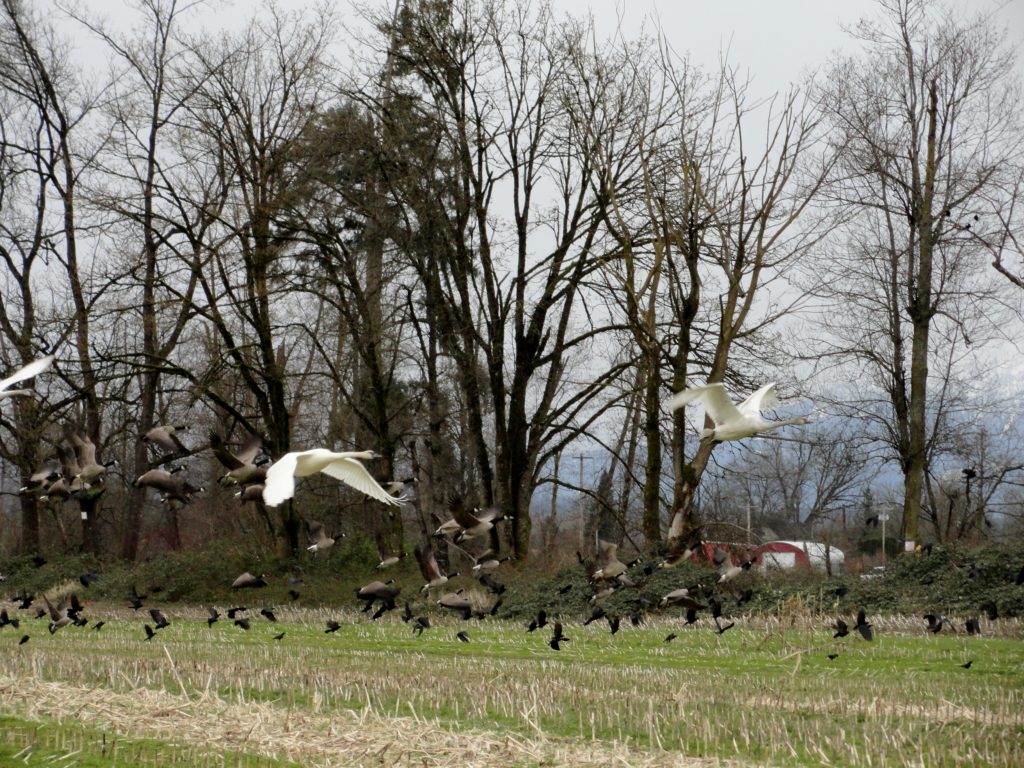
Quick Facts: Location: Snoqualmie Valley south of Monroe Land Agency: Washington Department of Fish and Wildlife (WDFW) Roundtrip: 2.2 miles Elevation Gain: None Notes: Discover Pass required; Crescent Lake is an active hunting area, so be aware of hunting seasons. Access: From Everett follow US 2 east to Monroe. Turn right onto SR 203 and follow for 3.8 miles turning right onto…
Read MoreLatourell Falls─First in a long line of stunning Columbia River Gorge waterfalls
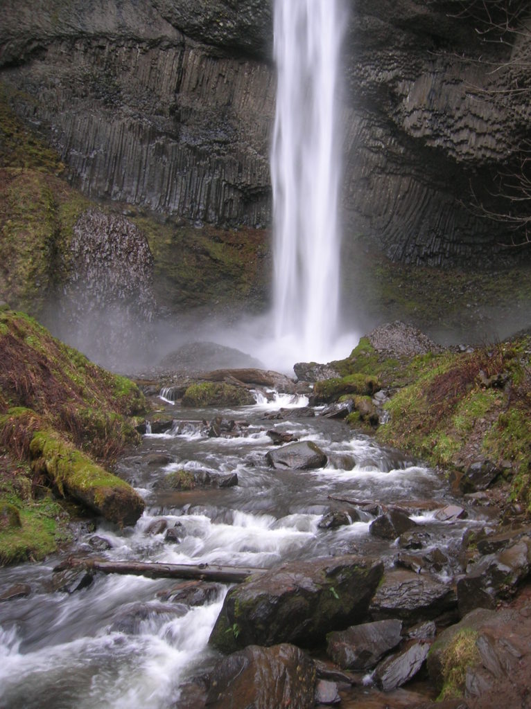
Quick Facts: Location: Columbia River Gorge National Scenic Area Land Agency: Oregon State Parks Roundtrip: 2.3 miles Elevation Gain: 650 feet Green Trails Map: Columbia River Gorge- West no. 428S Contact: Guy Talbot State Park Access: From Portland follow I-84 east to Exit 28. Then follow the Historic Columbia Highway west 2.6 miles to trailhead.…
Read MoreChristmas Lake and Cedar Butte- Bad tidings and spelling
Quick Facts: Location: Snoqualmie Valley near North Bend Land Agency: Washington State Parks Roundtrip: 4.2 miles Elevation Gain: 900 feet Green Trails Map: Rattlesnake Mountain Upper Snoqualmie Valley 205S Access: From Seattle take I-90 east to exit 32 in North Bend turning right (south) onto 436th Ave SE which soon becomes Cedar Falls Road. Follow for 3.1…
Read MoreMcLane Creek– Wetland wonderland within minutes from downtown Olympia
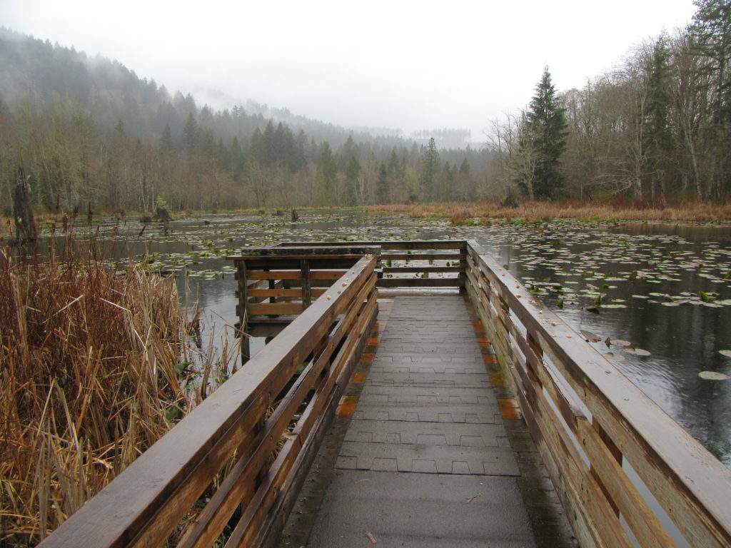
Quick Facts: Location: Capitol State Forest Land Agency: Washington Department of Natural Resources (DNR) Roundtrip: 1.5 miles Elevation Gain: minimal Contact: Washington Department of Natural Resources (DNR); South Puget Sound Region Office Notes: Discover Pass required; dogs permitted on leash Access: From Exit 104 on I-5 in Olympia, head west on US 101 taking the Black…
Read MoreCape Flattery─Hike to the northwestern most point in Washington State

Quick Facts: Location: Olympic Peninsula Coast Land Agency: Makah Nation Reservation Roundtrip: 1.5 miles Elevation Gain: 300 feet Contact: Makah Indian Nation Green Trails Map: Cape Flattery, WA- No 98S Notes: Dogs allowed on leash, Makah Recreation Pass required ($20, available at Washburn’s General Store ,the Makah Museum and several other locations in Neah Bay).…
Read More