Posts Tagged ‘Wildflowers’
Tubal Cain Mine and Buckhorn Lake — Take a “rhody trip” to an historic mine
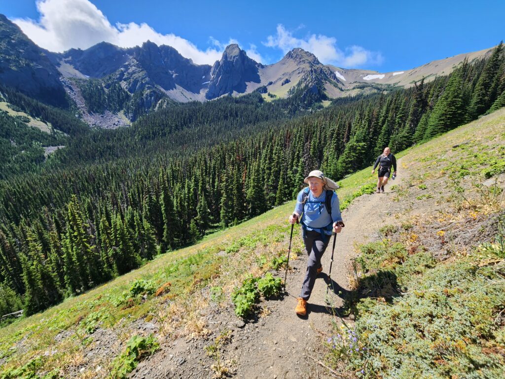
Quick Facts: Location: Buckhorn Wilderness, Olympic National Forest Land Agency: National Forest Service Roundtrip: 12.4 miles Elevation Gain: 2,100 feet Contact: Olympic National Forest, Hood Canal Ranger District, Quilcene, Green Trails Map: Olympic Mountains East 168SX Notes: Wilderness regulations apply Access: From Discovery Bay (Jct SR 20 and US 101), drive no US 101 north and turn left…
Read MoreCopper Butte via Old Stage Trail– Take a historic route to the rooftop of the Kettle River Range

Quick Facts: Location: Kettle River Range Land Agency: Colville National Forest Roundtrip: 6.0 miles Elevation Gain: 1615 feet Contact: Colville National Forest, Three Rivers Ranger District-Kettle Falls Access: From Republic, head east on SR 20 for 21 miles turning left onto FR 2030 (Albion Hill Road). From Kettle Falls, head west on SR 20 for 22 miles turning…
Read MoreSteens Mountain– Into the heart of Oregon’s “Big Empty”
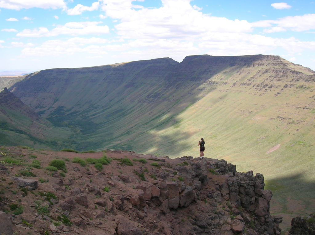
Quick Facts: Location: Great Basin, Eastern Oregon Land Agency: Steens Mountain Cooperative Management and Protection Area (BLM) Roundtrip: Kiger Gorge Rim; up to 4.0 miles Elevation gain: Up to 500 feet Difficulty: moderate Contact: BLM Burns Office Access: From Burns, Oregon travel 60 miles south to Frenchglen. Take Steens Mountan Loop Road for 23 miles.…
Read MoreLookout Mountain
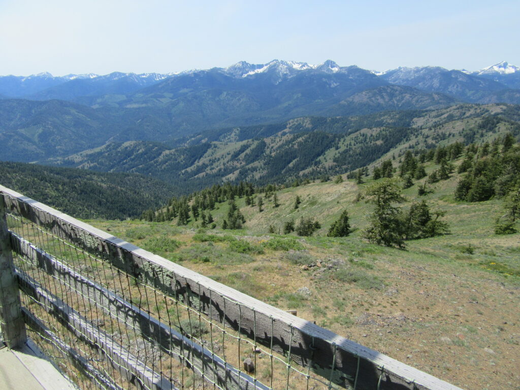
Look out over the Methow Valley and beyond Quick Facts: Location: Methow Valley, WA Distance: 3.0 miles one way Elevation Gain: 1170 feet Contact: Okanogan-Wenatchee National Forest, Methow Valley Ranger District Maps: Green Trails Methow Valley 51SX Recommended Guidebook: Day Hiking North Cascades (Mountaineers Books) Notes: trail open to mountain bikes and motorcycles; Final 1.5…
Read MoreMount Wells– Victoria area summit gushes with flowers and views

Quick Facts: Location: Victoria—Langford, BC Land Agency: Capital Regional District Parks Roundtrip: 2.0 miles/ 3.2 km Elevation gain: 865 feet/ 264 m Maps: CRDP site Contact: Capital Regional District Parks Notes: dogs permitted on leash; please stay on trail to protect rare plants Access: From Victoria, follow Trans-Canada Highway 10.5 for miles (17 km) exiting…
Read MoreLittle Giant Pass
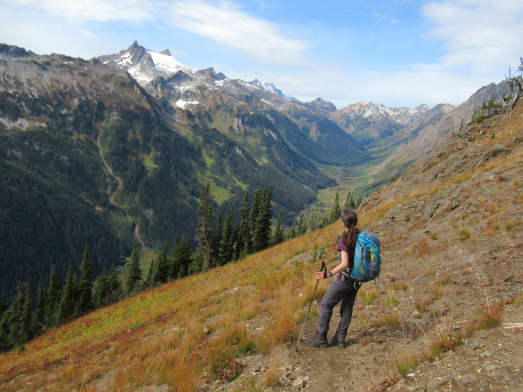
Shortest (but not easy) portal to the fabled Napeequa Valley Quick Facts: Location: Chiwawa River Valley Round Trip: 10.4 miles Elevation Gain: 4100 feet Contact: Okanogan-Wenatchee National Forest, Wenatchee River Ranger District, https://www.fs.usda.gov/okawen/Detailed Information: Day Hiking Central Cascades 2nd edition (Mountaineers Books) Notes: Wilderness Rules in effect; Chiwawa River must be forded—dangerous in high water…
Read MoreSunrise Ridge─What a setting!
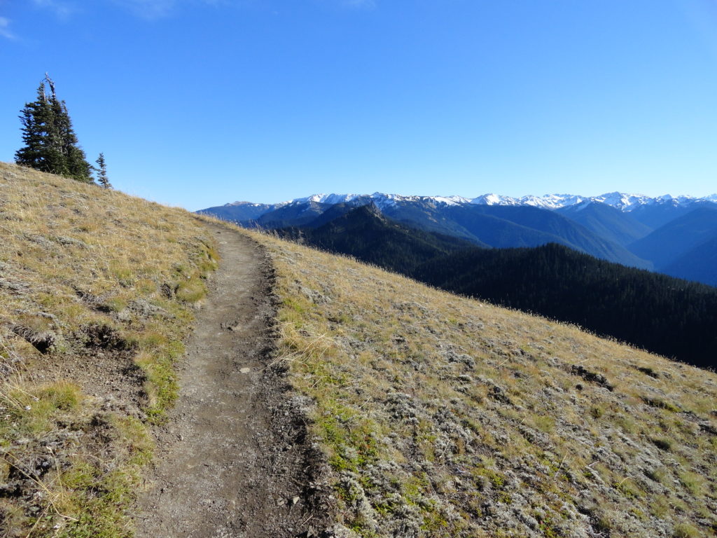
Quick Facts: Location: Olympic National Park – Hurricane Ridge Road Land Agency: National Park Service Roundtrip: 5.2 miles Elevation Gain: 1,100 feet Green Trails Map: Elwha North-Hurricane Ridge No. 134S Contact: Olympic National Park Access: From Port Angeles, follow Race Street south to Mount Angeles Ave to the Heart O’ the Hills Parkway (Hurricane Ridge…
Read MoreWhite Chuck Cinder Cone — Coolest volcanic cone north of Lassen
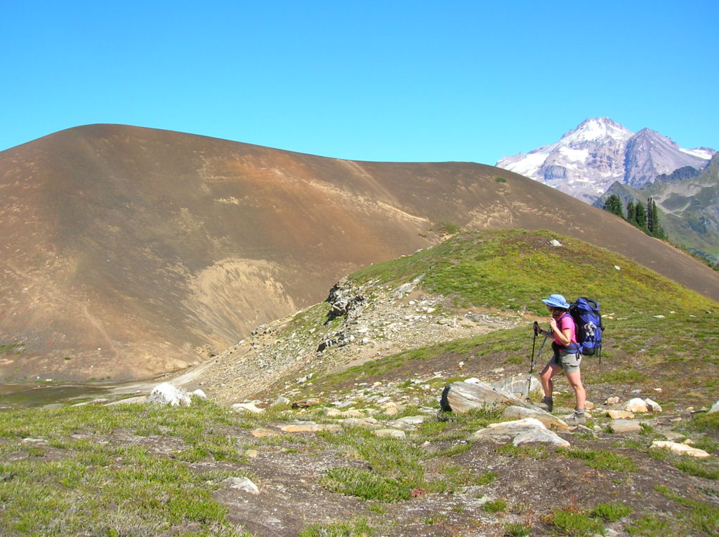
Quick Facts: Location: Glacier Peak Wilderness,Mountain Loop Highway near Darrington Land Agency: Mount Baker-Snoqualmie National Forest Roundtrip: 23.0 miles Elevation gain: 5,200 feet Green Trails Map: Mountain Loop Highway 111SX Contact: Darrington Ranger District: Mount Baker Snoqualmie National Forest (360) 436-1155 Notes: NW Forest Pass or Interagency Pass required Access: From Darrington, head south 16…
Read MoreNaches Peak–Big Scenic Payoff for little effort
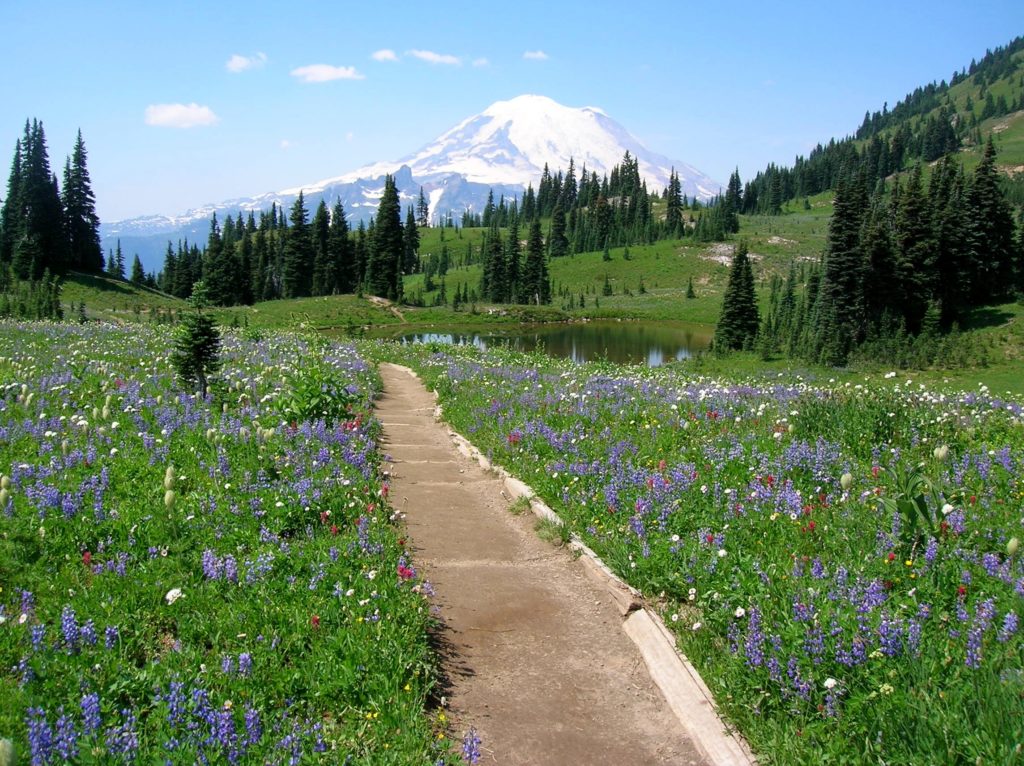
Quick Facts: Location: Naches Pass, Mount Rainier National Park Land Agency: United States Park Service Roundtrip: 4.0 miles Elevation gain: 600 feet Green Trails Maps: Mount Rainier Wonderland Map 269SX Contact: Mount Rainier National Park Notes: Dogs prohibited Access: From Enumclaw follow SR 410 east to Tipsoo Lake parking area just before Chinook Pass. Good…
Read MoreCascade Pass─Easy Portal into the North Cascades National Park
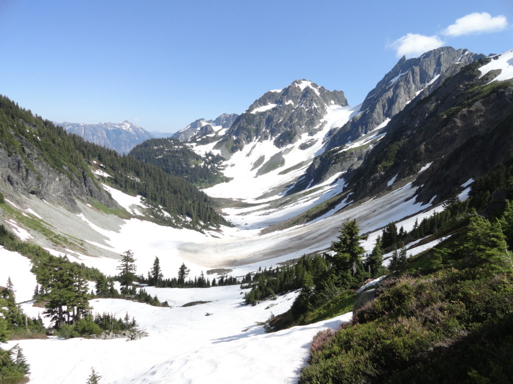
Quick Facts: Location: North Cascades Land Agency: North Cascades National Park Roundtrip: 7.4 miles Elevation Gain: 1,800 feet Green Trails Map: Ross Lake North Cascades No. 12SX Contact: Summer – North Cascades National Park Visitors Center Newhalem: (206) 386-4495 ext. 11 or NCNP Visitors Center Sedro-Woolley (360) 854-7200; www.nps.gov/noca Notes: Dogs prohibited. No trailhead camping.…
Read More