White Bluffs Hanford Reach
Wilderness and stark beauty along the Columbia River
Quick Facts:
Location: Hanford Reach National Monument
Round Trip: 7.0 miles
Elevation Gain: 500 feet
Contact: Hanford Reach National Monument, Mid-Columbia River National Wildlife Recreation Complex;
Detailed Information: Day Hiking Eastern Washington (Mountaineers Books)
Notes: watch for rattlesnakes; pack lots of water
Access: From Ellensburg, follow I-90 east to Exit 137 heading south on SR 26 for one mile. Bear right onto SR 243 and after 14 miles turn left onto the 24SW Road. Follow for 13.7 miles to SR 24, turning left and continuing east for 10 miles to turnoff right just past Milepost 63. Pass through a solar-powered gate (which closes at night) following a good gravel road south for 3.9 miles to a four-way junction. Turn right and continue 1.3 miles to trailhead located on right (before boat launch at old ferry crossing) near a locust grove.
Good to Know: historic, exceptional wildflowers, snowfree winter hike
Hike across towering white bluffs and massive sand dunes, and be dazzled by brilliant wildflowers. Here at the Hanford Reach witness the last free flowing non-tidal section of the Columbia River. In 1943 while in the midst of World War II the US government launched the Manhattan Project forever changing history with the birth of the atomic bomb as well as forever changing the landscape of the lower Columbia River Basin. To facilitate the processing of plutonium, a large remote area was needed with an ample nearby power source. The federal government chose the 428,000-plus acre Hanford Site. Two communities—Hanford and White Bluffs were condemned and the little town of Richland was transformed into a government city of 25,000.
Ironically this massive government project with its large buffer zones ended up preserving large tracts of natural habitat. In 2000, President Clinton declared 195,000 acres of the buffer zone a national monument, permanently protecting the 51-mile last free flowing non-tidal stretch of the Columbia and some of the last significant undeveloped sections of the Columbia Plateau’s sage steppe ecosystem. One of the driest parts of the state (annual rainfall averaging 7 inches) the Hanford Reach is a harsh but fragile environment; home to rare plants, endemic species, elk herds, and over 250 species of birds. Walk softly upon it and be prepared for extreme weather especially during the summer. Carry ample water and sunscreen.
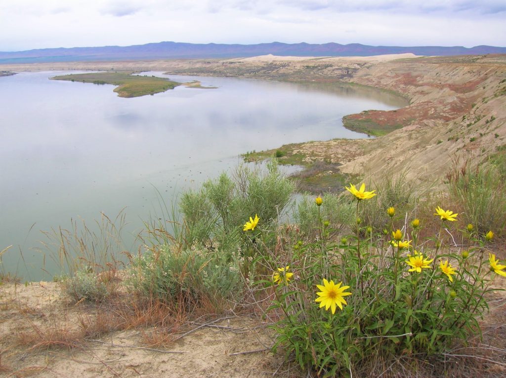
The rudimentary trail starts by a post near a grove of locust trees. Follow it up an open slope that dazzles with flowers in spring. The impressive White Bluffs immediately come into view. So too does the Columbia River. Watch for white pelicans below and swallows along the bluffs. The path can be sketchy—vanishing at times in dunes. Just work your way up and down along the bluff tops staying away from cliff edges.
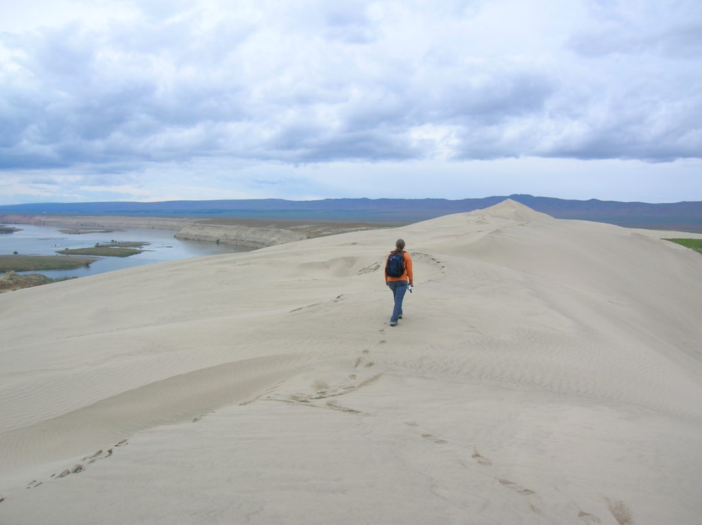
Enjoy excellent views of Locke Island below—Rattlesnake Mountain west and Saddle Mountain north. At about 2.0 miles reach impressive dunes that may have you feeling like you’re in the Sahara. Walk across the dunes continuing north. While always shifting, some of the higher dunes form pyramidal “summits” topping out at elevations over 725 feet. From these vantages more than 300 feet above the river you have commanding views of the shoreline below the bluffs. Scan it and the wetland pockets between the dunes for deer, coyotes, and jackrabbits and three species of mice—northern grasshopper, deer, and western harvest. At 3.5 miles the dunes end and travel beyond can be harsh making this the logical turn around spot.
For more details on this hike and many other amazing hikes in Washington state, pick up a copy of my best selling 100 Classic Hikes Washington (Mountaineers Books).