Vancouver Lake Regional Park
Volcano views and excellent birdwatching just west of downtown Vancouver, WA
Quick Facts:
Location: Vancouver, WA
Land Agency: Clark County Parks
Round Trip: 3.0 miles of trails
Elevation Gain: minmal
Contact: Vancouver Lake Regional Park
Detailed Information: Urban Trails Vancouver WA (Mountaineers Books)
Notes: year round parking fee of $5.00; Dogs permitted on-leash and prohibited on beach and lawns from April 1—Oct 31
Access: From I-5 in Vancouver take Exit 1C and drive west on SR 501 (E Mill Plain Blvd which becomes E 15th Street and eventually NW Lower River Road) for 5.0 miles. Then bear right onto NW Erin O Reiger Memorial Highway and continue for 0.6 mile turning right into park.
Good to Know: kid-friendly, snow free winter hikes, dog-friendly, wheelchair friendly
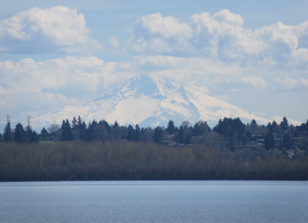
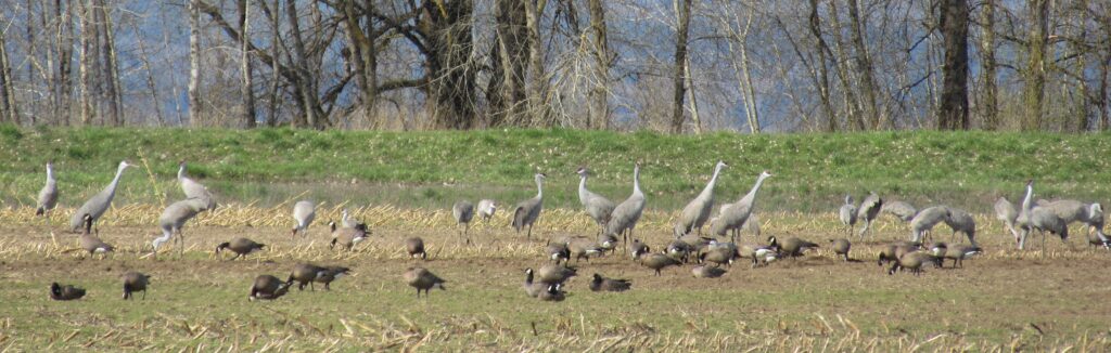
Vancouver Lake Regional Park may be known for its paddling and swimming opportunities, but this county park offers some wonderful walking and running opportunities, too. Meander the park’s manicured grounds; or head out for longer jaunts north through quiet forests, or alongside sloughs on the connecting trail to Frenchman’s Bar. Enjoy excellent views across the lake of Mount St Helens and Mount Hood. And watch for sandhill cranes during the winter months. Vancouver Lake is one of the best birding spots in Clark County.
Lewis and Clark referred to it has a pond. But with a surface area of more than 2300 acres and more than 7 miles of shoreline, lake seems like a better description for this large body of water west of Vancouver. Vancouver Lake lies on the Columbia River floodplain and is less than a mile from the river but its outlet creek flows into the Columbia at Ridgefield several miles to the north. And while the lake is large, it is shallow with a mean depth of 3 feet.
The Vancouver Lake Regional Park protects nearly 200 acres on 2.5 miles of shoreline on the lake’s eastern lakeshore. A series of short paved paths weave through the heart of the park traveling through picnic grounds and groves of stately hardwoods. Branching north and south from these paths are two longer trails. From the south parking area you can pick up a paved trail that travels for 2.5 miles along slough and through fields to Frenchman’s Bar Regional Park.
From the north parking lot you can follow a wide gravel trail for about .6 mile along the edge of a grassy opening and then through forest to its end on NW Erin O Reiger Memorial Highway. The Vancouver Lake North Trail branches from it traveling through a forest of Oregon ash, Garry oak and black cottonwood for about a mile before reaching a junction. Here you can head right to an oft-flooded so-so view of the lake; or head left to a sturdy bridge spanning Buckmire Slough. Just beyond the trail terminates at the NW Erin O Reiger Memorial Highway.
For detailed descriptions (including maps) for this hike as well as others in Battle Ground, Camas, Vancouver and the Yacolt Burn State Forest, pick up a copy of my best selling Urban Trails Vancouver WA (Mountaineers Books).