Archives
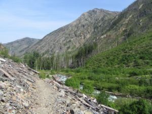
Follow a trail less traveled along a roaring waterway Quick Facts: Location: Methow Valley Round Trip: 5.0 miles Elevation Gain: 450 feet Contact: Okanogan-Wenatchee National Forest, Methow Valley Ranger District Detailed Information: Day Hiking North Cascades 2nd edition (Mountaineers Books) Notes: Northwest Forest Pass or Interagency Pass required; watch for…
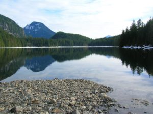
Quick Facts: Location: Ross Lake NRA, North Cascades Scenic Highway Land Agency: National Park Service Roundtrip: 4.5 miles High Point: feet Elevation gain: 1500 feet Difficulty: moderate Contact: North Cascades National Park Green Trails Map: North Cascades Ross Lake 16SX Notes: Dogs permitted on leash. Access: From Marblemount follow the North Cascades Highway (SR 20) east for…

Wilderness and stark beauty along the Columbia River Quick Facts: Location: Hanford Reach National Monument Round Trip: 7.0 miles Elevation Gain: 500 feet Contact: Hanford Reach National Monument, Mid-Columbia River National Wildlife Recreation Complex; Detailed Information: Day Hiking Eastern Washington (Mountaineers Books) Notes: watch for rattlesnakes; pack lots of water…
Quick Facts: Location: Skykomish River Valley Land Agency: Washington State Parks Roundtrip: 8.2 miles Elevation Gain: 1,500 feet Green trails Map: Index, WA-No. 142 Access: From Everett follow US 2 for 28 miles east to Gold Bar. Just before Milepost 28 turn left onto 1st Street (signed for Wallace Falls…
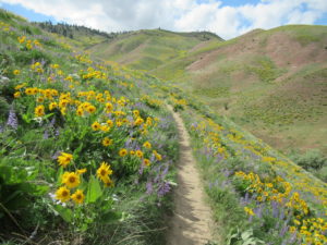
Bloomin’ good hike in Wenatchee Foothills Quick Facts: Location: Wenatchee Foothills Round Trip: 9.6 miles Elevation Gain: 1125 feet Contact: Chelan-Douglas Land Trust Detailed Information: Day Hiking Central Cascades 2nd edition (Mountaineers Books) Notes: Trail is closed from Dec 1 until March 31 to protect wintering mule deer. Dogs must…
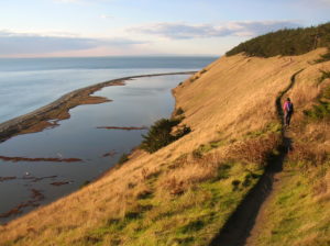
Quick Facts: Location: Whidbey Island Land Agency: National Park Service and Washington State Parks Roundtrip: 5.2 miles Elevation Gain: 260 feet Contact: Ebey’s Landing National Historical Reserve Suggested Guidebook: Urban Trails Everett Special note: Dogs permitted on leash. Access: Take Washington State Ferry from Mulkiteo to Clinton on Whidbey Island.…
Quick Facts: Location: Near Index, Skykomish Valley Land Agency: Mount Baker-Snoqualmie National Forest Roundtrip: 2.6 miles Elevation Gain: 850 feet Access: From Everett follow US 2 east for 37 miles to trailhead located on north side of highway just after entering Mount Baker-Snoqualmie National Forest. Green Trails Map: Alpine Lakes…
Quick Facts: Location: US 2 near Index, Land Agency: Mount Baker-Snoqualmie National Forest Roundtrip: 4.4 miles Elevation gain: 850 feet Green Trails Maps: Green Trails, Alpine Lakes Stevens Pass 176S Contact: Skykomish Ranger District: Mount Baker -Snoqualmie National Forest Notes: NW Forest Pass or Interagency Pass required Access: From Everett…
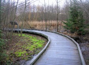
Quick Facts: Location: Everett Land Agency: Snohomish County Roundtrip: 1.8 miles Elevation gain: none Difficulty: Easy Contact: Friends of Narbeck Wetland Sanctuary Notes: Dogs must be leashed; open 7 a.m. to dusk Access: From Everett follow SR 526 west 2.5 miles exiting onto Seaway Boulevard. Proceed for 1.0 mile north.…
The crown jewel of Lake Washington parks Quick Facts: Location: Lake Washington Round Trip: 1.5 miles of trails Elevation Gain: minimal Contact: City of Renton Parks Commission Detailed Information: Urban Trails Seattle (Mountaineers Books) Notes: Dogs prohibited. Park open 8:00 am to dusk Access: Take Exit 5 on I-405. Then…