Archives
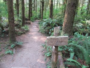
Quick Facts: Location: Stillaguamish River Valley, Granite Falls Land Agency: Snohomish County Parks Roundtrip: 7.0 miles Elevation Gain: 600 feet Contact: Snohomish County Parks Green Trails Map: Mountain Loop Highway 111SX Notes: Dogs must be on leash; park open dawn to dusk. Access: Follow SR 92 east to Granite Falls. Turn…
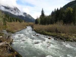
Quick Facts: Location: Mountain Loop Highway Land Agency: Mount Baker-Snoqualmie National Forest Roundtrip: 14 miles Elevation gain: 1500 feet Green Trails Map: Green Trails, Mountain Loop Highway, WA- no. 111SX Contact: Darrington Ranger District: Mount Baker Snoqualmie National Forest Access: From Darrington follow Mountain Loop Highway for 9.0 miles. Turn…
Quick Facts: Location: Chehalis River Valley Land Agency: Washington State Parks Roundtrip: 2.0 miles Elevation Gain: 125 feet Note: Discover Pass required; dogs permitted on leash. Access: From Exit 68 on I-5, proceed 2.5 miles east on US 12 to Mary’s Corner. Turn right onto Jackson Highway entering state park…
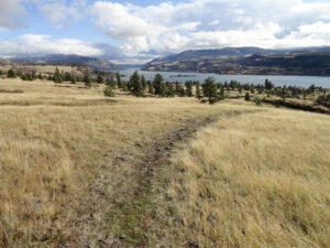
Quick Facts: Location: Columbia River Gorge National Scenic Area Land Agency: Columbia Gorge National Scenic Area Roundtrip: 5.0 miles Elevation gain: 1150 feet Difficulty: Moderate Contact: Columbia Gorge National Scenic Area Notes: Dogs permitted on leash. Be aware of ticks and poison oak. Green Trails Map: Columbia River Gorge East…
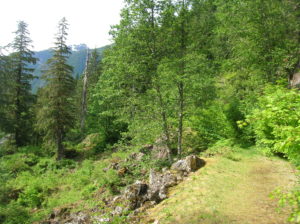
Location: Mountain Loop Highway near Granite Falls Land Agency: Mount Baker-Snoqualmie National Forest Roundtrip: 4.0 miles High Point: 2,450 feet Elevation gain: 400 feet Difficulty: difficult Green Trails Map: Mountain Loop Highway 111SX Contact: Darrington Ranger District: Mount Baker Snoqualmie National Forest ( Notes: Northwest Forest Pass required Access: : From…
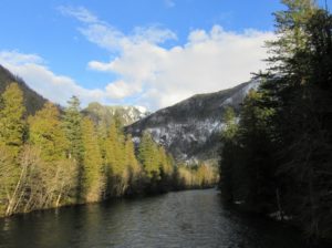
Quick Facts: Location: Ross Lake National Recreation Area, North Cascades Scenic Highway Land Agency: National Park Service Roundtrip: 1.8 miles Elevation gain: 100 feet Contact: NCNP Visitors Center Sedro-Woolley Green Trails Map: Marblemount, WA- No. 47 Guidebook: Day Hiking North Cascades 2nd edition (Mountaineers Books) Notes: dogs must be leashed, Practice…
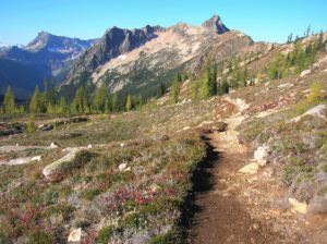
Quick Facts: Location: North Cascades Highway Land Agency: Okanogan-Wenatchee National Forest Round Trip: 10.0 miles Elevation Gain: 1850 feet Contact: Okanogan-Wenatchee National Forest, Methow Valley Ranger District, Green Trails Map: Washington Pass No. 50 Recommended Guidebook: Day Hiking North Cascades 2nd edition (Mountaineers Books) Notes: NW Forest Pass or Interagency…
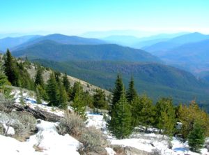
Location: Colville National Forest, near Republic Land Agency: US Forest Service Roundtrip: 8.0 miles High Point: 6,550 feet Elevation gain: 2,250 feet Difficulty: moderate Recommended Guidebook: Day Hiking Eastern Washington Contact: Colville National Forest Access: From Republic, head east on SR 20 for 25 miles turning left onto FR 2030…
Quick Facts Location: Twisp River Valley-North Cascades Land Agency: US Forest Service and National Park Service Roundtrip: 9.2 miles Elevation Gain: 2,460 feet Green Trails Map: Stehekin, WA – No 82 Recommended Guidebook: Day Hiking North Cascades (Romano) Contact: Methow Valley Ranger District: Okanogan-Wenatchee National Forest Notes: Northwest Forest Pass…
Quick Facts: Location: Mountain Loop Highway near Darrington Land Agency: Mount Baker-Snoqualmie National Forest Roundtrip: 28.3 miles Elevation Gain: 6,725 feet Green Trails Maps: Mountain Loop Highway 111SX Recommended Guidebook: Backpacking Washington (Romano; Mountaineers Books) Access: From Darrington, head south on the Mountain Loop Highway 16.0 miles turning left onto FR 49.…