Archives

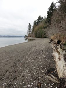
Quick Facts: Location: Indian Island near Port Hadlock Land Agency: Jefferson County Parks Roundtrip: 4.0 miles Elevation Gain: 70 feet Notes: Detailed information can be found in Day Hiking Olympic Peninsula (Mountaineers Books) Contact: Jefferson County Parks Access: From Kingston, drive State Route 104 turning right onto SR 19. Then continue north for…
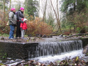
Quick Facts: Location: Edmonds Land Agency: Edmonds Parks and Recreation Department Roundtrip: About 1.5 miles of trails Elevation Gain: up to 300 feet Contact: Edmonds Parks and Recreation Access: From Everett or Seattle take I-5 to Exit 179. Then head west on 220th Street SW for 2.1 miles. Turn right and…
Quick Facts: Location: Olympia, Washington Land Agency: City of Olympia Parks and Recreation Roundtrip: 2.5 miles Elevation Gain: 300 feet Notes: Dogs must be on a leash. Access: From Lacey, follow I-5 south to Olympia taking Exit 105B to Plum Street. From Tumwater, follow I-5 north to Olympia taking Exit…
Quick Facts: Location: Mount Rainier National Park Land Agency: National Park Service Round Trip: 3.0 miles roundtrip Elevation Gain: 350 feet Green Trails Map: Green Trails Mount Rainier National Park 269S Contact: Mount Rainier National Park Notes: Dogs prohibited; Drones prohibited; National Park fee or Interagency Pass required Access: From Buckley,…
Quick Facts: Location: Mountain Loop Highway Land Agency: Mount Baker-Snoqualmie National Forest Roundtrip: 11.6 miles Elevation gain: 900 feet Green Trails Maps: Mountain Loop Highway Map 111SX Contact: Darrington Ranger District: Mount Baker Snoqualmie National Forest Guidebook Resource: Day Hiking North Cascades (Mountaineers Books) Notes: NW Forest Pass or Interagency…
Quick Facts: Location: Skagit Valley Land Agency: Skagit County Parks Round Trip: more than 5 miles of trails Elevation Gain: up to 150 feet Contact: Skagit County Parks and Recreation Guidebook source: Urban Trails Bellingham (Mountaineers Books) Notes: dogs permitted on leash; trails shared by mountain bikers Access: From Exit 232…
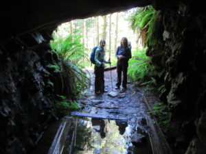
Quick Facts: Location: Mountain Loop Highway, near Granite Falls Land Agency: Mount Baker-Snoqualmie National Forest; Washington State Parks Roundtrip: 4.2 miles Elevation gain: 1,100 feet Green Trails Maps: Mountain Loop Highway 111SX Contact: Darrington Ranger District: Mount Baker-Snoqualmie National Forest Notes: access road is rough, high clearance vehicles recommended. Access:…
Quick Facts: Location: Mount Rainier National Park Land Agency: National Park Service Round Trip: 5.4 miles Elevation Gain: 900 feet Contact: Mount Rainier National Park Green Trails Maps: Mount Rainier National Park 269S Notes: National Park Entrance Fee or Interagency Pass; Dogs-prohibited Access: From Enumclaw follow SR 410 east for 37.5…
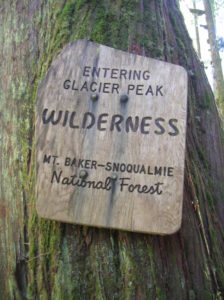
Quick Facts: Location: Mountain Loop Highway near Barlow Pass Land Agency: Mount Baker-Snoqualmie National Forest Roundtrip: 17.0 miles Elevation gain: 3,900 feet Green Trails Map: Mountain Loop Highway no. 111SX Contact: Darrington Ranger District: Mount Baker Snoqualmie National Forest Notes: Northwest Forest Pass or Interagency Pass required; A washout…
Quick Facts: Location: Skykomish Valley Land Agency: National Forest Service Round Trip: 3.8 miles Elevation Gain: 800 feet Contact: Skykomish Ranger District, Mount Baker-Snoqualmie National Forest Green Trails Maps: Green Trails, Alpine Lakes West Stevens Pass No 176S Notes: Northwest Forest pass or Interagency pass required; dogs must be leashed; wilderness…