Yost Park– Slice of Nature in the heart of Edmonds
Quick Facts:
Location: Edmonds
Land Agency: Edmonds Parks and Recreation Department
Roundtrip: About 1.5 miles of trails
Elevation Gain: up to 300 feet
Contact: Edmonds Parks and Recreation
Access: From Everett or Seattle take I-5 to Exit 179. Then head west on 220th Street SW for 2.1 miles. Turn right and head north on 96th Ave W for 0.5 mile. Then turn right onto Bowdoin Way and immediately turn left into Yost Memorial Park. Proceed 0.1 mile to parking and trailhead.
Good to Know: kid-friendly, snow-free winter hike, dog-friendly, historical
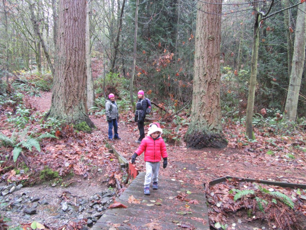
The small city of Edmonds tucked about midway between Seattle and Everett is known for its quaint and vibrant downtown; beaches and marinas; busy ferry terminal; and spectacular views of the Olympic Mountains across Puget Sound. What this city is not known for is natural landscapes. Nearly all of the land on this city’s shoreline, bluffs and hillsides has been converted to residential and commercial lots. But the 48 acres making up Yost Park within the heart of the city remain relatively natural. And while this park is small, about 1.5 miles of well-constructed and varied trails traverse the deeply forested ravine and hillsides within this emerald slice of Edmonds.
Yost Park contains a swimming pool and a couple of tennis courts; and during the summer months that is where most of the action in this park will be occurring. But come here in the autumn, winter and spring and embrace a more subdued atmosphere. Even though the park is surrounded by neighborhoods, the lay of the land and mature second growth forest of the park does a pretty good job obscuring the outside world.
Download a map of the park’s trail system and begin exploring. An old paved road closed to vehicles dissects the park and makes for a good trail for exploring by wheelchair or if you’re pushing a jogging stroller. Several trails branch off of the old road leading you either down into the ravine—or up along a steep hillside. In fact, while most of the park’s trails are only around a quarter mile or so in length you can get a good workout on the ones climbing the hillsides. The Overlook, Highline, and Cedar Loop Trails will all give you 100 or 200 feet of elevation change.
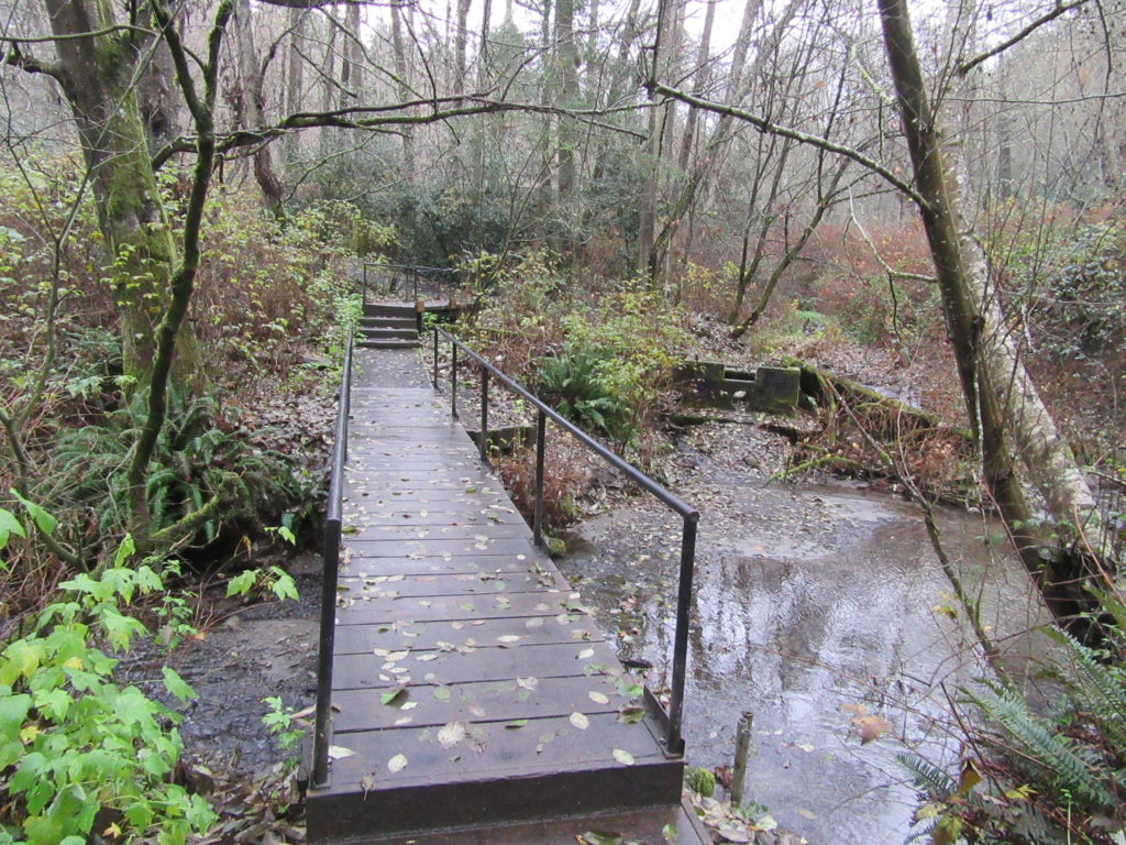
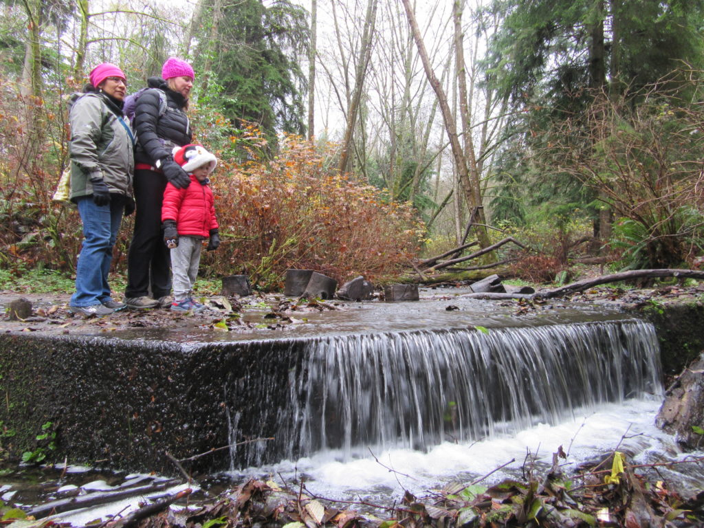
The Sword Fern Trail drops steeply to Shell Creek at the base of the ravine. Here and at the end of the Weir Trail you’ll see remains of old dams. In 1902 the Yost family established the Edmonds Spring Water Company here to supply water to the growing city. You can hike along Shell Creek for a while on the park’s most interesting trail. The Shell Creek Trail follows the tumbling creek through the ravine. It crosses the creek several times and utilizes a 1000-foot boardwalk.
Along the creek and elsewhere in the park, you’ll notice big stumps—remains of the giant cedars and firs that once grew here. Along the park’s uplands however, maturing second growth trees are beginning to reach some impressive dimensions.
The park is quiet during the winter and Shell Creek flows well during those wet months. Come back in the spring to witness an array of amphibians and birds adding sweet melodies to this little piece of wild in Edmonds.
For more information on where to play, stay, shop and eat in Edmonds and surrounding communities, visit Seattle NorthCountry
For detailed information on many other urban trails, in Snohomish County as well as nearby Whidbey and Camano Islands, pick up a copy of my brand new Urban Trails Everett (Mountaineers books). Urban Trails Seattle, Urban Trails Bellingham, Urban Trails Olympia and Urban Trail Kitsap are also available. Pick up a copy of one or more of these guides today and start exploring scores of close by trails!