Archive
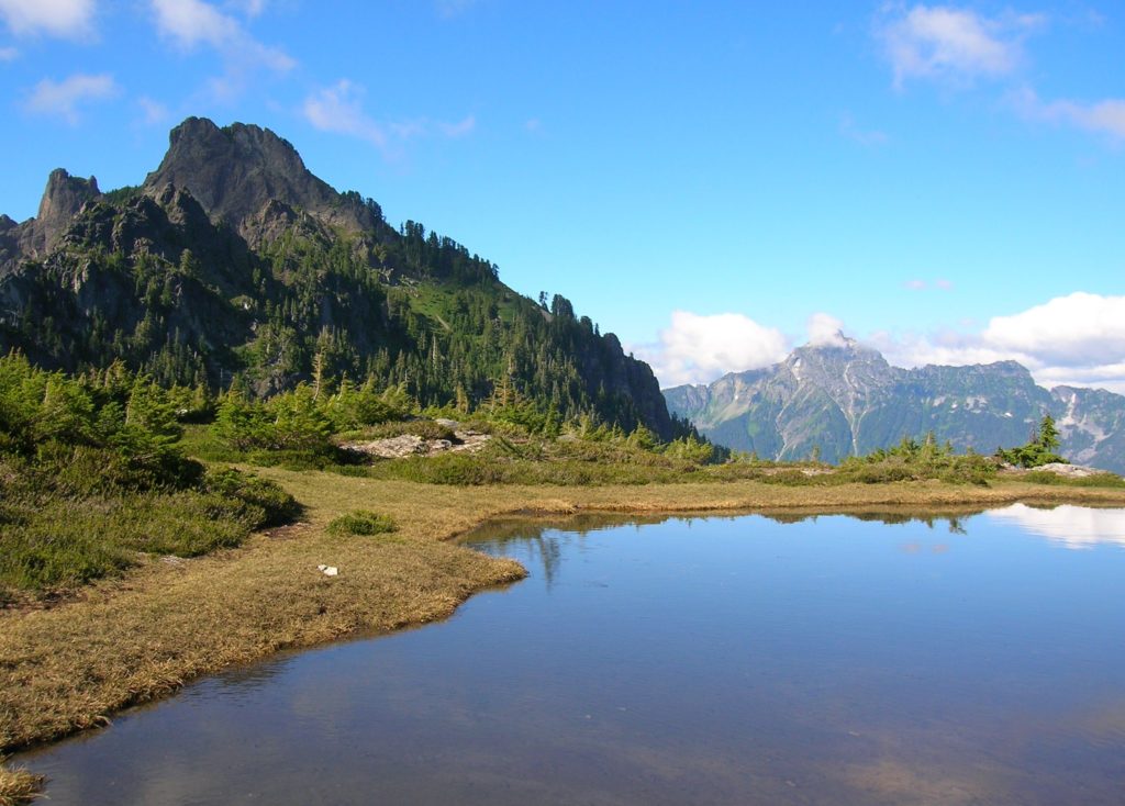
Cascade Pass─Easy Portal into the North Cascades National Park
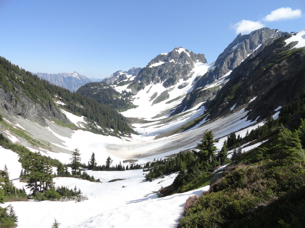
Quick Facts: Location: North Cascades Land Agency: North Cascades National Park Roundtrip: 7.4 miles Elevation Gain: 1,800 feet Green Trails Map: Ross Lake North Cascades No. 12SX Contact: Summer – North Cascades National Park Visitors Center Newhalem: (206) 386-4495 ext. 11 or NCNP Visitors Center Sedro-Woolley (360) 854-7200; www.nps.gov/noca Notes: Dogs prohibited. No trailhead camping.…
Read MorePerry Creek─Old growth, a cascade, sublime views to rugged peaks
Quick Facts: Location: Mountain Loop Highway Land Agency: National Forest Service Roundtrip: 11.4 miles Elevation Gain: 3.500 feet Green Trails Map: Mountain Loop Highway 111SX Recommended Guidebook: Day Hiking North Cascades 2nd edition (Mountaineers Books) Contact: Darrington Ranger District: Mount Baker-Snoqualmie National Forest Access: From Granite Falls follow the Mountain Loop Highway east for 27 miles…
Read MoreBarclay Lake–placid lake at the base of awe-inspiring Baring Mountain
Quick Facts: Location: Skykomish River Valley Land Agency: National Forest Service Roundtrip: 4.4 miles Elevation Gain: 225 feet Green Trails Map: Alpine Lakes Stevens Pass Map 176S Contact: Skykomish Ranger District: Mount Baker -Snoqualmie National Forest Recommended Guidebook: Day Hiking Central Cascades 2nd edition (Mountaineers Books) Special Note: Northwest Forest Pass required. Access: From Everett, head 40 miles east on US 2 to…
Read MoreLake Serene — Placid lake tucked beneath the terrifying towers of Mount Index
Quick Facts: Location: US 2 near Index Land Agency: Mount Baker-Snoqualmie National Forest Roundtrip: 7.2 miles Elevation gain: 2020 feet Green Trails Maps: Index WA- No. 142 Recommended Guidebook: Day Hiking Central Cascades 2nd edition (Mountaineers Books) Contact: Skykomish Ranger District: Mount Baker Snoqualmie National Forest Notes: NW Forest Pass or Interagency Pass required Access:…
Read MoreKelley Creek—Wild Sky gem and quiet portal to Johnson Ridge
Quick Facts: Location: Wild Sky Wilderness, Skykomish Valley Land Agency: Mount Baker-Snoqualmie National Forest Roundtrip: 8.8 miles Elevation Gain: 2,900 feet Green Trails Map: Green Trails Stevens Pass No 176, Benchmark Mtn No. 144 Recommended Guidebook: Day Hiking Central Cascades 2nd edition Contact: Skykomish Ranger District: Mount Baker Snoqualmie National Forest Notes: Northwest Forest Pass…
Read MoreIron Goat Trail –Hike back into time to one of Washington’s most tragic events
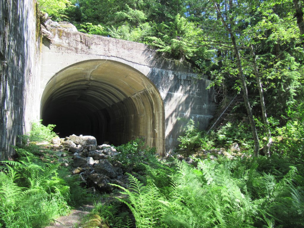
Quick Facts: Location: Stevens Pass Land Agency: Mount Baker-Snoqualmie National Forest Roundtrip: 12.0 miles Elevation gain: 650 feet Green Trails Maps: Alpine Lakes Stevens Pass no. 176S Contact: Skykomish Ranger District: Mount Baker Snoqualmie National Forest Notes: Northwest Forest Pass required Access: From Everett follow US 2 east for 55 miles to Milepost 55. Turn…
Read MoreWest Fork Methow River
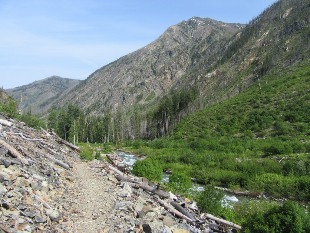
Follow a trail less traveled along a roaring waterway Quick Facts: Location: Methow Valley Round Trip: 5.0 miles Elevation Gain: 450 feet Contact: Okanogan-Wenatchee National Forest, Methow Valley Ranger District Detailed Information: Day Hiking North Cascades 2nd edition (Mountaineers Books) Notes: Northwest Forest Pass or Interagency Pass required; watch for rattlesnakes Green Trails Map: Methow…
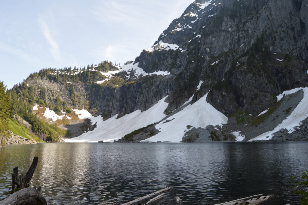
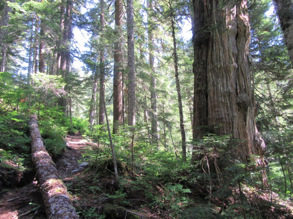
Read MorePyramid Lake–A puny lake, but monumental surrounding forest
Quick Facts: Location: Ross Lake NRA, North Cascades Scenic Highway Land Agency: National Park Service Roundtrip: 4.5 miles High Point: feet Elevation gain: 1500 feet Difficulty: moderate Contact: North Cascades National Park Green Trails Map: North Cascades Ross Lake 16SX Notes: Dogs permitted on leash. Access: From Marblemount follow the North Cascades Highway (SR 20) east for 21 miles to trailhead located…
Read MoreWhite Bluffs Hanford Reach
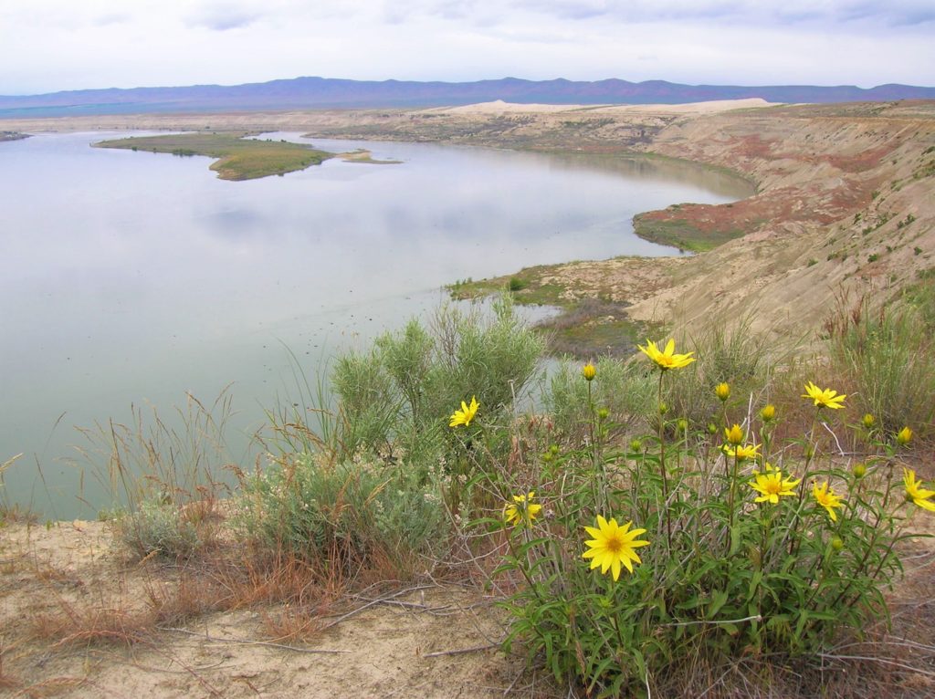
Wilderness and stark beauty along the Columbia River Quick Facts: Location: Hanford Reach National Monument Round Trip: 7.0 miles Elevation Gain: 500 feet Contact: Hanford Reach National Monument, Mid-Columbia River National Wildlife Recreation Complex; Detailed Information: Day Hiking Eastern Washington (Mountaineers Books) Notes: watch for rattlesnakes; pack lots of water Access: From Ellensburg, follow I-90…
Read MoreWallace Lake—Tranquil waters above thundering falls

Quick Facts: Location: Skykomish River Valley Land Agency: Washington State Parks Roundtrip: 8.2 miles Elevation Gain: 1,500 feet Green trails Map: Index, WA-No. 142 Access: From Everett follow US 2 for 28 miles east to Gold Bar. Just before Milepost 28 turn left onto 1st Street (signed for Wallace Falls State Park). Proceed for .4…
Read More