Uncategorized
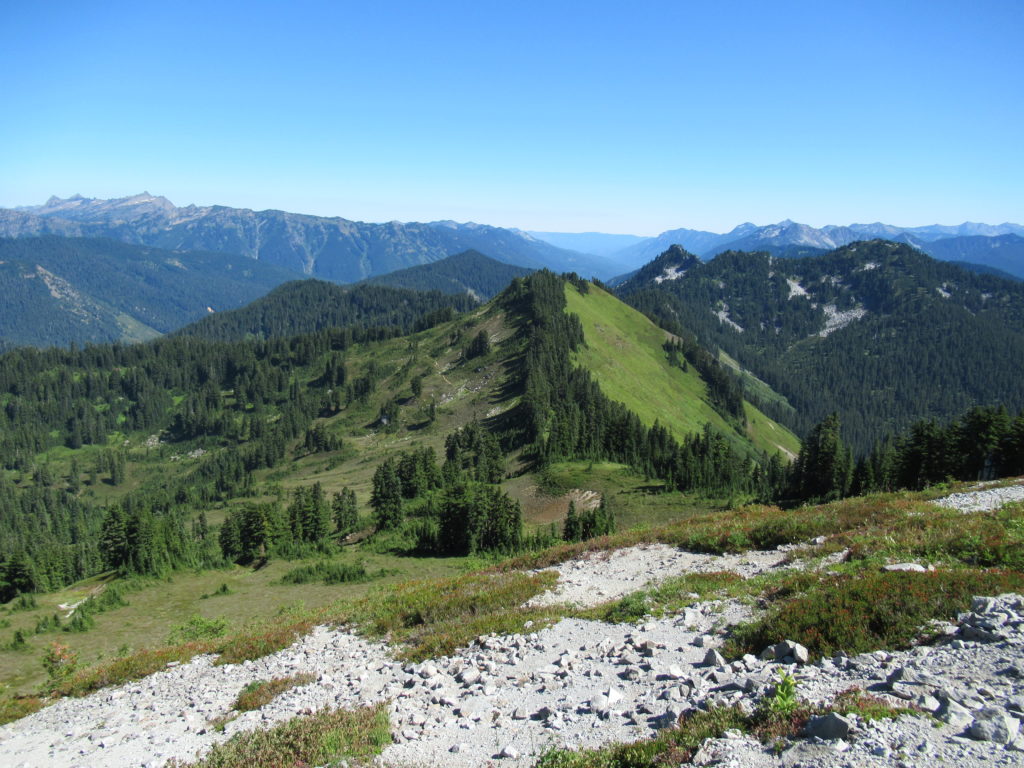
Crystal Peak
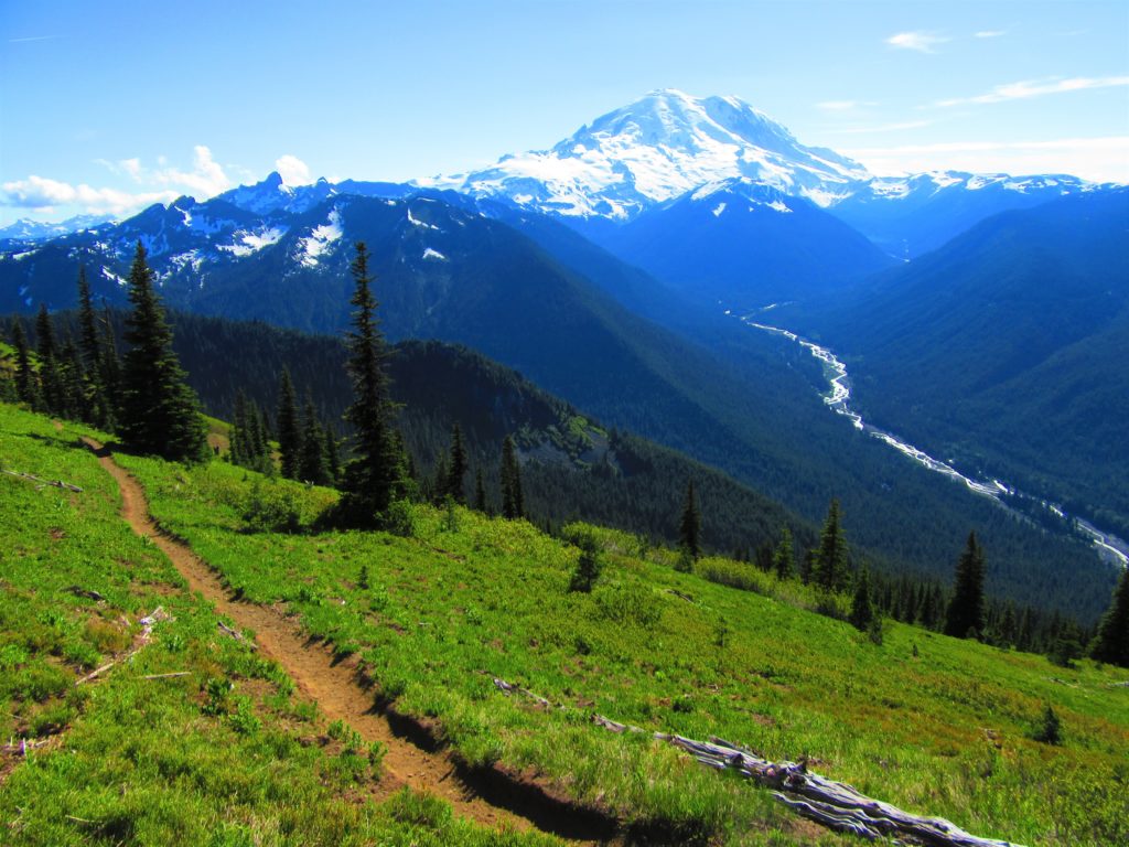
Old fire lookout site grants some of the best views in Mount Rainier NP Quick Facts: Location: Mount Rainier National Park Land Agency: National Park Service Distance: 7.8 miles Elevation Gain: 3,400 feet Contact: Mount Rainier National Park Map: Green Trails Mount Rainier National Park 269SX Notes: National Park Entrance Fee or Interagency Pass, Dogs-prohibited…
Read MoreMount Rose–How sweet are thy views!
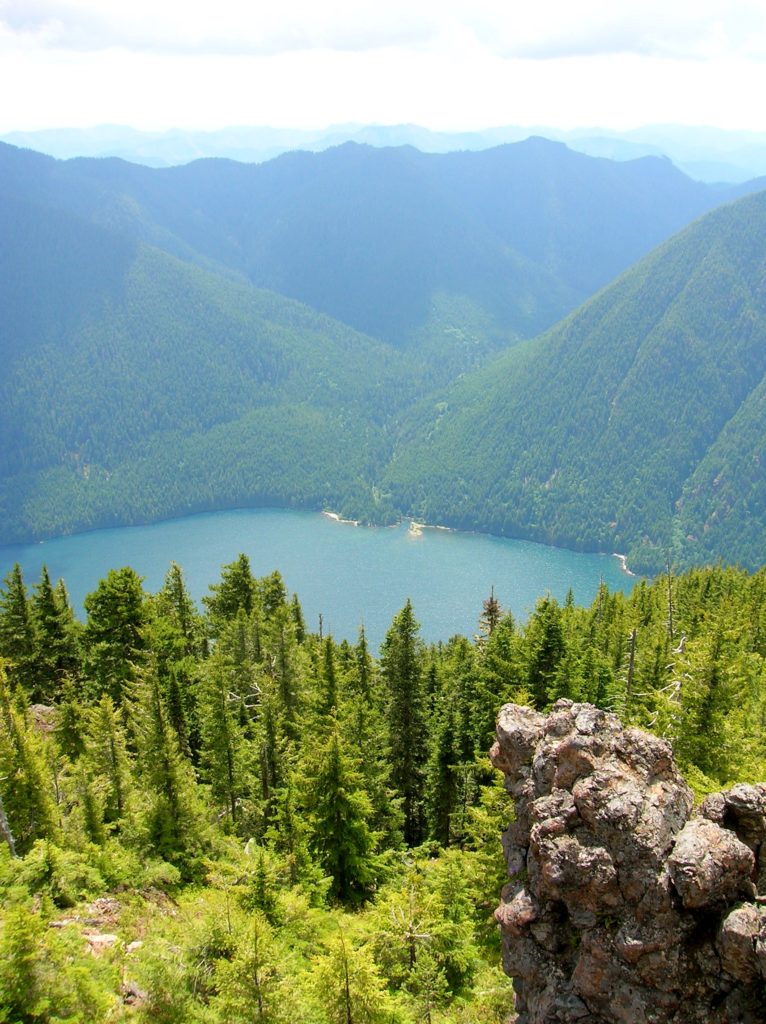
Quick Facts: Location:Mount Skokomish Wilderness, Southeast Olympic Peninsula Land Agency: Olympic National Forest Roundtrip: 6.7 miles Elevation gain: 3,500 feet Green Trails Maps: Olympic Mountains East No. 168SX Contact: Hood Canal District, Quilcene Notes: Wilderness regulations apply Access: From Shelton, travel north on US 101 for 15 miles to Hoodsport. Turn left onto SR 119…
Read MoreLimekiln Point and Preserve

Orcas, old quarries, and a beautiful lighthouse Quick Facts: Location: San Juan Island Land Agency: Washington State Parks and San Juan County Conservation Land Bank Roundtrip: 2.2 miles Elevation Gain: 265 feet Contact: Lime Kiln State Park or San Juan County Conservation Land Bank Detailed Information: Day Hiking the San Juans and Gulf Islands (Mountaineers Books) Notes: Discover…
Read MoreThe Hummocks — Hike through the former heart of Mount St. Helens
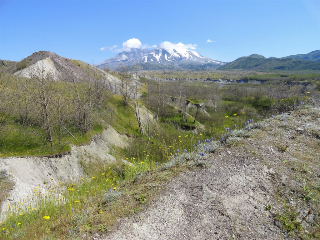
Quick Facts: Location: Spirit Lake Highway, Mount St Helens National Volcanic Monument Land Agency: National Forest Service Roundtrip: 2.5 miles Elevation Gain: 250 feet Contact: Mount St Helens National Volcanic Monument Green Trails Map: Mount St Helens 332S Notes: Northwest Forest Pass (or interagency pass) required; dogs permitted on leash; off trail travel prohibited. Practice Leave…
Read MoreSun Top — snowshoe to a historic lookout in the shadows of Mount Rainier
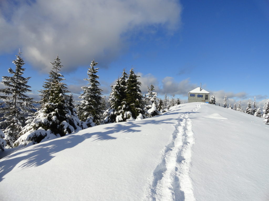
Quick Facts: Location: White River Valley Land Agency: Mount Baker-Snoqualmie National Forest Roundtrip: 11.0 miles Elevation gain: 3,050 feet Contact: Mount Baker-Snoqualmie National Forest Green Trails Map: Green Trails Maps – Greenwater no. 238 Notes: Sno-park Pass required. Route is non-groomed and shared with skiers (do not snowshoe on groomed ski trail). Beyond the upper…
Read MoreBenchmark Mountain–The meadows here measure up among the best
Quick Facts: Location: North Fork Skykomish River Valley Land Agency: Mount Baker-Snoqualmie National Forest Roundtrip: 14.2 miles High Point: 5,816 feet Elevation gain: 3,700 feet Green Trails Maps: Monte Cristo, WA-No. 143, Benchmark MT- No. 144 Contact: Skykomish Ranger District: Mount Baker-Snoqualmie National Forest Note: Northwest Forest or Interagency Pass Required Access: From Everett head…
Read MoreMount Pisgah–Hike to a promising land of spectacular wildflowers
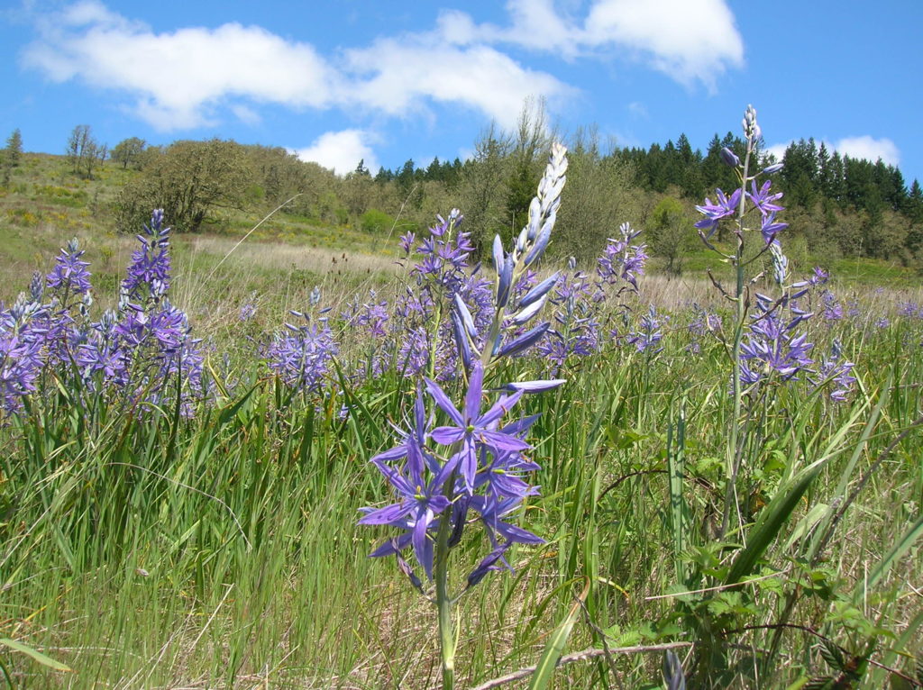
Quick Facts: Location: Willamette Valley south of Eugene Land Agency: Lane County Parks Roundtrip: 3.0 miles Elevation gain: 1,050 feet Map: Park map available online Contact: Friends of Buford Park and Mount Pisgah Notes: $5.00 day use fee; dogs must be leashed Access: From Eugene follow Franklin Blvd (Exit 189 I-5 southbound or Exit 188B northbound…
Read MoreLookout Loop

A good grunt to a so-so viewpoint in a great new forest preserve Quick Facts: Location: Lookout Mountain Forest Preserve Land Agency: Whatcom County Parks Round Trip: 4.0 miles Elevation Gain: 850 feet Contact: Whatcom County Parks Notes: dogs permitted on leash, trail open to mountain bikes Recommended Guidebook: Urban Trails Bellingham (Mountaineers Book) Access:…
Read MoreCatherine Creek Rock Arch–A touch of Utah in the Northwest!
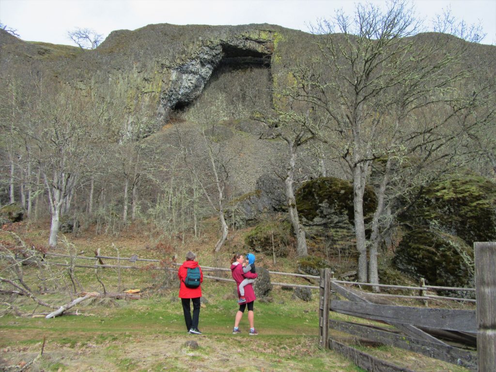
Location: Columbia River Gorge National Scenic Area Land Agency: Columbia Gorge National Scenic Area Roundtrip: 2.3 miles Elevation gain: 370 feet Difficulty: Easy Contact: Columbia Gorge National Scenic Area Notes: Dogs permitted on leash. Be aware or ticks and poison oak. Green Trails Map: Columbia River Gorge East No. 432S Good to Know: kid-friendly, dog-friendly…
Read MoreTucannon River– Riverside trail will have you singing the Blues

Quick Facts: Location: Blue Mountains Land Agency: Umatilla National Forest Roundtrip: 8.0 miles Elevation Gain: 500 feet Contact: Umatilla National Forest, Pomeroy Ranger District Detailed Information: Day Hiking Eastern Washington (Mountaineers Books) Notes: Northwest Forest Pass or Interagency Pass required Access: From Dayton, head east on Patit Road for 14 miles turning left onto Hartsuck Grade following 4.0…
Read More