Uncategorized
Barlow Point–Little known lookout site on Mountain Loop Highway
Location: Mountain Loop Highway near Granite Falls Land Agency: Mount Baker-Snoqualmie National Forest Roundtrip: 2.5 miles High Point: 3,222 feet Elevation gain: 850 feet Difficulty: moderate Green Trails Maps: Mountain Loop Highway 111SX Contact: Darrington Ranger District: Mount Baker Snoqualmie National Forest Note: Northwest Forest Pass or Inter-agency Pass required Access: From Granite Falls, follow…
Read MoreLyle Cherry Orchard–A great pick for spring wildflowers!
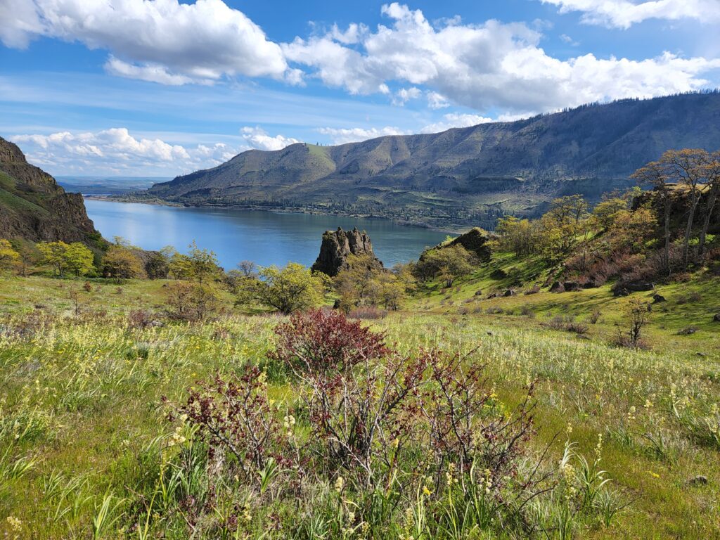
Location: Columbia River Gorge National Scenic Area Land Agency: Friends of the Columbia Gorge Roundtrip: 6.8 miles Elevation gain: 1,500 feet Contact: Friends of the Columbia Gorge Notes: Dogs permitted on leash; Beware ticks, rattlesnakes, and poison oak; parking limited especially on weekends Green Trails Map: Columbia River Gorge East No. 432S Access: From Bingen…
Read MoreFlowing Lake–For peaceful wandering, go with the Flow in the springtime
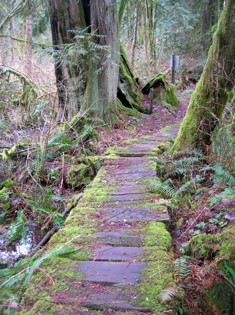
Location: Three Lakes, east of Snohomish Land Agency: Snohomish County Parks Roundtrip: 1.2 miles Elevation gain: 100 feet Contact: Snohomish County Parks Notes: $10.00 day use fee; Dogs must be on leash Access: From Everett follow US 2 east for 10 miles turning left onto Westwick Road. Follow Westwick Road for approximately 2.0 miles bearing…
Read MoreBarnaby Buttes
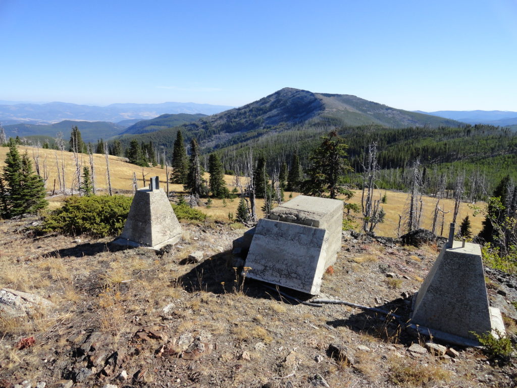
Mega-fauna hot spot in the Kettle River Range Quick Facts: Location: Kettle River Range Land Agency: National Forest Service Distance: 7.4 miles Elevation Gain: 1975 feet Contact: Colville National Forest Three Rivers Ranger District Recommended Guidebook: Day Hiking Eastern Washington (Mountaineers Books) Access: From Kettle Falls, travel west on SR 20 for 14 miles turning…
Read MoreCrystal Peak
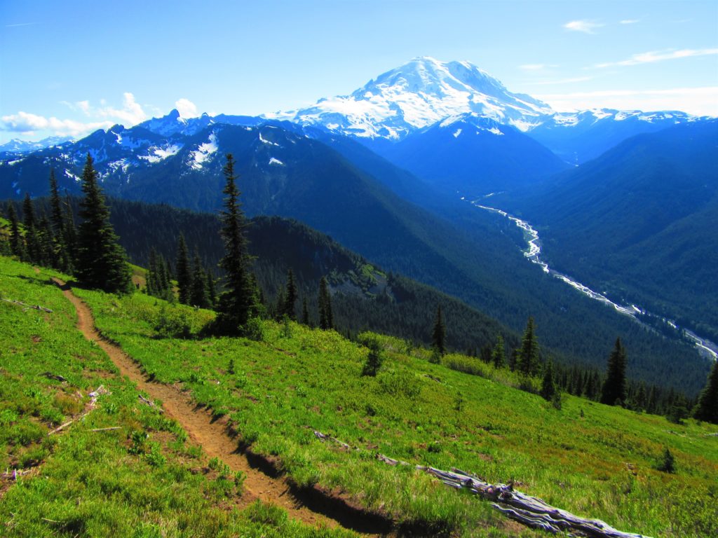
Old fire lookout site grants some of the best views in Mount Rainier NP Quick Facts: Location: Mount Rainier National Park Land Agency: National Park Service Distance: 7.8 miles Elevation Gain: 3,400 feet Contact: Mount Rainier National Park Map: Green Trails Mount Rainier National Park 269SX Notes: National Park Entrance Fee or Interagency Pass, Dogs-prohibited…
Read MoreMount Rose–How sweet are thy views!
Quick Facts: Location:Mount Skokomish Wilderness, Southeast Olympic Peninsula Land Agency: Olympic National Forest Roundtrip: 6.7 miles Elevation gain: 3,500 feet Green Trails Maps: Olympic Mountains East No. 168SX Contact: Hood Canal District, Quilcene Notes: Wilderness regulations apply Access: From Shelton, travel north on US 101 for 15 miles to Hoodsport. Turn left onto SR 119…
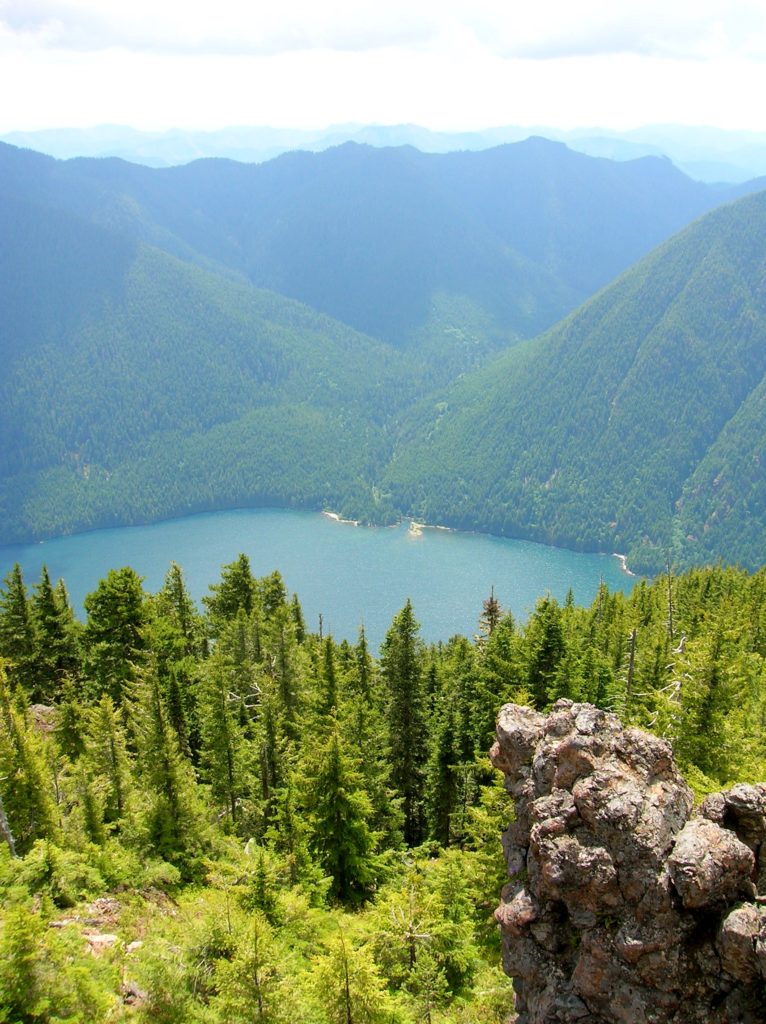
Read MoreLimekiln Point and Preserve

Orcas, old quarries, and a beautiful lighthouse Quick Facts: Location: San Juan Island Land Agency: Washington State Parks and San Juan County Conservation Land Bank Roundtrip: 2.2 miles Elevation Gain: 265 feet Contact: Lime Kiln State Park or San Juan County Conservation Land Bank Detailed Information: Day Hiking the San Juans and Gulf Islands (Mountaineers Books) Notes: Discover…
Read MoreThe Hummocks — Hike through the former heart of Mount St. Helens
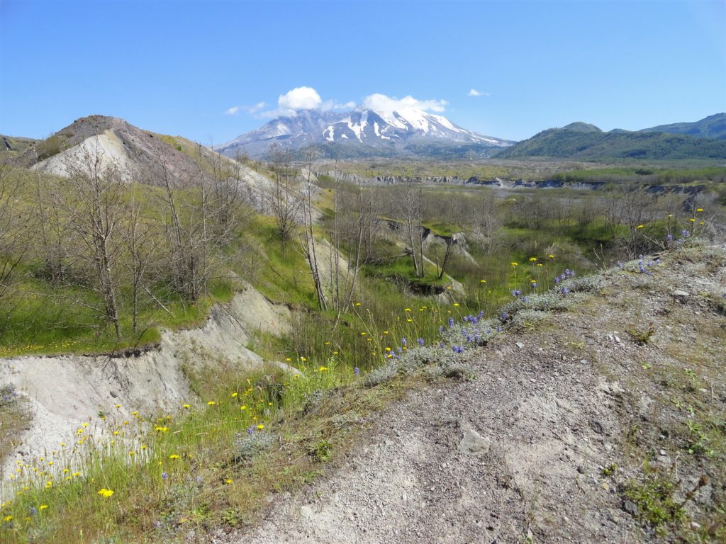
Quick Facts: Location: Spirit Lake Highway, Mount St Helens National Volcanic Monument Land Agency: National Forest Service Roundtrip: 2.5 miles Elevation Gain: 250 feet Contact: Mount St Helens National Volcanic Monument Green Trails Map: Mount St Helens 332S Notes: Northwest Forest Pass (or interagency pass) required; dogs permitted on leash; off trail travel prohibited. Practice Leave…
Read MoreSun Top — snowshoe to a historic lookout in the shadows of Mount Rainier
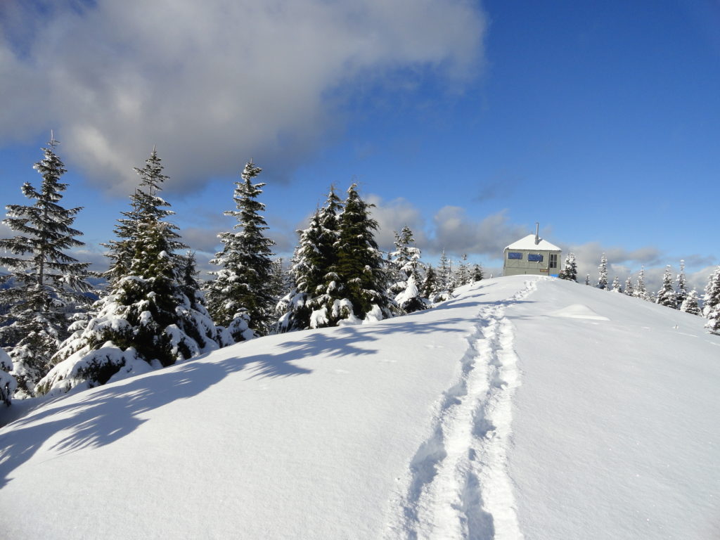
Quick Facts: Location: White River Valley Land Agency: Mount Baker-Snoqualmie National Forest Roundtrip: 11.0 miles Elevation gain: 3,050 feet Contact: Mount Baker-Snoqualmie National Forest Green Trails Map: Green Trails Maps – Greenwater no. 238 Notes: Sno-park Pass required. Route is non-groomed and shared with skiers (do not snowshoe on groomed ski trail). Beyond the upper…
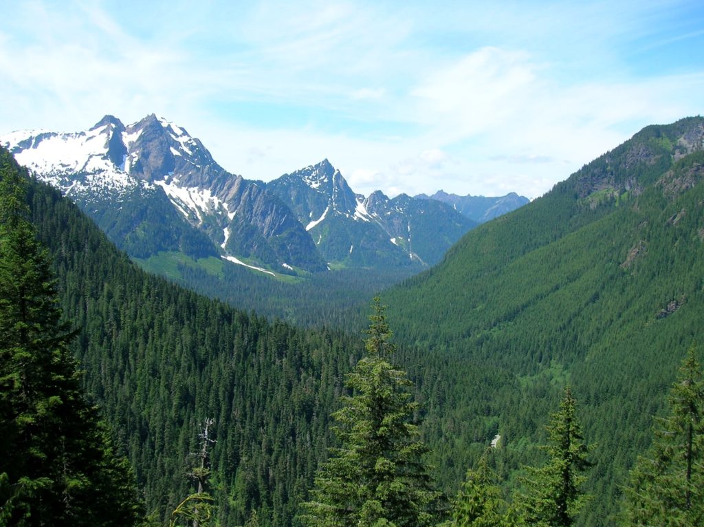
Read MoreBenchmark Mountain–The meadows here measure up among the best
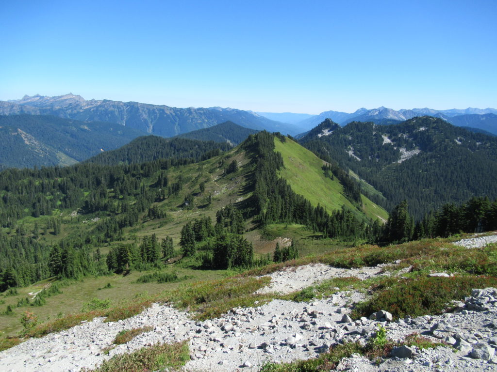
Quick Facts: Location: North Fork Skykomish River Valley Land Agency: Mount Baker-Snoqualmie National Forest Roundtrip: 14.2 miles High Point: 5,816 feet Elevation gain: 3,700 feet Green Trails Maps: Monte Cristo, WA-No. 143, Benchmark MT- No. 144 Contact: Skykomish Ranger District: Mount Baker-Snoqualmie National Forest Note: Northwest Forest or Interagency Pass Required Access: From Everett head…
Read More