Posts Tagged ‘historic fire lookout site’
Barnaby Buttes
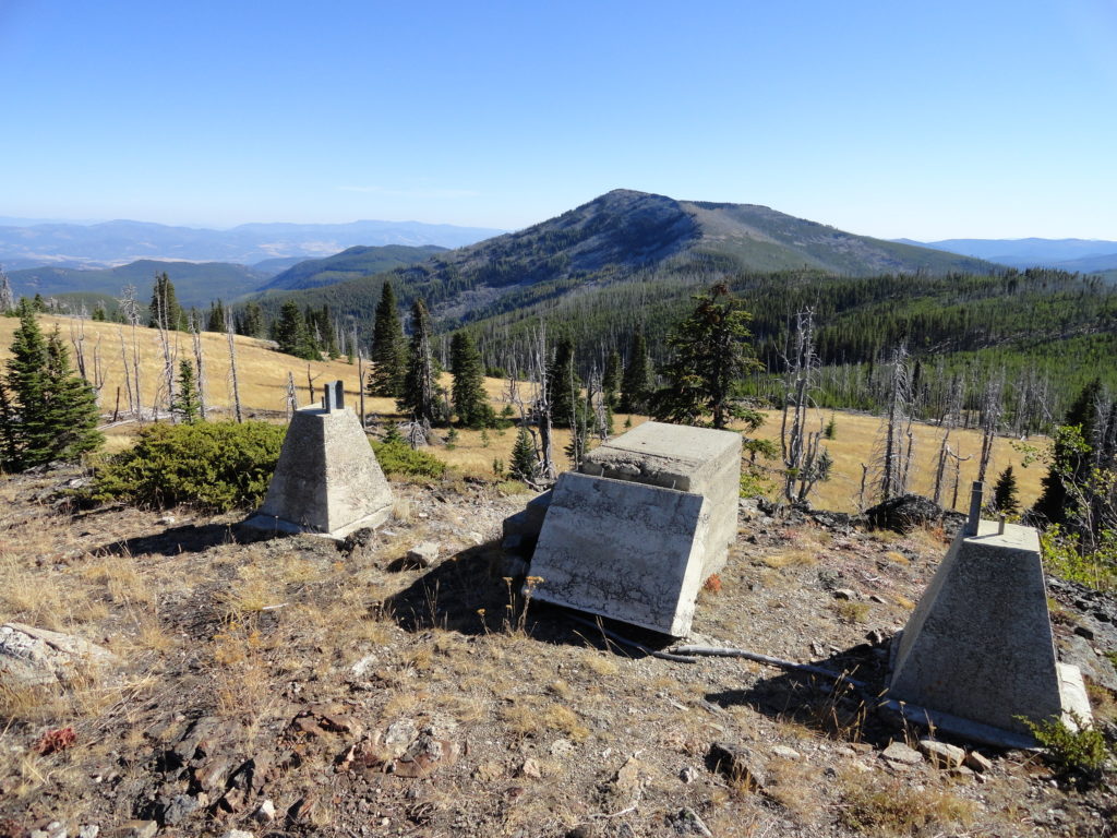
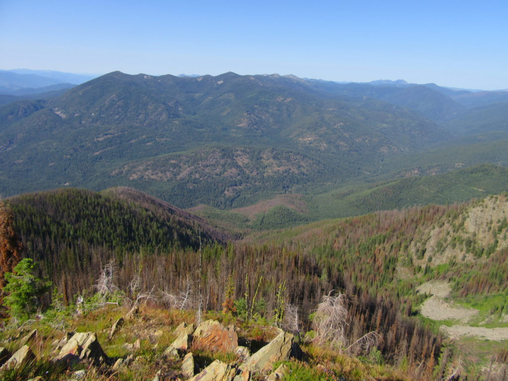
Mega-fauna hot spot in the Kettle River Range Quick Facts: Location: Kettle River Range Land Agency: National Forest Service Distance: 7.4 miles Elevation Gain: 1975 feet Contact: Colville National Forest Three Rivers Ranger District Recommended Guidebook: Day Hiking Eastern Washington (Mountaineers Books) Access: From Kettle Falls, travel west on SR 20 for 14 miles turning…
Read MoreLookout Mountain
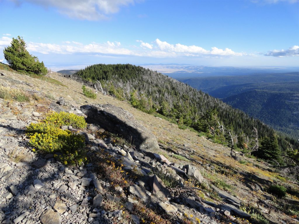
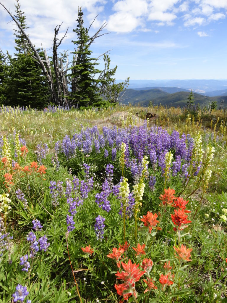
Flowers and sweeping views from highest point in the Badger Creek Wilderness Quick Facts: Location: Badger Creek Wilderness Land Agency: Mount Hood National Forest Distance: 2.5 miles roundtrip Elevation Gain: 550 feet Contact: Barlow Ranger District, Mount Hood National Forest Map: Green Trails Mount Hood Wilderness 462SX Notes: Northwest Trail Pass or interagency pass required…
Read MoreGee Point─ great views from this little-known peak!
Quick Facts: Location: Finney Block, Skagit Valley Land Agency: Mount Baker-Snoqualmie National Forest Roundtrip: 3.0 miles Elevation Gain: 700 feet Contact: Mount Baker Ranger District: Mount Baker Snoqualmie National Forest (360) 856-5700; www.fs.fed.us/r6/mbs Green Trails Map: Oso, WA-No. 77 Access: From Burlington head east 28 miles on SR 20 towards Concrete turning right onto the…
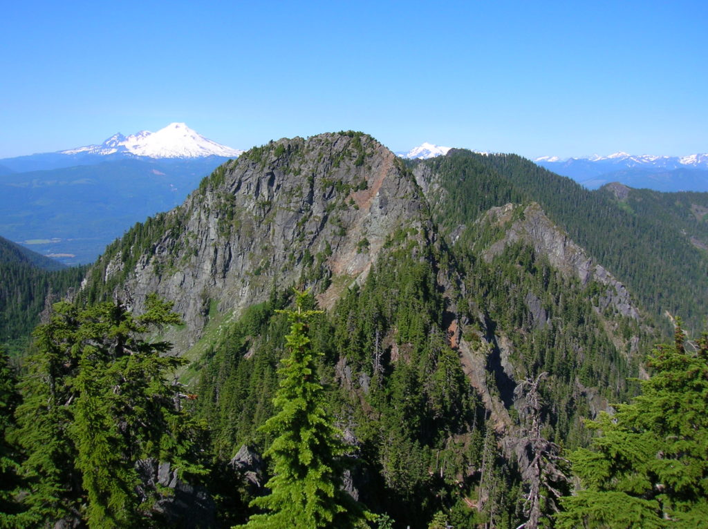
Read MoreSulphur Mountain –Savor Sweet Suiattle Valley Views
Quick Facts: Location: Suiattle River Road Land Agency: Mount Baker-Snoqualmie National Forest Roundtrip: 10.0 miles Elevation gain: 4,600 feet Green Trails Maps: Mountain Loop Highway Map 111SX Contact: Darrington Ranger District: Mount Baker-Snoqualmie National Forest Notes: Northwest Forest Pass or interagency pass required Access: From Darrington, travel north on SR 530 for 7.5 miles turning…
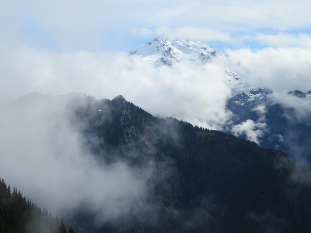
Read MoreHall Mountain via Noisy Creek– It’s a haul to this old lookout site
Quick Facts: Location: Selkirk Mountains, Eastern Washington Land Agency: National Forest Service Roundtrip: 14 miles Elevation Gain: 4130 feet Contact: Sullivan Lake District, Colville National Forest Notes: Practice Leave No Trace principles; grizzly habitat, trail passes recent burn zone–use caution Access: From Newport, Washington follow SR 20 north (west) 47 miles to the junction with SR 31 in…
Read MoreRock Mountain via Snowy Creek—Big sky views and perhaps a goat or two
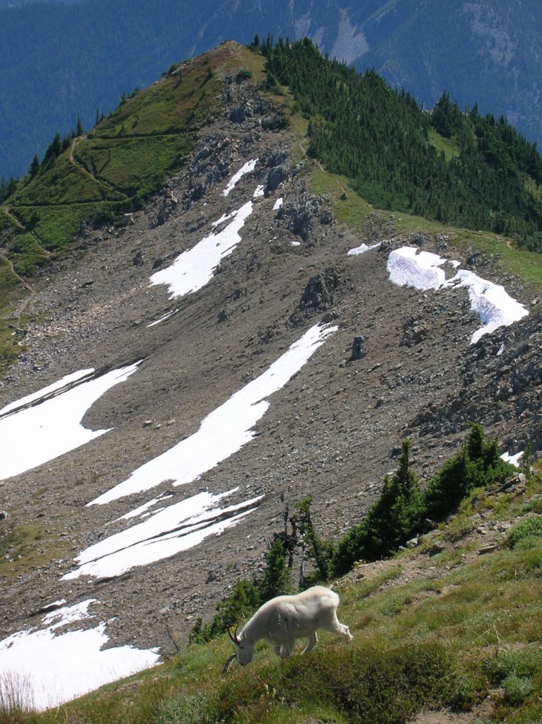
Quick Facts: Location: Nason Ridge near Stevens Pass Land Agency: Okanogan-Wenatchee National Forest Roundtrip: 9.8 miles Elevation Gain: 3,250 feet Green Trails Map: Alpine Lakes Stevens Pass Map 176S Access: From Everett head east on US 2. Four miles past Stevens Pass turn left onto Smith Brook Road (FR 6700). Follow for 6.0 miles turning…
Read MoreFourth of July Creek—Celebrate Independence Day with these explosive views!
Quick Facts: Location: Central Cascades Land Agency: Okanogan-Wenatchee National Forest Roundtrip: 11.4 miles Elevation Gain: 4,700 feet Notes: NW Forest Pass or Interagency Pass required; rattlesnakes are common along lower portions of trail. Green Trails Map: Alpine Lakes East Stuart Range 208SX Contact: Wenatchee River Ranger District (Leavenworth) More information: Day Hiking Central Cascades (The Mountaineers Books)…
Read MoreCopper Butte via Old Stage Trail– Take a historic route to the rooftop of the Kettle River Range
Quick Facts: Location: Kettle River Range Land Agency: Colville National Forest Roundtrip: 6.0 miles Elevation Gain: 1615 feet Contact: Colville National Forest, Three Rivers Ranger District-Kettle Falls Access: From Republic, head east on SR 20 for 21 miles turning left onto FR 2030 (Albion Hill Road). From Kettle Falls, head west on SR 20 for 22 miles turning…
Read More