Posts Tagged ‘Wildflowers’
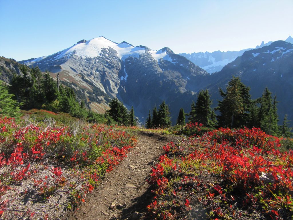
Hidden Lake Lookout
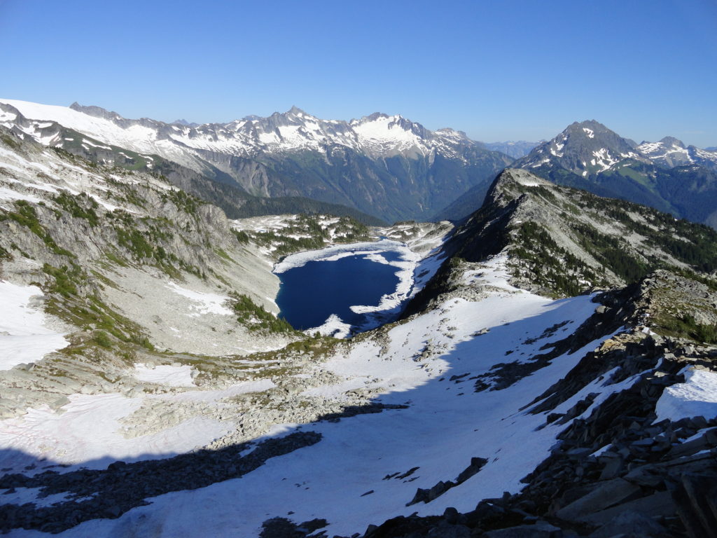
Savor stunning views from an historic fire lookout teetering on a lofty precipitous knoll Quick Facts: Location: Cascade River Road Land Agency: Mount Baker-Snoqualmie National Forest Roundtrip: 9.0 miles Elevation Gain: 3,340 feet Green Trails Maps: Diablo, WA-No. 48; Cascade Pass, WA-No. 80 Access: From Marblemount, head east on the Cascade River Road for 9.7…
Read MoreHigh Rock– The view of Rainier simply rocks from this precipitous peak!
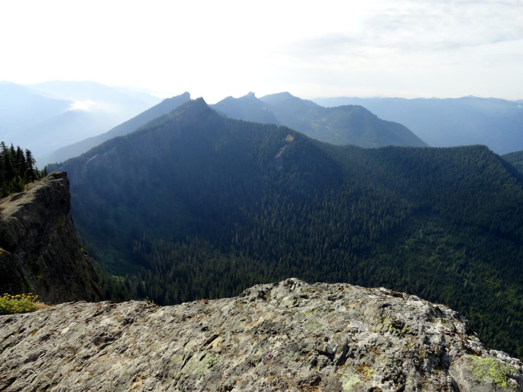
Quick Facts: Location: Sawtooth Ridge near Ashford and Packwood, WA Land Agency: Gifford Pinchot National Forest Roundtrip: 3.2 miles Elevation gain: 1,350 feet Green Trails Maps: Randle, WA no. 301 Contact: Cowlitz Valley Ranger Station (Randle); Gifford Pinchot National Forest Notes: Dogs are allowed, but should be on leash because of steep and dangerous drop offs.…
Read MoreWindy Pass
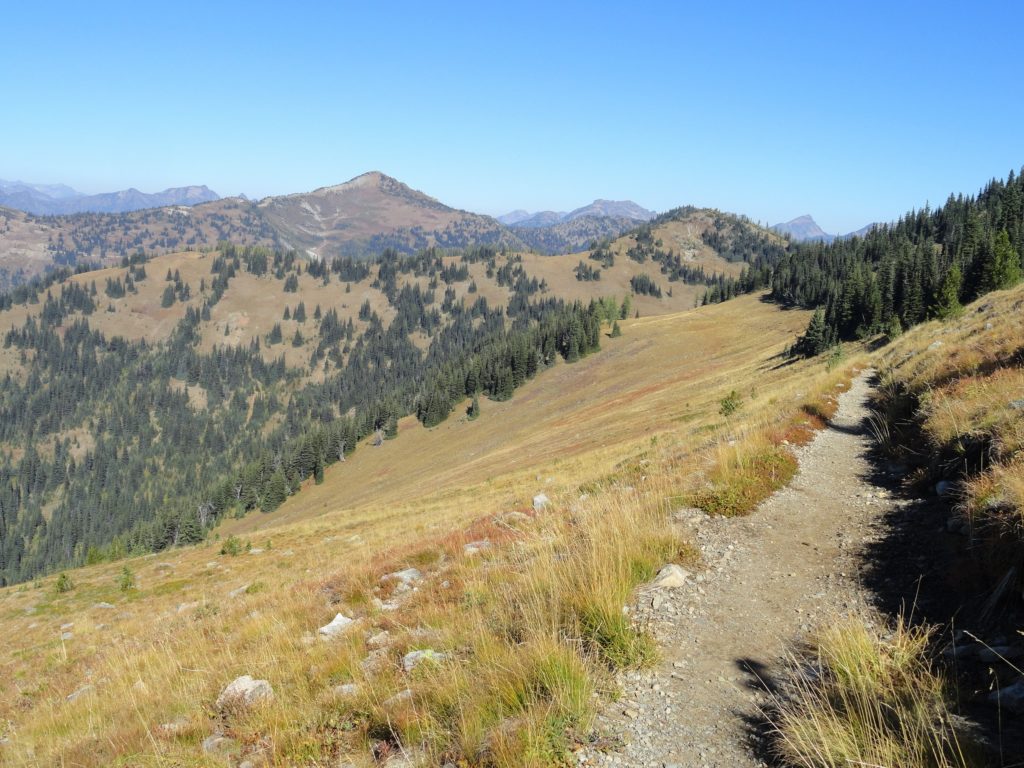
Easy wanderings high on the Pacific Crest Trail Quick Facts: Location: Harts Pass area Land Agency: National Forest Service Distance: 7.6 miles Elevation Gain: 900 feet Contact: Okanogan-Wenatchee National Forest, Methow Valley Ranger District Map: Green Trails Methow Valley Pasayten Wilderness 51SX Notes: Northwest Trail Pass or Interagency pass required Access: From Winthrop, drive State…
Read MoreCrystal Peak
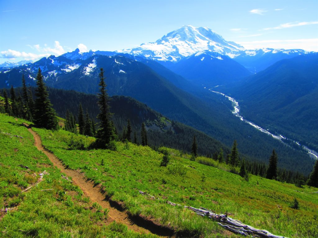
Old fire lookout site grants some of the best views in Mount Rainier NP Quick Facts: Location: Mount Rainier National Park Land Agency: National Park Service Distance: 7.8 miles Elevation Gain: 3,400 feet Contact: Mount Rainier National Park Map: Green Trails Mount Rainier National Park 269SX Notes: National Park Entrance Fee or Interagency Pass, Dogs-prohibited…
Read MoreScott Paul Trail
Loop on high slopes on Mount Baker Quick Facts: Location: Mount Baker National Recreation Area Land Agency: National Forest Service Distance: 8.0 mile loop Elevation Gain: 2000 feet Contact: Mount Baker–Snoqualmie National Forest, Mount Baker Ranger District Map: Green Trails Mount Baker Wilderness no. 13S Notes: Northwest Trail Pass or interagency pass required May 1-Oct…
Read MoreLookout Mountain
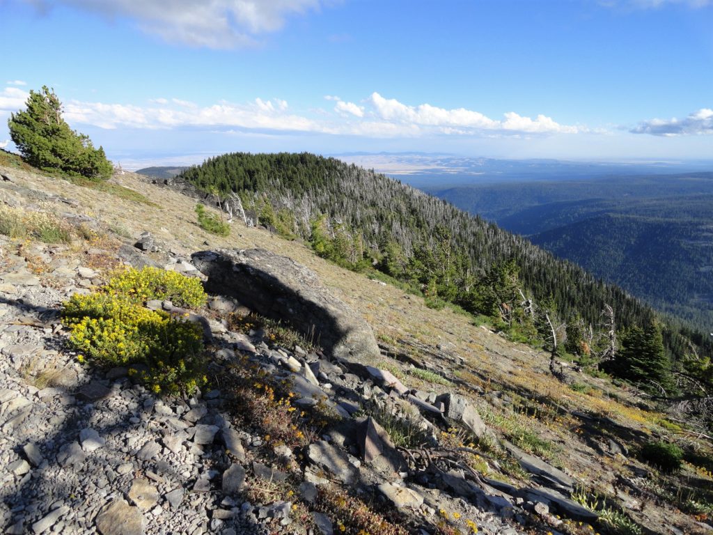
Flowers and sweeping views from highest point in the Badger Creek Wilderness Quick Facts: Location: Badger Creek Wilderness Land Agency: Mount Hood National Forest Distance: 2.5 miles roundtrip Elevation Gain: 550 feet Contact: Barlow Ranger District, Mount Hood National Forest Map: Green Trails Mount Hood Wilderness 462SX Notes: Northwest Trail Pass or interagency pass required…
Read MoreSaddle Rock—Iconic landmark of the Wenatchee Foothills
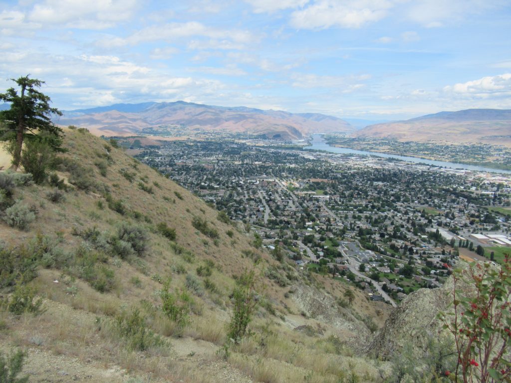
Quick Facts: Location: Wenatchee, Washington Land Agency: WA DNR and Chelan-Douglas Land Trust Roundtrip: 3.0 miles Elevation Gain: 1000 feet Contact: WA DNR and Chelan-Douglas Land Trust Notes: Dogs must be leashed; be alert for rattlesnakes Green Trails Map: Wenatchee/ Mission Ridge No. 211S Access: From US 2 in Wenatchee head south onto State Route…
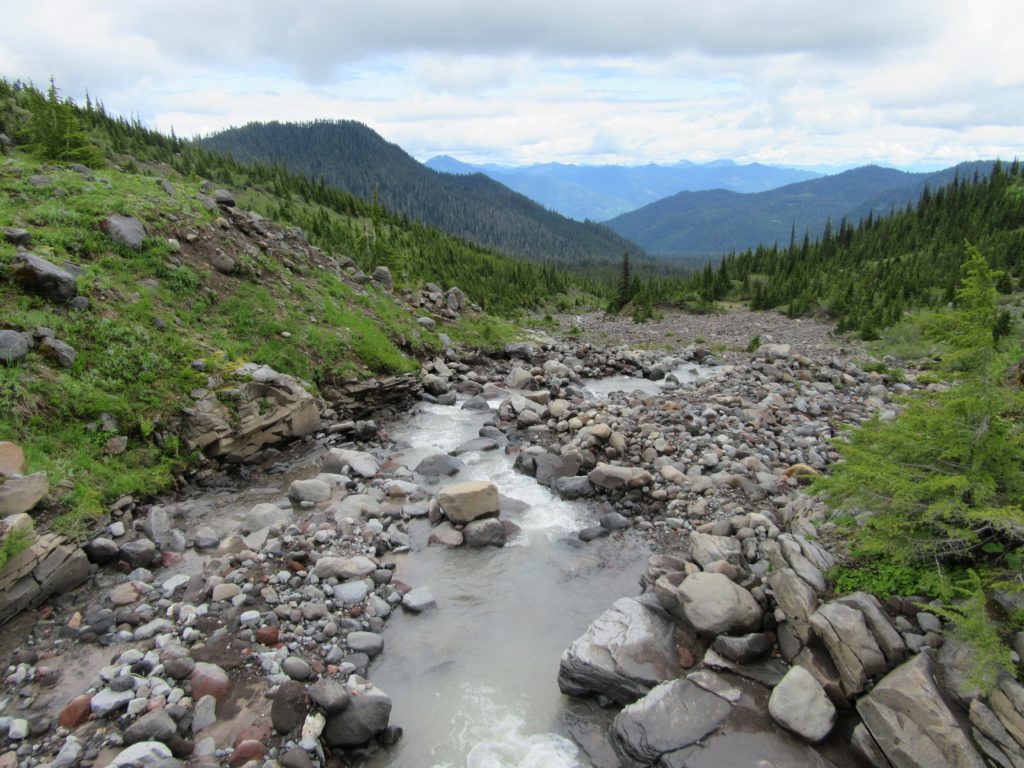
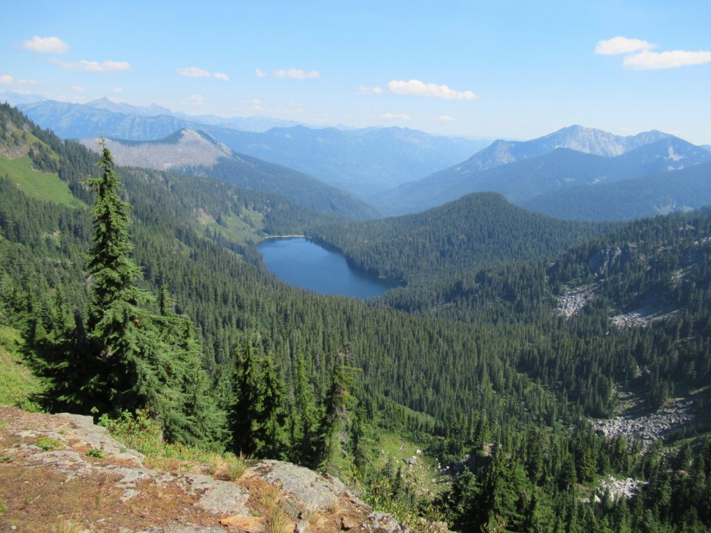
Read MoreThorp Mountain–Historic Lookout on Kachess Ridge
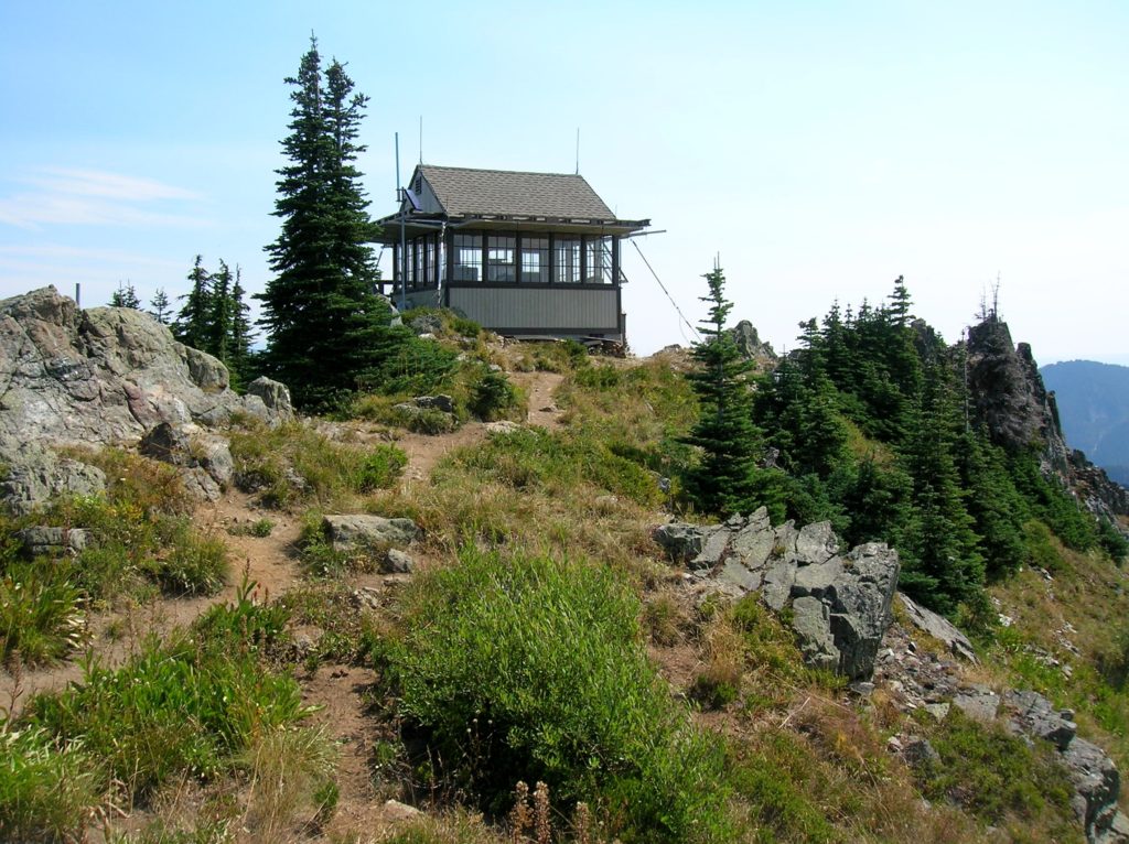
Location: Cle Elum River Valley near Salmon La Sac Land Agency: Okanogan-Wenatchee National Forest Roundtrip: 5.0 miles High Point: 5,854 feet Elevation gain: 1,700 feet Difficulty: moderate Green Trails Map: Kachess Lake – No. 208 Contact: Cle Elum Ranger District: Okanogan-Wenatchee National Forest (509) 852-1100 Note: FR 4308-120 is rough and brushy in spots. High…
Read MoreHannegan Peak– Supreme views of snow and ice—and that’s the truth, Ruth!
Quick Facts: Location: North Cascades Mount Baker Wilderness Land Agency: Mount Baker-Snoqualmie National Forest Roundtrip: 10.4 miles Elevation gain: 3,100 feet Green Trails Map: Mount Baker Wilderness 13SX Contact: Glacier Public Service Center or Mount Baker Ranger District: Mount Baker-Snoqualmie National Forest Notes: Northwest Trail Pass or Interagency Pass required; Wilderness rules apply Access: From…
Read MoreGrizzly Peak — It’s a long hike, but not a bear of a hike!
Quick Facts: Location: Pacific Crest Trail, Henry M Jackson Wilderness, Stevens Pass area Land Agency: Mount Baker-Snoqualmie National Forest Roundtrip: 16.4 miles Elevation gain: 3,400 feet Difficulty: difficult Green Trails Map: Benchmark MT- No. 144 Contact: Skykomish Ranger District: Mount Baker-Snoqualmie National Forest Access: From Everett, head east on US 2 to Stevens Pass. Continue…
Read More