Independence Lake–A great place to celebrate the 4th of July and the Freedom of the Hills
Quick Facts
Location: Mountain Loop Highway near Granite Falls
Land Agency: Mount Baker-Snoqualmie National Forest
Roundtrip: 1.5 miles
High Point: 3,700 feet
Elevation gain: 300 feet
Difficulty: easy
Green Trails Map: Silverton, WA- No 110
Contact: Darrington Ranger District: Mount Baker Snoqualmie National Forest (360) 436-1155
Note: NW Forest Pass required
Access: From Granite Falls, follow the Mountain Loop Highway east for 26 miles and turn left onto FR 4060 (Coal Creek Road). Follow this gravel road for 4.8 miles to its terminus at trailhead.
Good to know: Dog-friendly, kid-friendly, old-growth
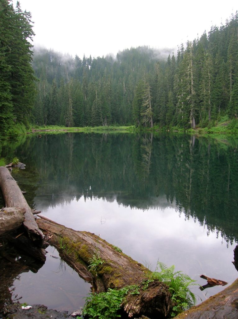
Looking for an easy getaway free from the crowds where you can celebrate your freedom this Fourth of July? Spend your Independence Day at Independence Lake! It’s located high above the South Fork Stillagumish River Valley surrounded by a rugged topography cloaked in ancient forests. But unlike other Mountain Loop lakes, Independence doesn’t attract large numbers of visitors, making it perfect to enjoy a fairly quiet picnic or night out at a backcountry lake. The hike is short enough too making it perfect for children or late in the day strolling.
The way begins in a 1961 clear-cut. But after negotiating a series of short switchbacks, primeval forest is soon encountered. Now, beneath giant hemlocks, the trail commences on a level to gently descending course towards the lake. However, while the grade is easy, the way can be rough in spots. Exposed roots and rocks will slow you down. After .5 mile cross a rocky streambed and begin a short climb regaining the 200 feet you lost. Independence Lake (el 3,700 ft) greets you a quarter mile farther.
The lake sits in a rugged little basin, flanked on the west by ancient trees and on the east by rocky slopes. It’s a pleasing enough spot, but the wild country surrounding Independence Lake rings out to be explored further. However, snow lingers much longer on the trail beyond heading to North Lake, making that destination a better place to celebrate Labor Day. You can still climb a short ways on that trail though early in the summer, passing seeps and openings that burst with flowers. Continue onward, along the western shore to the marshy and brushy north end of the lake. Amid a myriad of social paths, locate the trail to North Lake taking off to the northeast. On narrow tread, the trail steeply climbs Cross scree slopes streaked with wildflower regalia eventually coming to a massive double-trunked Alaska yellow cedar, one of the largest this side of Mount Rainier National Park’s Ipsut Creek record holding specimen. This tree has been gracing this slope well before the first Independence Day and should be around to see plenty more!
For more information on this hike and the hike to North Lake including maps consult my Day Hiking North Cascades Book 2nd edition.