Eagle Lake—Tough hike to a raptor’s delight
Quick Facts:
Location: Wild Sky Wilderness, Skykomish River Valley
Land Agency: National Forest Service
Roundtrip: 8.6 miles
Elevation Gain: 1,750 feet
Green Trails Map: Alpine Lakes West 176S
Contact: Skykomish Ranger District: Mount Baker-Snoqualmie National Forest
Notes: Northwest Forest Pass or Interagency Pass required.
Access: From Everett, head east 41 miles on US 2 to Baring. Just past Milepost 41 turn left onto 635th Place NE. Cross railroad tracks and after .3 mile, turn left onto FR 6034. Proceed for 4.0 miles to trailhead.
Good to Know: dog-friendly, wildflowers, backpacking possible, wilderness rules apply,
While many a hiker has ventured to Barclay Lake, far less have braved the trip to Eagle Lake. The trail to Barclay is well built and gains very little elevation, while the path to Eagle clambers over talus and heads straight up a steep slope. While Barclay is surrounded by Washington’s newest wilderness, the 106,000 acre Wild Sky, Eagle sits within the newly minted wilderness area. To reach Eagle, warm up by taking the Barclay lake Trail gaining just over 200 feet of elevation in 2.2 miles. The next 2.1 miles however will be a different story!
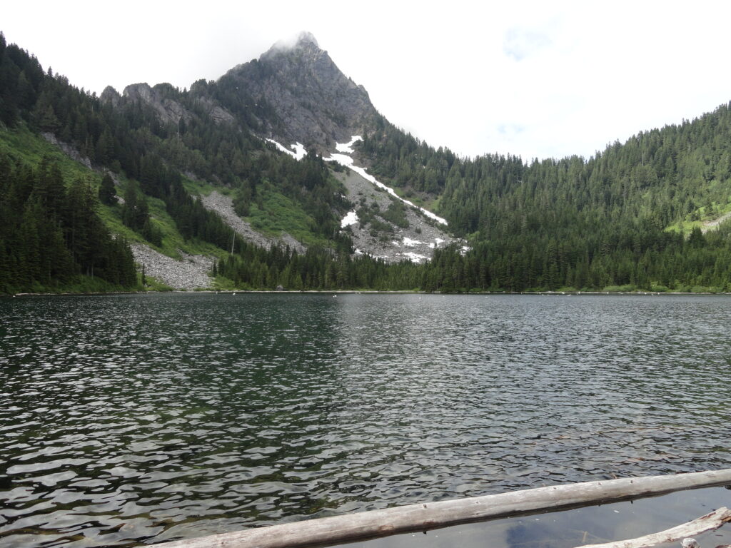
Start by hiking up a narrow valley hemmed in by Baring Mountain to the south and the craggy, rocky summits of Gunn and Merchant Peaks to the north. Soon after crossing Barclay Creek on a nice log bridge, reach Barclay Lake. Gaze out across it and up to the striking northern face of Baring Mountain. An imposing and well-known landmark visible from much of the Skykomish Valley; it’s truly stunning viewed from the lake.
Continue along the lakeshore and just after passing the second privy (and just before reaching a creek tumbling into the lake), locate an unmarked trail taking off left. Now the fun begins. Never formally built, this way trail immediately starts climbing up steep timbered slopes. Soon enter the Wild Sky Wilderness. Continue climbing. While the path is fairly discernable, be sure to pay attention as it sometimes fades and there are several large blow downs to clamber over.
After gaining about 600 feet, the way crosses a talus slope. Cairns help keep you on the way. This section is steep and can be treacherous in wet weather. After rock-hopping, the way enters a grove of yellow cedars and hemlocks and the grade eases. But the sailing isn’t smooth just yet. Continue into a forested basin fed by a bubbling spring—then climb steeply once more to a gap draped in old growth forest. After gaining about 1,500 feet in 1.2 miles, reprieve is finally offered at pretty little Stone Lake.
Now make one last climb, albeit an easy one after what you have just hiked and crest a 3,900-foot divide. Then descend slightly into a marshy muddy meadow. A trail right leads down the Eagle Creek Valley. Go left dancing around mud holes and traverse a beautiful meadow awash in flowers and orchids appropriately named Paradise Meadow.
Hop across Eagle Creek a couple of times and then re-enter forest. Eagle Lake lies just ahead. Sit on a log near its outlet or explore the old trapper’s hut on its shore. Stare up at the open slopes of Mount Townsend or the sheer intimidating rock face of Merchant Peak. While Eagle Lake is off-the-beaten path, it receives a fair amount of use—and unfortunately from some who aren’t well-versed in backcountry ethics. Treat this place with care.
For more detailed information on this trail and 135 others along the US 2 Corridor, consult my Day Hiking Central Cascades 2nd edition