Region
North Cascades
Quick Facts: Location: Ross Lake NRA, North Cascades Scenic Highway Land Agency: National Park Service Roundtrip: 4.5 miles High Point: feet Elevation gain: 1500 feet Difficulty: moderate Contact: North Cascades National Park Green Trails Map: North Cascades Ross Lake 16SX Notes: Dogs permitted on leash. Access: From Marblemount follow the North Cascades Highway (SR 20) east for 21 miles to trailhead located…
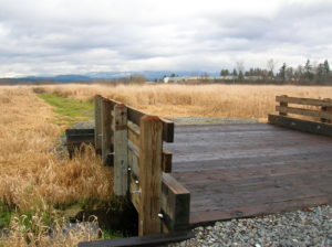
Quick Facts: Location: Arlington Land Agency: Snohomish County Parks and Recreation Contact: Snohomish Parks and Recreation Department Roundtrip: 2.0 miles Elevation Gain: minimal Notes: Dogs prohibited Access: From Exit 208 on I-5 (Arlington) head east on SR 530 for 2.3 miles. Then turn right onto 59th Ave SE. Continue for 0.2 mile and turn right…
Quick Facts: Location: Mountain Loop Highway Land Agency: Mount Baker-Snoqualmie National Forest Roundtrip: 1.5 mile Elevation gain: 200 feet Green Trails Map: Mountain Loop Highway 111SX Contact: Darrington Ranger District: Mount Baker Snoqualmie National Forest Notes: No passes needed Access: From Darrington, follow Mountain Loop Highway for 11.3 miles to unmarked trailhead located on your…
Quick Facts: Location: Mountain Loop Highway Land Agency: Mount Baker-Snoqualmie National Forest Roundtrip: 7.0 miles Elevation Gain: 2,650 feet Contact: Darrington Ranger District: Mount Baker -Snoqualmie National Forest Green Trails Map: Mountain Loop Highway 111SX Recommended Guidebook: Day Hiking North Cascades 2nd edition (Mountaineers Books) Special Note: Northwest Trail Pass or Interagency Pass required. Access:…
Quick Facts: Location: Mountain Loop Highway near Darrington Land Agency: Mount Baker-Snoqualmie National Forest Roundtrip: 10.4 miles Elevation Gain: 1,400 feet Green trails Map: Mountain Loop Highway-No. 111SX Access: From Granite Falls, follow the Mountain Loop Highway east for 31 miles to Barlow Pass and end of pavement. Continue for 3.5 miles turning right onto FR…
Location: North Fork Sauk River Land Agency: Mount Baker-Snoqualmie National Forest Roundtrip: 19.4 miles High Point: 5,850 feet Elevation gain: 4,000 feet Difficulty: strenuous Green Trails Maps: Mountain Loop Highway 111SX Contact: Darrington Ranger District: Mount Baker-Snoqualmie National Forest Note: Northwest Forest Pass or Interagency Pass Required Access: From Darrington, travel south on the Mountain…
Savor stunning views from an historic fire lookout teetering on a lofty precipitous knoll Quick Facts: Location: Cascade River Road Land Agency: Mount Baker-Snoqualmie National Forest Roundtrip: 9.0 miles Elevation Gain: 3,340 feet Green Trails Maps: Diablo, WA-No. 48; Cascade Pass, WA-No. 80 Access: From Marblemount, head east on the Cascade River Road for 9.7…
Quick Facts: Location: Glacier Peak Wilderness, Suiattle River Road Land Agency: Mount Baker-Snoqualmie National Forest Roundtrip: 8.0 miles Elevation gain: 3,100 feet Green Trails Maps: North Cascades Ross Lake 16SX Contact: Darrington Ranger District: Mount Baker-Snoqualmie National Forest Notes: wilderness rules apply Access: From Darrington, travel north on SR 530 for 7.5 miles turning right…
Easy wanderings high on the Pacific Crest Trail Quick Facts: Location: Harts Pass area Land Agency: National Forest Service Distance: 7.6 miles Elevation Gain: 900 feet Contact: Okanogan-Wenatchee National Forest, Methow Valley Ranger District Map: Green Trails Methow Valley Pasayten Wilderness 51SX Notes: Northwest Trail Pass or Interagency pass required Access: From Winthrop, drive State…
Loop on high slopes on Mount Baker Quick Facts: Location: Mount Baker National Recreation Area Land Agency: National Forest Service Distance: 8.0 mile loop Elevation Gain: 2000 feet Contact: Mount Baker–Snoqualmie National Forest, Mount Baker Ranger District Map: Green Trails Mount Baker Wilderness no. 13S Notes: Northwest Trail Pass or interagency pass required May 1-Oct…