Region
North Cascades
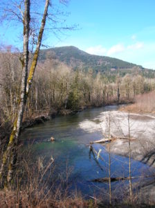
Quick Facts: Location: SR 530 Darrington Land Agency: Snohomish County Parks Roundtrip: 14 miles Elevation gain: 160 feet Difficulty: Easy Contact: Snohomish County Parks Green Trails Map: Mountain Loop Highway no. 111SX Recommended Guidebook: Day Hiking North Cascades (Mountaineers Books) Notes: Dogs allowed on leash Access: Take exit 208 off of I-5 and drive 25 miles east…
Quick Facts: Location: Mountain Loop Highway near Granite Falls Land Agency: Mount Baker-Snoqualmie National Forest Roundtrip: 5.0 miles Elevation gain: 1,100 feet Difficulty: moderate Green Trails Map: Mountain Loop Highway Special Series 111SX Contact: Darrington Ranger District: Mount Baker-Snoqualmie National Forest Access: From Granite Falls, follow the Mountain Loop Highway east. One mile beyond the Verlot Visitors…
Quick Facts: Location: Mountain Loop Highway near Granite Falls Land Agency: Washington Department of Natural Resources Roundtrip: 8.8 miles Elevation gain: 1,200 feet Green Trails Map: Mountain Loop HIghway 111SX Contact: Northwest Region Ranger District WA DNR (360) 856-3500 Notes: Discover Pass required; trail beyond Ashland Lakes sees little maintenance, is extremely difficult and not…
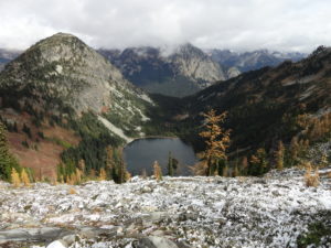
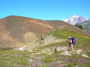
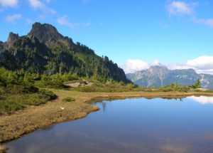
Quick Facts: Location: North Cascades Highway –Rainy Pass Land Agency: Okanogan-Wenatchee National Forest Roundtrip: 7.2 miles Difficulty: Moderate Elevation Gain: 2,000 feet Green Trails Maps: Ross Lake North Cascades 16SX Access: From I-5 north (Exit 230 ) in Burlington, head east on SR 20 (North Cascades Highway) for 98 miles to Rainy Pass near Milepost 158. Turn right into the…
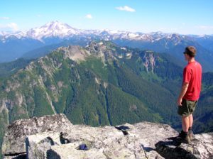
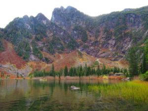
Quick Facts: Location: Glacier Peak Wilderness, Mountain Loop Highway near Darrington Land Agency: Mount Baker-Snoqualmie National Forest Roundtrip: 11.0 miles Elevation gain: 5,300 feet Green Trails Map: Mountain Loop Highway Special Series 111SX Contact: Darrington Ranger District: Mount Baker Snoqualmie National Forest Notes: NW Forest Pass or Interagency Pass required; The last 1.5 miles of hike…
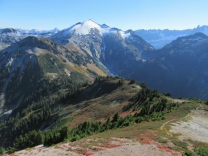
Quick Facts: Location: Glacier Peak Wilderness,Mountain Loop Highway near Darrington Land Agency: Mount Baker-Snoqualmie National Forest Roundtrip: 23.0 miles Elevation gain: 5,200 feet Green Trails Map: Mountain Loop Highway 111SX Contact: Darrington Ranger District: Mount Baker Snoqualmie National Forest (360) 436-1155 Notes: NW Forest Pass or Interagency Pass required Access: From Darrington, head south 16…
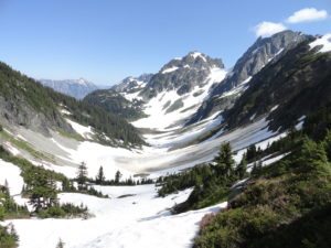
Quick Facts Location: North Cascades Mount Baker Wilderness Land Agency: Mount Baker-Snoqualmie National Forest Roundtrip: 10.4 miles Elevation Gain: 3,100 feet Contact: Glacier Public Service Center (360) 599-2714 or Mount Baker Ranger District: Mount Baker Snoqualmie National Forest (360) 856-5700; www.fs.fed.us/r6/mbs Green Trails Map: Mt Baker Wilderness 13SX Special Note: Northwest Trail Pass or Interagency…
Quick Facts: Location: North Cascades Land Agency: North Cascades National Park Roundtrip: 7.4 miles Elevation Gain: 1,800 feet Green Trails Map: Ross Lake North Cascades No. 12SX Contact: Summer – North Cascades National Park Visitors Center Newhalem: (206) 386-4495 ext. 11 or NCNP Visitors Center Sedro-Woolley (360) 854-7200; www.nps.gov/noca Notes: Dogs prohibited. No trailhead camping.…
Quick Facts: Location: Mountain Loop Highway Land Agency: National Forest Service Roundtrip: 11.4 miles Elevation Gain: 3.500 feet Green Trails Map: Mountain Loop Highway 111SX Recommended Guidebook: Day Hiking North Cascades 2nd edition (Mountaineers Books) Contact: Darrington Ranger District: Mount Baker-Snoqualmie National Forest Access: From Granite Falls follow the Mountain Loop Highway east for 27 miles…
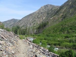
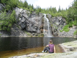
Follow a trail less traveled along a roaring waterway Quick Facts: Location: Methow Valley Round Trip: 5.0 miles Elevation Gain: 450 feet Contact: Okanogan-Wenatchee National Forest, Methow Valley Ranger District Detailed Information: Day Hiking North Cascades 2nd edition (Mountaineers Books) Notes: Northwest Forest Pass or Interagency Pass required; watch for rattlesnakes Green Trails Map: Methow…